My final answer: I want to see what's going to happen with Basin and Range in western North America. Will North America remain a single block as Basin and Range spreading subsides? Will a single subcontinent break off and beome a Texas- or Alaska-sized island heading off to the northwest? Or will this region, composed of numerous terranes stitched together over the last 70-80 million years, break up and form a new generation of lithospheric ships, drifting independently on a Mohorovičić sea?
To put the question in context, we need to go back a few tens of millions of years, and watch the Farallon plate get consumed by subduction under the edge of North America. Between about 60 and 80 Ma, numerous small pieces of continental and thickened oceanic crust carried by the Farallon- terranes- were accreted to North America. Much of Nevada and Washington, and most of California and Oregon are formed of these terranes. According to Wikipedia,
"The Farallon Plate is also responsible for transporting old island arcs and various fragments of continental crustal material rifted off from other distant plates and accreting them to the North American Plate. These fragments from elsewhere are called terranes (sometimes, "exotic" terranes). Much of western North America is composed of these accreted terranes."At 30 Ma, the spreading ridge (a remnant of which is now known as the Juan de Fuca Ridge) on the western margin of the Farallon had moved under the edge of North America, leading to the birth of the San Andreas Fault.
 (This and the next illustrations from here) So one question I want to answer is "Did the subducted spreading ridge continue generating magma and spreading under the continent, or did it become inactive? Was it effectively destroyed, or is it still down there?" The current configuration is below:
 There's very little doubt that much of the Farallon is still down there, the ghost of a deceased seafloor haunting the middle mantle. Tough Cookie at Magma Cum Laude has a good write-up that covers much more on this plate. Below is a representation of the current disposition of the plate from Wikipedia.
 And below is another from The Art of Science- nice descripition of the photo here.
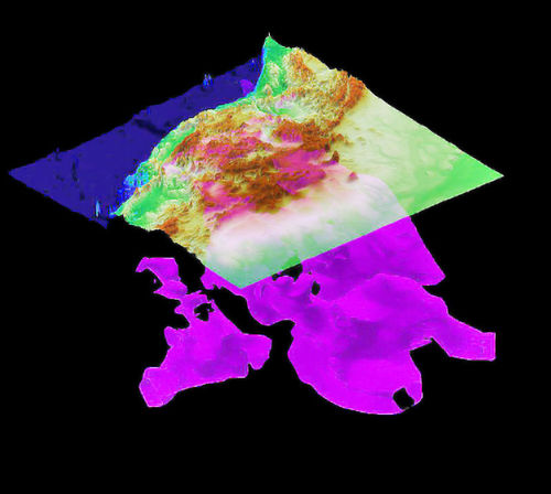 There are two competing theories (that I know of) to explain Basin and range spreading. First, the spreading ridge is still down there. In that case, the western US is in the process of giving birth to a new ocean. This is the story line so delightfully developed in John McPhee's "Basin and Range." The second theory is the subduction of the spreading ridge, which I can only imagine would be like me trying to swallow a watermelon without chewing, buttressed and compressed western North America, and caused an over thickening of the crust. In this narrative, basin and range spreading is simply a relaxation, a temporary expansion, following the removal of a previously compressive regime. This was the story line preferred by my profs 20+ years ago.
I haven't kept up with the literature. I don't know what directions ideas have gone in the last two decades. I just want to go see.
Here is an outline map of modern seismicity in the central and southern basin and range (from USGS). I have seen what look to me like fairly modern fault scarps on the east side of Steens Mountain in SE Oregon. There are some clear patterns, but I'm not sure what they tell us. Do we have enough of a record to say anything sensible? I doubt it.
 Here's a Google Earth Image of the basin and range as it looks today:
 And here's a map and list of major structural features associated with basin and range (hand drawn from memory, so do not cite this):
 (note major features in bold yellow; approximate boundary of BR not associated with any features I know of in light yellow) From roughly north to south,
 OWL=Olympic Wallowa Lineament, it's not clear what the significance of this feature is, but it may represent a more northerly analogue of the Brothers Fault Zone (BFZ)
YHS=Yellowstone Hotspot- I've always been tempted to link BR spreading to YHS migration, but I have nothing but intuition to back me up.
BFZ= Brothers Fault Zone- The roughly east-west trending northern termination of Basin and Range spreading across central oregon. The fault system allows accomodation between motion in BR and the (more or less) stable Blue Mountains of NE Oregon. More here.
WF= Wasatch Fault- The eastern boundary of basin and range in Utah.
EC-WRL= Eastern California- Walker Rim Lineament- The fault running through Owens Valley, up toward Reno, creating the eastern edge of the Sierra Nevada, and the apparent half-graben bounding the east side of the southern Oregon Cascades. I'm not finding documentation, but I drew this as a continuous feature; it may not be. I'll try to find more info later. But is this the actual western boundary of the North American plate?
SAF= San Andreas Fault- currently considered the western boundary of southern North America... but is it, really?
GF- Garlock Fault- A left-lateral strike slip fault in southern California, that, like the BFZ in Oregon, allows accomodation of basin and range spreading against non-spreading adjacent rocks.
Now the standard geo-future projection with LA near the lattitude of San Francisco, and seaboard southern California has become so iconic, I won't bother to reproduce it. But if, as I suggested above, the "EC-WRL" is actually the tectonic edge of the North America, and if the subducted ridge is still trying to spread, we might see something like this in about 30-40 million years:
 But there's another possibility: might the Wasatch front be the edge of the future ocean?
 And one final possibility that was the preferred hypothesis of a geologist from southern California whose lecture I attended a few years ago... I really like this one myself, but I don't have the background to judge how plausible it really is.
 From Terranes was my home assembled. To terranes will my home return? Note that I have used major structures as the edges, but internal disruption is entirely arbitrary.
OK, enough chitter chatter! Let's Warp!


1 comment:
I'd better go buy a boat! And if you add in the Walker Lane, we might get at least one more island in that last projection (which is my favorite one).
Post a Comment