Saturday, March 2, 2013

Saturd80's: Shriekback

Haven't done one of these for a while, but recently something reminded me of "Nemesis," which I love. My take has always been that it satirizes "evil," rather than glorifying it, but your mileage may vary.
All of these are from the 1985 album, "Oil & Gold." "Everything that Rises Must Converge:"

"Malaria:"

And to finish off, the quiet and contemplative "This Big Hush:"

Geo 365: March 2, Day 61: Scour-and-Fill

A set of small scour-and-fill structures in the Table Rock tuffaceous sediment, and it looks like another disconformity above them. I find stuff like this awfully pretty.

Photo unmodified. August 20, 2011. FlashEarth Location. And with this one, I'm one-sixth done with the Geo 365 project.

Friday, March 1, 2013

Geo 365: March 1, Day 60: Table Rock Tuff

A bit farther back from yesterday's view, the hammer has not been moved. The ball-and-pillow structure from that photo is visible to the left of the hammer handle, and there are similar, though more subtle, examples to the right of the hammer handle. A minor fault with a few inches of normal offset runs from upper left  toward lower right across the middle- the chisel tip of the hammer is pretty much right on it. Meanwhile, the hammer itself is hanging in a vertical joint. Just under the head of the hammer is some nice cross-bedding.

There's a lot going on here, but that's fairly typical for Table Rock. Full size view is recommended.

Photo unmodified. August 20, 2011. FlashEarth Location.

Thursday, February 28, 2013

Geo 365: Feb. 28, Day 59: Table Rock Ball-and-Pillow

We drove up the little dirt road- it's a bit rutted, but in good shape overall- parked near the base of Table Rock, then followed the base north a hundred yards or so. There are a multitude of sedimentary and volcanic structures nicely highlighted by contrasty beds. Actual lava flows didn't make it to this area- or or if they did, they were later, higher in the pile, and have subsequently been removed by erosion- so this is strictly a volcanoclastic sedimentary environment. I suspect it's highly influenced by very rapid deposition, with surges of water and sediment triggered by explosive volcanism a mile or two away, and further modified by frequent quakes and shocks associated with the eruption.

Above, we see a pair of ball-and-pillow structures. It looks as if the material overlying the structures was planed off, then filled in again later- a disconformity. These are quite common in Table Rock.

Photo unmodified. August 20, 2011. FlashEarth Location. Just to the west of the crosshairs, you can see a flat area that's good for parking, so you don't obstruct the dirt road, and aren't sitting over dry grass (fire hazard!) but to be honest, I have never seen anyone else off the paved road here.

Wednesday, February 27, 2013

Accretionary Wedge 55: Avoiding Geo Injuries

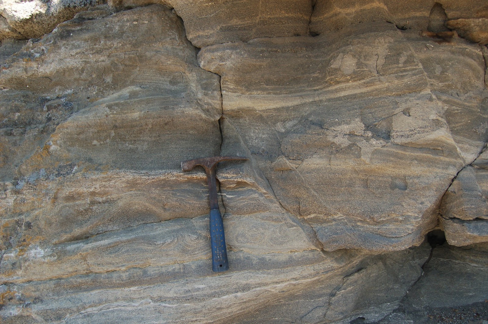
Avoiding Geo Injuries: this is not the way to do it.
Maitri is hosting Accretionary Wedge 55 on the topic of geo injuries: injuries acquired while doing geology. Now I had, from the outset, intended to not participate in this one, for two reasons. First, I couldn't recall any significant injuries, and second, as mild as Maitri's injuries have been, just reading that post made me a bit queasy. Yes, I'm extremely squeamish, and averse to blood or any other injuries. When faced with an emergency situation, I respond calmly and appropriately. As soon as my role and responsibility are relieved, though, such as by the arrival of emergency responders, I'm likely to vomit, and even approach going into shock myself. I can't really explain the mindset, though it basically comes down to "If I'm honestly needed, I'm there. Otherwise, HOLY FUCKING SHIT GET ME OUTTA HERE!" Overdeveloped empathy, I guess. I'm very sensitive to pain in others.

A short story: my favorite part of every term was after buying my new texts, taking them home and paging through them. I decided, toward the end of my undergrad years, that if I was going to go into education, I should get a first responder course under my belt. I didn't know if that was the direction I'd go yet, but it was one I was considering, and such a course couldn't hurt, no matter what I decided to do. So I signed up for one, and at the start of the term, took my spiffy new text home, and started paging through it. Bad idea. About half way through, I had been treated to photos of a pencil through the cheek, a horse bite, and a lawn mower injury. Then I got to the section on avulsions, a term which, up to that point, had applied in my mind only to fluvial geomorphology.

I woke up with my forehead planted firmly between two pages. I closed my eyes, raised my head and shut the book before opening them again.

I don't cope well with injuries unless I have to. (I actually coped pretty well with the class, and aced it, but there was plenty of discomfort in the process)

It occurred to me that I *have* been injured in the course of fieldwork. I rather badly cut the back of my left thumb with a machete while surveying in the boundary of a study area for a project called Long Term Ecological Research (LTER) at the HJ Andrews Research Forest, east of Eugene in the Western Cascades. Oddly, my own injuries don't bug me as much as those of others. That particular one was a barrel of laughs (Yes, there were a number of times I actually laughed at the ludicrousness of the situation). We had almost completed the rectangular plot, and had cut over a mile of line at that point. Rather than trudging back up the mountain side, across, then down the mountain side, then across the other direction, then back up the mountain side to the spur where the car was parked, we simply set off through the brush, down the mountain side- the car was only a hundred yards off or so. But we missed the car, and only barely noticed when we crossed the lower traverse. So we hiked back up the cut and surveyed line to where we were parked, then drove over an hour into the closest town, Blue River. In all, it was nearly two hours before we got to the doctor, and the gauze in which the wound was wrapped was a solid mass. I had been holding it tight, keeping pressure on it, so the bleeding had long stopped. And the wound itself didn't really hurt all that much. But getting the gauze off was hellish.

However, it was for ecology and forest soils, so while the skill sets overlap, it really doesn't count for geology.

I had considered yesterday posting on why my safety record, despite spending somewhere around two thousand hours in the field with hundreds of middle school and high school age kids- a demographic not known for their attentiveness to safety or common sense- is so clean. As I commented on Geotripper's post yesterday, "I've been incredibly lucky (and I hope preemptive) in terms of clearly explaining safety issues, and not having to deal with anything requiring more than a squirt of antiseptic and a band-aid." Then, when I saw Callan's submission this morning, I knew I felt like I'd be dodging my responsibilities as an educator, a geologist, and a contrarian, if I didn't.

It's mostly about awareness, alertness and common sense, but here are some guidelines:
  • When visiting a spot for the first time, be especially alert, and actively look for potential hazards. These may include bad footing, danger from falling material, steep or precipitous drops, traffic, rough or cold water, and any of many other potential dangers.
  • If taking someone else to a potentially hazardous spot for the first time, point out hazards you've previously identified.
  • Keep a close eye on, and strong awareness of, your surroundings. This is more difficult than it sounds; we all know how easy it is to get focused on an outcrop, spot a feature of interest, and start toward it without looking at where your feet are going to step. This is a fine way to trip, or step on a snake, or some such disaster. 
  • When taking groups out, especially young people, set a minimum number of of clear, specific, and simple guidelines, so it's easy for them to remember those rules. If possible, do this *before* you go to the field- once you're there, learners are eager to get to the sights, and not really focused on paying attention to you. The Quartzville trip, which I did something like 35 times with middle schoolers, had a pretrip meeting of about 2 hours. It had some teasers, to get excitement up, but the whole point of the meeting was to prep the kids to be comfortable and safe. It included instructions on how to dress, what to bring, how to behave, but most important, the ground rules. These were, 1) No climbing; 2) When you hear a car coming, yell out "Car!" to alert the rest of the group, and get well off the pavement; 3) Be aware of what's over your head, and stay back from cliff faces as much as possible; 4) If you're holding a rock hammer, I expect to see goggles over your eyes. If you have them over your forehead or neck, I will ask you to put on another pair to PROTECT YOUR EYES! 5) When all else fails, pay attention to the leader. (These, by the way are pretty good guidlines overall, but in some cases, I would delete one or two on other trips, and add one or more others as needed.) I would then warn them that we would not leave the motor pool (Where we convened, the day of the trip) until THEY could recite these simple rules back to me. Then at stops that had their own specific problems, I would point those out when we got out of the car. I also built an expectation that at each stop, they would wait for information and instructions before I set them loose on the outcrop. Another tidbit: I know it's not easy with large groups, but try to get every individual's name down: it's much easier to get their attention when you can address them by name. "Hey, Dan!" Get down off there!" is much more effective than "Hey, you!"
  • Be prepared with a first aid kit, and know how to use it. The only thing I ever used it for were a few band aids and antiseptic, but I felt better having it along.
  • Again, for groups, a second responsible adult is pretty much a must, in my mind. First, it makes it much easier to keep an eye on the muchkins. My attention was often diverted by people asking questions; having another adult along meant that between the two of us, we could pretty well keep an eye on the group at all times. Second, what if *I* got injured? Who would drive? Who would fetch help? Likely less of a problem with college-aged students and up, but definitely something that weighed heavily on my mind on occasions when I was alone with a group of kids.
  • Try to make sure someone knows your general itinerary back home. When I did extended camping/natural history tours in central/SE Oregon with high schoolers, I gave parents a list of routes, destinations and where we were expecting to stay each night. We didn't always adhere strictly to the list, but we kept pretty close.
  • Pay attention to weather. This is both a safety and comfort issue. Snow in remote areas is a killer. Heat and dehydration in hot weather are killers. The planet isn't actively trying to kill you, it just doesn't care. Which brings me to...
  • Always carry extra water, food and gear to deal with getting stuck, whether in a ditch, or with vehicle problems.
  • Be aware of the closest location where help is likely to be found. This may be quite some distance if you're in a remote area.
  • Don't over-rely on technology. Many areas in eastern Oregon have no cell phone coverage. You can't just pick up your phone and call 911. More to the point, never, repeat, NEVER rely on GPS routing in remote areas with which you're unfamiliar. Ideally, you should carry decent topo maps of the area you're visiting. I used to have a dog-eared DeLorme atlas/gazetteer of Oregon. Not very expensive, and plenty detailed enough for navigation. And if you don't know how to use and navigate with a topo map, learn to. It's not just a useful skill, but a matter of life and death. We in the geoblogosphere have the phrase "Death by GPS," which refers to tragedies that occur several times a year, when a bot instructs a driver to turn off on some remote road, they get stranded and die. It's sad and preventable. Don't be one of those people, please.
  • As Callan pointed out, try not to spend time geologizing alone. Sometimes it's unavoidable, but no responsible employer should expect solitary fieldwork, in my opinion.
Finally, I'll repeat: "It's mostly about awareness, alertness and common sense." Also, take the time to help companions and students develop those same habits and skills by pointing out known hazards. Anyone who has been following my geoblogging for any period of time knows that I'm compulsive about explicitly noting dangers in specific spots- as recently as yesterday, in fact. It's due to my training as a teacher: keep the kids safe. And it's because I care about the people, even those I don't know, who may follow my directions to some of our wonderful geology without any further advice, and NOT notice hazards. I wouldn't likely know if they were harmed or killed due to following my recommendations, but I kind of feel that heightens my responsibility. I can proactively alert them there are things they should be cautious about.

I think it's an internalization of that set of values, paying attention to everything around me while, at the same time, allowing myself to get lost in the wonderful landscapes and rocks, that has kept me pretty much geo injury free for all these years.

Geo 365: Feb. 27, Day 58: Table Rock

From the same pull out as yesterday's photo, a closer look at Table Rock. You can see there's a road spiraling right to the top, though I've never been farther up the dirt path than just to the edge of the edifice. You can never tell with roads like this on the east side. Sometimes, a road that looks like it would be largely useless and unmaintained is, in fact, quite passable, even to common passenger vehicles. And roads that look as if they should be pretty commonly used and well-maintained are nearly impassable except to high-clearance, rugged 4-wheel drive SUV's. I was more willing to stick my nose in when I was driving an OSU motor pool van- they had good power and good clearance, if not 4-wheel drive. And I was cautious enough to make sure I could always simply turn around and go back. But on this trip, we were in Dana's sedan. She actually suggested that we explore farther up the road, and in other circumstances, I wouldn't have been averse to the idea. But the day was pushing on, and I had at least two other major stops I wanted to make, and just didn't think it made sense.

But I'd dearly love to see if I could make it to the top, some day. I imagine the views would be glorious.

Photo unmodified. August 20, 2011. FlashEarth Location. For a quick-and-dirty overview of the geology of this feature, see Monday's post. I'll be spending the rest of the week looking closely at the distal structures and sedimentation associated with this eruption.

Tuesday, February 26, 2013

Rocks for Cannibal Panda

Cannibal Panda (her pseudonym on Twitter) recently sent me some rocks and money to ship her a chunk of blueschist, and a few other miscellaneous items I tossed in for good measure. So here's what's going out:
One side of the blueschist block, from here, and a post on the rock and location. The lens cap is 52 mm in diameter. Also you can make the photos much, much bigger if you right click on the lens cap, then choose "Open Link in New Tab." Weird how that works.
The opposite side of the same block.
A piece of pyritized hydrothermal breccia.
And because it looked too washed out in the preview window, sitting on the lens cap for better contrast. This sample is from the stop at Mile 16.7 on this road log, in the Quartzville area.
Also on the Quartzville trip, this is vesicular basalt with zeolites. I think most of them in this sample are stilbite, but there is a little bit of natrolite, and likely some calcite as well, though I didn't look carefully enough to be certain. This is the first stop after Green Peter Dam, at Mile 0.2.
I don't think I've actually done a blog post on this location yet, except to mention it in passing. This is an utterly fabulous roadcut into what looks like it might be a rheomorphic rhyolite (it's definitely rhyolite), with lithophysae and abundant opaline and chalcedonic agate. In the center of the above photo, a single lithophysa is visible. A bit of opaline agate is visible on the lower corner. Located here, in the northwest corner of Nevada.  This sample has an excellent geopetal structure, that is, one that tells you not only the direction "up" when it formed, but gives a very precise horizontal as well. It can be found in one of the photos of the rock here, but I'm leaving it as a puzzle for Cannibal Panda to find. I don't think it'll be very obvious in the photos. No more clues for now

Since I'm a bit anal about commenting on safety issues when I post spots that I think could be hazardous I'm compelled to add: parking is NOT obvious. Park here, then walk a couple hundred yards down hill to the cut. DO NOT park in the cut. Yes, there's room, but as the road is turning inside a fairly narrow trough, you are not visible until the last second. Cars coming in the lane on the south side are coming downhill fast, and do not expect people on the side of the road. There's plenty of room to get well off the pavement on that side, where the exposure is best, and you'll hear vehicles coming, but they won't see you until literally a second or so before they pass, so they have no time to react.
Another of the same rhyolite from a different angle. (The pyritic breccia is propping the rock up to get the angle I wanted.)
And another of the rhyolite.
Another rhyolite, this one hydrothermally altered and pyritized. The glinting area to the lower right of the middle is a little cluster of pyrite.
And a vein of pyrite in the same sample. This is from Mile 14.9 in the Quartzville road log.
Another view of the vein.
And finally, a wee bit of permineralized charcoal, written up by Dana Hunter here, and from Mile 11.2 of the Quartzville Road log. This sample consists of mostly weathered surfaces. To get the sooty black to rub off on your fingers, you'll have to chip a fresh surface. But it is a cool and puzzling phenomenon: a rock soft enough to smudge your fingers, but at the same time, hard enough to scratch steel. (Incidentally, despite Dana's comments, I didn't write a whole article about it for OSU. We used one photo of a microscopic view of this rock to illustrate a GSA field guide for teachers on the petrified wood in this portion of the Western Cascades.)

Know What I Did Last October? (Or "Halloween: The Ambushing.")

Interzone Nickelle sewed me up a pretty floral bonnet for Halloween, and I went around all day swearing by it. The shirt was a little tight, but it's the most cowboyish thing I own.

Interzone Bill took some photos with my camera, but I only today figured out how to get them onto this computer with out a whole lot of fuss. Take the memory card out and stick it into the appropriate slot. I don't like handling the memory card, but apparently, it's not that big a deal.

Geo 365: Feb. 26, Day 57: A Last Lingering Look

Before driving the dirt road up to the edge of Table Rock, we pulled off the pavement to get a last lingering look at the very northern edge of Oregon's Basin and Range in this area. Picture Rock Pass, which I mentioned yesterday, and at which we didn't stop (we missed the pull-off, visibility  is poor, and starting downhill, traffic is picking up speed, so I didn't feel like it was sensible to try to go back), is the notch on the horizon to the right.

The nature of termination of Basin and Range varies from place to place in Oregon. In this area, the faults get lost under either younger volcanics (such as Table Rock, on the left edge of the photo), or Pleistocene pluvial sediments (such as Silver Lake, the basin along the line of sight in the photo to Picture Rock Pass). North of Table Rock is the Fort Rock-Christmas Lake Valley, which I think is more properly described as a tectonic basin, but it isn't of the Basin and Range style. It's elongate in an east-west orientation, rather than north-south, which is the standard for Basin and Range.

The last paragraph of this post does a pretty good job, I think, of introducing the nature of Basin and Range's termination against the Blue Mountains across Oregon's High Lava Plains- the latter being the proper name of that physiographic province, not simply a physical description. It's a topic I hope to get back to, and will have plenty of opportunity over the coming days, as I expect to continue this day's photos for a while. In case you hadn't noticed, everything over the last week, since Monday, Feb 18, was taken on the same day. In fact that first photo at Abert Rim was taken only 3 1/2 hours earlier than this one, and well more than half that was spent at stops, not driving. A quick check on Google says that Valley Falls to Silver Lake is an hour and 17 minutes drive time. Valley Falls is a bit closer than the Abert Rim pull out, and the community of Summer Lake is a bit farther than Table Rock, so that's a good approximation. There's a heck of a lot of fantastic geology packed into this drive, and few take advantage of it.

Photo unmodified. August 20, 2011. FlashEarth Location. (Aside- I generally have a very good "location memory," and I have taken a fair amount of pride in putting the cross hairs within, literally, a few feet of where I was standing when I shot the photo. In this case though, I know there was a wide berm on the east side of the road, but I don't recall exactly where we were. So the cross hairs are on a wide berm in a spot that looks like it has about the right geometry for the above photo.)

Monday, February 25, 2013

Geo 365: Feb. 25, Day 56: Approaching Table Rock

Here, we've come down off Picture Rock Pass (named because there are some petroglyphs on the backside of a large boulder west of the highway at the pass), and we're facing roughly northwest. Table Rock, a tuff ring like the more famous state park Fort Rock, sits on the horizon. While it has much in common with Fort Rock, Table Rock is much larger, and in later stages changed from explosive phreatic eruptions to more effusive basalt eruption. This filled the center of the ring, creating the flat, table-like summit visible here.

Photo unmodified. August 20, 2011. FlashEarth location (approximate; this was taken on the fly)

Sunday, February 24, 2013

Sunday Funnies: Turn This Boat Around Edition

Blackadder -Because I can totally see Sulu saying "Buckle up, bitches." (I have no clue how I got that formatting, but I kinda like it.)
Criggo
What Would Jack Do?
Balloon Juice
"My professor explaining the geology of the outcrop." Geology is Hard
Criggo
Poorly Drawn Lines
Sofa Pizza
Sober in a Nightclub
GraphJam
Senor Gif
"When an emeritus drinks at a social." What Should We Call Grad School?
"Things You Contemplate When You Own a Periodic Table Shower Curtain" GraphJam
Sober in a Nightclub
Bits and Pieces
The whole crew has been Pixarfied here, along with some of the supporting cast.
From Rollin' Wild, via Tastefully Offensive.
Tastefully Offensive
Are You Talking to Meme?
"That's right human, don't stop." Senor Gif
"Every time I think something is ready to publish." What Should We Call Grad School
Sober in a Nightclub
"How I feel when the students in my lab ask if sandstone is igneous." Geology is Hard

Geo 365: Feb. 24, Day 55: Oregon Outback Scenic Byway

Cheating a bit on this one: no actual rocks and/or landscapes. However, this was new to me- they (whoever "they" are) have designated a stretch of US Route 395 and OR Route 31 from Lakeview to La Pine as the Oregon Outback Scenic Byway. Now personally, I consider Oregon's "Outback," named after Australia's Outback in terms of it's dessication, remoteness, and relative lack of residents, as east from Abert Rim to the Oregon-Idaho border. So, in a way, this drive skirts the western edge. The problem with the interior is that the roads are rarely paved, and often not much more than tracks. As noted, there are few residents and towns, and it's dry. So it's probably wise to not lure naive tourists out into a remote area that's going to kill off a portion of them. This route is not "busy" or "heavily traveled," but the road is in good shape, the traffic is moderate but frequent and steady, and there are frequent communities where one can gas up or get supplies. Engine problems will not kill you, just inconvenience you.

And the geology *is* quite wonderful.

The above photo was taken at the Summer Lake Rest Area, and is signage at the same stop from which I took yesterday's photo of Winter Rim. Dana and I were both very amused that a previous visitor had struck out "pushed together" and written in "pulled apart," to correct the mistake on the regional geology. Despite the mistake, I was pretty impressed with the number and quality of the interpretive signs scattered around the rest area. Of the various stops along the Byway, we stopped at only this one and at Fort Rock. I think it would be fun to systematically stop at each of the locations marked on the sign below. I'm often less than impressed by these sorts of interpretive efforts, but by and large, I was quite happy with what I saw here.
Rather than following 31, then back-tracking to Fort Rock, we took the marked but unlabeled road between Christmas Valley and Silver Lake, which allowed a stop at Table Rock. Table Rock will be the subject for at least the beginning of the upcoming week.

Photo unmodified. August 20, 2011. FlashEarth location.