Saturday, March 28, 2015

Geo 1095: March 28, Day 817: Over the Rivers and Through the Woods

The sign above and to the right of Dana's head reads "Entering Over the Rivers and Through the Woods Oregon Scenic Byway." Here's some information on that route, and I won't argue with its scenic nature... but behind us, and to the left (we're looking more or less west, here), are some of the most scenic routes in the state. See numbers 5 and 6 at that last link. In the mid-distance, you can see an abrupt transition from bouldery ground and sparse vegetation to a large, uniform stand of old growth Douglas fir. That transition marks the edge of the most recent lava flow in this area.

Photos unmodified. October 9, 2012. FlashEarth Location.

Geo 1095: March 27, Day 816: Fiery Flow

Continuing over Tombstone Pass, after the site of the most recent posts, we come to McKenzie Junction. I've posted a number of photos from here before, which were also taken on this particular day trip. However, I was just starting the Geo series, and there were quite a number of shots I skipped at the time that I think are worth sharing. In addition, since those earlier posts, I've been back to the McKenzie trough/River/Pass at least three or four times, so I'll be mixing in some shots from those trips as well. You  might like to review the geology of this spectacular area in these posts from the wayback machine:

Geo 365: Jan. 21, Day 21: Reflections
Clear Lake Addendum
Geo 365: Jan. 22, Day 22: Clear Lake Lava
Geo 365: Jan. 23, Day 23: McKenzie Junction and Three Fingered Jack
Geo 365: Jan. 24, Day 24: Close Enough
Geo 365: Jan. 25, Day 25: Sahalie Falls
Geo 365: Jan. 26, Day 26: Koosah Falls
Geo 365: Jan. 27, Day 27: Springing Forth

This is looking north from the highway berm; the slope in the upper mid-left more or less represents the western half-graben of the High Cascades Graben (See "Day 24: Close Enough," above). But what really delights me about this photo is the bright red vine maples, echoing the recent fire of this flow. I'm not sure whether this particular lava flow is from Nash Crater or Little Nash Crater, but it's almost certainly one of those two. There were a number of recent flows from a line of cinder cones east of here about 3000 years ago.

Photos stitched in HugIn. October 9, 2012. FlashEarth Location.

Friday, March 27, 2015

Geo 1095: March 26, Day 815: Inhospitable Ground


A final shot of the ignimbrite on the approach to Tombstone Pass, at the crest of the Western Cascades along Route 20. Plants evidently can, under the right circumstances, get established in this material, but a single hot, dry year can kill them off. Below, as I sometimes do, I've included a landmark to help find this spot. There are a number of pullouts, and at least two (and I think more) with similar exposures. This sign is just uphill from the pullout at the exposure I've been curious about since I first saw it, 30-some odd years ago.
.Photo unmodified. October 9, 2012. FlashEarth Location.

Wednesday, March 25, 2015

Geo 1095: March 25, Day 814: Ignimbrite!

About nine days ago, @Volcanologist tweeted, "A mini erosive scour at the base of the Fasnia Ignimbrite, Tajao, Tenerife." (Click here to see accompanying photo.) If you take a look at that picture, you can see numerous similarities to the above and previous post. In the above photo, the lens cap is in the same spot as in the previous post, and I've just moved the frame a bit to the right, and come in a little closer. @Volcanologist confirmed that this looked like an ignimbrite, too, though I should emphasize that identifying rocks through photographs is problematic at best. What convinces me is not the photo, though, but fact that the process/change fits the deposit so very well. (There's that "story-telling" aspect I was talking about in the previous post.) Here's an excellent summary by @Volcanologist explaining what an ignimbrite is, and what they represent. Perhaps even more important to my narrative, though, is some discussion of how they can vary. Nearly all of the examples I've seen before, and, I think all of the examples I've seen in the field, are close to 100% juvenile material, with only a few lithic fragments from previous eruptions of different kinds of lava. The thing that threw me here is that the pumice is not flattened, which has been more typical in my experience, and the abundance of "lithics," which. in this context, refers to previously existing rock that got caught up and entrained with the fresh lava blown out in this particular eruption. In this case, that would be the relatively small portion (maybe 10%) of varied, but generally darker, pebbles. Here's an example of an ignimbrite/welded tuff that I posted about six (!) years ago, which is more typical of what I have experienced.

Now I was excited to finally put this together in a way that made sense. And lacking another geology person in the shop, I had to come up with a way to explain it to a person who I knew would be interested, but didn't really have the background to understand. The following is a semi-accurate paraphrasing of how I told the story.
Imagine you're cooking up a batch of pea soup in a pressure cooker, and the lid blows off. It coats your entire kitchen with a layer of the thick paste. That's the kind of ignimbrite I've seen before. Now imagine you're cooking up a really big batch of pea soup in a really big pressure cooker, but the lid doesn't blow off, the whole cooker explodes, covering the whole neighborhood with pea soup, fragments of dishes, window glass, drywall and building lumber. It's mostly pea soup, but it has all these fragments of other stuff that happened to get carried along with it. That's what this ignimbrite is.
The lesson in all this is that it's perfectly okay to not know something, but if it bugs you, keep at it, and be watchful for clues... you never know when or where an answer that makes sense will pop out at you. This one has been an irritant for 2 1/2 years. Others have taken me decades. If it puzzles you, just puzzle it right back!

Photo unmodified. October 9, 2012. FlashEarth Location.

Geo 1095: March 24, Day 813: Dim, Not Bright

...is how this rock made me feel. I recognized the parts, but had no idea of how it could have happened.

Now, to non-geology types, that may not make a whole lot of sense. Here's the thing: all geology is about change. Something changed, or that rock (or land form, or what have you) wouldn't be there, or in that form. What geology struggles to do is to tell stories about what changed, how, and maybe why ("why" in terms of causal mechanisms). Just eyeballing this rock, I roughly estimate the components at pumice (the light, somewhat rounded pebbles about half a centimeter in diameter- the lens cap is 52 mm diameter), 50%, ash (the slightly darker fine material between the pebbles), 40%, and quite a range of mafic to intermediate fragments (the much darker bits) at 10%. Again, that's just a quick and dirty guess. I can tell you what the pieces are, but the point is, what's the story? How was this deposited? It's too-well sorted to be a lahar, but too poorly sorted to be a simple ash fall. What's the deal with those dark pebbles and grit? Where did they come from, and how did they get in there?

The fact of the matter is, I should have been able to recognize the answers to those questions, but there were some features here (notably the dark bits) that I had never seen in such abundance, and some others (notably the well-sorted pumice) I hadn't seen in this form. So when I finally got a look at a similar rock on Twitter, the link clicked immediately. Not knowing "the answer" troubled me, but finding the answer made me understand why I didn't see it to begin with. Learning can be a frustrating process, but reaching a satisfactory conclusion is satisfying, even when accompanied by a mental facepalm. "Oh, of course! Duh!"

Photo unmodified. October 9, 2012. FlashEarth Location.

Monday, March 23, 2015

Geo 1095: March 23, Day 812: Baffling Bedrock

There is talus raveling down the small gullies to the left and upper right, and the base of a larger talus cone in the lower right. Note that most of the plants are rooted in that talus, which can hold small amounts of moisture later into the dry season. In the lower middle of the photo, there are some angular, larger cobbles of rock, which I suspect have fallen from the overlying lahar deposits. The remainder of what is seen here is a fairly light rock, overall, but with many much darker small pebbles. Internally, it's very poorly sorted, but within a narrowly restricted size range, from sand to pebbles in grain size. What this rock represents should have been much more obvious to me than it was, but here's the thing: I'd never seen anything quite like it, and I couldn't get my mind around those darker, more mafic, bits. It looked like a tuff- a solidified ash deposit- but what the heck was going on with the completely different rock types?

Photo unmodified. October 9, 2012. FlashEarth Location.

Sunday, March 22, 2015

Geo 1095: March 22, Day 811: Badlands Close-Up

Here we have a closer look at how the lower unit has weathered and eroded into an (albeit small-scale) example of badlands morphology (described in more detail a few posts back). It was about this point I realized this rock was not what I expected it to be, which was a more or less homogenous, uniformly composed, ash bed. Having driven by this outcrop probably nearly a hundred times, I was assuming an unwarranted degree of familiarity. Pro-tip: Never make assumptions about rock you haven't looked at carefully... or at least, detailed assumptions.

Photo unmodified. October 9, 2012. FlashEarth Location.

Sunday Funnies: Ambition Edition

Jim Benton
I just want to be as happy as this potato. Tastefully Offensive

Or, at the very least, have someone describe me in this manner. Darius Whiteplume
This would be acceptable, too. Blackadder
"When the seminar speaker makes a science pun" What Should We Call Grad School?
 "The Truth At Last" Sober in a Nightclub
Jim Benton
Senor Gif
Tastefully Offensive
Wil Wheaton
Pie Comic
Non Sequitur
What Would Jack Do?
Historic LOLs
Tastefully Offensive
Berkeley Mews
Wrong Hands
"Y = -X^3" TYWKIWDBI
Partially Clips
Pie Comic
Maximumble

Savage Chickens
GraphJam
Tastefully Offensive
Very Demotivational
 Bad Newspaper
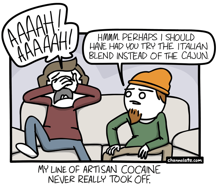
Channel Ate
Bad Newspaper
Poorly Drawn Lines
Cyanide and Happiness
I Hate My Parents
Funny to Me
"Another child sacrificed to the rainbow worm." I Hate My Parents
Cats, Beavers & Ducks
Cheezburger
Funny to Me
Bad Newspaper
Maximumble
 Cyanide and Happiness
Pandyland
Cheezburger
Berkeley Mews
Tastefully Offensive
Historic LOLs
Tastefully Offensive
Darius Whiteplume
Blackadder