Saturday, September 7, 2013

Geo 365: Sept. 7, Day 250: Crater Lake

A treat for this 250th day of 2013: a panorama of Crater Lake from the Merriam Point viewing area, at North Junction. Every approach to this caldera lake keeps it hidden until the last possible moment, then... POW! (Right click the image here for size options)

Photo unmodified. August 18, 2011. FlashEarth location.

Friday, September 6, 2013

Geo 365: Sept. 6, Day 249: Lupines!

Lupines are very common "spring" wild flowers at mid- to higher elevations in the Cascades, especially on recent fragmental volcanic deposits. That was certainly the case here, as we approached the rim of Crater Lake. They are legumes, like peas and beans, and have similar flowers and seed pods. Also, like many (most? all?) members of that group, they're "nitrogen fixers," which is a somewhat inaccurate shorthand of saying they have root structures, or nodules, that host commensal symbiotic bacteria. It's those bacteria that take atmospheric N2, and convert it to biologically useful nitrogen compounds like ammonium and nitrate. This gives lupine a competitive advantage in colonizing nitrogen-poor soils. I vaguely recall that there was one nitrate mineral listed in one of my texts, but for practical purposes, rocks contain no biologically useful nitrogen. Young tephra deposits may have available phosphorus and potassium as they weather, but there will be no available N until something like this lupine puts it there (there is also a small contribution by lightning). So while these pretty little flowers aren't geology directly, they're a huge part of the story of this area's recovery from a catastrophic volcanic eruption.

Photo unmodified. August 18, 2011. FlashEarth location.

Thursday, September 5, 2013

Geo 365: Sept. 5, Day 248: Red Cone

Looking roughly northwest, across scraggly trees struggling to hang on in this harsh environment, Red Cone occupies the right horizon. This source describes Red Cone as "the best preserved, the largest, and probably the youngest of the three northern cones." Of particular interest to me, though, at this stop, was the youthful "soil." Consisting mostly of rocks and tephra at the surface, I expect there's more sand and clay a few inches down. This area has only a few snow-free months each year, so residents need to be able to gather a years' sustenance- or complete their life cycles- very quickly.

Photo unmodified. August 18, 2011. FlashEarth location.

Wednesday, September 4, 2013

Geo 365: Sept. 4, Day 247: Mt Thielsen Over The Pumice Desert

Just a mile or so before the rim of Crater Lake, we pulled off the road to admire the views and the "spring" wild flowers. It was mid-August, but it had been an unusually late summer- the rim road wasn't open until late July- so the flowers were later than normal as well. There were still large piles of snow in many areas, especially on slopes with a north-facing aspect. The site of the last few days' photos, the Pumice Desert, can be seen as the tan plain in the middle of this photo, with Mount Thielsen rising directly behind it.

Photo unmodified. August 18, 2011. FlashEarth location.

Tuesday, September 3, 2013

Geo 365: Sept. 3, Day 246: An Odd Boulder

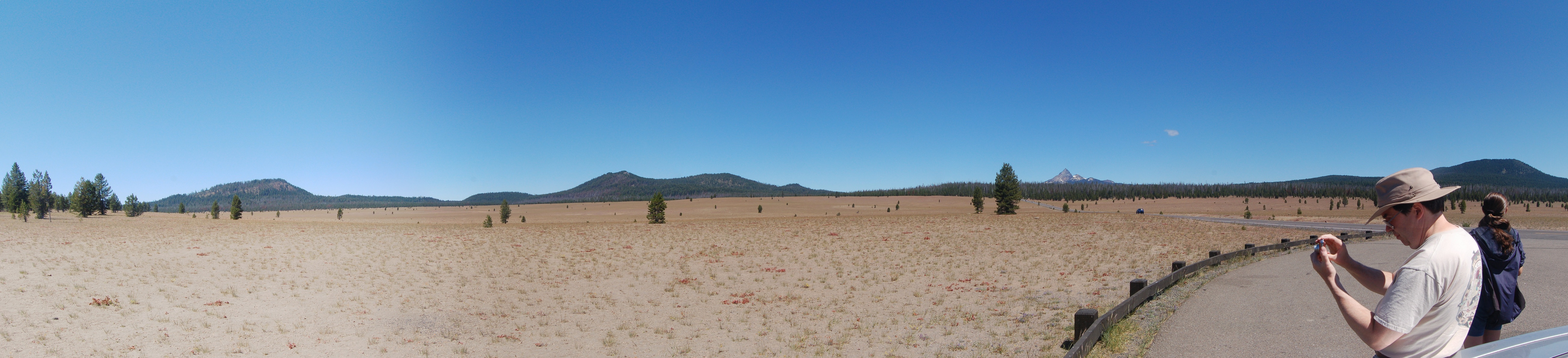
At first glance, no big deal. Looking more carefully though, there are some odd things about this (and if memory serves, a number of others nearby) boulder. First, this is sitting on top of an enormous pile of pumice (we're still at the Pumice Desert here). There's no way I can conceive of this rolling into place by some mass-wasting event. The only way I can see it getting to its current location (short of being put here by people, which seems unlikely) is being lobbed during the late stages of the Mazama eruption. We're a number of miles from the caldera here, and the boulder, while vesicular, is not pumice- this would have had to have been a heck of a blast.

The second oddity is the compositional banding. You can see some darker, apparently more mafic, bands between lighter, apparently more felsic, bands. The catastrophic Mazma eruption is thought to be the result of a basaltic addition at the bottom of a mostly felsic magma chamber. Is this boulder a result of the following mixing and overturn event? I can't say with any degree of confidence. I guess the way to put it is that it seems to me to be a reasonable speculation, but I have a lot of difficulty coming up with a mechanism that would put this boulder on top of pumice eruptions, from lower in the magma chamber, onto a plain roughly five miles from the caldera's edge. Lens cap is 52 mm in diameter.


Photo unmodified. August 18, 2011. FlashEarth location.

Monday, September 2, 2013

Geo 365: Sept. 2, Day 245: Mt. Thielsen Over Pumice Desert

Mt. Thielsen is another one of the Cascade peaks that has been inactive for a long time- in this case, about a quarter million years- and has been heavily incised by glacial erosion, leaving little more than a horn. For some reason that's not clear, the peak attracts lightning strikes more than similar peaks, and its summit is supposedly entirely polished to glass. Lightning-created glass is also known as fulgarite. As a result, Thielsen is known as the "lightning rod of the Cascades." Another bit of trivia: this is the southern-most Cascade peak I've been able to spot from Marys Peak. That was just one time, in the early-mid 1980's, when I got up there during a winter inversion. Inversions keep most of the human pollution down on the valley floor, but higher elevation air is crystal clear.

Photo unmodified. August 18, 2011. FlashEarth location.

Sunday, September 1, 2013

Geo 365: Sept. 1, Day 244: Pumice Desert Panorama

I've not yet touched Crater Lake in this series, and I probably have enough photos to do a whole month on that location. Not that I will, but I probably could.

So here we are, coming in the north entrance, at the Pumice Desert, looking more or less northward. (right click on the image here for size options)  You may recall the tremendous normal faulting I posted back in January, along Route 97, as we headed up toward this area. This mis-named "desert" actually gets plenty of precipitation, especially winter snow, but the high permeability and depth of the pumice (about 200 m) means rain and melt water simply drain through, and plants have been unable to become well established.

Photo stitched in HugIn. August 18, 2011. FlashEarth location.

Sunday Funnies: SPACE Edition

Bits and Pieces
 Darius Whiteplume's Tumblr
Funny to Me
Bits and Pieces... skeptical aliens among us!
Blackadder
Julia Segal
Wil Wheaton's Tumblr
Derpy Cats
Cheezburger
Bits and Pieces
"My daughter wanted to dress up her hamster in dolly clothes..." Several other costumes at Tastefully Offensive.
Blackadder
What Would Jack Do?
Bits and Pieces
There, I Fixed It.
Buttersafe
Cheezburger
Partially Clips
Savage Chickens
And notice who's standing in the lower left corner... Funny toMe
xkcd
Deathbulge
Funny to Me
Bits and Pieces
Bits and Pieces

"The roadwork Gotham deserves." There, I Fixed It.
Senor Gif
Senor Gif
Tastefully Offensive
Darius Whiteplume's Tumblr
Tastefully Offensive
All this time, I assumed Ewoks were most closely related to bears. Nope, kittehs. Derpy Cats
Jewel Staite
Very Demotivational
It would be even better if b)'s option was 100%, because in one interpretation, that would be correct as well. Very Demotivational
Derpy Cats