Saturday, March 30, 2013

Saturd80's: Suburban Lawns Edition

With only one album (and a couple singles), this is an obscure group, but nevertheless, a lot of fun. Flavor Crystals:

"Janitor" was their "big hit," so to speak. I really didn't "get" the chorus at the time, though I liked the verses. It turns out the chorus was a bit of an inside joke: from Wikipedia,
According to Smith, the two were conversing in a loud room when they first met:
She asked me what I did for a living. I said "I'm a janitor," and she thought I said "Oh my genitals." [Richard Whitney] overheard this and wrote the song.

(There's also a very fun live version here (with lyrics overprinted); I finally chose the above because I just love its retro look.)

Finally, this basically ties with Flavor Crystals- I love the lyrics (though repetitive, I find them hilarious)- as my favorite SL song: Mom and Dad and God.

Geo 365: March 30, Day 89: Hazy Horizon

Looking roughly northwest from Pilot Butte, on a hazy late summer day, near sunset. Near the center of the horizon, Mount Jefferson rises to a bit over 10,000 feet. A bit to its left is Black Butte. And barely visible halfway between Mount Jefferson and the right edge of the photo, Mount Hood pokes up (It's the pointy, low one, not the first rise right of Jefferson). I often complain about Oregon's haze in the mid to late summer, but a bit of perspective is in order. First, it's frustrating to me because I've seen the same views on good days: truly breath-taking. I just haven't been able to get back with my current camera. Second, let's look at the actual distances we're peering across: Black Butte is about 30 miles away, Jefferson about 50, and Hood, 93. So whining about "barely" being able to see 93 miles may be a bit of, well, whining. Below is a crop of the relevant section of horizon, run through Paint.net's auto-level routine:
On the other hand, take a look at a panorama from this same location, on a clear day with better light. (Wikipedia link) West toward the Three Sisters during our visit was looking directly into the sun, and futile. The lesson is that this may be a location better visited in the morning, at least for views of the Cascades.

Main photo unmodified. August 20, 2011. FlashEarth Location.

Friday, March 29, 2013

Geo 365: March 29, Day 88: Newberry From Pilot Butte

Looking more or less south from the top of Pilot Butte, the Newberry Volcano shield dominates the horizon. Some of the hundred-plus parasitic cones that cover that edifice can be seen on its flanks, through the foreground foliage.

Photo unmodified. August 20, 2011. FlashEarth Location.

Thursday, March 28, 2013

Geo 365: March 28, Day 87: Pilot Butte

Pilot Butte is a cinder cone smack in the town of Bend. I'm not finding information on its age, but simply judging from the lack of dissection, on one hand, but the moderately well-developed soils and full vegetational colonization on the other, would lead me to guess this is Holocene, but at least several thousand years old. [Note: See second thoughts and semi-correction here] While the photos with which I'll fill out the rest of the week were taken August 20, this was taken the next day on our return from Newberry Volcano National Monument. We're on "new" Route 97, heading north, here. "Old" (or Business) 97 was the route I was accustomed to taking through Bend as an undergrad. The new four-lane expressway was started in the late 80's I think, and completed sometime in the early 90's. There's nothing wrong with Bend, but my destinations are almost always on the other side of it, wherever I am. So it's always felt like an obstacle to get through or around, and I never really learned the layout of the town itself. But as we checked into the Budget Inn, something clicked, and I asked the clerk whether, if we drove up old 97 a ways, we could find Pilot Butte. I was awfully glad I did: it was a very pleasant- and unexpected- end to our day.

Photo unmodified. August 21, 2011. FlashEarth Location.

Wednesday, March 27, 2013

Geo 365: March 27, Day 86: Fire on the Motel

I had been planning on moving on from the obsidian in the motel facade today, but I realized I had a pair of photos from different angles that illustrate the "fire" quite nicely. It's only barely visible at the above scale, but if you click to enlarge, you can see the play of light is visible in the left ellipse, but not in the right. As a viewer moves, or slowly turns a loose cobble in their hands, you can see reddish-orange-gold flickers skimming through the rock's interior. "Fire mahogany," however useless it is as a geologic term- we'd just lump it all as obsidian- is a truly apt name for this rock.

Photo pair cropped and joined, otherwise not processed. August 20, 2011. FlashEarth Location.

Followup: I forgot to mention this when I first wrote it up, but it's important and interesting enough to add it on: Note the conchoidal fracture, originating from the edge on the lower right. That shell-like pattern persists across the whole exposed surface. Looking carefully, you should be able to see little streaks, like meteorites, perpendicular and radial to the conchoidal fracture, and if you look at the full-size version, you can indeed see little white blebs at the head of each, at the end of the streak toward the impact spot at the lower right. Those white blebs are phenocrysts- sanidine would be an educated guess- that disrupted the shock/fracture front as it propagated. So if you look over the entire exposed rock, you can see that the whole surface was created by one impact and one fracture.

Tuesday, March 26, 2013

Geo 365: March 26, Day 85: Obsidian Close-Up

A close up of one of the chunks of obsidian in yesterday's photo, the one near the doorknob on the right. It's not easy to see at this scale, but there's a bit of a glow to the red portion in that lower squiggle. Rock hounds have a slew of names for various colors and textures in what geologists would consider to be a single rock or mineral type. Plain red obsidian is called "mahogany," but examples like this, which preferentially reflect light at certain angles, are called "fire mahogany." Indeed, the dancing play of light can be quite reminiscent of flames in the right samples in the right conditions. It's quite lovely. I suspect the effect is due to an alignment of microscopic crystals- possibly hematite or magnetite- caused during viscous flow. It's fairly common, as I mentioned yesterday, at Glass Butte, about an hour east of Bend.

Photo unmodified. August 20, 2011. FlashEarth Location.

Monday, March 25, 2013

Geo 365: March 25, Day 84: A Pleasant Surprise at a Cheap Motel

Toddling from La Pine to Bend is a gorgeous drive with lots of volcanic features to admire, but the day was getting late, and having been shut out of lodging in La Pine, we wanted to get signed in as quickly as possible before setting out in search of dinner. The Budget Inn in Bend has horrible reviews, though I didn't think it was all *that* bad- lord knows, I've stayed in worse that were more expensive. However, my opinion may have been swayed slightly by the facade- the whole front of the building is studded with beautiful chunks of obsidian. I'm guessing this is likely from Glass Butte, about an hour east of town on Route 20. That dome has a tremendous variety of colors and textures, as seen above. However, short of geochemical testing, there's no real way to be certain.

Photo unmodified. August 20, 2011. FlashEarth Location.

Sunday, March 24, 2013

Sunday Funnies: Snow Day Edition

Were having a nice day here- a thin overcast, but the sun is warm. But from what I'm hearing out of the upper Midwest, people are getting tired of winter. Bits and Pieces

It's official: I got my BS in the Paleozoic. Tastefully Offensive
"When my professor asks if I read her latest publication on Greenschist Facies" Geology is Hard
 Blackadder
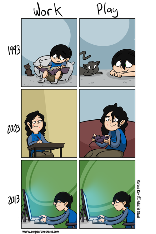
Corpse Run Comics
Sofa Pizza
"White House Petition of the Day" Wil Wheaton's Tumblr
Kicking Cones
Bits and Pieces
"When I do an outreach program all about volcanoes at an elementary school" Geology is Hard
Tree Lobsters
"When a bigwig visits my poster." What Should We Call Grad School
The Things That Were
The print is too fine on this one to post it here, so click over to Tom Tomorrow to see the whole thing- you can click the comic for full size snark.
"Vader's Little Princess" Four more at Mezcla Mental, via Blackadder.
Tastefully Offensive
Funny to Me
Pygalgia
Blackadder
Funny to Me "...day ain't over yet."
Pygalgia

Savage Chickens
Sober in a Nightclub
Historic LOLs
Julia Segal
Sober in a Nightclub
Funny to Me
Bits and Pieces
Wil Wheaton's Tumblr
Funny to Me
Blackadder

Geo 365: March 24, Day 83: Deschutes Meander

A meander in the Deschutes River, near "The Big Tree" in La Pine State Park (which I wrote up here). We had been expecting to stay in La Pine, but the lodging options there were more limited than I'd recalled, and a hotel that was reasonably priced didn't have room for us, so we drove up to Bend. This was a very worthwhile stop on the way. While we basically thought the geologizing was over for the day, there were still a couple of surprises in store for us...

Photo unmodified. August 20, 2011. FlashEarth Location.