Saturday, May 16, 2015

Geo 1095: May 16, Day 866: Conifer Confusion

If you look back at some of the photos from late March and early April of this year, on lava flows almost double the age of this one (~3000 years versus ~1600 years), you can see the trees near McKenzie Junction are scattered and stressed. That's not to say some of them aren't large and healthy, but the fresh surface to the east are clearly difficult for the conifers to flourish upon. We see a similar situation here. However, given that this flow is roughly half the age of the flows near the junction, it's a bit of a puzzle how these ones are doing as well, and are as mature, as they are. This area is perhaps more sheltered from strong winds (though I'm guessing; the valley could act as a funnel, and strengthen them), and being higher elevation, may get more annual precipitation. On the flip side, higher elevation means cooler, shorter growing seasons. The short version is that it's difficult to imagine even scattered trees growing to the sort of maturity we see here, from barren, sterile lava, in only 1600 years.

Photo unmodified. October 9, 2014. FlashEarth location.

Friday, May 15, 2015

Geo 1095: May 15, Day 865: Blocky Basaltic Andesite

This is pretty typical of the landscape of the Collier Cone Lava Flow's surface on the Proxy Falls Trail loop. There's not much here for a firm sense of scale, but those vine maples (with the bright fall colors) are probably a bit less to a bit more than person-height. If I was standing in the middle of this photo, most of their foliage would be lower than the top of my head, but a few of the taller stems might be a foot or two over it. When you take that scale into account, you can see what an unpleasant, and, bluntly, treacherous landscape this would be to attempt to cross or do fieldwork upon. If you didn't click through to the research paper I linked yesterday (mostly paywalled, but you can get the gist from the abstract), it's about using LIDAR on this flow to thoroughly map it, and using that data to elucidate how the morphology of the flow was created by its emplacement conditions.

Photo unmodified. October 9, 2014. FlashEarth location.

Thursday, May 14, 2015

Geo 1095: May 14, Day 864: Not What It Looks Like

After our brief stop up in the Lost Creek Cirque, we continued back down to the west until we got to the Proxy Falls trail head. The area south of Route 242 and the parking lot (FlashEarth location) is dominated by a steep berm of the Collier Cone Lava Flow. Most of the walk (maybe a mile or a bit more)  is upon that flow, the most recent in the area, at about 1600 years. The blocky Collier flow is basaltic andesite, with an oddly smooth, glass-like (but definitely not glassy) texture and feel to it. Given that it came from a cinder cone, there were certainly portions of the eruption that were gassy, but whether this was a later, less gas-rich portion of the original magma, or perhaps in this distal portion of the flow, the lava had almost entirely lost its volatile components, the result is rock almost if not entirely free of gas bubbles (in geologese, "non-vesicular.")

So I was sort of surprised to see what looked like breadcrust texture on this block. The first of those two links describes what "breadcrust texture" means, how it forms, and therefore what it implies. With little exsolving gas, breadcrust texture shouldn't form. As it turns out, it didn't. This is actually a coating of moss and lichen, nearly an inch thick, that I'd guess has shrunk with dessication at the end of a long dry summer. In the case of breadcrust texture, the crackles are the result of an expanding interior breaking up a solid surface. This is a case of a shrinking exterior breaking up over a solid interior. It pays to look twice.

Photos unmodified. October 9, 2014. FlashEarth location.

Wednesday, May 13, 2015

Geo 1095: May 13, Day 863: Precipice Perspective

As I illustrated with a crop from a topographic map a few days ago, this section of road is on an extremely steep headwall of a cirque at the head of (what I presume would be called) Lost Creek Canyon. I'll bet your eye was caught pretty quickly, as was mine, by the warning/speed limit sign in the upper left side. I'll also bet you didn't notice the similar one for traffic coming uphill, in the lower right.
Yep. There's a road down there.
Generally, I only post one photo per daily piece, and occasionally two to help clarify or extend an idea or feel of a location. I think this is the first time I've posted three, with the exception of a few "teaser posts," where I'm trying to capture a few highlights of a particular day's stops. In this case, I think these work well together, but the second and third wouldn't really be noteworthy on their own.

Photos unmodified. October 9, 2014. FlashEarth location.

Geo 1095: May 12, Day 862: More Sloping Lava and The Husband(?)

Walking down the road toward the lower switchback (note sign in lower right), there are more steeply tilted emplaced lava flows in the road cut. This would have been quite a show to see from nearby, but this particular location would have been an unpleasant spot from which to watch it. The issue likely wouldn't have been the lava itself, at least at first. Even runny lava doesn't tend to advance that fast. But on  this slope, hot boulders breaking and rolling off the flow would have heralded the advancing front. And even if you managed to avoid getting brained by one of those, they probably would have been setting numerous fires as they bounded merrily down the mountainside.

While the above is simply an exercise of my imagination, it's neither empty nor pointless; similar events will, with almost complete certaintly, occur in the future. The portion of the Cascades between North Sister and Route 20 has been highly active during the Holocene, and with the exception of the high peaks standing above the High Cascades platform, has been almost entirely repaved with fresh young mafic flows during the past 10,000 years. This road's existence will be quite short in geologic terms. It may not be destroyed in the lifetime of anyone reading this, in fact, it most likely won't be. It might be centuries, but it might be only months... this drive will almost certainly be buried under fresh basalt.

As I indicated in the title, I think the peak on the horizon in the left middle is The Husband, a large peak to the west of The Three Sisters, though of lower prominance than any of them. I'm not certain, though, thus the parenthetical question mark.

Photo unmodified. October 9, 2014. FlashEarth location.

Monday, May 11, 2015

Geo 1095: May 11, Day 861: Still Not Horizontal

We're looking, at the top of this shot, directly up-dip into the lava flow in the center of the previous photo. Even though it looks flat, it's tilted toward us. You can imagine standing squarely in front of a house and seeing a seemingly flat edge of the roof above the gutter. The "line" is flat only because it cuts perpendicularly to the gradient of a tilted plane. That doesn't mean the roof is flat or horizontal. This is exactly the same situation, but with rocks, not roofs. (The blurry blue thing at the bottom is a passing car.)

Photo unmodified. October 9, 2014. FlashEarth location.

Geo 1095: May 10, Day 860: Original Horizontality... Not!

Looking down the road from our pullout, you can see the slope of a few post-glacial lava flows, most notably the prominent one near the center of the photo. The post title refers to a principle of interpreting sedimentary rocks, in that the general assumption is made that sediments were deposited in horizontal or near-horizontal beds. If you want to get picky about it, that's not always precisely accurate, but it's a starting point, and it's accurate enough in the majority of cases. As we can see here, though, when we're dealing with lava flows, despite the superficial appearance of bedding, we can't start by assuming those "beds" were deposited horizontally. In this case, they were deposited on and parallel to the ground surface, which is pretty darned steep here.

A nice example of a basal breccia can be seen under the center flow.

Photo unmodified. October 9, 2014. FlashEarth location.

Sunday, May 10, 2015

Sunday Funnies: Graduate Edition

For most universities, this is graduation time, but OSU is on a quarter system rather than a semester system, so ours isn't for another month. Best wishes to all the new diploma holders!
Tastefully Offensive
"A graduate always repays their debts." Tastefully Offensive
Tastefully Offensive
"This is what friends are for." Senor Gif
Jim Benton
Down the Upward Spiral
Tastefully Offensive
Jim Benton
Surviving the World
Senor Gif
Gone into Rapture
Needs the subcaption, "I'll be back for you next week." Jim Benton
Funny to Me
Savage Chickens
Mike Luckovich
Jake Likes Onions
Tastefully Offensive
Sober in a Nightclub
Jim Benton
Funny to Me
Down the Upward Spiral
"When my friends assume I get the summer off." What Should We Call Grad School?
xkcd
Sid Trotter
How to drink space water." Senor Gif
Tastefully Offensive Two of a number of "Anna Kendrick's shower thoughts." More at the link.
Jack Ohman
Savage Chickens
Buttersafe
Funny to Me
Sober in a Nightclub
One of five science trivia facts at Fake Science
Sarah Andersen
SMBC
Tastefully Offensive (Fun word to delight friends and family: borborygmus)
Tastefully Offensive
Mumbletimes
Ryan Selvy
Wondermark
Sober in a Nightclub
Tastefully Offensive
ChannelAte & Bonus Panel
Jen Sorensen
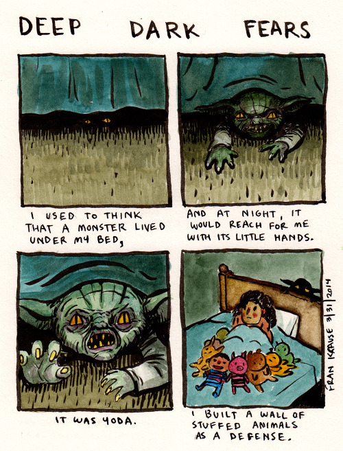
Deep Dark Fears
xkcd
Spud Comics
Pie Comic
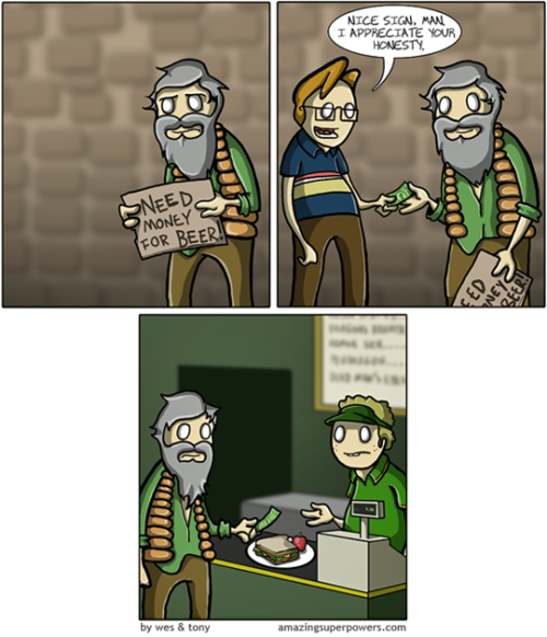
Amazing Superpowers
Pleated Jeans
What Would Jack Do?