Showing posts with label OMN. Show all posts

Sunday, June 14, 2015

Why, Hello, There!


Apologies for the two-week hiatus. If you follow me on Twitter, you know we had about five days over that interval that were hot enough to knock me down and out- hot weather destroys my appetite, so poor nutrition was likely a factor too. I finished the Upper McKenzie stretch of the Geo series, and I just lost motivation- coinciding with the first of the hot days. Then my co-presenter for the Oregon Master Naturalist Willamette Valley Geology workshop had to cancel, so instead of planning half of that day, I'm planning all of it. And I got called for jury duty tomorrow (Update: Yay!). And on and on. I make no promises either way on the continuation of the Geo series, though I have hatched an idea that could allow for a quick catch-up with minimal work. On the "maybe not" side, Dana is also suffering from a series of set-backs (pitch in if you can), I haven't been out in the field since October, and I don't have a whole lot more trips to choose from in terms of photo series.

And yes, I am still tagging stuff for Sunday Funnies. Both the last two Sundays have been beastly, and finishing this up today means I won't have time this Sunday either. But never fear, they'll be back. Sigh... okay, here's a good one:

On the flip side, I did do a scouting trip for next Saturday's field trip (too busy taking notes to take photos, though) so here's the result. For those doing this trip on their own, it would likely be easiest to reverse stops 1 and 2, starting in the parking area, then going two to three tenth miles back to the Tyee soil, then subtract 4.9 miles from the mileage at each subsequent stop. (In other words, no need to start at OSU, just start at Chip Ross Park.)

Marys Peak Field Trip Route and Stops

Players in the story, oldest to youngest:
·                     Siletz River Volcanics- sea-floor and Hawiian-island type basalt, about 60 to 50 million years old (Ma = "mega-annum," or million years.)
·                     Kings Valley Siltstone- formed from erosion and marine redeposition from one or more islands of SRV. Toward the end of same span as SRV.
·                     Tyee Formation- Turbidites, vast underwater "sand and dust storms" that settled out in distinctive sand->mustone couplets, from erosion of granite to the east, in or near the Idaho Batholith. About 48 to 38 Ma.
·                     Corvallis Fault- A fracture in the earth's crust creating the boundary between the Willamette Valley floor and Coast Range foothills in the Corvallis area. Probably active around 35 Ma for a few million years, but does not appear to have been active since the following intrusive activity.
·                     Marys Peak sill (along with numerous similar intrusions of about the same age and composition in central Coast Range)- Gabbro, similar in composition to basalt, but slower cooling, so larger mineral grain size. Quite resisitant to weathering and erosion. 30 Ma.

We will be walking along the roadside at several stops. Be alert for traffic, and make safety your first priority.

Mileage Location/Stop Number/Feature

0.0 Depart Richardson Hall. Zero odometer as you turn onto 30th Street northward.

-At intersection with Harrison Blvd., turn right, and jog over a block to 29th.
-At 29th, turn left and continue north to Walnut Blvd.
-At Walnut, turn right, and continue east to Highland Dr.
-At Highland, turn left and wind up the hill to the ridge crest.
-Just before Highland descends into Crescent Valley, turn left on Lester Avenue. There's a small brown sign pointing to Chip Ross Park on the right (Correction: left- this is an unusual case where I really did recall right, rather than making a sloppy mistake) berm.
-We didn't get accurate mileages until noted, so the first two stop mileages are estimates from Google Maps

4.6 Stop 1 Lester Ave. Roadcut. Soil developed from Tyee Formation- note light yellow color. The Corvallis Fault cuts across the lower saddle between here and the Chip Ross parking area. As we move from stop 1 to stop 2, look for nice views to the southwest of Marys Peak and Alsea Pass, where this same fault cuts across the Coast Range crest.

4.9 Stop 2 Chip Ross Park Parking lot. Soil developed from Siletz River Volcanics- Note dark red color. Why are we going up Marys Peak to look at the geology of the "Willamette Valley?"

-Return to Highland, and turn right.
-At Walnut, turn right.
-Follow Walnut roughly 5.5 miles to Philomath Boulevard. The line of hills to the north and west of this drive is more resistant Siletz River Volcanics, uplifted by offset along the Corvallis Fault. The less resistant Tyee (and overlying Spencer) Formation form, at most, low hills to the south and east.

11.8 -(At this intersection, we figured out how to get tenth-mile accuracy on our exploratory vehicle.) At Philomath Boulevard, turn right and procede through Philomath.

15.6 - Route 20/34 split. Turn left, and follow route 34 to Alsea Pass.

24.5- Marys Peak Road- turn right, and drive to the Marys Peak Summit Parking area.

34.0- Stop 3 Marys Peak Summit Parking area. Lunch. Depending on interest, some of the group may choose to hike to the summit. (We budgeted about an hour here.) This, to me, is one of the most profound viewpoints in Oregon. There are quite a number that are more scenic, but I can think of few that have such a mental wallop. We're standing on the Coast Range crest, the divide of the Cascadia forearc ridge. To the east, if we have decent visibility, a few to many of the Cascade Peaks are visible. Normally, Mount Jefferson and Three Sisters can be seen, and Mount Hood can be picked out more often than not. On rare days with near perfect conditions, one can see from Mount Rainier in the north to the vicinity of Crater Lake to the south. To the west, the Pacific Ocean can be seen, taking on different appearances as the light changes through the day. With help from trigonometry, you can calculate that the distance to the horizon is about 75 miles, which is close to where the Juan de Fuca Plate begins its long slide into the earth's interior. It's that slide that has created the forearc ridge of the Coast Range, the more-or-less vertically stationary forearc basin of the Willamette Valley, and water "sweating" off the subduction slab causes melting in the upper mantle, creating the magma that produces volcanism in the Cascades. My favorite metaphor to describe what we're seeing is that here, we have an overview of one piston in the engine that drives earth's plate tectonic activity!

Before departing, be sure to make use of the sanitary facilities at the south end of the parking lot. There will be no further opportunities for actual restrooms until we return to Richardson Hall.

35.1 Stop 4 (Possible, depending on how time looks) This meadow provides a long parade of wildflowers from mid-spring into mid-summer, but in terms of rocks, a short walk up the road to the closest cut will reveal a metamorphic rock called hornfels, created when heat from the underlying Marys Peak Sill baked the overlying Tyee formation. This is similar in nature and effect to what happens when you fire a raw clay pot in a kiln; it becomes harder, stronger, and more dense.

36.7 Stop 5 Parker Creek Falls. This is the dense, tough, and extremely resistant to weathering and erosion Mary's Peak Sill, a rock called gabbro, and a good illustration of how Marys Peak sits about a thousand feet higher than any other Coast Range mountain. Note that most of the weathered, and lichen/algae coated cut face looks like basalt. But if you look carefully, a more recently broken surface will show a typical "salt-and-pepper" appearance. Those light and dark grains are the minerals making up the rock. Individual mineral grains are not visible to the naked eye in "typical" basalt. (There are exceptions beyond the scope of this workshop.)

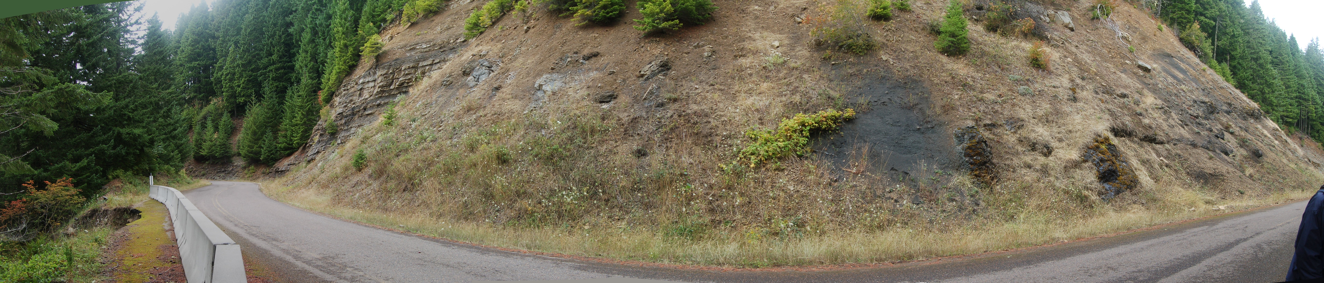
37.1 Stop 6 We'll pull off a bit up the road from the outcrop, as there isn't safe space at the spot itself, and walk down the road to a nice outcrop of horizontally-bedded Tyee Formation. Note the abundant mica flakes and fragments of plant material- these two features can help distinguish this rock unit from others. A bit farther on, there is a fairly chaotic outcrop of Kings Valley Siltstone, which is derived from erosion of Siletz River Volcanics. As we saw at Chip Ross Park, the color difference between these two units is striking. Given that the Tyee is horizontal, there must be a fault between these two exposures, even though we can't see it. Walking across the road to the guard rail, we see another effect of the hidden fault: a fairly large landslide. The fault created a zone where the rock was broken up, and water and air had better access to the rock, speeding weathering and further weakening it.

39.9 Stop 7 Parking lot. Park here and walk back about a quarter mile or so to a quarry exposing spectacular pillow basalts of the Siletz River Volcanics. Keep in mind, these were erupted on the ocean floor. Here, they've been uplifted to thousands of feet above sea level.

40.5 Stop 8 (Possible, depending on how time looks) Columnar basalt is common in Oregon, which is no surprise, given how much of the state is covered with that rock. These are the best examples I know of on Marys Peak.

40.7 (In passing; we'll try to slow down a bit to get a look, but we won't be stopping.) Slickensides. The vertical scratches, or striations, you see on this wall were created as a fault ground the two opposing surfaces. The orientation of the "slicks" gives you two possible directions for fault offset: up or down, parallel to the scratches. Continue back to Route 34, and turn left (east) back toward Philomath and Corvallis.

45.1 Stop 9 We will not be crossing the road here. Both we and oncoming traffic have very poor visibility. Tilted beds of the Tyee Formation. Unlike the flat-lying beds of Tyee we saw near the top of the peak, these are steeply tilted. Now off the Siletz River Volcanics, we've crossed the Corvallis Fault again, but it's very close by, probably crossing through the clear cut up the valley. Deformation and folding near major faults is common, and explains why these beds are tipped over to such a degree.

58.3 Return to Richardson Hall.

Postscript: The sequence we've seen here, ocean floor volcanics, overlain by marine sediments, and modified by later events, such as magma intrusions and faulting, varies in details from place to place in the Willamette Valley and the Coast Range, but as a general outline, is consistent across the region. In other words, if you were to drill a hole on the Willamette Valley floor, you would go through a few to a few hundred feet of  Missoula Flood and Willamette River sediment, then you'd hit marine sedimentary rock of one formation name or another. (From the Albany-Salem area north to Portland, you'd also encounter Columbia River Basalt interfingered with the uppermost marine sedimentary rock.) Eventually you'd go through the Tyee, which is the lowermost of those sedimentary units, and pretty much ubiquitous in the region. Finally, you'd hit basalts of the Siletz River Volcanics. Those basalts are not continuously exposed on the surface, so they have different names in different areas (Roseburg Volcanics and Crescent Volcanics, for example), but they were all formed the same way in a geologically short period of time, and they are believed to be all the same unit, connected underground where we can't see it. Climbing nearly four thousand feet off the valley floor has allowed us to see rocks that lie thousands of feet below it. Furthermore, as we saw at the first two stops, due the the milder climate of the lower elevations, rock that is exposed in the valley is often too weathered to get much information from.

Monday, July 21, 2014

Geo 730: July 21, Day 567: Sidewalk, Redux

Okay, it's a pretty lousy photo, and the shadows from the fence when I was out taking pictures don't help at all, but here's the same stretch of sidewalk I featured five years (!) and a month ago. I've annotated just two of the more distinctive pebbles, but you can see the full deal here. That photo seems to have a big impact in presentations I've done over the past few years. In a field trip a month ago, participants found quite a few nice agates at our first stop, and were somewhat distracted from the geology we wanted to point out. No great loss, though. If they take away the importance of geological materials in construction, I can concede distraction from other rocks.

Photo unmodified. July 18, 2014. FlashEarth location.

Sunday, July 20, 2014

Geo 730: July 20, Day 566: 9 to 5, and Nighttime, Too

Interzone's sundial is marked from nine AM to five PM, and oddly, "Night" is marked, too. How does that work? When the sun goes down, the street light comes on, and casts a shadow along the marked path. We're on a spnning ball of rock, which means the sun appears to move through the sky, but the lamp spins with it, so it appears fixed.

Photo unmodified. July 18, 2014. FlashEarth location.

Saturday, July 19, 2014

Geo 730: July 19, Day 565: Lavender Garnished with River Gravel and a Bonus Butterfly

Prior to chalking in the sundial in yesterday's photo, Tim and his son removed the cheatgrass that normally dominates the base of the pole, brought in some good soil, and planted a number of lavender starts. Then they tiled the bare areas with some river gravel. It's a refreshing change from the nasty invasive. A passing butterfly appears to agree.

While the angle of the shadow with respect to 16th and Monroe is not evident in this photo, I'll first admit, I threw out a bit of a deceptive comment yesterday when I described 16th as running "roughly north-south." The original street grid in Corvallis was laid out parallel to the riverfront, and runs about 20 degrees east of north. At Kings Avenue, a block west of my current location, the street grid snaps to N/S-E/W, or truly compass oriented (See the FlashEarth location). Second, due to modern horological conventions, we're currently on daylight savings time, which means the clock gets to noon about an hour earlier than the sun reaches "true noon," at its greatest height in the sky and directly to the south. Put those two factors together, and you can see why the two o'clock mark is the one that's almost parallel to 16th street, not the 12 o'clock mark.

Understanding these sorts of seemingly unrelated tidbits to make sense of the world around us is all part and parcel of "thinking like a geologist." I commented, "we're looking at an intersection of geology, geography, horology, and human history." When solving geological puzzles, one needs to be able to draw from a great many disciplines, even if the puzzle is as trivial as, "Why isn't the shadow falling where we'd expect it to?"

Photo unmodified. July 18, 2014. FlashEarth location.

Friday, July 18, 2014

Geo 730: July 18, Day 564: High Noon at Interzone

I'll be taking a few days' break from Quartzville to enjoy a spontaneous bit of art that happened at Interzone starting on Tuesday. Every hour, on the hour, IZ denizen Tim snapped a chalk line on the left edge of the shadow cast by the street lamp/telephone/power pole on the northeast corner of 16th and Monroe. Then the lines were bolded and times colored in with sidewalk chalk by Heidi and Erin. Shea drew a silhouette on the two o'clock line, which is the one most parallel to the street. This was shot within a minute of noon; for the time being, it's surprisingly accurate.

Where's the geology in this? If you've followed this blog at all, you know my attitude is that it's all geology, and this is no exception. Under the "12" is asphalt, a mixture of petroleum products, sand and gravel. Under my shadow and in the upper right is concrete, made of lime (CaO) (which in turn is limestone (CaCO3) heated to drive off the CO2) mixed with clay, to which water, sand and gravel are added and allowed to set. The chalk itself is either the same composition as limestone (true chalk) or gypsum (which is softer and easier to work with). These materials are normally powdered, some clay added for a higher degree of consistency and hardness, then pigment and binder added. The result is then molded into the cylindrical form in which we are accustomed to using it.

At a more esoteric level, we're looking at an intersection of geology, geography, horology, and human history. I'll get back to this tomorrow, but I'll leave with a comment and a couple questions: the streets in this area run roughly north-south. Why is the sun at noon casting a shadow so far to the west? Wouldn't you expect the shadow to be falling northwards, roughly parallel to the street, rather than across it?

Photo unmodified. July 18, 2014. FlashEarth location.

Saturday, November 2, 2013

Geo 365: Nov. 2, Day 306: Cloudy Coast

Back on Route 101 from the Otter Crest Loop, the view down to Beverly Beach was pretty hazy, but the cloud line where moist coastal air was being pushed up the mountainside was very clear. Seeing the clouds forming like this helps clarify why the coast gets so much more rain than we do: here the air is rising. On the valley side of the Coast Range, the air is descending. We have plenty of gloomy, damp weather in Corvallis, but our actual precipitation rate annually is fairly moderate, at just over 40 inches. The actual coast gets 100 to 120 inches per year, and higher areas up near the Coast Range crest can get up to 160 inches or more.

Speaking of the Loop road, I meant to mention that its northern portion is one-way, north to south, and much of it is single lane. There are lots of bikers and pedestrians, so take it slow. But it's a beautiful few-mile drive I hadn't done before, and very much worth while.

Photo unmodified. May 6, 2013. FlashEarth location.

Thursday, August 8, 2013

Collapsing Schools

The Eugene Weekly is a free "alt" newspaper that comes out of Eugene, Oregon every Thursday. "Collapsing Schools" is the cover story this week.
Photo by Trask Bedortha
I occasionally pick up a copy to read "This Modern World" and "Red Meat" or to browse through when I've finished reading the internet. My take on the article? It has a very definite Eugene focus- which is to be expected- but change the names and locations to any other west side PNW district, and it's pretty representative of the problems those districts face. Rebuilding and/or remodeling/retrofitting is awfully expensive, and too often, keeping up with new building code is simply impossible. But the closing comments in the final paragraph are too important to ignore:
For engineers like Wang, it’s all about protecting Oregon’s infrastructure and, more importantly, its people.  “The goal is to get something done slowly but surely so it’s not that painful when we divert a small percentage of our funds to improve things,” Wang says of the statewide mission to prepare Oregon schools for a major earthquake. “After it happens, we will definitely wish that we did more. I’ve seen it all around the world. No one ever expects it; it’s always a surprise. But those who prepare well recover more quickly.”
Yes, I think we should be working more quickly. But it's reassuring, as always, to know that even when I'm not aware of it, progress is being made.

Wednesday, June 26, 2013

Geo 365: June 26, Day 177: Jefferson and Three Sisters

A view similar to Monday's panorama, but a single shot. Mount Jefferson is visible in the gap in the trees to the left, and Three Sisters, somewhat obscured in low clouds, can be seen near the center. I suspect there are viewpoints less obscured by trees farther up the summit trail, but we were time constrained on Saturday, and I no longer have the stamina to tackle even a portion of that trail lightly. Unless the viewing is excellent, I'm not going to wear myself out trying.

Photo unmodified. June 22, 2013. FlashEarth location.

Tuesday, June 25, 2013

Geo 365: June 25, Day 176: These Are Some Features in My Neighborhood

Looking east out over the Willamette Valley from the top of Marys Peak, the fault marking the boundary between the valley floor (forearc basin) and the Coast Range (forearc ridge) is pretty obvious. The fault itself actually sits about 1 1/2 km (1 mile) in front (east) of the prominent ridge. This sort of landform, where the escarpment runs parallel to the fault, but not on the fault- typically because erosion has beveled the ridge back- is called a fault line scarp. This differentiates it from a fault scarp, which is taken to mean that the ridge accurately marks the location of movement.

The Corvallis Fault is stitched by gabbroic/diabasic intrusions of Oligocene age, contemporaneous with and similar to the Marys Peak Sill. These intrusions have not been broken tectonically, providing good evidence that our neighborhood fault has not been active for roughly 30 million years. Despite its proximity to town, it's not one we need to worry about with respect to seismic hazards.
1st photo unmodified; in 2nd, contrast ramped up and annotated in Paint.net. June 22, 2013. FlashEarth location.

Monday, June 24, 2013

Geo 365: June 24, Day 175: The View Across the Valley

The view on Saturday looking out over the Willamette Valley (forearc basin) to the Cascade volcanic arc. Mount Jefferson on the left (north), Three Sisters on the right (south). We're standing on Marys Peak, the highest point in the Oregon Coast Range, the forearc ridge. It's difficult to describe how profound this view is to me; we're looking at a fundamental component of the earth's engine.

Photo stitched in Hugin, otherwise unmodified. June 22, 2013. FlashEarth location.

Wednesday, June 19, 2013

Marys Peak Geology Roadlog

Saturday, I'm doing another Willamette Valley Geology Workshop for the Oregon Master Naturalist Program, and yesterday Bob Lillie and I went over the schedule, outlines of presentations, and scouted out the Marys Peak Geology field trip we'll be doing to top the whole thing off. I've posted various bits of stops up Marys Peak in the past, but never really brought the whole thing together in one cohesive guide before, so I hope this is useful to people who are interested in exploring the area on their own.

Imagine Coffee is at 53rd and Philomath Boulevard (Route 20/34) between Corvallis and Philomath. I had never been in there before yesterday, but based on my visit, it's a nice relaxing space, with good coffee, tasty breakfast sandwiches, and a nice selection of pastries. I'm sure they wouldn't mind your business, but if you're in a rush, just zero your odometer as you go through the intersection with 53rd Street.

Why Marys Peak? I know my Oregon Central Coast Range geology pretty well, and there is no place that gives an as complete or well-exposed transect as the drive up Marys Peak. It shows a tale of ocean floor eruptions, building to Hawaiian-style subareal eruptions, with associated erosion and deposition of volcanoclastic sediments on the flanks of that(those) island(s). This was followed by subsidence, accretion to North America, and pretty much at the same time, burial under a voluminous Eocene sediment source in the form of an apparent river drainage coming out of the Idaho Batholith. I've seen speculation that the headwaters of this drainage lay in the lake environment that created the Green River Formation in the UT/WY/CO tri-state area, but I don't know whether that was ever confirmed. While the coarser deltaic facies of the Tyee Formation now lie to the south, in the Roseburg area, in the central coast range, this unit forms well-defined couplets of sandstone-silt/mudstone turbidites. Finally, about 30 million years ago, as the reactivated (after stepping back and reinitiating following the above-mentioned accretion) Cascadia subduction zone got going, a series of Oligocene intrusives invaded the Coast Range. The thousand-foot-thick Marys Peak Sill is an outstanding example of one of these, and its resistance to weathering and erosion make it a capstone protecting the softer underlying rocks, explaining why Marys Peak is the highest in the Coast Range.

Even if you aren't into geology, the drive to the top is replete with wonderful scenery and a parade of ecological change as you drive through ever higher elevations and frequent changes in aspect, leading to large variations in sun and moisture availability. The views from the summit area are to die for. And for geologists, the ability to walk from one side of a parking lot to the other, and see from pretty much directly over the subduction zone, under the ocean horizon to the west, the forearc ridge (where the peak stands), the forearc basin (the Willamette Valley), to the volcanic arc (the Cascades), is utterly mind blowing. You can, from one spot, see a cross section of one of the major features resulting from the plate tectonic activity of our planet.

0.0              Start (Intersection of 53rd and Philomath Blvd-Route 20/34)
0.4              View to north of hills on N side of Corvallis Fault- Siletz River Volcanics
3.7              Turn Left on Route 34, to SW, toward Alsea & Waldport
10 .0           Switchbacks up to Alsea Pass
11.1            (pull off on left; caution crossing opposite lane) Stop 1: Steeply dipping beds of Tyee Formation turbidites.
12.7             Turn right onto Marys Peak Road
14.8             (Optional stop- not easy to get more than one or two vehicles off the road here, not recommended for larger groups) Hyalocalstite below (on the right, if you're facing upslope), crudely columnar jointed basalt sill above (left). In between,  a few inches of Kings Valley Siltstone, the result of erosion and deposition of Siletz River Volcanics that erupted subareally. This is the lowest (stratigraphically) spot in which I've found it.
15.9             (Optional stop) Pullout on left. Across the road is a nice set of columnar joints that roll over along the outcrop, so you can see them both from the side and on end. They rest over some oddly and very heavily weathered sphereoids of (possibly) a pre-existing flow. I'm not certain how to interpret this contact, but I've been considering that it might be a stream channel that was filled by a later subaereal flow. I want to emphasize that that idea is highly speculative, but I haven't been able to come up with an explanation I like better.
16.4             Large parking area on left, pull out and regroup for walk to Stop 2, Pillow Basalts (+lunch) See further discussion here. Hand sledge for scale on lower left of outcrop.
18.2             Harlan Road to left (Optional side trip) Drive about a mile down a very rough, pot-holed gravel road to the outcrop just past where the power line crosses the road- there's room to get off the road on the downhill side at the lower end of this outcrop. This is the best exposure I know of of the Kings Valley Siltstone, though it's weathered pretty badly over the years. See this for a detailed discussion of the unit. Another feature here are some ashy layers. It was suggested in the early 80s that these might be derived from the Challis Volcanics (PDF), and with the clearer picture of the Coast Range block migration that emerged in the mid to late 80s, that seems to make even better sense.

Continue down the road another 1/2-3/4 mile (We didn't do this spur on our scouting trip yesterday, so I don't have good mileages), to where the road turns well into the hillside to contour into a significant drainage, Parker Creek. There a very obvious parking area, a fire ring and a number of large, beautiful cedars. I particularly like this spot due to the gorgeous riparian habitat, with ferns everywhere, and the gigantic trees. Geologically, though, we've gone downhill, but up section- the bedrock is Tyee Formation, which overlies the Siletz River Volcanics and its associated Kings Valley Siltstone member. So we can infer a significant fault somewhere between the previous stop and this one. Return to the main road, and turn left.
19.2             Pull out to left as far as possible, walk back to Stop 3, Tyee Fm, Kings Valley Siltstone, fault and landslide
(Click here for a selection of sizes at Flicker; right click on that image for a list of size choices. Alternatively, right click on the photo above and open image in a new window.) To the left, you can see the horizontally bedded Tyee Formation, with its well-defined sand-mud couplets. On the right, the poorly bedded and more chaotic Kings Valley Siltstone stands out mostly because it's so much darker- almost black- than the Tyee. Again, we can infer a fault between these two exposures. Another point of interest is that you can see the base of the Tyee above the Kings Valley on the right side (though it doesn't really show up in the above photo)- the only place I think I've ever seen the base of that unit. On the left-most side of the photo, you can see a temporary Jersey Barrier, and the edge of the road has collapsed. This has been repaired, and the barrier replaced with a hefty guardrail, but this failure was very likely due to the fault, which shattered the rock, and allowed easier access for water and air to weather the zone out more quickly and easily than elsewhere.
19.6             Parking area to right for Stop 4, Parker Creek Falls, Marys Peak Sill (Gabbro) This is a terrbly tough, resistant rock that intruded into the base of the Tyee about 30 million years ago. It has acted as a protective capstone, about a thousand feet thick, over the softer, more weathering and erosion-prone rocks below it. That, in combination with uplift between the Corvallis and Kings Valley faults, explains why Marys Peak is nearly 1000 feet higher than the highest of the other Coast Range Peaks.
21.2             (Optional stop) Meadow Pullout on right. Due to elevation, with subsequent harsh winter weather- deep snow pack, powerful winds, bitter cold, and comparatively short growing seasons- along with parched, dry summers- this is the first place along the road where we see the mountain meadows that dominate the crests and south sides of the Coast Range's tallest peaks. Flower season runs from early May into July, with a long cast of characters that's constantly changing. Take a moment to consider how the stack of geology we've seen so far has created the environment that supports this botanical wonder, then walk east up the road and look for the rocks in the road cut. This type of rock is called hornfels, and it was created by contact metamorphism when the sill below cooked overlying Tyee sandstones and silts. See Dana's post for more information being explained by me in video format.
22.3             Summit Parking area, Stop 5: views of subduction zone, forearc ridge, forearc basin, and volcanic arc. I can't say enough about this spot. There must be other places in the world where you can basically see from the location of the subduction zone to the associated volcanic arc, but this is the one I know. And it blows my mind every time I get up there on a clear day. Again, here's what Dana had to say about it. Below is a view to the west from near the summit parking area; the dim blue line is the horizon above the Pacific Ocean, and a bit of trigonometry suggests that the horizon is about 75 miles distant- very close to the location of the decollement fault where the Juan de Fuca plate begins its dive under North America!
One final optional side trip, if you want a bit more petrologic goodness. At the northeast corner of the parking area, a trail descends the mountain side after following the summit ridge a ways. Walk a few hundred yards/quarter mile or so down the trail, and keep an eye out for cobbles of Marys Peak Sill weathered out onto the surface.
Enjoy your geotripping!

Saturday, June 15, 2013

Accretionary Wedge #57: Seeing Geology Everywhere!

Evelyn is hosting AW # 57, Seeing Geology Everywhere.

I see rocks. They're everywhere, in everything. And most of the time, people don't even know they're rocks.

This is a topic I've brought up more times than I can count at this point. (See "Show Me Your Sidewalk," "Geology is All Around Us!" "Geology at Oregon State University," "AW #52: Geology Dream Course," "The Geo Biz," "We Dohn' Need No Steenkin' Rocks," "98 102 97 88" "Cycles Without End (AW #30)," and, in particular, "A Worldview That Resonates With Me," as a few selected examples.) The question I keep getting stuck on is, "What can I say that I haven't said before?"

The only thing I can think of is to phrase it as a challenge: I defy you to find *anything* in your environment that isn't directly or immediately indirectly (by which I mean only one or two steps of remove) dependent upon, or shaped by, geological resources and processes. The thing is, there really isn't anything that doesn't fit that description. The landscape you live in (or vacation in, for that matter), however modified by human engineering, was created in its basic outlines by water, the solid earth, climate and biological interactions. The computer you're reading this on is a creation of a wide variety of minerals and petrochemicals, painstakingly fabricated, doped with extraordinary precision, and despite its incredible complexity, assembled and sold at a price people can readily afford. Almost everything in your home was delivered by (mainly) steel vehicles propelled by hydrocarbon combustion. It's a rare meal indeed, at least in the developed world, that doesn't have a healthy (or unhealthy) dose of table salt, NaCl, or halite. For the sodium sensitive, you can substitute in a certain amount of KCl, or sylvite. If you get heartburn after a hearty meal, you can take an antacid made of fine-grained calcite, CaCO3, or gibbsite, aluminum hydroxide, Al(OH)3, to neutralize the acid. Then you can relax with a glossy magazine or coffee table book. The reason the pages are glossy is that a mixture of clay minerals has been rolled and compressed into the paper; the tiny clay flakes are flattened parallel to each other, giving the paper the appearance of reflectivity. It's the man-made equivalent of phyllite.

Geology's ubiquity and importance in terms of materials and energy make it among the most economically important of the sciences. The fact that so few people seem to get that is frustrating. I am by no means arguing that everyone should be an expert in geology, but I would argue that nearly everyone would benefit by having a good high school-level, year-long, geology course. What rightly or wrongly is perceived as a recent spate of billion-dollar disasters have been in large part geologically mediated. It doesn't require a college degree to be able to pick out settings that are more or less susceptible to flooding, storm surges, wind damage, landslides, slumps, debris flows/lahars, tsunamis, earthquake damage and so on. In many cases, a minimum of education, rather than waiting for the intonations of experts, could help an intelligent consumer make better choices about places that are more or less safe to live.

And I haven't even touched (here) on the awe and amazement I feel when, with the help of both what I know, and research performed by others, I stand on an outcrop, and gaze clearly into the past, through an abyss that might measure billions of years in duration. I have felt nothing, and I mean absolutely nothing, that makes me feel one with creation, in the way that experience does.

So, yes. I see rocks. They're everywhere. Most people don't even know they're rocks. And from my perspective, that's an enormous loss on their part.

Saturday, April 13, 2013

Geo 365: April 13, Day 103: PNW Palms in the Breakers

Out toward the open end of Devil's Churn, so-called "sea palms" have evolved to thrive in one of  the most violent environments on earth: the breaker zone of the PNW's rocky coasts. Below the sea palms, against the right edge of the photo, a knobby cluster of mussels blends in well against the basaltic breccia bedrock.  Toward the bottom, barnacles and encrusting algae are other organisms that can cope with this rugged, battered habitat. As hostile as it looks from our perspective, there are many factors that make this an appealing spot for critters that can handle it: highly oxygenated water, high nutrient levels from upwelling, and a relative paucity of predators. Starfish are the main carnivorous predator, sea urchins the main browser. This zone is a bit too high- too often above the tide level- for either to be able to get to the area.

Photo unmodified. September 21, 2010. FlashEarth Location.

Thursday, February 7, 2013

Geo 365: Feb. 7, Day 38: Darlingtonia

Following yesterday's discussion of how the geological setting affects plant life, I'm compelled to post a photo from Darlingtonia Wayside, a pocket park just north of Florence, Oregon. These odd plants, Darlingtonia californica, are elegantly adapted to capture and digest insects, to supplement the paucity of nutrients available in the water-saturated, nitrogen-poor, soil of this low spot in the dune environment. The geological situation is somewhat different here from yesterday's setting. Obviously, sandy dunes are very water-permeable. Streams coming out of the coast range in this area frequently terminate in lakes on the east side of the dunes, and drain as groundwater to the ocean. In this spot, a low area ended up below that groundwater table, and turned into a peat bog. Because of a lack of aeration in the water, organic material decays very slowly, and the nutrients bound therein are not released. This is exactly the kind of environment in which carnivorous plants compete best.

Photo unmodified. September 21, 2010. FlashEarth Location.

Wednesday, February 6, 2013

Geo 365: Feb. 6, Day 37: Oregon Dunes Viewpoint and Clay

Looking approximately NW from one viewing platform to another viewing platform in the Oregon Dunes. I don't want to try to guesstimate the elevation here, but from the ocean in the distance, you can see we're up at least a few hundred feet. The Wikipedia article says these dunes can get up to 150 meters (~500) feet in height.

What with the heavy coastal rain (The coast gets substantially more than we do here in the valley; we get about 40-45 inches/year, the coast gets 60-80) and temperate climate- rarely below freezing- plants desperately want to colonize these surfaces. However, summers are dry, and there are only a few species that can get roots down deep enough into open sand in a few wet months to tap sufficient moisture during the dry season. A second, more complicated, barrier to colonization is that the sand is dominated by quartz. Typical soils have lots of clay, and clay is the result of weathering of (in particular) feldspar.

Clays are complicated, but very important. In geology, the term has two very distinct meanings: a particle size and a mineral group. In the first sense, it means a particle size of less than 1/256th mm- way tiny. In the mineralogical sense... well, it's complicated. Clays are platy minerals, phyllosilicates, like micas. So they split easily into very thin sheets. Here's the important part with respect to this discussion: first, their inclination to split into sheets means they have stupendous surface area. Second, their composition gives them areas of weak positive and negative ionic charges distributed across those surfaces. This means they bind weakly to all sorts of anions and cations, and can capture them as they're transported by water moving through the soil. That may not seem like a big deal, but here's a partial list of things that clays will glom onto: ammonium, nitrate, potassium, phosphorus salts, and magnesium, among others. That list should ring a bell: it's the major set of soil nutrients needed by plants.

In short, clays allow soils to hold onto nutrients that plants need to grow and thrive, rather than just being carried away by seeping groundwater. Quartz and feldspar don't do that.

Incidentally, the term "clay" is often used loosely, because the things we call by that name tend to be both at the same time: clay minerals are most often clay-sized particles.

Now there is some feldspar in the sand, which is undoubtedly weathering to clays. The problem, in this eolian environment, is that when the wind is strong enough to blow the sand around, it's strong enough to remove clay from the area entirely. While sand bounces and rolls, "saltates," in the jargon, clay just goes airborne, and is probably deposited inland somewhere, or is washed out by rain.

What we're seeing, in the picture above, is an area that has been stabilized long enough that the clays have had a chance to develop without being removed, vegetation of one form and another has grown there long enough that the clays have captured a rich store of plant nutrients. This, in turn, has allowed a mature Douglas fir forest to be established and thrive. If we were to turn and look south from here (see this photo, from this post), we'd be looking over an area of open sand, moving and migrating through the years, and other swaths of forest in the distance.

This patch of forest is almost certainly doomed over a period of decades to centuries, but that's not really a bad or sad thing. Other areas will stabilize, and the process will repeat. While on one hand, geologists cherish life just as much as anyone else, on the other, I think we're more accepting of the idea that, in the long term, we're all dead. Oregon Dunes is simply an environment where "the long term" is shorter than many other places.

And one of the smallest and least obvious components of that environment, clay, is the thing that allows it to happen.

Photo unmodified.  March 8, 2012. FlashEarth Location, cross hairs on the viewing platform on which I was standing when I shot this photo, if you care to zoom in a bit.

Followup- meant to add that clays also cling to water, which means plants that can't colonize open sand, because they desiccate during the dry season, have at least some, if meager, water available year-round.

Monday, January 14, 2013

Sketched in Sand

I mentioned this on Twitter yesterday, but saw no reaction- no retweets or favorites- so I presume most of my geo-type followers missed it. And it's much too cool for me to let that happen. A friend e-mailed me the link to this site yesterday, and the story told by this picture (and many others) is really quite amazing...
So what do *you* see in the above design? Hmm?

I'm betting "seismogram" was not the first thing to pop into your mind...

Wednesday, January 9, 2013

Geo 365: Jan. 9, Day 9: Noble Fir

Dana standing next to a noble old-growth noble fir, in roughly the same area we found yesterday's aplite dikelet. While I never made a thin section of the rock in this area, others I made of the Marys Peak sill revealed what seemed to me a surprising amount of apatite, calcium fluorophosphate- about 2% by volume. In terms of soils, this would mean plenty of phosphorus. I'm no expert, and I'm really just speculating, but I've always wondered if the sill is an important component of why this forest seems especially fecund and healthy. How different would this forest be if, for example, it was developed on Tyee turbidites?

Photo unprocessed. July 8, 2012. FlashEarth location (approximate).