Showing posts sorted by relevance for query lahar. Sort by date Show all posts

Saturday, February 15, 2014

Geo 730: Feb. 15, Day 411: Downsection

Here we can see most of the overall section at this stop, without the rimrock basalt. The smaller channel is above and to the left of Dana, on the middle left edge of the photo, and the upper left corner shows the tafoni-weathered homogenous tuff. Near the middle, you can see the contact between the larger lahar and the gently dipping tuff beds, which I believe were water-laid. Above Dana's head, maybe 20 feet, and a bit to the right, you can see a block of what appears to be the same yellowish tuff as the material into which debris flow is entrenched. So we can propose a series of events here to explain what we are seeing:
  1. Deposition of volcanic ash, probably fluvially transported, possibly in a lake or floodplain.
  2. Uplift (or drop in base level), with subsequent erosion of a large channel.
  3. Deposition of a debris flow/lahar into that channel.
  4. Erosion of a smaller channel into that deposit.
  5. Deposition of a smaller lahar into the smaller channel
  6. (There may have been other lahar desposits, but I'm not seeing any clear-cut evidence for them)
  7. Deposition of homogenous tafoni-weathered tuff, either as airfall, or as in #1.
  8. Eruption of basalt, possibly of CRB/SMB affinity, creating rimrock.
This is why I love geology. Every roadcut is a puzzle, some more, some less, complex than this one.

Photo unmodified. August 19, 2011.

Monday, May 10, 2010

What If They Called a Lahar And Nobody Left?

A lahar is generally described as a "volcanic debris flow." They can be triggered by volcanic activity, but active volcanism is not a necessary component.May 18, 1980 lahar covering highway at the Toutle River. The bridge was wiped out.
USGS Photograph taken July 1, 1980, by Lyn Topinka. (Large version, archived here)

So the above, from St. Helens 1980 eruption qualifies as a lahar, and so does the following, which was not associated with an eruption:Photo of the debris flow at Newton Creek, Mount Hood, 2006. This debris flow turned and flowed down Highway 35, destroying several miles of highway (photo from Bill Burns, 2006) (Large version, archived here)

Volcanic arcs, such as the Cascades, tend to have numerous composite stratovolcanoes. Those two modifiers- composite and strato- refer to the fact that the volcanoes are made of layers (strata) of differing rock types (composites). Volcanoes of this type tend to be tall and steep. Volcanic rocks tend to be heavily fractured, and to weather rapidly compared to many other rock types. Combine this with increased precipitation due to orographic effects, and it becomes obvious that lahars are a natural and inevitable consequence of volcanic landscapes. Eruptions can trigger them by shaking or by rapidly melting large amounts of snow and ice, or they can be triggered by something as innocuous as a fall rain (like the Mt Hood example) or spring snowmelt.

Debris flows are a well known hazard throughout the more rugged parts of the Pacific Northwest, but they are of particular concern in heavily populated areas on the western drainages from the Cascades. And nowhere is the concern greater than the northwest flank of Mt Rainier. A test of a debris flow monitor and alarm system failed there; it turns out the wrong audio file was loaded. The report says it has been fixed.

I say get a kid with an Ipod to double check (and maybe get his/her recommendations for an alarming audio file as well), then test it again. This one's too important to bollix it up.

Monday, December 1, 2014

Geo 730: December 1, Day 700: Lava->Lahar

A closer view of the same outcrop as yesterday's shot, showing lahar deposits over grey volcanic rock- likely something in the andesite/dacite range. Given the clean contact- as opposed to a brecciated lava surface, I'm guessing the top of the lava was an erosional surface for a period of time before the lahar deposits were emplaced. Again, the line of alders is a result of water following that contact until it reaches the cut.

Photo unmodified. October 10, 2012. FlashEarth Location (possibly maybe).

Sunday, August 17, 2014

Geo 730: August 15, Day 592: Plants, Old and New

The new plants are pretty obvious, though browning in the early August heat. The old "plant" is not so obvious, but easy to spot once you know what to look for. See the black splotch in the bedrock, occupying the central portion of the photo? That's a large block of what seems to be permineralized charcoal. About a month ago, I posted a microscopic view of this material. It's weird stuff. The carbon in the charcoal is preserved, unmodified, but all the pore space has been filled with quartz. As a result, the charcoal exposed at the surface will smudge your fingers, but the rock as a whole is hard enough to scratch steel.

Unfortunately, I only have two photos of this terrific outcrop. I think there are two major issues: I've done this trip close to fifty times, so it's all deeply familiar to me. I simply don't think about the necessity of having illustrations for people who *haven't* been here. Also, this is a long, tiring day, and often when I'm tired, I'm just operating on autopilot... I'm not even thinking abut thinking. At any rate, I'll just describe it verbally. At the base of the exposure is lahar deposits, based on the angular nature of the clasts, their volcaniclastic composition, and their extremely poor sorting. There may be a second lahar over the oldest exposed, but the outcrop is weathered enough now that I can't see the possible contact I thought I had identified many years ago. Over that is a clearly water-transported and sorted sandstone, which is a ledge-forming bed about a foot thick. Rarely, you can find permineralized, horizontally oriented, woody fossils, which I take to be roots. Above the sandstone is a thin layer of siltstone, which, if and when you can find it, has abundant plant fossils: leaves that look like alder, some sort of coniferous needles, sticks and twigs, and (very) rarely, seeds, cones and catkins. On top of the silty layer is a ruddy layer that I think is a paleosol, a few inches thick. Above all that, finally, is the rubbly layer containing the charcoal. The cobbles are poorly sorted, but seem better rounded. I'm not sure how to interpret the rock, but I'm suspicious I'm seeing sphereoidal weathering, not transport-related rounding. The blocks of charcoal look as if they're entire tree trunks, and their size- up to several feet in diameter- is consistent with that. For more photos, see Dana's posts, a geologic riddle, and with a better overview of the outcrop, the follow-up answer.

Photo unaltered. August 5, 2012. FlashEarth Location.

Thursday, February 6, 2014

Geo 730: Feb. 6, Day 402: Lahars!

A "lahar" is a volcanic mud and debris flow- volcanic in the sense that the dominant clast type is volcanic in origin. They may or may not be associated with on-going volcanic eruptions. As we'll see in coming days, there are at least two lahars in this panorama, possibly three or even more. Their compositions overall are similar enough that, with the exception of the finer-grained channel fill to the upper left, it's not easy to make distinctions. On the right edge, we can barely make out some finer-grained, yellow-to-orange ash tuff beds, which are gently dipping to the left (NNW, if I have the location right.) between the channel on the right and the beds on the right, is what I'm for the time being presuming is a single larger lahar deposit. I say "for the time being" because I may notice something that indicates otherwise as I scan over these photos from 2 1/2 years ago.

Speaking of "2 1/2 years," that's plenty of time to forget details, like the location, for example. The closer I look at the indicated FlashEarth location, the more confident I feel I've got it right, but I'd be remiss in not admitting I'm still a little uncertain. For one thing, it's farther east and closer to Adel than I recalled.

Photo stitched in HugIn. August 19, 2011. FlashEarth Location.

Monday, August 4, 2014

Geo 730: August 4, Day 581: Calcite-Filled Fault

This stop has been badly weathered over the years, but it's an interesting one in that it shows a gradient from a more or less unaltered lahar deposit(s) to highly altered near the vein showing above. The vein doesn't stand out well from the surrounding clay-rich material, but it's the diagonal slash in the rock face below the alder tree at the top. This is another stop that rewarded multiple visits; the weathered surface of the unaltered (by hot water) lahar material looks almost indistinguishable from basalt at a cursory glance. However, if you break open a fresh surface, it's pretty easy to tell it's volcaniclastic, not directly volcanic. For years I had told kids it was basalt, and had to change my story when an adult assistant found a bit of petrified wood.

Photo run through Paint.Net's auto-level routine for saturation and contrast. June 19, 2014. FlashEarth location.

Sunday, October 14, 2012

Geogalavanting Around Oregon with Dana, Part II

Wednesday, we'd planned to spend most of the day in the Columbia River Gorge, but as we approached I-84 on I-205, the air quality was just ooogly. It got better as we proceeded, but it never got really good, and the waterfalls were mere trickles- unsurprising given how dry this summer was. On top of that, the historic highway is closed until the end of the year from Larch Mountain to Bridal Veil... there are plenty of other things to see, but that is one of the best stretches. We decided to pull off at Multnomah Falls and try to decide what to do.
Crown Point from I-205, looking up through the haze. As I've mentioned before, that point was submerged by the Missoula Floods.
Multnomah Falls from the parking area between I-205 eastbound and westbound... hazy and weak flow.
The best spot to see the Bridge of the Gods landslide is from the top of Beacon Rock- yes there is quite a nice complex of stairs and trail segments to climb to the top of that pinnacle, an old volcanic neck, on the Washington side of the river. However, the poor air quality made that an unattractive choice.

Dana wanted to see Bridge of the Gods (which she didn't realize was also an actual bridge) at Cascade Locks (which she didn't realize was also an actual town), so we postponed decision-making until we'd done that. It was stop at a spot I quite liked, and while I'd been to the area many times, I'd not been to the parkish spot where the sternwheeler sight-seeing boat tour docks; it was a very nice site.
The bluffs on the mid right and left are the south and north sides of the river. Prior to this enormous landslide, the river would have run pretty much right down the middle of this photo. As you can see, it was pushed well to the south by the run-out and toe of this slide. You can see the slide quite well in the FlashEarth link above.
This is also called the Bridge of the Gods.

We decided to bag further exploration of the Gorge, and drove east to Hood River (which is also a town in addition to being a river), and drove up Route 35 to Mount Hood.
Trees damaged and suffocating from overflow lahar deposits near White River...
...and the newly-rebuilt bridge over White River, with Hood looming on the skyline. This was without a doubt the most exciting moment of the day for me. There was a lot of road work and heavy machinery, so there was no possibility of stopping and looking more carefully. But still... very powerful stuff here!
 Zoomed in for a better view of lahar deposits. You can also see the upper ski "hut" for the ski area out of Timberline on the slope in the middle of the photo.
A view of Mount Hood's summit, from a pullout just before Timberline Lodge.
Looking down the spine of the Cascades; Mt Jefferson is barely visible poking up through the haze in the right middle of the horizon. Timberline Lodge is just out of frame on the right.
Beautiful tile mosaic in the entry hall of the ground floor of Timberline Lodge.
Looking back at the lodge as we were leaving.

So our third day of geogalavanting was not what we expected it to be when we set out in the morning, but you'll hear no complaints from me! (And Part 1 of our geogalavant this fall is here, if you missed it.)

Monday, December 8, 2014

Geo 730: December 7, Day 706: White River Lahar

Yeah, Mount Hood is in there, too, but Day-um! This was, by a long shot, the most exciting moment of the day for me. The bank shown in the previous post is visible on the far right, and there are some sparse trees below it, which is why I think that bank is unrelated to this particular flow. But to the left of those lower trees... nothing but volcanic rubble. There's not much in the way of reliable scale, but the tops of a couple campers are just sticking up over the berm to the left in the mid-distance. I have seen countless lahar deposits in various settings, but I don't think I've ever seen one this young and fresh. The devastation is stunning. I'll mention the berm at the river bend in the distance in passing, but I have a better shot coming up soon.

Photo unmodified. October 10, 2012. FlashEarth Location.

Sunday, November 30, 2014

Geo 730: November 30, Day 699: Perched Water

Turning around to look at the outcrop across the road, we see the jointed lava flow overlain by rubbly lahar deposits. I (and others) have mentioned before that alders- the trees growing in a horizontal row across this cut- like to have their feet wet, and a tight cluster like that suggests a concentration of water. See comments 12 and 13 here, and my write up on the "Cheshire Cat outcrop," here, particularly clue #2. So that line of trees tells you that there's a bit more water in that portion of the cut than elsewhere, and that makes perfect sense. The lava, while jointed, is less permeable than the loose lahar deposits, so water tends to flow laterally along that contact until it reaches the surface, and signals its presence by supporting a stand of alders.

Photo unmodified. October 10, 2012. FlashEarth Location (possibly maybe).

Monday, February 10, 2014

Geo 730: Feb. 10, Day 406: Incised Channel

This appears to be either a channel cut by normal fluvial processes, then filled by a lahar, or possibly a channel actively cut by a lahar, then subsequently buried during the same event. In trying to figure out what's going on here, I did track down some information that looks useful and relevant. In this listing of geologic units of Lake County, Oregon, the rock appears to be the "Andesite and dacite and sedimentary rocks (Miocene? and Oligocene)."Clicking through on that link leads to a more detailed description, which is basically consistent with what we're seeing here, as well as a number of map references. Opening the Adel Quadrangle link (click on the thumbnail to open a viewing window), and zooming and dragging to look at the SW corner of that map, you can see the canyon emerging into the Warner Valley from the west, where the rock unit is labeled "Tts." And looking at the legend, the description of that unit is again consistent with what one can see on the ground and in this photo. The map doesn't quite get as far west as this spot, but I'm pretty confident I've got this nailed down.
The unit's description:
What we're seeing here is clearly not "fine-grained," but we are off to the west, so we're apparently into the pumice lapilli tuffs. And as I mentioned in Thursday's post, we haven't seen them clearly yet, but there are a series of finer-grained tuff beds off to the right.

Photo unmodified. August 19, 2011. FlashEarth Location (somewhat uncertain).

Wednesday, December 3, 2014

Geo 730: December 3, Day 702: Unhealthy Forest

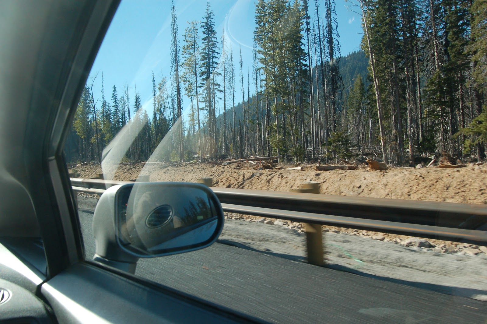
Continuing to drive up toward the pass north of Mount Hood, I suddenly realized we were traveling through a very unhealthy-looking forest. Unlike forests killed off by pine bark beetles (where pretty much all the trees are dead), this one ran the gamut of dead, dying, and damaged trees, with a few looking fairly well off. That, in addition to the long stretch of road work, had me puzzled for a bit. Then something clicked, and I remembered there had been a very damaging lahar in the area some years earlier. (I just checked- it was 2006. See the bottom of this page for a short description and a very impressive photo of the aftermath at the Route 35/Mount Hood Highway Bridge over the White River.) What I hadn't realized until this trip was that the debris flow inundated a large area of forest in the area as well. Burying a tree's roots, for most trees, causes them to slowly suffocate, explaining the problem here.

In the FlashEarth view, you can see why it's called White River, but that's all loose volcanic rubble, not snow. You can also see some post-lahar incision, and how the debris fanned out into the forest when it reached the vicinity of the highway.

Photo unmodified. October 10, 2012. FlashEarth Location (Approximate).

Monday, April 6, 2009

Doubtful Decision-Making at Redoubt

The Big Picture has a great gallery of photos from Alaska's Redoubt Volcano.

Though the above does not mention it, I've been meaning to post on the Drift River Oil Terminal for a while... briefly, it was badly damaged when Redoubt erupted 20 years ago. In their infinite wisdom, they decided to rebuild it...wait for it... in exactly the same place, ignoring the fact that Redoubt is a frequently active and violent volcano. The oil terminal is on the broad plain of the major drainage off the volcano. It's far enough from the vent that it's probably not directly at risk from an eruption, but volcanic mudflows, or "lahars," put the terminal at great risk. It was these lahars that caused the damage in 1989.

The news articles I've seen claim that the dikes protecting the tank farm have held and done the job they were intended to do. That may be true, but I find it hard to reconcile such statements with photos like this from the Alaska Volcano Observatory:Picture Date: March 23, 2009 Image Creator: Read, Cyrus;
Image courtesy of AVO/USGS.Please cite the photographer and the Alaska Volcano Observatory / U.S. Geological Survey when using this image.

...and this:Picture Date: March 23, 2009 Image Creator: McGimsey, Game;
Image courtesy of AVO/USGS.Please cite the photographer and the Alaska Volcano Observatory / U.S. Geological Survey when using this image.

The above picture is much reduced, but if you look carefully, that dark splotch in the middle of the dike that runs from the upper left to lower right, is a place where the lahar has ramped up against it and overtopped it. There's also some overflowing on the back dike, but it's hard to make out in this picture. All that dark watery looking stuff outside the dike is debris flow deposits. I can't figure out how to link to the full-sized pictures, but this search should allow you to find them. Fair warning: they're much scarier in full detail. This was a barely-dodged bullet, and the bullets are still flying.

Now the infuriating aspect of this is that Redoubt has been grumbling for about two months now... plenty of time to prepare. I wouldn't be the first to point out the odd correlation between Bobby Jindal's "something called volcano monitoring" comment and the first hints of restlessness at Redoubt. It's only been over the last couple of weeks that it's been venting major blasts. So how did they do with emptying the tanks? Well, they talked and talked and talked. Finally it was announced Thursday (9 days after the date on the above photos) that a tanker was on its way to empty the tanks on Saturday. Oh, and because of the way the tanks are designed, it's not safe to empty them more than half-way. They might float away if swamped.

Saturday, it was announced that due to a major volcanic explosion, it was unsafe for the tanker to approach the area, and it had been turned around.

There's six million gallons of crude sitting in the path of lahars from a dangerous, active volcano. Looks like the oil's stuck there for the forseeable future. Sounds like a really, really stupid disaster movie, doesn't it?

Stupid? You Betcha!
Disaster? This could make the Exxon Valdez look like patty-cakes.
Movie? Sorry. This is the real world.

Oops, forgot to stick in a link to the article that preciptated this rant...

Saturday, March 21, 2015

Geo 1095: March 20, Day 809: Contact(s)!

There is one very distinct contact in the photo above, between what I've been referring to as the upper unit (lahar deposits), and the lower unit, which, at the time I took the photo, I was assuming were ash deposits of some kind. Turns out, they kind of are, but it's more complicated than I thought, and I only reached a satisfying conclusion a few days ago as to the nature of how they formed.

While I would describe the "upper unit" as poorly sorted overall, there do appear to be several other, though much less certain, contacts that may represent subsequent volcanic debris flows. In the annotation below, the upper-lower unit contact is a solid line, and the tentative contacts within the upper unit are dotted lines.
Photo unmodified. October 9, 2012. FlashEarth Location.

Wednesday, May 18, 2011

31 Years Later

Last year, for the 30th anniversary of the Mount St Helens eruption(s), I posted a series on the events of spring 1980. Partly reminiscence, partly drawn from accounts at the time, and largely based in the narrative line of "what was happening 30 years ago today," it was fun to compile.

I had moved from the Cleveland area (Mentor, to be specific; I'll have to show you the "house" I lived in sometime.) to Corvallis to start spring term at OSU, and the first rumblings came the first week I was here. It did sometimes feel as if the mountain was putting on the show to welcome me to the PNW.

For this year's anniversary, I don't have much new to add, so I've decided to simply index my posts from last year. Note that from mid-April to May 17, I emphasize that not much was happening- and that is exactly the point. The public, the media, and from what I've read, even most volcanologists were uncertain what, if anything, the mountain would do next. Was the show over? No one knew.
If I had to pick the two that do the most to explain the situation, I would recommend May 18, part III, and May 19. May 19 was, of course, when most of the print news became available, and the confusion surrounding St. Helens is a core memory for me. No one knew until months, even years, later, what exactly had happened. It's easy to look back now with hindsight and feel as if this was all understood. Let me be blunt: it was not.

Tuesday, May 18, 2010

It Was A Dark and Stormy Morning

The Big Picture has the definitive collection of photographs from the oodles I've seen so far today. As you might imagine, there are lots and lots of articles and blog posts on St. Helens today and over the last few days. I'll probably post several pieces myself today. The above photo (or a very similar one, or perhaps a crop of the above) covered 2/3 of the whole front page of The Oregonian on Monday. I bought two copies, and one was a wall poster for years. The other got filed.

It was shortly after noon today that I woke up for a second time, went out to the community room, where maybe 3 dozen people were crowded around the television, watching... something. It was a hazy, apparently black and white, writhing, seething mass between two walls of trees on either side. Trees would snap off and disappear into it.

"What is that?" I asked, of no one in particular.

Someone glanced over their shoulder and replied, "Mt. St Helens."

I didn't comprehend what I was seeing for quite some time, but I was witnessing a lahar on the Toutle River. I'll keep looking, but I haven't found any clips of those debris flows. But after the above image, my initial glimpse of the volcanic fury that day, ironically debris-choked water, mud and wood, remains, for me, the most iconic image from Mt. St. Helens.

Friday, November 28, 2014

Geo 730: November 28, Day 697: Hood River Rubble

I was not able to get a good, clear photo of the lahar deposits around the river at this stop, but this is the best of them. In the little slice of whitewater right near the center of the shot, you can see some of the rounded boulders that characterize much of the upper stretch of this river. And though it's over exposed, you can see more of the poorly sorted and essentially un-bedded deposits on the far bank. Near the top, it looks as if we're seeing a talus pile from a still higher (though not necessarily younger) lava flow, based on the angular, un-transported nature of the rock, and the consistency of color and apparent composition.

Photo unmodified. October 10, 2012. FlashEarth Location (possibly maybe).

Monday, March 23, 2015

Geo 1095: March 23, Day 812: Baffling Bedrock

There is talus raveling down the small gullies to the left and upper right, and the base of a larger talus cone in the lower right. Note that most of the plants are rooted in that talus, which can hold small amounts of moisture later into the dry season. In the lower middle of the photo, there are some angular, larger cobbles of rock, which I suspect have fallen from the overlying lahar deposits. The remainder of what is seen here is a fairly light rock, overall, but with many much darker small pebbles. Internally, it's very poorly sorted, but within a narrowly restricted size range, from sand to pebbles in grain size. What this rock represents should have been much more obvious to me than it was, but here's the thing: I'd never seen anything quite like it, and I couldn't get my mind around those darker, more mafic, bits. It looked like a tuff- a solidified ash deposit- but what the heck was going on with the completely different rock types?

Photo unmodified. October 9, 2012. FlashEarth Location.

Saturday, March 14, 2015

Geo 1095: March 14, Day 803: No Idea

There is no such thing as a "typical" Klamath Mountain roadcut or outcrop... I suppose this is true for most mountain systems, but with familiarity one can picture a relatively few kinds of scenes one might expect to see in a particular range. With the Coast Range, I expect shallow to deep marine terrigenous sediments, or basalt of one kind or another. With the Cascades, lots of lahar deposits, or basalt to andesite of one kind or another. Oregon's Basin and Range? Cenezoic alluvial to lacustrine sediments... oh, and basalt. Lots and lots of basalt. Columbia River Plateau? Duh. Basalt. You get the picture.

The Klamaths are an utter rats' nest that never ceases to amaze me, and which I will never understand, other than in the most rudimentary, basic sorts of ways. It's a mish-mash of pretty much every kind of rock known to man (though lacking metamorphics of higher grade than schist), squarshed, whirled, blended, folded, spindled, and mutilated, often beyond recognizability. Are there faults in this photo? Almost certainly. Are they where they look as if they might be? Maybe, maybe not. And quite possibly in places where they don't look as if they might be.

I feel a little bad posting this panorama, because, as I pointed out in the title, I have no idea. But upon reflection, I realized that it's a good metaphor for my general understanding of the Klamaths: complicated, fascinating, and humbling, in the sense that they make me painfully aware of how much I don't know, but at the same time, proud that I have clearly learned where that line is, when I get to something that's beyond my ken.

Photo unmodified. May 9, 2013. FlashEarth Location. (Pure guesswork on this one... no idea.)

Thursday, August 14, 2008

Chaiten Again

Just after I started this blog, I posted on Chaiten Volcano. This picture was taken shortly after that post. I just found it (this post) on the Eruptions blog- an absolutely terrific spot for excellent volcano pictures and information on current eruptions. I don't know that the blogger reports every eruption or event, but he's certainly hit a number that I haven't seen reported elsewhere. And he reported on the Kasatochi (Alaska, Aleutian Island) eruption and its effects on air traffic when those effects were still in the future- days before the papers picked it up.

There's a full size version of the above picture (without labels), and a wider overview here. In the overview, you can see the ash cloud and the base of the volcano in the northeast quadrant. Note that the label "harbor" in the above picture sits entirely upon a delta of volcanoclastic debris- in fact, if the label was double its size, it would still fit on the delta. If you look at the full-sized picture, look at the (I'm geussing) lahar deposit out onto the runway in the southeast corner. Given that this was taken at the end of May, and Chaiten is still chugging away, this town is going to take a long time to recover.

Wednesday, November 26, 2014

Geo 730: November 26, Day 695: School of Hard Knocks

Looking over later photos of this outcrop, I found I'd misremembered it somewhat in yesterday's description- it appears to be a lava flow- likely andesite or similar- overlain by lahar deposits, not simply piles of those debris flows. However, there's still plenty of bouldery, loosely consolidated and poorly sorted debris up above that andesite (?) cliff, and pieces obviously fall out and off frequently. This poor, beaten up Jersey barrier testifies clearly to that.

Photo unmodified. October 10, 2012. FlashEarth Location (possibly maybe).