Saturday, January 12, 2013

Teaching Controversial Topics 101

Jessica Ball, AKA Tuff Cookie, AKA the author of Magma Cum Laude, earlier asked a question to which I can relate: namely, how does one approach teaching a (potentially) controversial subject?

First, you want to make sure you know your stuff. Students can smell instructor uncertainty. Definately familiarize yourself as well ahead of time as you can with the textual material your students will be using. I've seen a decent student in science ed get chewed up and spat out because he was really not qualified to TA the subject matter- he didn't have to take that position, he had other options, but thought it would be "fun." I was teaching a different section of the same course, and in some ways was a bit better prepared- though not academically. The difference was I had an interest in the material, I had done plenty of reading about it on my own, and I made sure I understood it better than the students were going to be expected to. I can honestly say the same would be true on the topic of climate change- I've had little formal classwork on the subject, but it's very interesting to me, and I've done a lot of independent reading on it. Below is a list of climate and related blogs/sites I follow in RSS, and a brief sketch of the value I get from each.

Arctic Sea Ice News & Analysis- This may seem like a very esoteric topic, but Arctic sea ice appears to be the most sensitive component of out planet with respect to climate change. It can be viewed as the "canary in the coal mine" or "bellwether" for the rest of the planet. And this is the go-to site for data tracking daily to long term trends in the ice pack up top. Their monthly, seasonal, and annual summaries are don't miss. And their coverage of the approach to least extent in mid-September is stunningly good and gripping.

Arctic Sea Ice Blog- This guy makes no pretense of being an "expert" (do take a moment to read the disclaimer) but he's clearly no slouch, and clearly finds the topic fascinating. He's also very good at finding important statistics and data.

Real Climate- Gotta be honest, this one is generally a bit too wonky for me. I generally skim the posts enough to get the general gist, then skip the gory details. Still, it's a good one for keeping abreast of current news.

Open Mind- One of my favorites of the bunch. There are times when the detailed approach to stats is more than I want to wade through, but generally readable. In particular, Tamino goes out of his way to bluntly take down nonsense from deniers, with Anthony Watts front and center (See "Dishonorable Mention," below).

Jeff Master's Wunderblog- Not a "climate blog" per se, but weather-focused. I think Masters would be among the first to point out meteorology and climate science are different (if related) disciplines. However, news related to climatology pops up there regularly- such as today's post on billion-plus dollar disasters and top ten meteorological events of 2012.

Dishonorable Mention: Watts Up With That? Not recommended as regular reading, but you should know what the deniers are up to... and Anthony Watts is probably the highest-profile denier out there. I often find his posts through links from take-downs, and there is a certain pleasure in reading one and spotting the fallacy (or fallacies) on one's own. The errors take on a few standard forms: misrepresentation or faulty selection of data, misunderstanding or faulty implementation of statistical methods, conflating adjustments to data (which have been debated, discussed, and finally accepted among a large community of qualified scientists as providing better accuracy) as "fudging" or "making up" data and so on. And when all else fails, fall back on ad hominem attack, which in some circles is apparently a valid debating tactic.

Continuing, it also helps to have enough confidence to flatly state "I don't know," when that's accurate. And if the question is important enough to merit it, follow though and find out- then share the answer with the class and/or questioner as seems appropriate. On the other hand, do not promise to follow through on every question. Many are trivial (there's no harm in curiosity, but it can waste a lot of time), and in many, many cases, it's as easy for the student to Google the answer as it is for you. (I love LMGTFY, but it's a bit too snarky to use on any but the most pesky student.)

Don't proselytize. Your job is to inform, not convert. My attitude with respect to evolution was "I don't much care if you 'believe in' evolution or not, but I expect you to understand why most scientists do." For example, I *understand* the tenets of Christianity pretty well- enough to discuss them intelligently- and I think that's important due to the profound cultural impacts of that belief system. That doesn't mean I believe it. Likewise, I understand the ideas, and wonderful twists of logic in "Alice in Wonderland." We each have the freedom to choose what we do and don't believe, but in an academic setting, choosing not to know the consensus in terms of facts has a price- several prices, actually. Grades, advancement, and future performance are all at stake. Letting students know you're looking for understanding, not agreement, can defuse an urge to "push back" against a perceived "agenda." Along similar lines, accept dissent calmly, but ask for reasoned supporting evidence. [Followup: was just outside for a smoke, discussing this with another IZ patron. His comment: "It's like a comparative religion class. The goal is obviously not to convert anyone to any particular religious belief system, but to get everyone to a certain level of understanding."]

I just went back to figure out exactly what the position was; don't be afraid to ask your team-teaching prof- who presumably has much more expertise and experience- for advice, especially when/if sticky situations come up.

Since many topics of this type can be bleak and depressing, find and keep success stories in reserve. How does this relate to controversy? When faced with what seems like inevitable doom, humans are tempted toward two options: fatalistic acceptance, or denial. Both lead to doing nothing. Remind students often that we actually do have quite a number of options for coping with climate change. Some will likely not work out, but some probably will. I personally would like to see more work done with mineralized carbon sequestration- that is, tying up CO2 in carbonates. In the end, if we find effective mitigation techniques, my suspicion is that it will involve a number of measures, not one "magical cure." A favorite example of mine is the ozone scare of the late 80's and early 90's. While ozone depletion is still a bit of a problem, it's getting better. We banned CFC's, and I don't think most people even noticed a blip. There are some problems with some of the replacement chemicals, so the issue is not 100% solved, but for the most part, it's a success story that the vast majority of the public never heard, or have totally forgotten.

Finally, I think the comments by others on that post are thoughtful and helpful. I'd especially like to follow up on Ron's regarding science versus policy: they are two different things. The task of science is to inform and guide policy, not create it. Sentences like "science says the consequence of doing x is y," are useful. Those like "science says we must do x,." are not. Policy has to take into account a bunch of factors like costs, human nature, practicality, benefits, and motivation, that science does not.

Good luck. As I wrote in my quick note, I don't think controversy is something to be "worried" about, but it's not a bad idea at all to be aware it could cause problems, and be thinking proactively about ways to mitigate or avoid it.

Geo 365: Jan. 12, Day 12: Pillow Basalt

The margins of three basalt pillows, highlighting the void space between them. That void is filled with a mixture of basaltic glass (sideromelane and tachylite), palagonite (altered or weathered basaltic glass), and zeolites. The zeolites at this location are small- this isn't a good collecting spot for them- but to the extent they are identifiable, seem to be comprised mostly of analcime, natrolite and stilbite, in that order of abundance. Here is a post I never got around to actually finishing talking about pillow basalts and this spot in particular. Hint: this is the finest exposure of pillow basalts I've ever seen, and I've seen a lot of them. DON'T MISS! (if the opportunity arises)

Photo unprocessed. July 8, 2012. Lens cap is ~52 mm diameter. FlashEarth: Park here, even if gate is open (you could get locked in), then follow access road west/south-west, with a hook north at the end, to here. Pillows are on the west-facing wall of a defunct quarry.

Friday, January 11, 2013

Geo 365: Jan. 11, Day 11: Parker Creek Falls

Parker Creek Falls, right along the main road to the Marys Peak summit. Not as big as it looks... it's probably only about 8 feet high, though I've never actually measured it. Still, awfully pretty. This is right next to yesterday's photo.

Photo unprocessed. July 8, 2012. FlashEarth location.

Thursday, January 10, 2013

Geo 365: Jan. 10, Day 10: Marys Peak Sill

Dana gets a closer look at the (near) base of Marys Peak sill, near Parker Creek Falls, which is just out-of-frame to the left. The composition here is more mafic, and based on observations from a thin section I made of a sample, is mostly labradorite feldspar, An 65, at about 70% of the rock volume. I no longer have that section, nor ready access to a petrographic scope, so I'm merely recalling, but this is one weird rock. The remainder is mostly pyroxene, but there is also a small amount of alkali feldspar and quartz, in  granophyric intergrowths, a vanishingly small amount of olivine- which technically shouldn't be possible- and a fair amount of an opaque mineral I took to be magnetite. Also, as I mentioned yesterday, what seemed to me a surprising amount of apatite, a trace mineral by most definitions, but at the upper end of what would be considered "a trace," at about 2 percent. Overall, I'd call this rock a granophyric gabbro, though texturally, it might perhaps be more appropriate to refer to it as a diabase.

As I noted above, quartz and olivine should not be able to co-exist in close proximity, though it's quite possible in the same intrusive rock mass that's been fractionally segregated. That and the existence of the aplites I posted Monday are my favored explanation for this conundrum. Had the rock mass cooled slowly and evenly, that last couple percent of olivine would have back-reacted with the silica to form pyroxene. But the sudden loss of volatiles, mostly water, as the aplite dikelets were forced into the overlying rock, basically quenched the system before it could reach equilibrium. Just before stopping here, we made a stop at a spot where I have, in the past, occasionally been able to find examples of diktytaxitic texture, but we weren't able to find any on this trip. That would represent the source of the residual melt that formed the overlying aplites, and the vesicles were the regions where that felsic melt resided before it was forced out by escalating vapor pressure,

That's my guess, anyway, and I'm sticking with it until someone comes up with a better one.

Photo unprocessed. July 8, 2012. FlashEarth location.

Wednesday, January 9, 2013

Geo 365: Jan. 9, Day 9: Noble Fir

Dana standing next to a noble old-growth noble fir, in roughly the same area we found yesterday's aplite dikelet. While I never made a thin section of the rock in this area, others I made of the Marys Peak sill revealed what seemed to me a surprising amount of apatite, calcium fluorophosphate- about 2% by volume. In terms of soils, this would mean plenty of phosphorus. I'm no expert, and I'm really just speculating, but I've always wondered if the sill is an important component of why this forest seems especially fecund and healthy. How different would this forest be if, for example, it was developed on Tyee turbidites?

Photo unprocessed. July 8, 2012. FlashEarth location (approximate).

Tuesday, January 8, 2013

Geo 365: Jan. 8, Day 8: Aplite Dikelet

The Marys Peak Sill was intruded during the Oligocene, about 30 million years ago. It intruded conformably (and is thus a sill) near the base of the Tyee turbidites, a few hundred feet above the contact of that unit with the underlying Siletz River Volcanics. I find the Marys Peak Sill of particular interest for its magmatic differentiation. Overall, the sill is gabbroic in composition, but it cooled to have components that are intermediate to felsic as well. The fragment above is unusually fine-grained for the sill, and I suspect it may be part of the quenched rim- that is, rock that represents the pre-segregation composition of the the original melt, that cooled nearly instantly as it was injected into the cool host rock.

But of particular interest is the lighter line running horizontally across the upper portion of the fragment. As the magma cooled, the volatile component was excluded from the crystals, and was thus more and more concentrated in the melt- effectively driving gas pressure through the roof... literally. Toward the end of the crystallization, the vapor pressure got high enough to fracture the overlying solid rock, and the very last liquid bit of magma, called aplite, was driven out into the network of fine fractures. I've read these actually extend out into the overlying Tyee, though I've not seen that myself. The example above is fairly typical for what I've seen in the area: subtle, and only a mm or two across.

This was a spur-of-the moment choice when Dana visited in July- I wanted her to see the old growth noble fir forest on the mountain top (that'll be tomorrow's photo), and I've always thought the aplite dikelets were pretty cool. However, I'd never really thought to look for them in an organized way- I'd just find them occasionally hiking up the north side trail. It turns out, if you walk down the trail from the summit parking area, and keep an  eye on the cobbles and pebbles of sill weathered out onto the ground, they're not that uncommon or hard to find.

Photo unprocessed.  July 8, 2012. FlashEarth Location (approximate) Lens cap is ~52 mm.

Monday, January 7, 2013

Geo 365: Jan. 7, Day 7: Heeere's Water!

Snow Melt
On the last day of Dana's visit in October, we had intended to do the Columbia River Gorge. But the air quality was horrid, and at the end of a long, record-setting dry summer, the waterfalls were mere trickles. So we did a drive-through, and when we got to Hood River, we turned south onto the Mt. Hood Highway (Route 35), and up to Government Camp, then up to Timberline Lodge.

Timberline Lodge deserves a few posts of its own. The rustic, hand-wrought, rough-hewn architecture is wonderful. But after a walk through the lodge, both of us wanted to get outdoors and enjoy the views of the mountain. So we walked east, crossing a gully that was damp, but had no flowing water in it. The path we were following turned north to parallel the gully, but at some distance from it. We had gone no more than a couple hundred feet from where we crossed, when we heard the distinctive notes of trickling water. I was puzzled, but had my suspicions.

We walked back to the gully, and sure enough! We just happened to be at the right spot, at the right time, to catch the arriving front of the day's snow melt.

Just two weeks later, winter had returned...

(And as an aside, the title is an allusion to The Shining, parts of which were filmed at Timberline Lodge.)

Converted from .jpg to .gif and resized in Paint.net, animated .gif assembled in UnFreez, hosted at PhotoBucket, otherwise unprocessed. October 10, 2012. FlashEarth location.

Sunday, January 6, 2013

Sunday Funnies: Experimental Edition

"Parents who love their children don't let them experiment with paleontology."
What Would Jack Do?
Cheezburger
 Blackadder
 Are You Talking to Meme?
Liz Climo
Cheezburger
Tastefully Offensive
Poorly Drawn Lines
"When I try to break off a small piece of metamorphic rock for a hand sample" Geology is Hard
 Blackadder
 Bits and Pieces
"The world's most polite cat." Actually, Bif does this fairly often. Especially if I sleep late. Sober in a Nightclub
Sober in a Nightclub
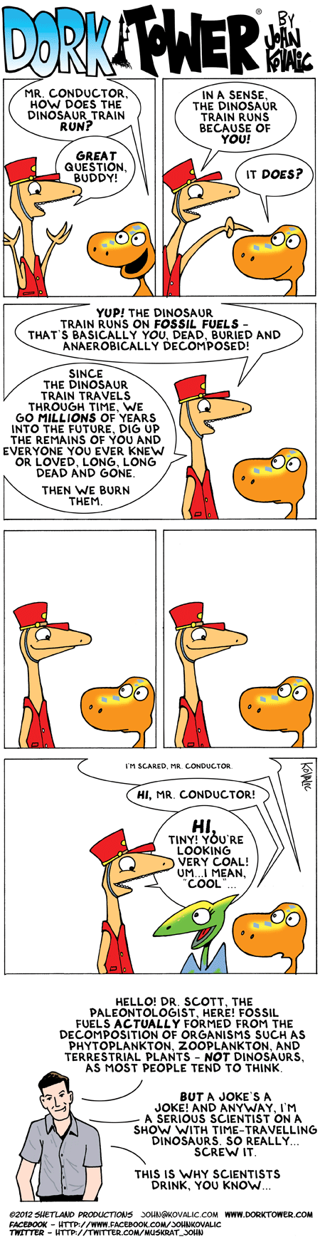
Dork Tower
Tastefully Offensive
"When old lab members come back to visit." What Should We Call Grad School?
Criggo: "Nothing more to say here."

90% Unrelated
 "Canadian swim team." Tastefully Offensive
"Looking through pictures from the Geology Club's Annual Holiday Party" Geology is Hard
"The first time I heard my professor use the word 'amygdaloidal'" Geology is Hard
Very Demotivational
Bits and Pieces
Criggo
Tastefully Offensive
Lawyers, Guns and Money


90% Unrelated
 Funny to Me

Geo 365: Jan. 6, Day 6: Doherty Grade

Still no rain, so another "dry" photo. This was taken some miles after yesterday's, just as we turned south and started the four mile climb up Doherty Grade.
Everyone should have at least one photo of rocks. Photo unprocessed, August 19, 2011. FlashEarth Location.

Saturday, January 5, 2013

Saturd80's: Shout!

Devo

Tears for Fears

Ferris Bueller, Twist and... (Beatles, actually)

Geo 365: Jan. 5, Day 5: Guano Valley

It looks like our first rain of the year (aside from a brief, light sprinkle on Thursday) is coming in today, so I thought I'd put up something a little dry. Okay, very dry.
Looking eastward across Guano Valley to "Doherty Slide." Route 140 turns abruptly south, and runs diagonally right up the cliff face. While not terribly obvious at this scale, if you click on the photo for full-size, it should be apparent. While the road is brilliantly engineered, with a lot more room than you realize, the first time up or down this stretch is very disconcerting. However, once you accept that you're not going to die, the views from that grade are spectacular.

This area's main geologic claim to fame (aside from being fabulously gorgeous) is that it is the source of the USGS Andesite Standard, AGV-1. I've not seen the exact location of where it was collected, but it would make sense that it might well be right along the road- perhaps even at the wide pull-out that I've often stopped at. In addition, there is a hang glider launch area at the top of the grade that is apparently quite famous.

Photo unprocessed. Augst 19, 2011. FlashEarth location (approximate).

Friday, January 4, 2013

Geo 365: Jan. 4, Day 4: 20,000

The dock ripped out of a Japanese harbor by the tsunami following the Tohoku earthquake. It crossed the Pacific Ocean in the following year, and grounded late last spring at Agate beach, at the north end of Newport, Oregon. Dana and I visited it in July. Yaquina Head dominates the background, and the road down to the quarry cove "tidepools" can be seen over the left end of the dock.

I was not prepared for my reaction to seeing this; I kept tearing up, and had a difficult time speaking without my voice cracking. My comment to another visitor was "20,000 people died to send us this message. We should pay attention to it."

Photo unprocessed. July 10, 2012. FlashEarth location (approximate; dock has been removed now. Some sections have been saved to display as memorials.)

Followup, 6:13 PM PST: There's another dock ashore near Forks, Washington. This one is not as accessible, and it's on a rocky shore rather than a sandy beach. The winter waves are not being kind to it. A photo gallery was just posted.

Thursday, January 3, 2013

Geo 365: Jan. 3, Day 3: Devils Churn

Devil's Churn, at Cape Perpetua State Park. The rock is Yachats Basalt, and composed of breccias and dikes in this area. The Churn is developed and eroded along a small fault, and I'm standing over a sea cave eroded into its end. While this is a spectacular spot, caution is warranted. The rocks can be slippery, and if you were to fall in, the only way out is to fight the turbulent water to the end of the head. I've always felt this would be a wise spot for a coil of rope for emergencies. On the other hand, I've never heard of any accidents here. Dana for scale in upper left. Photo unprocessed (other than rotating it). September 21, 2010. FlashEarth Location.

Wednesday, January 2, 2013

Geo 365: Jan. 2, Day 2: My Corner of the World II

A closer view of Corvallis, from Chip Ross Park, in the Coast Range foothills north of town, looking approximately southward. Padawan Dana is near the bench, looking at the monument in the middle left. Most of the lowlands in this view are covered with a veneer of Pleistocene sediments, including Missoula Floods deposits, and modified by Holocene river processes. Underlying that is the Eocene Spencer Formation, which is the shallow water facies of the older Tyee Turbidites. However, the rock we're standing on is Siletz River Volcanics, an early Eocene oceanic plateau. This unit extends south to Roseburg, where it's known as the Roseburg Volcanics, and north to the Olympic Penninsula and southern Vancouver Island, where it goes by the name of the Crescent Volcanics. Interestingly, the rocks are older at the northern and southern ends, and youngest in the middle. This is thought to represent a hot spot on a spreading ridge; picture an amalgam of the Hawaiian Islands and Iceland.

There is a major fault along the base of this hill that runs NE to SW, the Corvallis fault, which I personally think represents an oblique-slip, but primarily strike-slip, fault. Getting a general sense of vertical offset is fairly easy, but difficult to estimate precisely due to poor exposures and folding near the fault. Getting a sense of horizontal offset is next to impossible, as far as I've been able to tell. My belief that it's primarily strike-slip comes from two lines of evidence: first, it's more consistent with the stress-strain patterns that would have been present during the mid-Neogene, and second, nearly every slickenside I've seen in and around this fault zone is close to horizontal. Another item of importance is that this fault has a wide (1000-2000 foot) crush zone of cataclastic material. Neither a normal or reverse fault with roughly 2000 feet of vertical offset would have a 1000 foot crush zone; strike-slip faults tend to have wider crush zones. I consider this supporting evidence, though, not persuasive in and of itself.

The fault is sutured in at least a few places by Oligocene intrusives, which are not broken. This suggests the fault has not moved since then, that is, for about 30 million years, and it's not considered to be a significant seismic risk.

If you visit this park, especially on a damp day (the best views are clear days in the winter, which are rare but spectacular, and in the early summer before the haze has a chance to set in and muck up the sights) watch the ditches as you drive in along the ridge line. The soils will be kind of orangey-yellow. This is a cue you're on Tyee or Spencer Formation bedrock. Just before you get to the parking lot, there's a dip in the ridge; this is where you're crossing the Corvallis Fault. In the park itself, not only are there abundant chunks of basalt float that have survived weathering and pedogenesis, but the soils are a dark brick red. Weathering goes fast in our mild, moist climate, and soil colors become a thing one pays attention to, even if, like me, your color acuity is poor.

Photo run through Paint.net's "auto-level" processor to try to cut through the haze and bring out some details. October 8, 2012. FlashEarth Location- not certain this is exactly the spot, but close enough, and I think the bench and monument are just below (south of) the cross-hairs.

Followup: Just realized you can see a color difference in the soils on opposite side of the fault in FlashEarth: Compare this (on basalt bedrock) to this (on sedimentary bedrock). The Corvallis Fault runs between these two spots in this area, and that view is backed out enough to include the other two. The color difference is even more distinct when it's damp/wet.

Geo 365: Jan. 1, Day 1 My Corner of the World

So yesterday was a lazy hazy day, and another that was confusing to Bif. As on Christmas, he was expecting me to leave anytime; every time I'd get up or even shift in my chair, he'd run for the door to play our daily game of "Can I get out without him catching me?" I watched Batman Begins, which I hadn't seen before. Mixed feelings. Liam Neeson is definitely kick-ass. Katie Holmes, who I'd never seen outside of tabloid type reports, didn't really work as a tough-as-nails DA, IMO. And the "superweapon" that is central to the climax was absurdly wrong- my guestimate for its power consumption is in the trillions to quadrillions of watts. In other words, in excess of the power consumption of the entire human race. With no cord. And no explanation of why it didn't just vaporize the water in every living creature in range, but rather selectively delivered that energy to the water supply inside metal pipes. Gah.

At any rate, this morning, I noticed that Ian Stimpson ‏, AKA Hypocentre, is finishing up his "Rock 366" series- a rock photograph for every day of 2012. If you haven't been following it, and you enjoy gorgeous rocks, gorgeously photographed, that link is highly recommended. You can click each photo for a much-enlarged version, along with some information on the specimen. And I thought, well, I can't match his photographic skills, but I'll bet I can find 365 photos of interesting geology for the next year.

Some will be photos I've posted before, hopefully with some tidbits of new information. Some will be of poor quality, but show some interesting features. I'll focus heavily on Oregon, since almost all of the photos I currently have are from within the state. As such, expect plenty of volcanics, not so much metamorphic stuff. (Oregon does have some metamorphic belts, but on my recent geogalavanting, we've only visited a couple corners of them.) I don't even promise I'll carry it through to the end. Ian says that it becomes a plodding struggle, and I tend to throw my hands up at those.

By and large, I'm looking for inspiration and motivation to post something every day, even if I have a minimum to say about it, even if it only takes me a couple minutes. I know I have enough photos to pull this off, but I don't know if I have enough *interesting* photos.

We'll see, won't we?
Looking west from near the intersection of I-5 and Route 34. Corvallis is 9 or 10 miles away, between this spot and Marys Peak. The latter is the high point of the horizon, and rises to just over 4000 feet (the valley floor here is a bit over 200 feet). Marys Peak is the best transect of Coast Range geology I know of, and consists of a base of sea floor and hot spot basalts, overlain by a fairly restricted pile of sediments derived from those basalts when they rose above sea level. That in turn is buried under a thick- though in the area of the peak itself, mostly removed by erosion- pile of Eocene turbidites, the Tyee formation. Then in the Oligocene, a thousand-foot thick sill was intruded near the base of the turbidites. That thickness, along with its composition and high volatile content, allowed compositional fractionation during its cooling, which is readily observable in the field, and quite striking microscopically. Picture processed to increase saturation and contrast. August 17, 2011. FlashEarth location.

Monday, December 31, 2012

My Favorite Posts of 2012

There are a number of year's end memes that go around each year, but rather than playing any of those, I'm just going to put up a list with links to my posts of the previous year which I most enjoyed writing, and which give me the most pleasure to go back and read. With the exception of the 6/15 and 12/26 posts, and, arguably (though not persuasively as far as I'm concerned), the 6/9 post, every one of these has a strong geology focus. Gee, hooda thunk it?

Given the increasing difficulty of my previous computer dealing with increasingly unstable updates to Firefox-even though it still does fine with everything else besides Firefox- I didn't even put up my first post until April. With the arrival of a new computer in the late summer, blogging became practical again. In addition, visits from Padawan Dana in March, July and October have provided diverse fodder for writing and photos. Of 16 selected posts, half of them are results of my geogalavanting about Oregon with her.

Happy New Year, all! And may the new year bring you much joyous geogalavanting!

4/12: March 2012 Coastal GeoGalavant, Part I
4/21: March 2012 Coastal GeoGalavant, Part II
5/31: AW #46: Geology, Life and Civilization- Chaotic Feedback
6/9: Twice in a Lifetime
6/15: How the Internet Works
7/26: Quartzville Road Log
9/6: The Little Robot That Could... Visits Miranda!
10/5: Vegetation Gradient
10/13: Geogalavanting Around Oregon with Dana
10/14: Geogalavanting Around Oregon with Dana Part II
10/15: Geology at Oregon State University (And do click through on the links to see all of Dana's glorious photos! Links were added later, so you may have missed those.)
10/21: Cheshire Cat! The Whole Story
11/28: AW #52: Geology Dream Course
12/13: #ObscureGeoHazards
12/20: Bring on the Geopocalypse: Accretionary Wedge #53
12/26: Bif's Best Christmas EVAR!

Runners up: This series was tedious to plow through, but I was happy with the outcome. A reconstruction of my presentation for the Oregon Master Naturalists program in September.
Part One
Part Two
Part Three
Part Four
Part Five

Sunday, December 30, 2012

Sunday Funnies: Self Esteem Edition

Bizarro
"Every. Damn. Time." Sober in a Nightclub

"I'm not a morning person." Sober in a Nightclub
Bits and Pieces
Pygalgia
Funny to Me
Wil Wheaton's Tumblr
The expressions of a cat left outside in the rain are priceless. Tastefully Offensive has more.
What Would Jack Do? We now have a national ban on assault breasts...
Tastefully Offensive
Medium Large
Bits and Pieces
Very Demotivational
"Meowio" Tastefully Offensive
Sofa Pizza
Buttersafe
What Would Jack Do?
Bits and Pieces
Tastefully Offensive
I agree. Rocks trump everything. Are You Talking to Meme?
Cyanide and Happiness
On Circulation


Wil Wheaton's Tumblr
"Why I need to use safety goggles." What Should We Call Grad School?
Ugliest Tattoos
xkcd
 "When new students ask me for advice on grad school." What Should We Call Grad School?
Sofa Pizza
Senor Gif
Fake Science
Funny to Me
"When I know the answer to a question in lecture" What Should We Call Grad School?
"After hours of counting melt inclusions." Geology is Hard
Hammer for Scale
Funny to Me
Bits and Pieces
Tastefully Offensive