Monday, October 1, 2012

OMN Willamette Valley Geology Presentation Part Two: Streams, Processes and Landforms

In the second part of my presentation on Willamette Valley Geology, I talked about streams and stream processes. I have thus far neglected to mention that my presentation was preceded by a talk by Bob Lillie (Emeritus Prof from OSU Geology), on plate tectonics and the overall tectonic setting of this region. I bring that up at this point, because I generally mention that technically speaking, the Willamette Valley isn't really a valley. A valley, by definition, is a water created/carved feature, and the Willamette Valley exists, first and foremost, because of its plate tectonic setting. With a forearc ridge to the west- the Coast Range- and a volcanic arc to the east- the Cascades- the Willamette Valley is a structural depression. Even that can be a bit misleading, as it could lead people to think it's actively descended compared to its surroundings. The Coast Range has risen due to compression, folding, and underplating. The Cascades have been elevated due to warming (hence more buoyancy) from below and addition of lava from active volcanism. The Willamette Valley, in contrast, has basically just sat where it is, near sea level.

That is not to say this is a geologically static environment, by any means. While the Willamette River exists where it does due to tectonics, rather than the valley existing because of the river, the river and its tributaries are constantly moving and reworking the sediment that sits on the valley floor. There have been marked changes in the landscape even in the brief period since Europeans moved in, starting a bit more than 150 years ago.
I used the above image (from here) to talk briefly about stream meandering and the landforms created during that process: point bars, cutoffs, oxbow lakes, meander scrolls, swell-and-swale topography and so on.
Corvallis lies on the west/left side of the above image, and near the top there's a nice example of an oxbow on the east side of the Willamette River. Also, if you enlarge the image to full size, you can see that the Benton/Linn County line was established along the historical Willamette River channel, but that the channel has moved since settlement. An area on the other side of the river, labeled "Fisher Island" in the image above, is technically part of Benton rather than Linn County. Rivers are not a good basis for boundaries; they move.
Another oxbow, near Keizer, Oregon
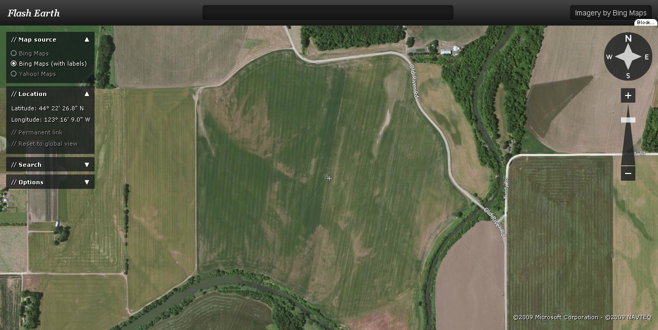
A somewhat randomly chosen area north and west of Eugene to illustrate how much of our farmland has been shaped by stream processes. You can see traces of meander scrolls almost everywhere on the valley floor if you think to look.
Nice examples of point bars at the Willamette/McKenzie confluence north of Eugene. Point bars "point" downstream.
Willamette Falls, at Oregon City. Oregon City became an important industrial center in the Oregon Territory early in its history, due to the availability of hydropower. Much of the 19th Century commerce in the region centered around the Willamette River as a transportation corridor, and while there is a canal and lock system to get by the falls (which has fallen into disrepair and was closed a couple years ago), Oregon City was also a transportation hub. The drop here is about 40 feet, and I hadn't realized it until I was doing some background reading in preparation for this talk, but in terms of volume, this is the 4th largest waterfall in the US. The bedrock is Columbia River Basalt, and there are some nice paleosols exposed in the roadcuts along I-205 a bit farther north from this image.
A cross section of the alluvial fill in the mid-valley area. During the ice ages (Pleistocene), glaciers did not reach the valley floor. There is no firm evidence of glaciation in the Coast Range, though there is some suspicion that there may have been an ice field on the north flank of Marys Peak. However, alpine glaciers were extensive in the Cascades, and major streams coming out of those mountains show clear evidence (U-shaped valleys) of glacial erosion. While the exact elevation of maximum extent varies, the general rule of thumb is to look for terminal moraines at around 1000 feet elevation- note that this is the maximum extent of how far down the valleys glaciers were able to push. Actual accumulation of ice would have been at much higher elevations. Ice is much more erosive and competent (that is, much better in its ability to carry sediment) than is water, so it's thought that major streams coming out of the Cascades, and indeed much of the Willamette Valley, was sediment-choked, and would have been dominated by braided streams. A relevant feature of the Willamette River is that it follows the west side of the valley for much of its length. It has been suggested that this may be a result of it being "pushed" to the west as a great pile of sediment accumulated from the east. Towards the end of the Pleistocene, as I discussed in Part 1, variable amounts of sediment accumulated during repeated inundations from the Missoula floods. In the Corvallis area, if memory serves, the amount of silt is about 10 meters/30 feet.
This is a few miles east of Corvallis on route 34. It's subtle, but you can see the area where the tractor and power pole are, on the left, are a bit lower than the surrounding area. This is typical swell-and-swale topography. It's much more obvious in the winter when it's raining; water often accumulates in the swales.
This was a quick photo, taken along Parker Creek on the south side of Marys Peak, to point out that especially in smaller streams, but even in large streams and rivers in the absence of human intervention, large woody debris plays a complex but important role in shaping channels and their forms. In this case, a splintered slab of wood is moderating the rate at which the stream can erode lithic sediment.
Erosion can be much quicker than we perceive. The branching roots of this tree would have been established when it was a seedling. But during its lifetime the stream has removed about 3 or 4 feet of soil, leaving the top of the root system above ground. (Below North Falls, Silver Falls State Park, Oregon.)
The sediment in stream bottoms can tell you quite a bit too... the large, angular nature of the cobbles and gravel above tells me there's not too much upstream here. If the watershed was larger, the clasts would be more rounded. That they're as large as they are tells me that either it's a very steep watershed, or that it gets occasional extreme precipitation and corresponding flow rates. (In fact, it has both a steep gradient and occasional downpours- this is just a bit down the trail from the tree above.)
An old river bank on the east side of the OSU Campus. More specifically, this is the transition from a medium-level to a high-level terrace
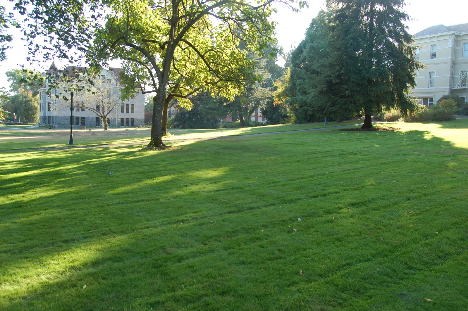
Benton Hall, right (the oldest standing building on the OSU Campus), and Education Hall, left, standing on or near the high-medium terrace transition.
Looking east from about the same spot as the previous photo was shot, looking out over the mid-level terrace. These same terrace deposits underlie downtown Corvallis. Corvallis was originally established as Marysville, on the other side of the river. That side, though, is about 15-20 feet lower in elevation, and Marysville was destroyed in a flood during the late 1800's. It was rebuilt as Corvallis in subsequent years, between Oregon State College and the Willamette River. This helps to explain why paying attention to the niceties of low, middle and high terraces is important for would-be property owners. Low terraces are good for golf courses, parks and agriculture- around here, at least, where flooding is almost completely restricted to winter and early spring months.

Sunday, September 30, 2012

OMN Willamette Valley Geology Presentation Part One: Ice Age Floods

A couple weeks ago, I gave a presentation on the geology of the Willamette Valley. I prefer to simply use slides and talk to the audience directly, rather than powerpointing them to death. My own personal feeling is that Powerpoint kills spontaneity, takes the focus off the speaker and content, and enforces a linearity of thinking I find offensive. On the other hand, the style I use means I can never give the same talk twice, nor necessarily be able to recapture certain moments, no matter how much I'd like to (and we did have a couple of those, which I'll bring up in later parts). On the other other hand, I'm free to come up with new "perfect moments" whenever inspiration hits.

So I've decided to attempt, not to recapture that talk, but to post the images I used, reiterate some of the important points, mention locations when appropriate, and include some links to relevant material. Most of the links will be from a post last week, but they'll be better organized by topic in this series.

The talk was organized into several segments, including Ice Age Floods, Stream Processes and Fluvial Landforms, Rock Materials of the Willamette Valley and Environs, and a brief overview of (what we were expecting to see at) Silver Falls State Park Geology. A final portion that I was not able to cover during the talk was on non-tectonic geologic hazards (Bob Lille covered earthquakes and volcanoes), with emphasis on mass movement and flooding. (Note: all the images will get much larger if you click on them, and you may find it more convenient to right click and open images in new tabs, so you don't need to reload the whole blog when you come back)
I didn't get hard links to each of these images, but the lat-long information is recorded in the data on the upper left of each one, so those interested should have no difficulty getting arbitrarily similar images from FlashEarth. Above is a satellite imagery map of Washington, Northern Oregon, Northern Idaho and Western Montana. Almost the entirety of the area affected by Glacial Lake Missoula and the Missoula floods is shown. Since I'm not entirely certain how far east the lake extended, it may have gone off the right edge of the image.
Zooming in to Eastern Washington, the dark streaks illustrate the "scab" in "scablands;" these are the channels followed and gouged out as the enormous torrent of water drained from Lake Missoula each time the ice dam collapsed. The consensus is that there were at least 40 of these floods, but there may have been more than twice as many. This would mean the repeat time was in the range of 50 to 100 years between floods.
This shows Crown Point, in the western portion of the Columbia River Gorge. Note that the point has no trees. Although it stands 800 feet above the Columbia River, it was overtopped by the floods as they emptied through the gorge, and stripped bare down to its CRB bedrock. I commented in an older post that this is, to me, the single most staggering and incomprehensible statistic I know of regarding these floods... to stand on Crown point, look across the gorge, and picture everything up to that point under water is mind-blowing.
Above is the I-84/I-205 interchange in NE Portland. Rocky Butte is the core, or neck, of an old volcano, and resisted erosion by the jet of water emerging from the gorge. To this day, the upstream moat is quite obvious to the east of Rocky Butte, where the turbulence created as the flood interacted with the solid rock  eroded out the eastern side. Streams of sediment were deposited to the the north and west, and to the south and west, where the current slowed and its competence was reduced. The deposit to the south is called Alameda Ridge, and I-84 to the lower left is following Sullivan's Gulch, a drainage channel that the floods created.
Northwestern Oregon and the Willamette Valley... I commented that the transition from green to tan, roughly the same as the transition from higher-elevation temperate rainforest to the oak-savannah biome of the valley floor, is probably a pretty good proxy for the area inundated by the floods. This is not exact, to be clear, but at this scale, it looks to me to be a good approximation.
Detail from an interpretive sign at the entrance to Erratic Rock State Wayside, which generally summarizes some of the points I've made thus far.
Text below the map shown above, making the point that much of the soil in the valley has developed from sediment deposited by these floods. While I know next to nothing about wine, let alone terroir, I'll point out that my understanding is that for Pinot Noir grapes, at least, the lateritic soils developed on highly weathered Columbia River Basalt produces a better flavor
The point of this slide is to illustrate the location of Erratic Rock. This sign points up the footpath, however, on an initial drive-by, it's easy to assume it's telling you to go around the corner ahead and turn right. The pullout is, in fact, right across the road from here, next to the garage on the left side of the photo.
Looking down the footpath up to Erratic Rock, Dana's car on the left, and the garage from the previous photo just visible under the overhanging tree near the end of the path. It's about a quarter mile walk in, with a climb I'd estimate to be about 150 feet.
And the rock itself...
Various sources claim that more than half of the rock's original bulk has been removed by collectors. While the rock type is quite unusual for Oregon- especially this part of Oregon- it's not that unusual in the grand scheme of things. Please don't collect samples here. You can find similar stuff in the Klamaths, in Idaho, and the Rocky Mountains of both the US and Canada. (See argillte, and particularly the section on the Belt supergroup, which is the likely source of this rock)
Looking up the hill, over a fragment broken off of the original block, in the mid-distance.
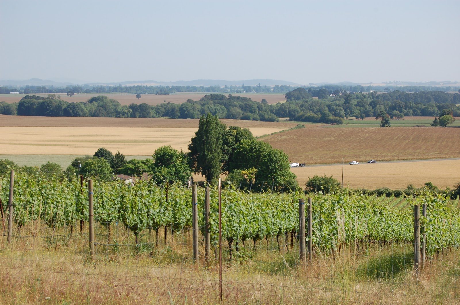
Turning around, and looking down the hill toward the valley floor. The rock itself isn't as impressive as its location on the upper shoulder of a pretty substantial hill. Note the crop: wine grapes!
Dana and Lockwood for scale- these are not little clasts! Photo from (though not by) Dana Hunter.This was from the last day of Dana's visit in July of this year, and if you click for the full-size photo, you can get a good sense of how terribly exhausted I was at this point. But happy.
And, in fact, these blocks are large enough to be seen (With decent optics, to be sure- I'm certain these are not visible to the naked eye.) from space.
The cross hairs are just to the right of the start of the foot path up to the rock- another slide to help clarify the location. This little parklet can be a pain in the butt to find. I'm sure I've driven by looking for it at least as many times as I've actually visited it. My general attitude is that this wayside isn't really worth a significant drive by itself, but if you're in the neighborhood, it's worth going out of your way a bit to visit. There are no facilities of any kind- no water, no restrooms.
This is another Missoula Erratic in Monroe, Oregon. I doubt it's in the exact site where it was originally deposited- it's carved with the date of the erection of the church with which it's associated. This and the following are from Dana's first visit, two years ago. (The upper cross hair is just onto this rock in this FlashEarth link)
Close up of the granitoid material making up the erratic in Monroe- there are some granitoid rocks in western Oregon, but they're uncommon, and you never see blocks this size out on the floor of the Willamette Valley. Lens cap is 52 mm in diameter.
South Viewpoint at Silver Falls State Park, Oregon, looking approximately west. This is well above the ~400 foot elevation reached by the floods- I think we're a bit over a thousand feet here- but much of the valley floor under the haze in the distance would have been inundated.

Sunday Funnies: Back to School Edition

OSU's first week of classes is now over, and I'm pleased to say the noise of Thursday, Friday and Saturday nights was not as bad as I anticipated. I generally like the students when I interact with one or a few of them, but their noise and destructiveness on party nights can be very irritating. Here's to more polite partiers!

Darius Whiteplume's Tumblr
Rhymes with Orange
Married to the Sea
What Would Jack Do?
Oglaf.com (HT to )
 Original source unknown, found on Facebook
What Would Jack Do?
Darius Whiteplume's Tumblr
Sober in a Nightclub
Blackadder
Cats That Look Like Hitler
I Can Has Cheezburger?
 Sober in a Nightclub
Sober in a Nightclub
Very Demotivational
ROFLrazzi
 Julia Segal Time
Julia Segal Time
Original photo from Julia Segal Time, caption by moi.
Pundit Kitchen
Tom Toles
Bits and Pieces
ROFLrazzi
I Can Has Cheezburger?
The Far Left Side
Bits and Pieces
Sober in a Nightclub
Darius Whiteplume's Tumblr