 From The Washington Post, trying to figure out how medieval map makers achieved the accuracy they did. No one knows. (But we're pretty sure it wasn't aliens. No, seriously. It wasn't.)
 Rogue River-Siskiyou National Forest at the Botany Photo of the Day, found in Julia's shared items. Sigh... plants and rocks and falling water... sigh. I love Oregon.
 A recently created Hubble Picture of the Week site at ESA, via Bad Astronomy.
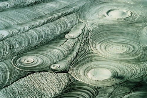 A lovely abstract in New Zealand mudpots; Geology Rocks.
 Textural and mineralogical characteristics of unpronounceable ash at Eruptions.
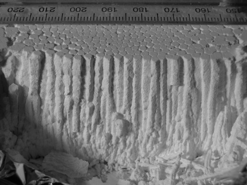 Columnar basalt model with a common kitchen material and water + time, via Geology Rocks. Add coloring for more realism?
 California is a world in itself; Hollywood's map of location locations, from Strange Maps.
Yesterday's Big Picture was a glorious set of 30 images from Saturn; here's one of them:
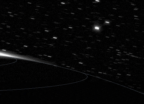 That's an animation of the first visible wavelength images of the Saturnian Aurora.


No comments:
Post a Comment