Sunday, October 6, 2013

Geo 365: Oct. 6, Day 279: Towers of Tephra

The Pinnacles is a spot where it's difficult to get a sense of scale. The wall is quite steep, and the material composing it looks awfully crumbly and friable. Even if clambering down is permitted (and I doubt it is), it would likely be dangerous. And if one did manage to get down without breaking a number of useful bones, the climber would probably find it impossible to get back up again. The point is, I can't tell just how large some of those clasts embedded with the finer tephra really are. Some look quite large though, and speak volumes about the violence and energy with which the deposits were emplaced. This is roughly seven miles from the crater rim; trying to conceive of an ignimbrite carrying clasts that large, that far, is difficult for me.

Photo unmodified. August 18, 2011. FlashEarth location.

Saturday, October 5, 2013

Geo 365: Oct. 5, Day 278: Echoes

One of the things I find especially appealing about this area is the way the inorganic pillars and the trees echo each other. The Pinnacles are described as the remains of fumaroles, where hot gasses escaping from the tuff altered the surrounding rock, cementing it better and making it more resistant to erosion than in areas farther away from such vents.

Photo unmodified. August 18, 2011. FlashEarth location.

Friday, October 4, 2013

Geo 365: Oct. 4, Day 277: Two-Toned Tower

The compositional difference between the upper and lower portion of the tuff at The Pinnacles is particularly obvious in this photo, due to the dramatic lighting. I mentioned yesterday that for years, I had understood this compositional change to be due to magmatic segregation in the enormous Mazama magma chamber. But in retrospect, and thinking a bit more carefully, magmatic segregation occurs not by felsic and mafic components separating in molten form- they are not immiscible liquids. Segregation occurs as higher melting/freezing temperature minerals crystallize out of the solution, leaving the liquid portion of lower melting/freezing compositions behind, commonly by settling, or being "sieved" out. The resulting more felsic melt might also be pressed out, leaving the more mafic solids behind. In other words, magmatic segregation does not form two different compositions of melt, it forms a molten portion and a (mostly) solid portion of two compositions. Multiple episodes of cooling could form three or more distinct compositions.

What we're seeing here is clearly two different compositions of melt.

Now, I've not read any scholarly papers on this, but I did read an article in Scientific American in the mid-80's, and discussed the ideas therein pretty thoroughly with Ed Taylor. To the best of my recollection and understanding, what this represents is an injection of mafic composition into the bottom of a felsic melt. (Note, I do not know the true compositional names of these- is the felsic portion rhyolite, dacite, rhyodacite, etc? So I'll just refer to them as mafic and felsic.) The higher temperature of the additional melt may have triggered a massive convective overturn in the overlying felsic pool, which had previously been stable. The cooler (less thoroughly volatile saturated?) upper felsic magma was replaced with hotter (more volatile saturated?) lower felsic magma. Like Lake Nyos in Cameroon, this disruption led to runaway gas exsolution from the magma (though the primary gas was certainly water, not CO2)- in other words, a catastrophic eruption.

So in shortest form, what we're seeing here is not only the result of the eruption, but also the trigger for the eruption. And that blows my mind, in a caldera-forming sort of way.

Photo unmodified. August 18, 2011. FlashEarth location.

Thursday, October 3, 2013

Geo 365: Oct. 3, Day 276: The Pinnacles

As spectacular and awe-inspiring as the caldera and lake are, The Pinnacles, to me, is the most illuminating geological feature at Crater Lake National Park. The story told in these deposits is awe-inspiring in its own right. When I was an undergraduate, I was under the impression (I don't recall whether I was told or pieced together my own knowledge and assumptions) that this represented magmatic segregation , with the felsic component on top, and the mafic component on the bottom. This sequence was then subsequently inverted as the magma erupted from the top down when the magma chamber was breached during the catastrophic eruption. There is, however, a serious problem with that conjecture: that's simply not how magmatic segregation works! I'll talk a little more about that and the theory that emerged in the 1980's that may help explain the trigger for this and other large eruptions, tomorrow.

Photo unmodified. August 18, 2011. FlashEarth location.

Wednesday, October 2, 2013

Geo 365: Oct. 2, Day 275: Klamath Basin

Standing on Dutton Ridge, looking to the south-southeast, across Kerr Valley and Sand Creek, we're looking from the Cascade Range out into Basin and Range. The typical "range and basin" topography of the latter province isn't well expressed in the photo, mainly because the enormous Klamath Basin dominates the distance. But if you look carefully at the scarps on the far side of that basin, their form is unmistakeable.

Photo unmodified. August 18, 2011. FlashEarth location.

Tuesday, October 1, 2013

Geo 365: Oct. 1, Day 274: Mount Scott

From Dutton Ridge, looking across Kerr Valley, Mount Scott dominates Crater Lake's southwestern horizon. This ridge between Kerr and Sun Valleys- both glacially modified- is deeply buried in Mazma tephra, which can easily be seen in the foreground. The excellent drainage this creates can make it difficult for perennial plants to get established, and results in vast, beautiful meadows with single and small clusters of trees standing out here and there. Additionally, the fact so much water simply goes into the ground means it has to come out somewhere, and springs are abundant around the area. One in particular that I visited once, Anderson Springs, was quite impressive. It was like a whole hillside gushing water. There was no trail, I just walked off the road. I don't know if the park either encourages or discourages this kind of bushwhacking, but I had the time and opportunity to do so, and felt well-rewarded.

Photo unmodified. August 18, 2011. FlashEarth location.

Monday, September 30, 2013

Geo 365: Sept. 30, Day 273: Vidae Falls

In this location, I think Vidae Creek is best thought of as a hanging valley. It's coming down from a high platform, and here, it's falling off the edge of the Sun Notch glacial valley. The lake itself is the big draw in this park, but many of the lesser-known and unsung features are worth one's time, too.

Photo unmodified. August 18, 2011. FlashEarth location.

Sunday, September 29, 2013

Sunday Funnies: Half Off Edition

Guinea Something Good
Cyanide and Happiness
"Fun prank if you want out of a relationship." Funny to Me
There, I Fixed It
"Things With Faces," a few of quite a large collection at Tastefully Offensive.
Dr. Boli
SMBC
Toles, via Balloon Juice
"Grading short essay responses" What Should We Call Grad School?
Funny to Me
Very Demotivational
Poorly Drawn Lines
Bits and Pieces
Sober in a Nightclub
Funny to Me
One of a few in a collection of "Bald men with water wigs." Tastefully Offensive
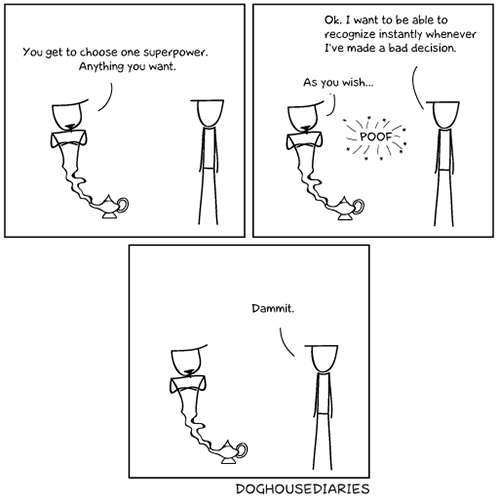
Doghouse Diaries
Tastefully Offensive
"Charlie Bronson Brown" Bits and Pieces
Sober in a Nightclub
The Far Left Side
Angry Mop is Angry. Funny to Me
Berkley Mews
Bizarro
Senor Gif
Tom Tomorrow, via Matt Bors
"Impressive, most impressive … but I find the lack of Storm Troopers disturbing." My Wanton Self
Savage Chickens
"My inbox after not working over the weekend." What Should We Call Grad School?
Derpy Cats
Tastefully Offensive
Blackadder
Bizarro- and heads-up: the other cartoon on this post is awfully funny, too.

Geo 365: Sept. 29, Day 272: Sinnott Memorial Overlook

With Dana Hunter in the foreground, this is the view northward from Sinnott Memorial Overlook. It provides a good view of the caldera and lake, but also has a small museum of sorts, with artifacts from early to modern study of the lake, as well as some interpretive geology exhibits. Another memorable feature is the raised relief model of the park area, which provides a perspective you simply can't get from the ground. Llao Rock and Wizard Island make cameos in the distance. There are many spots with good views, but there's only one spot like this.

Photo unmodified. August 18, 2011. FlashEarth location.

Saturday, September 28, 2013

Geo 365: Sept. 28, Day 271: Caldera's Edge

Looking straight down from Sinnott Memorial Overlook, it's terrorizing to consider what we're looking at: the collapse of an entire mountain or multi-peak platform into an evacuated magma chamber. We're looking at the remains of an enormous eruption and subsequent failure of nearly 30 square miles of the High Cascades platform. It's roughly 1000 feet from the caldera rim down to the water, and the deepest parts of the lake are about 2000 feet below the waterline. In other words, we're seeing roughly a third of the total distance of the collapse. The ranger here said that underwater features of sufficient size are clearly visible to 200 feet. I can't vouch for that, but assuming he's correct, the fuzzy boundary where the talus fades out into Crater Lake's weird blue is at about 200 feet down.

Followup: @eruptionsblog adds: "Don't forget, the mountain extended above the current rim and the lake bottom has significant sediment and landslide fill." Good point. The "total distance" of collapse was certainly greater than what is preserved from today's rim to today's greatest depth.

Photo unmodified. August 18, 2011. FlashEarth location.

Friday, September 27, 2013

Geo 365: Sept. 27, Day 270: Phantom Ship

From Sinnott Memorial Overlook, Phantom Ship is right smack in the middle of the photo, below Dutton Cliff, and with Kerr Notch behind and to the left of it. Phantom Ship has long been thought to be the remains of a dike, but work a few years ago, linked in this post, seems to suggest it's a set of flows. (I don't know if or where that was ever formally published.) Dated at 400,000 years, it's now recognized as the oldest feature in the caldera.

Photo unmodified. August 18, 2011. FlashEarth location

Thursday, September 26, 2013

Geo 365: Sept. 26, Day 269: Watchman and Hillman

From the left, The Watchman and Hillman Peak form the high points on the rim. "Devils Backbone" is the name given to the set of radial dikes on the right flank of Hillman Peak. Wizard Island, which I've learned is andesitic (I tend to assume cinder cones are basaltic), sits in the lake on the lower right, and the western end of Llao Rock rises on the far right portion of the rim.

Photo unmodified. August 18, 2011. FlashEarth location.

Wednesday, September 25, 2013

Geo 365: Sept. 25, Day 268: Llao Rock and Wizard Island

From the Rim Village, near Sinnot Memorial Overlook, Wizard Island sits close to the western caldera wall, and Llao Rock sits prominently in the wall behind it to the right. I've been told "Llao" is a Native American word for "eagle," but I'm not finding any corroboration for that online. It makes sense; the "wings" off of either side of the thickest part of the central flow are quite evocative of a soaring bird. However, "makes sense" is by no means the same as "correct." Just off the east (right) flank of Llao Rock, Mt. Thielsen makes yet another appearance.

Photo unmodified. August 18, 2011. FlashEarth location.

Tuesday, September 24, 2013

Geo 365: Sept. 24, Day 267: Up-Spine

Looking up the spine of The Cascade Mountains from the Crater Lake Rim Drive, Mt. Thielsen is on the right, Diamond Peak to the left and behind that. I don't know the names of the prominences in front of and to the left of Diamond, but we've climbed enough from the view of September 16 that the haze is distinctly less. The High Cascades is not as rugged as one might guess. Yes, there are some tall, pointy peaks, and glacial canyons are incised deeply and precipitously, but the High Cascade platform which dominates this view is really more of a gently rolling ridge overall than anything else.

Photo unmodified. August 18, 2011. FlashEarth location.

Monday, September 23, 2013

Geo 365: Sept. 23, Day 266: Dacite and Doug Fir

We're looking up at the sky here, not down at the lake... I had a brief moment of bemusement and amusement as I was going through to choose today's photo, and my mind tried to tell me the Douglas fir was growing horizontally from the caldera rim. To be honest, I'm not absolutely certain we're looking at either dacite or Douglas firs, though both are the most likely options. Dacite is intermediate between rhyolite and andesite, and is common on Mt. Mazama. The block to the lower left shows a nice conchoidal fracture. This was a random stop on the roadside, so I'm not precisely certain of the location; the link below is my best guess.

My, I'm doing a lot of guessing today, aren't I?

Photo unmodified. August 18, 2011. FlashEarth location.
Sunday, September 22, 2013

Sunday Funnies: Student Edition

Oregon State is on a quarter system, unlike, it seems, most universities, which are on a semester system. The first day of classes is September 30, a week from tomorrow. As of yesterday, Corvallis has become noticeably more busy. By the middle of this week, I expect it'll be a zoo.
This one is mine, suggested by Adam Clark.
Also mine, in reaction to the first one.
This was suggested as a caption by a source I've lost; I just made it happen.
Matt Bors
The Gentleman's Armchair
"This is what happens when a car gets an allergic reaction." Funny to Me
Bits and Pieces
Funny to Me
Tastefully Offensive
I was going to caption this "free-range red blood cell." But I didn't. Blackadder
9 Gag... "It actually did work."
"And the gap keeps getting bigger." Liz Donnelly, at The Nib
Blackadder
Are You Talking to Meme?
Lawyers, Guns and Money
Fake Science
Bits and Pieces
Text From Dog
Dr. Boli
Are You Talking to Meme?
Blackadder
Funny to Me
"How the Sex Education Section in Class Goes:"
Bits and Pieces
Safely Endangered
Bots... Wil Wheaton's Tumblr
Spud Comics
Very Demotivational
Funny to Me
Tastefully Offensive
Doghouse Diaries
Savage Chickens
Funny to Me
You mean, Obama twerks, too!? Tastefully Offensive
Bits and Pieces
Bits and Pieces
Surviving the World
Blackadder
What Would Jack Do?
Chainsawsuit
Bits and Pieces
Funny to Me
Extrafabulouscomics
Via Blackadder (Gary Larson, The Far Side)