Saturday, June 23, 2012

Oregon Geo-sites: Comments and a Request for Help

I've started listing out Oregon sites of particular geological significance, and am beginning to realize it'll be no small task. In terms of reaching 100, no problem. In terms of ranking... well... problem. In terms of "uniqueness," again, problem. I think what I'll do is aim at 150 to 200 sites, which will take some time in and of itself, then cull the list down to 100. I'll list them by physiographic province, then follow with my own personal ranking. In other words, if I was to recommend to a geologically interested person sites to visit, the order in which I would recommend a site, assuming travel schedule, distance, and time were not issues (though of course, they always are). I will list all the sites that don't make the top 100 as unranked runners up.

Despite how it may seem, there are lots of places in Oregon I've never been, including places with great geology. Off the top of my head, a few examples include:
  • Crest of Steens Mountain
  • Smith Rocks State Park
  • Leslie Gulch and Owyhee Canyon
  • Jordan Craters
  • Saddle Mountain
  • Richardson's Rock Ranch
...and I don't doubt there are many more. As I said, those are just a few great spots that popped into my head in a few moments of thought, which I'd like to visit, but have never quite worked into other trips. I'm aiming at particular, rather specific spots, though some areas, such as Crater Lake and Newberry Volcano have dozens, if not hundreds, of noteworthy sites in and of themselves. Given the futility of trying to list all the important features of areas such as those two examples, I'll just list them as single locations.

This is prompted, in part, by Callan Bentley's geomeme of two posts back, and in particular by my exasperation at Lava River Cave as one of only two Oregon sites listed. There's nothing wrong with Lava River Cave, and it will definitely make my list. It's the longest tube in Oregon, it's developed, so anyone in moderately good physical shape can enjoy it, and it's easy to get to and find. On the other hand, I can think of three other lava tubes that I think have more to offer than this one (I will be including these in my final list as well). They are, in descending order, Derrick Cave, Wind Cave, and Malheur Cave. The first has an amazing slew of cool features, the second is breath-taking in its sheer size/cross-sectional area, and the third has an underground lake as its terminus. If I had to pick my top two Oregon sites, I would cheat and pick three, with Newberry Volcano and Crater Lake in a tie for first, and the Columbia River Gorge in second. NV and CL are, in broad terms, very similar. Much of what one can see at CL can only be seen at a distance, though there are things to see there that aren't visible at NV. On the other hand, there's plenty to see at NV that's not at CL, and it's easier to get hands-on there. Toss-up. (Honestly, though, if I wasn't inclined to cheat, I'd have to give CL the nod on the basis of its scientific importance.)

The reason I'm posting this heads-up, though, is to request help. I'll probably spend a couple of weeks or more working on this. Maybe much more. If you've spent time geologizing in Oregon, please leave a comment on this post, or @ me on Twitter (@lockwooddewitt), with sites that struck you as particularly geologically awesome, important, or beautiful. As I said, there are plenty of Oregon spots I know are important, but nevertheless have not had the opportunity to visit. I'll be relying on Geology of Oregon to fill in some of the gaps, but I am curious to hear what others have to say, and it will help me avoid missing sites that deserve to be included.

Thanks ahead of time for any help given.

Saturd80's: I've Got the Vapors! Edition

"Turning Japanese" was their big hit, but I was very fond of the entire album, "New Clear Days." It would definitely rank in my top 100 rock albums- the phrase "waiting for the weekend" in previous meme post put me in mind of the group- perhaps in the top 50. I'm always frustrated when a "one hit wonder" group's other music is overlooked despite the fact that it's pretty damned good. Turning Japanese:
Waiting for the Weekend:
Letter From Hiro:

101 Geo-sites Meme

Callan Bentley started this meme a few days ago, and I've been waiting for the weekend to take a stab at it. More accurately, I'd been hoping to clean out my RSS feed, but that's beginning to look like a lost cause. I'll mostly withhold comment on the quality of the list; I haven't read the book on which it's based, and the author may have justification for his choices. However, in a lot of ways, this strikes me as a rather hit-and-miss representation of what the US has to offer, geologically. I'm half tempted to create a list of 100 must-see geo-sites in Oregon, just to show where I'd rank Lava River Cave. It would certainly be on the list, but it would be half way down or more. All that said, the rules are typical: bold the ones you've visited. I'll only bold the ones I'm absolutely certain I've been to, and append a comment to ones that I'm either uncertain of, or don't really remember.

1. Wetumpka Crater, Alabama
2. Exit Glacier, Alaska
3. Antelope Canyon, Arizona
4. Meteor Crater, Arizona
5. Monument Valley, Arizona
6. Prairie Creek Pipe, Arkansas
7. Wallace Creek, California
8. Racetrack Playa, California
9. Devils Postpile, California
10. Rancho La Brea, California
11. El Capitan, California
12. Boulder Flatirons, Colorado
13. Interstate 70 Roadcut, Colorado
14. Florissant Fossil Beds, Colorado
15. Dinosaur Trackway, Connecticut
16. Wilmington Blue Rocks, Delaware
17. Devil’s Millhopper, Florida
18. Stone Mountain, Georgia
19. Kilauea Volcano, Hawaii
20. Borah Peak, Idaho
21. Menan Buttes, Idaho
22. Great Rift, Idaho (Possibly... is this the Great Rift in the Craters of the Moon? If so, yes)
23. Valmeyer Anticline, Illinois
24. Hanging Rock Klint, Indiana
25. Fort Dodge Gypsum, Iowa
26. Monument Rocks, Kansas
27. Ohio Black Shale, Kentucky
28. Mammoth Cave, Kentucky
29. Four Corners Roadcut, Kentucky
30. Avery Island, Louisiana
31. Schoodic Point, Maine
32. Calvert Cliffs, Maryland
33. Purgatory Chasm, Massachusetts
34. Nonesuch Potholes, Michigan (I know I've been very close, but not sure)
35. Quincy Mine, Michigan
36. Grand River Ledges, Michigan
37. Sioux Quartzite, Minnesota
38. Thomson Dikes, Minnesota
39. Soudan Mine, Minnesota
40. Petrified Forest, Mississippi
41. Elephant Rocks, Missouri
42. Grassy Mountain Nonconformity, Missouri
43. Chief Mountain, Montana
44. Madison Slide, Montana
45. Butte Pluton, Montana
46. Quad Creek Quartzite, Montana
47. Ashfall Fossil Beds, Nebraska
48. Scotts Bluff, Nebraska
49. Crow Creek Marlstone, Nebraska
50. Sand Mountain, Nevada
51. Great Unconformity, Nevada
52. Flume Gorge, New Hampshire
53. Palisades Sill, New Jersey
54. White Sands, New Mexico
55. Carlsbad Caverns, New Mexico
56. Shiprock Peak, New Mexico
57. State Line Outcrop, New Mexico
58. American Falls, New York
59. Taconic Unconformity, New York
60. Gilboa Forest, New York
61. Pilot Mountain, North Carolina
62. South Killdeer Mountain, North Dakota
63. Hueston Woods, Ohio
64. Big Rock, Ohio
65. Kelleys Island, Ohio (I have been told I visited here, but I was too young to remember)
66. Interstate 35 Roadcut, Oklahoma
67. Mount Mazama, Oregon
68. Lava River Cave, Oregon
69. Drake’s Folly, Pennsylvania
70. Hickory Run, Pennsylvania
71. Delaware Water Gap, Pennsylvania
72. Beavertail Point, Rhode Island
73. Crowburg Basin, South Carolina
74. Mount Rushmore, South Dakota
75. Mammoth Site, South Dakota
76. Pinnacles Overlook, South Dakota
77. Reelfoot Scarp, Tennessee
78. Enchanted Rock, Texas
79. Capitan Reef, Texas
80. Paluxy River Tracks, Texas
81. Upheaval Dome, Utah
82. Checkerboard Mesa, Utah
83. San Juan Goosenecks, Utah
84. Salina Canyon Unconformity, Utah
85. Bingham Stock, Utah
86. Whipstock Hill, Vermont
87. Great Falls, Virginia
88. Natural Bridge, Virginia
89. Millbrig Ashfall, Virginia
90. Catoctin Greenstone, Virginia
91. Mount St. Helens, Washington
92. Dry Falls, Washington
93. Seneca Rocks, West Virginia
94. Roche-A-Cri Mound, Wisconsin
95. Van Hise Rock, Wisconsin
96. Amnicon Falls, Wisconsin
97. Green River, Wyoming
98. Devils Tower, Wyoming
99. Fossil Butte, Wyoming
100. Steamboat Geyser, Wyoming
101. Specimen Ridge, Wyoming (Not sure... I've been to the place where there's a petrified, upright tree trunk at YNP, but dunno if that's the same place.)

So that's a total of 16... a pretty weak showing. But as I said, it strikes me as a pretty weak list.

Saturday, June 16, 2012

Saturd80's: Creepy Kate Bush Edition

I adore Kate Bush, and have ever since I first heard her music. Part of what I really like is her ability to hide the creepy and macabre under a veil of beautiful music and vocals. For example, Experiment IV: "They told us what they wanted was a sound that could kill someone at a distance. So we go ahead, and the meters are over in the red." (BTW, that is indeed a very young Hugh Laurie)
Under Ice: "It's wonderful
Everywhere, so white
The river has frozen over
Not a soul on the ice
Only me, skating fast
I'm speeding past trees leaving
Little lines in the ice
Cutting out little lines"
and Waking the Witch: "What say you, good people? Guilty! Guilty! Guilty!"

Friday, June 15, 2012

How The Internet Works

It's very, very silly. That's fundamentally what you need to know. The back story is that a female representative in the Michigan House was banned from speaking on the floor yesterday after using the word "vagina" in criticizing and opposing a particularly nasty piece of legislative work that would tremendously restrict women's ability to make their own choices regarding reproductive health. Now the way the internet works, is that this is an opportunity to engage in relentless mockery of the Michigan House conservatives... in particular, by gratuitous overuse of the word "vagina." There were a number of very good zingers and funny lines. I especially enjoyed a short bit from the Portland Mercury: Vagina is the new Voldemort, along with this picture:
RT "In Michigan, you can't say "vagina" anymore. Good thing this is Oregon. Vagina vagina vagina vagina vagina and vagina!" 

Finally, a meme/game emerged, which on twitter is often signified with a hashtag, like so:

#VaginaMovieLines

Partly to archive these for myself, and partly to share with others who for whatever reason aren't on twitter, the following were my contributions to this meme, along with the ones I retweeted.
  • "Follow the vagina....Just follow the vagina."
  • - "Look, you stupid bastard. You've got no vagina left." - "Yes I have." - "Look!" - "Just a flesh wound."
  • "Why don't you just make ten louder and make ten be the top number and make that a little louder?" "These go to vagina."
  • "You keep using that Vagina. I do not think it means what you think it means."
  • "Hello. My name is Inigo Montoya. You killed my vagina. Prepare to die!"
  • - "Hey, Houston, we've had a vagina here." - "Say again, please?" - "Ah, Houston, we've had a vagina."
  • "The first rule of vagina is you do not talk about vagina. The second rule of vagina is you do not talk about vagina."
  • "You make me want to be a better vagina"
  • "They may take our lives, but they will never take our vagina."
  • "As far back as I can remember, I always wanted to be a vagina."
  • "One does not simply walk into vagina."
  • "Vaginas? Where we're going, we don't need vaginas."
  • "Show me the vagina!"
  • "I'll get you, my pretty, and your little vagina too!"
  • "Carpe diem. Seize the day, boys. Make your vaginas extraordinary."
  • "Cinderella story. Outta nowhere. A former vagina, now, about to become the Masters champion."
  • "A vagina. Shaken, not stirred."
  • "Open the vagina bay doors, HAL."
  • RT ‏@drskyskull: "Is this going to be a stand-up fight, or another vagina hunt?"
  • "Gentlemen, you can't fight in here! This is the Vagina Room!"
  • RT @dvnix: "I am a Vagina on the Wind; watch how I soar…"
  • RT @blakestacey: "A strange game. The only winning move is not to play. How about a nice game of vagina?"
  • "Vagina, for lack of a better word, is good."
  • "A census taker once tried to test me. I ate his liver with some fava beans and a nice vagina."
  • "I'm going to make him a vagina he can't refuse."
  • RT ‏@drskyskull: "You take the red pill - you stay in Wonderland and I show you how deep the vagina goes."
  • "Bond. Vagina Bond."
  • "Have you ever been mistaken for a vagina?" "No. Have you?"
  • Hey, maybe you haven't been keeping up with current events, but we just got our vaginas kicked pal!
  • "I feel a great disturbance in the vagina."
  • RT @drskyskull: "Sir, the possibility of successfully navigating a vagina is approximately 3,720 to 1."
  • (My reply:) "Never tell me the vagina!"
  • Via @CaldenWloka "I'm taking us closer to one of the big vaginas..."
  • Followup from @CaldenWloka "Weirdly, I think it would probably be possible to do the whole movie this way and still have it intelligible."
  • RT ‏@GynoStar: Of all the vaginas, in all the towns, in all the world, she walks into mine.
  • "Frankly, my dear, I don't give a vagina."
  • RT @phive0phor: "We're off to see the Wizard. Maybe he can get you a vagina."
  • "Vagina!? You can't handle the vagina!"
  • "Vagina. Definitely vagina."
  • "Paint me like one of your vaginas."
  • "Back off man, I'm a vagina."
  • "Apparently she saw a vagina once."
  • "I coulda been a vagina!"
  • "I'm as mad as vagina, and I'm not going to take this anymore!"

Having spent a good part of the day mocking the MI GOP, I think that last one is a dandy quitting place. Because vaginas everywhere *should* be mad as hell, and they *shouldn't* have to put up with such BS.

Followup: Lisa Brown, the Michigan Representative, has some choice words about the incident that are well-worth reading, among them, "Shouldn't we be able to discuss body parts if we're going to pass laws about them? Am I really to believe that my opposition is undone at the mere mention of a woman's anatomy?"

Saturday, June 9, 2012

Twice in a Lifetime

...And as best as I can recall, I missed the first opportunity because it was too early in the morning and the weather was expected to be cloudy. But on Tuesday, we had decent weather- mostly clear skies, with some broken clouds- and a great chance to watch the last transit of Venus for 105 years. And thanks to discussions by other bloggers following the annular eclipse (partial, here) two weeks ago, I learned how to project an image with one side of my binoculars. And the quality of the projection far exceeded my wildest expectations.
Interzone people gathered around the projected image, and below, what we saw:
Our high-tech equipment...
The paper is 8 1/2 by 11 inches, so not only was the image sharp and bright, it was a good size, too.
 Below, a crop from the above photo, with labels.
And another view of folks gathered around enjoying the show:
The best part? I've since had three people come up and tell me they went home, got out their own binoculars, and gathered little crowds of their own. In the words of Douglas Adams, "Last chance to see!" There will be a transit of Mercury on May 9, 2016, and with that planet both smaller and more distant from us, it will be more challenging to view. But I'm very impressed with this projection technique- it's far superior to a pinhole viewer- and I'm guardedly optimistic we can pull it off.

Addendum: Today's APOD shows the image quality you can get with good equipment. In this case the Hinode satellite.

Saturd80's: Oingo Boingo Edition

What Danny Elfman did before his permanent installation into Tim Burton films. Grey Matter:

Only a Lad:

Ain't This the Life?:

Saturday, June 2, 2012

Saturd80's

Split Enz, I Got You:
Missing Persons: Destination Unknown
Berlin, Metro:

Thursday, May 31, 2012

AW #46: Geology, Life and Civilization- Chaotic Feedback

Cat at Knowledge Flocs is hosting this month's Accretionary Wedge with a topic that looks relatively simple and straightforward, unless it's a topic you've spent some serious time contemplating, as I have. To wit: "How has life or civilisation been affected by geology or how has geology been affected by life?" With the provision that I'm going to change the last "or" to "and," here are some conclusions I've come to over the years, with a prefatory tangent.

The concept of "chaos," as it was developed during the late 70's and early 80's, and coming to public attention particularly in the late 80's, is at once fairly simple and straight-forward, but at the same time, I think, widely misunderstood. The important idea is that arbitrarily small differences in starting conditions of a particular system can lead to arbitrarily large differences in outcomes given enough time or iterations of the equations that describe said system. The iconic images illustrative of the concept, those of the Mandelbrot set, are the result of iterating a single simple equation (albeit one using complex numbers) to determine which starting conditions do not result in tending toward infinity after approaching infinite reiterations. Even very simple systems can exhibit chaotic behaviors, such as one of the ones first recognized as such, the Lorenz attractor. Note that while this is described as "a system of three ordinary differential equations," it isn't necessary to think of them as differential equations; one could consider them as a set of iterated steps:
  • Using current x, y, z positions, calculate new velocities (dx/dt, dy/dt, dz/dt).
  • Add new velocities to current positions to get new positions, and go back to beginning to reiterate.
Simple, huh?

The point is, the earth's components/systems, which because of my background, I tend to compartmentalize as geosphere [solid], hydrosphere [liquid], atmosphere [gaseous], and biosphere [living], with additional influences from the environment in which it rests ["space"], are each, in and of themselves extremely complex chaotic systems, involving huge numbers of variables. The above two examples are chosen to illustrate the simplicity of systems in which chaos can arise. Any one of earth's component systems is many magnitudes more complex than these... and when one tries to integrate all five into a unitary "Earth System..." well, speaking for myself, my mind just boggles. It's not a "complete fail;" I can dimly perceive patterns, trends, I can sensibly speculate, but I feel I'm relying more on constrained imagination than data, logic, and reason. My confidence in the "conclusions" I reach is best described as "minimal."

The focus of much popular science in the public mind is on things that are simply not understood by the vast majority of us (and yes, I intentionally include myself). Ask a group of random (or selected- I doubt it makes much difference) people, "Based on what you know and read, what are the most important questions science is trying to address?" I would be willing to wager responses that come up most frequently would include:
  • What is the nature of the Higgs Boson? Does it exist?
  • What is Dark Matter?
  • What is Dark Energy? Does it exist?
  • What sources of non-fossil energy are practical, and how can we transition to them with minimum effort?
  • Does life exist elsewhere in the cosmos? Where might it?
  • What is the cure for cancer/HIV/the common cold (Yes, I understand that the first and last are nonsensical, the second might too, and that's kind of the point.)
And while you might occasionally get something along the lines of "What are the consequences of global warming?," or "Is global warming real?," I'd also be willing to wager that an answer you would almost never get is along the lines of, "How can we better understand the dynamics of the total earth system, and make better predictions of the consequences of our interactions with it, in order to maintain our civilization without putting ourselves and important aspects of the earth at risk?"

And I ask, in all sobriety, "Can there be a more important question than that?"

The focus here is intended to be geology, but if you've read this blog for any length of time, you know I tend to flog the point that the solid earth is, directly or indirectly, the source of almost every single resource we use. I was going to say, "excluding air," but realized even that is in part a result of solid earth interactions with the biosphere. (Plants require phosphorus, potassium and magnesium, as well as a variety of micro-nutrients, that are available over the long term only from the solid earth.) I see no real point in beating on that theme again.

However, for those a little newer to OTI, here are a couple of older pieces that address this month's theme. The first, "Geo-Biz," focuses on some geology/economics news over a period of just a few days- and those few days were by no means atypical. Keep in mind "money" is at best a symbol of value, at worst an illusion. The real issue is the central consequence of being a living organism: the necessity to acquire resources. Economics is the study of how we as a species and a culture exchange resources we have in excess for those of which we are experiencing a deficit, with some other entity for which/whom the opposite is the case. Money is merely a consensual illusion that facilitates such exchanges.

The second, "Unanswered Questions," considers one aspect of a question that fascinates me deeply, and has for many years: "How has the presence and ongoing evolution of life influenced the overall evolution of the planet?" Specifically, the question I address is "how would the earth be different if life had never existed on it?" Spoiler: my conclusion is that for all practical purposes, it would be completely unrecognizable.

To end on an optimistic note, there are uncountable numbers of people working to make sure that we as a civilization continue to acquire the resources we need, and similarly uncountable numbers trying to assess, predict and avoid chances of environmental problems, disasters, and catastrophes. In other words, the scientific question I regard as most important is being addressed. I'll grant we're a long way from definitive answers on many important aspects of that question, and further still from integrating component answers into a broad understanding of "the Earth System," but the lack of discussion in most sources does not mean no one is working on it. Millions are. Many of these are scientists, many are not. Of the scientists, many are geologists. Many are computer scientists, chemists, atmospheric scientists, climatologists, astronomers or physicists in other sub-disciplines, biologists, and so on. But it bothers me, as a matter of pride, as a matter of pragmatism, and as a concern for the future, that the media, and as a result, the general public, is essentially blind to the fact of how fundamentally civilization is grounded (pun intended) in understanding, and understanding how to responsibly use, the solid earth.

Saturday, May 19, 2012

Satur80's: Horslips

I first heard Horslips on a trip cross-country, while staying in Medford, OR- also, my first visit to this wonderful state. When I got back to the Cleveland area, I tracked down their album, "Book of Invasions," which had this song. While tracking down this clip, I found that they were still playing as recently as last year. Kinda like Jethro Tull, but more Celtic, more flute-centric, and more power rock. An obscure group that in a fairer world would have received more attention.
There's a live version here from 2011; I'm impressed with their polish playing live, but the sound quality/recording is too muddy for me to take.

Saturday, May 12, 2012

Saturd80's: Lauda


Haven't done one of these for a long, long time, but standing outside for a smoke, I recalled Kim Robertson... I listened to her first album probably in the summer of 81, and immediately fell in love with her. She did a show in Corvallis in 93, I think, and I loved her even more. She recounted a story from her graduate studies in music. She and her advisor did not get along well, and her practice room was adjacent to his office... she would purposely knock her harp out of tune just to piss him off. How could you not love a woman like that? The above isn't her, but it is a note-perfect (albeit shortened) rendition of the first piece off her first album, Windshadows. Even after countless listenings, Lauda, meaning "praise," still gives me goosebumps.

Sunday, April 29, 2012

Geopilgrimage: Death Valley

The theme for this month's Accretionary Wedge, #45, and hosted by Denise Tang at  Life as a Geologist, is to describe a
Geological Pilgrimage – the sacred geological place that you must visit at least once in your lifetime

Because the topic may slightly overlap the previous AW#16 – Geologists’t List, I would like to define the pilgrimage as a single place, which is “geologically” unique, relatively remote, and requires some difficulty to get to. If you have already done your geological pilgrimage, please share with us your experience. If you are still planning your pilgrimage, then let us know where your sacred geological spot is and why.
Now I figured someone else, maybe someone who has some photos of their own, would choose Death Valley, and save me the trouble, but with approximately a day left, I haven't seen this location given the shout-out it so richly deserves. I'm not going to go into lots of detail, but I don't think a lifetime would be enough to fully explore the enormous territory and complexity of this, the largest National Park in the lower 48. In the screen capture above, I have labeled the approximate locations of a number of sites I have visited- many on multiple occasions- in my visits to this park. Due to the necessity of choosing a limited area for the image, some spots, especially to the south, are unlabeled: Shoreline Butte comes to mind. And on my most recent trip, about 4 years ago, we ended an exploratory drive WAY the hell up in the Cottonwoods somewhere near White Top Mountain... I haven't been able to tell with certainty exactly where we were, but it was on a ridge out into the main valley, with a stunning view to the south over the dunes. And I know I could find it again, though I probably won't.

There's just so much to see and do in the area that it feels futile to try. I think the best I can do is to point to a recent series by Gary Hayes at GeotripperStrangers in a Strange Land. I'll also quote a story I've told many times, but only once on this blog:
Coming down off the Panamints, one can see the rugged geology of those mountains, but the wider view of the valley floor is mostly obscured until rounding a corner a little ways above Stovepipe Wells. Suzy was sitting in the front seat looking back at me the moment we went around that corner. As she recounted later, between gales of laughter, I leaned forward, my eyes went wide, and my jaw slowly dropped. I gasped, "Oh. My God. Look at all the naked rocks."
The exposure is frankly hard to believe, the diversity seems almost endless, the spring wildflowers are glorious (my favorite time to visit is late March), and the scenery is other-worldly. There are plenty of places that merit my consideration in the US and Canada, but Death Valley trumps every single one of them. No matter what kind of geology rings your bell best, Death Valley has it.

Followup note: I realized the arrows to Ubehebe Crater and Racetrack Playa might be confusing: the arrow pointing NW near the labels is toward Ubehebe Crater, but you have to go that way to get to the Racetrack, too. The arrow under the Racetrack Playa label actually points to that feature.

Saturday, April 21, 2012

March 2012 Coastal GeoGalavant, Part II

Day 2, Stop 7a: Sunset Bay State Park- Our last, and most involved, stop of the day, there's a slew of things to see here. On top of that, the park now "closes," whatever that means, at 6 PM, at least during the cold months... I don't know how they could justify or enforce that during the evenings during the summer, when the sunsets are about 9:00 PM, and twilight lasts until nearly 10. At any rate, we decided to head back to the car sooner that we'd have liked, to make sure we didn't get locked into the parking lot. Only to discover the exit has a gate, but the entrance doesn't. WTF!?
http://www.flashearth.com/?lat=43.333463&lon=-124.371974&z=16.3&r=0&src=msl
 Looking ~SW across Big Creek, at weathered spruce stumps, supposedly killed by earthquake-associated subsidence about 1000 years ago. I say supposedly, because this trip was first I heard this, and the source, a pamphlet Dana picked up at Shore Acres, did not look very well researched or knowledgeable to me.
 Dana on the same stump for scale. From here, we walked up stream a bit, maybe a hundred yards to a footbridge, then back along south shore.
I'm on a stump! Looking across bay to north shore. There's less to see on the south shore than along the north, but these stumps are a kick, and worth the effort on their own. However, there are some other noteworthy features. For example, see Dana's post on strike and dip... this site is a nice clear example of a concept that we tend to forget is abstract and confusing for beginners. One of the major features discussed in an old DOGAMI field overview (3.2 MB PDF) is the "drag folding" associated with a strike-slip fault running through the bay. The drag folding has confused me for as long as I've visited the area. This trip, I figured out why.
 Turning and looking the opposite direction from the spot where I took the second photo in Dana's strike and dip post, the "drag folding" is apparent, with the sense of offset to the left. In other words, if this is drag folding, the opposite side of the hidden fault should have moved left with respect to our perspective from this side. But wait...
This is not very far away, probably less than 50 yards farther to the NW along the wave-cut platform. Bafflingly, here, the sense of offset is to the right. I noticed there was a kind of chaotic area between these two spots, and out closer to the water's edge, but I hadn't quite grasped the conundrum until I was going back through the photos that evening, so I didn't think to get any shots of that area. The problem, if it isn't obvious, is that if this is drag folding, the fault was moving in both left-lateral and right lateral senses, and that don't work.  I think rather than saying there's something weird going on here, I'll just say there's something going on here that I don't understand, and won't be able to make any sense of, at least until I get back. It may or may not have a simple solution, but I can't tell from Corvallis.
Finally, we mustn't ignore modern features. Above are some nice examples of snubbed ripples, asymmetric current ripples whose crests were planed off flat, or snubbed, by last bit of sheet wash as the previous high tide receded.

Blooger has changed their interfaces yet again, and I'm exasperated, but slowly figuring out how to function in this new environment. So I think I'll just drop this for now and come back to the north shore portion of Sunset Bay later.

Thursday, April 12, 2012

March 2012 Coastal GeoGalavant, Part I

I got a request for the locations and overviews of the stops Dana Hunter and I made on our rocking around Oregon a moth ago. Instead of locations, I've added FlashEarth links, which have detailed Lat-Long information attached to them. Additionally you can zoom in to surprising resolution, or out to get a better sense the where the spot is in relation to other things.

Note: Dana and I pointedly planned this trip to coincide with a series of negative tides (those with low water elevations below the average of the lower of the two daily low tides) specifically so we had good, safe beach access, and a maximum extent of time to look at rocks exposed there. DO NOT takes chances with the Pacific Ocean. It's anything but "pacific," and it's very cold here in the PNW. Even the strongest and healthiest have little time to survive if they unexpectedly find themselves in the water and can't quickly get themselves out.

Day 1 (half day)
Stop 1, Yaquina Head- Columbia River Basalt reached the location of modern coast in a number of spots. Yaquina Head is one of them. Cobble Beach, a lovely beach of polished basalt cobbles and tidepools, and Quarry Access, a well-intentioned, but poorly geologically thought-out project to provide wheelchair access to tidepools. The inevitable result, which I predicted correctly just a few weeks after it opened and I visited it the first time, is reason enough to go down to the "tidepools" here. Aside from the geology, the visitor center is quite nice, and the views from the cliffs near the lighthouse are epic.
http://www.flashearth.com/?lat=44.674502&lon=-124.073795&z=15.1&r=0&src=msl
Looking north from near the lighthouse.
Looking SE from lighthouse parking area, down onto Cobble Beach; Newport, OR in the distance.
Cobble Beach
Quarry Access "tidepools." An abandoned quarry was modified, pathways added, and opened to the ocean in hopes of creating a unique spot that allowed handicapped access to tidepool viewing. Unfortunately, I don't think any geotypes were involved. It was blatantly obvious from the outset that the site was an excellent sediment trap, and would not permit the high-energy wave environment necessary to create and maintain tidepools.
Columns in Miocene Columbia River Basalt in the Quarry Access walls.

Stop 2, Beverly Beach State Park- Fossiliferous cliffs in Miocene Astoria fm- walk under highway bridge from day parking then turn left (south). Mud/siltstone has scaphopods that are difficult to collect; nicest fossils are in sandstone, past the muddy cliff. Collecting (I just learned on this trip) is technically illegal here. Sadly, I didn't see that until after we'd returned to the car. Oh well.
http://www.flashearth.com/?lat=44.7294&lon=-124.05735&z=15.3&r=0&src=msl
A sweet little gastropod which my have followed me home
A resistant, well-cemented sandstone weathering and eroding along its joints.
Same spot as previous, looking north, with Dana Hunter for scale.
A typical fossiliferous boulder at Beverly Beach. Lens cap is ~52 mm. Scallop-looking critter is a pecten.

Stop 3: Devil's Punchbowl State Park- 1st, drive to lot at end of headland, for a nice view down into the namesake punch bowl. Then turn around and drive the couple blocks or so to the beach access parking between B and C Avenues. We went down the south cove, which was every bit as awesome as I remembered- haven't been down there since late 80's. North cove is a bit more of a walk (less so if you park in the overflow parking off 2nd, west of C), but also has good geology exposed, plus, if you go during a good tide, you can get an interior viewing of the punchbowl. If you choose to do this, keep a very close eye on the water... people have been trapped there. Don't recall anybody dying, but it's scary and expensive. Yes, they pass as much of the cost on to the rescued as they can.
http://www.flashearth.com/?lat=44.747153&lon=-124.064289&z=17&r=0&src=msl
Devil's Punchbowl- color/contrast tweaked to bring out details down in the hole, so lip is completely washed out.
Looking west, toward first point, south cove, Devil's Punchbowl State Park.
Clastic dike, not too far from base of stairs, south cove, Devil's Punchbowl State Park.
Cute little pair of faults a little ways further along from clastic dike.
View around the first point in south cove...
...where the rock is full of marcasite nodules like this one.
Sea cave around second point in south cove

Day 2:
Stop 1, Seal Rock- Quick stop for overview from terrace, didn't go down to beach. Nice beach, but geologically there are more interesting places. Major importance of this spot is that it's the southernmost spot known where CRB reached the location of modern coast.
http://www.flashearth.com/?lat=44.496849&lon=-124.08329&z=16.4&r=0&src=msl
View to the north from top of elevated terrace at Seal Rock.
View to the south. Between these two views, you can see this is an "invasive" dike. A subaerial flow of CRB reached unconsolidated sediments at the Miocene Coast, then intruded down into them. This is not uncommon along the central to northern Oregon Coast, but it is a sort of odd situation; "intrusive lava" ought to be an oxymoron, but there it is. It was beginning to be suspected, during the 80's when I was an undergrad, that this was indeed the case, but by the time I finished up, it was only accepted firmly for some of the more northerly occurrences. At this point it seems to be accepted for most of the isolated, younger basalt headlands north of the Yachats Basalt headlands, which can be seen on the horizon in the distance in the second photo. (Also, to try to avoid confusion, the basement rock of the Coast Range is Siletz River Volcanics, sea floor and oceanic plateau basalt, and it shows up in some outcrops along the northern coast too, but it's older, Eocene, and shows typical oceanic basalt features such as brecciation and pillows.)

Stop 2: Coming down off headlands toward Florence, there are some pull-outs with nice views out over the Dunes. Another quick stop to admire the scenery and snap a few photos.
http://www.flashearth.com/?lat=44.100933&lon=-124.121103&z=12.4&r=0&src=msl
View to the south, coming down off Yachats Basalt headlands, looking south over the dunes.

Aborted stop, but nice and recommended: Honeyman State Park. In the Oregon Dunes, wind-blown sand has blocked numerous streams, so there are numerous fresh-water lakes, which drain to the ocean only by groundwater movement. Cleawox Lake at this park is a good example. The forest here is also beautiful, and the dunes are some of the best I knew of until I found Eel Creek... though at my age, I'm less thrilled than I used to be at climbing up hundreds of feet of loose sand.
http://www.flashearth.com/?lat=43.929301&lon=-124.111111&z=14.2&r=0&src=msl

Stop 3: Oregon Dunes Overlook roadside rest area- Not the best place to see Dunes, though my nephew had a blast running and falling down them here when he was out a few years back. The outstanding thing to see here is the various stages of succession from open sand, to grass, to low shrubs, to larger shrubs and shore pines, to mature Douglasfir forest. From the overlook viewpoint, you can see examples of each of the stages from one spot, and see just how disorderly and patchy the process really is, while at the same time, being able to clearly see the progression. Perhaps the only thing missing is a clear example of forest being swamped and killed by advancing dunes, starting the process anew. But you can see that at the next stop...
http://www.flashearth.com/?lat=43.833305&lon=-124.151551&z=17.3&r=0&src=msl
Looking more or less south from dunes overlook: nice stand of isolated, mature Douglasfir.
Looking out toward coast, dunes overlook.

Stop 4: Eel Creek- Park at the day use area, which I'm pretty sure I have in the cross-hairs. (The campground entrance is about a half mile further to the north, and is a nice spot to stay with kids. On field trips with HS students, we've stopped at other places and this can be a convenient place to know about.) It's about a half mile walk in through lush coastal forest, and you come out onto the open dunes rather abruptly. DO take a moment to look around and note prominent landmarks... it's easy to lose your bearings on open sand, especially if you get out of view of the spot at which you came in. This location features some of the nicest dunes I've seen in my life. The large dune to the south of the trail's egress into the sand is relatively easy to get up if you walk to its eastern end, then follow the ridge crest up. From the top, the view to the south reveals coastal forest being overrun by advancing sand, as well as seemingly endless ridges of it out into the distance. Extremely mesmerizing and memorable.
http://www.flashearth.com/?lat=43.583814&lon=-124.18492&z=15.3&r=0&src=msl
Emerging abruptly from the forest onto the sand.
View to the southeast of forest being killed by advancing dune- though as you can tell from the grasses established along that slipface, the process is sporadic, not a steady, gradual one.
View south. Note slumping of slip faces on dunes in mid-distance.
Dana looking at some sweet cross-bedding.
Sand saltating across the top of the dune. Yes, it was windy.

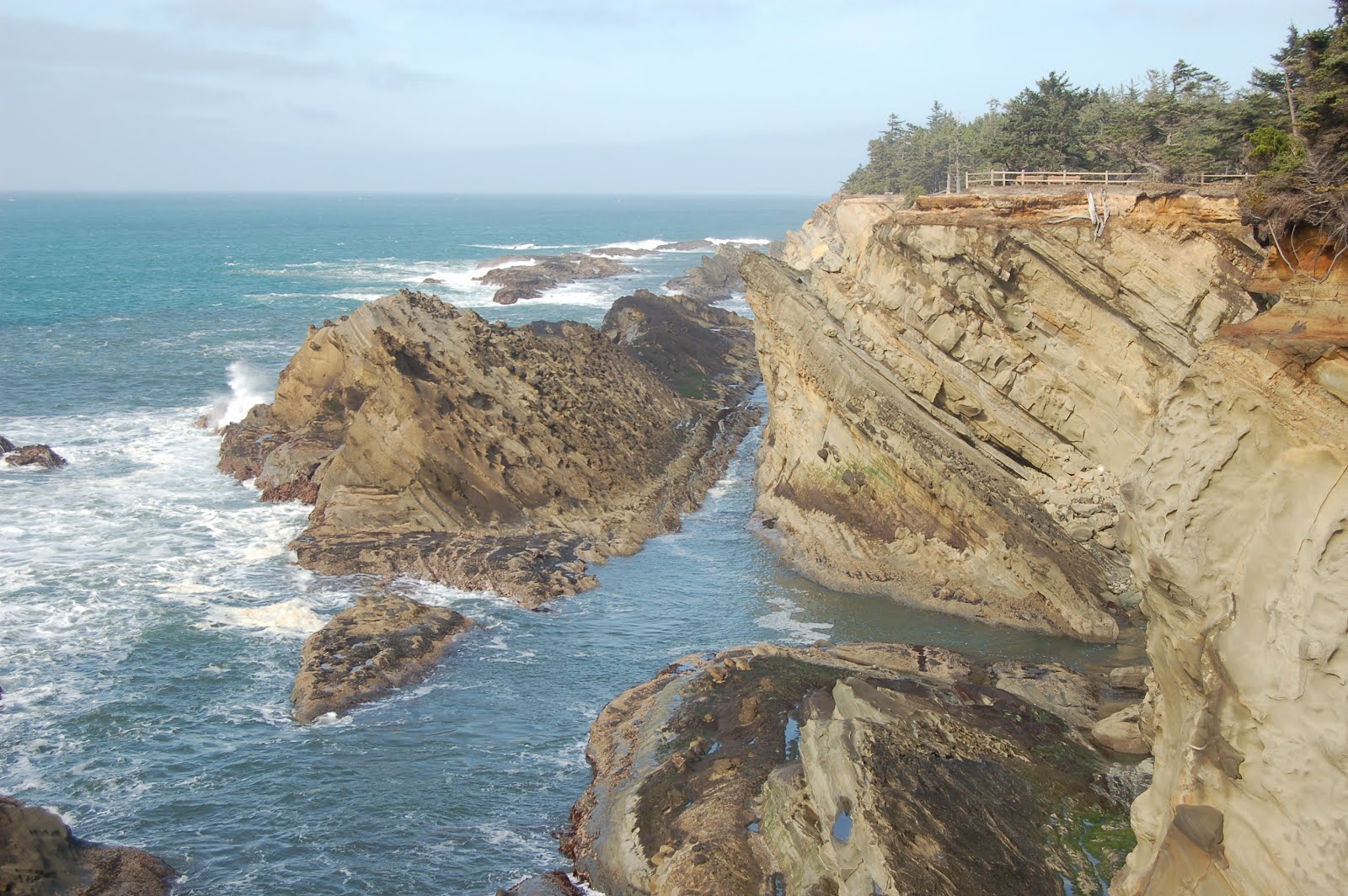
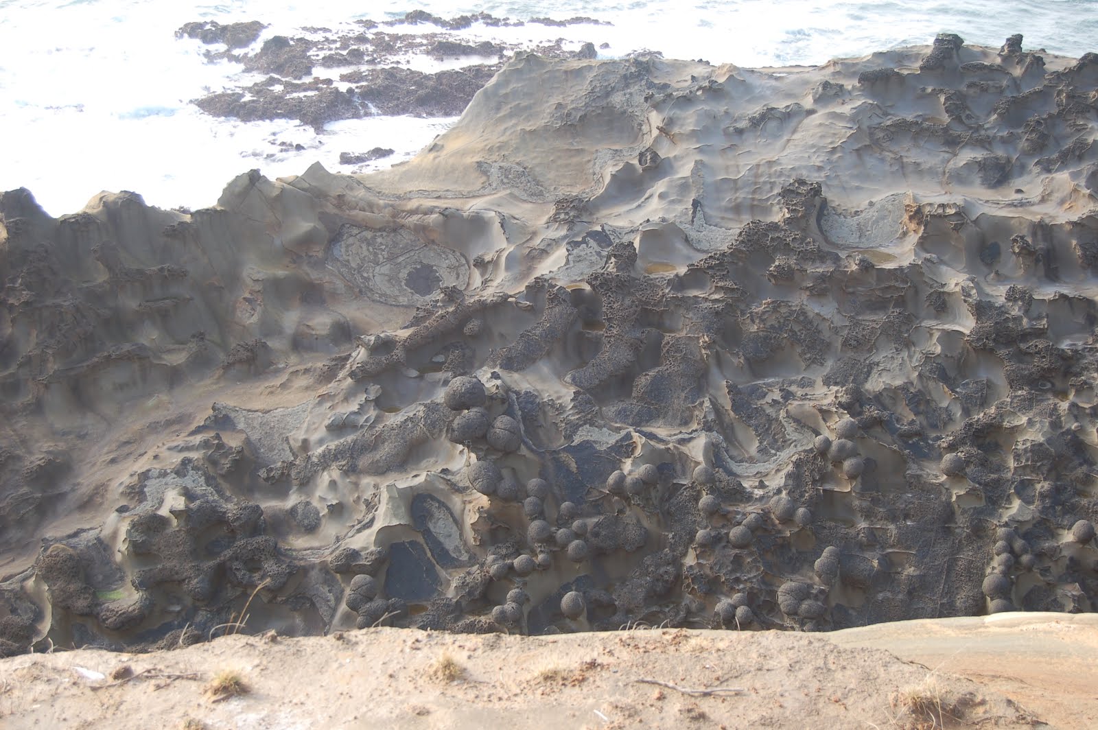
Stop 5: Shore Acres State Park- Coos Bay (the bay itself, not the town) lies on the axis of a progressively folding syncline; younger beds are less steeply dipping than older beds. The triplet of state parks along this section of coast are my favorite Oregon coast locations- and I love the coast, so that's no small compliment. Shore acres has numerous features to explore. You can get to sea level in the south cove, but for the most part, I've been content to simply explore the top of the terrace here. The elevated terrace, incidentally, shows a noticeable increase in elevation from north to south, from Sunset Bay to Shore Acres, to Cape Arago, respectively. The views are breathtaking here; a shot taken near the shelter house is the first photo I've preferred to blank, undistracting gray as my desktop image. Cannon Ball Rock is covered with large concretions, and there are some lovely examples of tafoni weathering on the platform north of that. Looking down into the cove from that platform at low tide, one can see several faults criss-crossing the new wave-cut terrace. If you want to spend some time not doing geology, the gardens are very nice. However, just strolling the path along the cliff and enjoying the scenery can burn plenty of time too. This is the spot to spend your time when the tide is still up; the other two are best visited at low tide.
http://www.flashearth.com/?lat=43.324228&lon=-124.386203&z=15.6&r=0&src=msl
Looking north toward Cannonball Rock- my current desktop photo.
Dana on walk around to Cannonball Rock, giving sense of scale to fence behind her, and in turn to fence both in the distance and in the previous photo.
Large concretions give Cannonball Rock its name.
Tafoni weathering on terrace surface where younger sediments have eroded off, exposing tilted bedrock, south of Cannonball Rock.

Stop 6: Simpson Reef overlook- Most people want to look at the seals and sea lions that haul out on these offshore rocks. Geologists take one look at that zigzag pattern and go "Ooh! Plunging syncline-anticline pair!" Can't remember which is which right now... I'll look it up later.
http://www.flashearth.com/?lat=43.312404&lon=-124.395659&z=15.6&r=0&src=msl
Simpson Reef

Aborted Stop, but highly recommended: Cape Arago- we were getting pressed for time, and choosing between walking down yet another flight of stairs to spend low tide at Cape Arago, or driving back North to Sunset Bay was a no-brainer. Structurally though, and in terms of diverse geology, Cape Arago is the gem of these three parks. Ideally, one should set aside two low tides at this park, one for the south cove and one for the north cove- I don't think the middle cove is safely accessible. North Cove: some great folds, enormous cut-and-fill channels, some kewl sed structures. South Cove: some excellent sed structures, coalified driftwood, hidden but fairly easily inferrable fault. Good tidepools. The FlashEarth imagery does a nice job of highlighting the erosion into criss-crossing faults on the sandstone headland itself.
http://www.flashearth.com/?lat=43.306056&lon=-124.398947&z=16.5&r=0&src=msl

Tuesday, April 10, 2012

PNW Survival Tips And Still Not Dead Yet

Apologies for the long hiatus here. It is intended to be "just" a hiatus, but until I can unsnarl the intertangled problems of an aging computer, Adobe updates devilishly designed to lock up the system, and Blooger updates requiring me to learn new interfaces regularly, it's simply more fight than I want to cope with. I set this up for my own entertainment, and to share my amusements with others. When it has me grinding my teeth in frustration, it's not worth it.

However, I did want to archive today's Twitter tear in a place where I could find it, and others could enjoy it too. So without further ado, "Pacific Northwest Survival Tips:"
  • We divide our fresh water into three categories: ground water, surface water & air water: water that is currently falling.
  • The outdoors is there to enjoy. Careful though. It will chew you up and spit you out dead if you don't use common sense.
  • Be careful. We're coffee snobs. But you already knew that, right?
  • We still support and have small independent bookstores. Yeah, we're retro like that.
  • Newcomers have about a one month grace period to learn correct pronunciation of names. Except Orygun. No grace on that one.
  • We don't believe the world will end in 2012. We believe world went into an endless coma in 1980 when Reagan was elected.
  • If anyplace in the US moves to metric, it will be PNW snow reports. Because snow amounts near 1000 inches are just silly.
  • Yes, walking around in shorts, tee shirt and flipflops is possible in winter, and will get you looks. Contemptuous ones.
  • If we had a state gastropod, it would be the banana slug.
  • People here do weird things just to be different. Like anywhere else. Unlike other places, we don't make a fuss about it.
  • Contrary to widespread belief, "The Earthquake Forecast" is not part of the evening news. But we're working on it.
  • Bend has grown enormously, from small town nearly impossible to get through to large city nearly impossible to get through
  • Salem is known for the golden pioneer on the State Capitol building. And not much else.
  • Reasons we tell CA they can't have our water: agriculture, salmon, hydropower. Real reason: craft beer.
  • Recently, a healthy population of moderate Republicans was discovered here, to much astonishment. Please don't disturb them
  • "Drain Oregon" is a town, not a demand. Likewise, "Boring Oregon" is not a description.
  • *Real* hipsters just *say* they hang out in Portland so the would-be hipsters can't find them.
  • You can tell it's spring in Corvallis when the fragrance from the dairy barns overwhelms that of the flowers.
  • The spirit of the sixties didn't die. It retired to Eugene.
  • Roads can be narrow and rudimentary on the east side, because sand people always drive single file to hide their numbers.
  • We actually *do* have real winters here, but we keep it in mountains and out of most peoples' ways.
  • We're actually quite sanguine about all our volcanoes. Don't expect them to erupt, but looking forward to show if they do.
  • A gift idea for a west side child that guarantees endless frustration? A telescope.
  • Do not tell a PNW woman how to manage her reproductive health. She'll sic her bear on you.
  • Another true fact: People on the east side sometimes get a malady called "sunburn." West side doctors frequently misdiagnose it.
  • True fact: 2/3 of PNW is much drier than the midwest. We call it "the east side," and most people have never heard of it.
  • When we refer to "undesirable immigrants," we're not talking about our respected Latino workers, but Californians.
  • Half the traffic is enormous SUV's, trucks and Hummers. Other half is hybrids. Go figure.
  • Ignore the frequent liberal fads. They'll inevitably fade away in a few decades. Or not.
  • Hazelnuts and filberts are the same thing, but damned if I can ever remember which name we're "supposed" to use here.
  • That freakishly bright orb in the sky? That's the sun. Yeah, it *is* weird.
  • We're the largest exporter of waterfall photos in the world.
  • Our "cities" would mostly be considered "towns" elsewhere. And we like that.
  • That's not black paint in the older apt you're checking out. It's mold.
  • OR state rock is thunderegg, but ought to be basalt.
  • Learn to use a map. GPS is Darwinism in action. It *will* try to kill you in remote areas.
  • Traveling to coast during winter, watch for fish. When you see them, you're there.
  • Do not tease the scrub jays. They will remember you, and make you sorry you're alive.
  • If you're from another part of the country, you won't like it here. Really. Take my word for it.
  • Don't blink during summer time, or you'll miss it.
  • Harumphing about people carrying umbrellas for our light drizzle misses the point: umbrellas *ensure* it's only light rain.
  • Don't face eastward too long, or your left side will get all mossy, and you'll sprout ferns there.

Friday, October 28, 2011

Test Post

I haven't been able to get any Blogger pages to load for at least the last two days- not even my own blog. Twitter inquiries lead me to believe this is just me, not an issue with Blogger. I'm still seeing posts in RSS, but for those who clip their posts, sending just an intro snippet to their feed, I can't click through to read the rest... or rather, it won't load. I can get to the "create post" page, though, so I'm testing whether I can still post, and if doing so will allow me to get to OTI.

Tuesday, October 18, 2011

Volcanic Ramblings Part 6: Cascades Slop Over Into Basin and Range

We managed to consistently get started at a decent time each day of the trip, aiming to gather for breakfast at 8:00. Since we had driven about an hour south from the turn-off to Crater Lake, that meant we had to drive an hour north- though I recently realized there IS a more direct, probably significantly shorter route that would have taken us to the SW entrance. But wait'll you see the juicy outcrops we would have missed in that case!

Descending into the Klamath Basin, numerous ~N/S normal faults have opened up some terrific exposures I had never bothered to look at carefully- though the next one (after this) in particular is one I've wistfully watched as I sailed past it more times than I care to count over the decades. But here's the thing: the rock is steep, not particularly competent, so mass wasting into the road is commonly a problem, route 97 is sort of shoehorned in there where it fits, often with little space for pull-outs or break-down lanes... and it's a fast, busy and dangerous road. So opportunities to geologize need to be chosen carefully, with an eye toward safety.

All that said, we did find a few pre-park stops which, though they chewed up and spat out enormous amounts of precious time (the commodity which was in shortest supply for the whole trip), were definitely worth it. For most of the stops on the trip, I tried to remember to take a shot or two of helpful landmarks for anyone else who would like to check the spots out for themselves someday, and so I could more confidently and precisely find them in Flash Earth. The lead photo above is the intersection of Algoma Road with Route 97. We were able to get off the road, park in a pull-out on the south side, get behind the Jersey Barrier (which was very nice to have between ourselves and traffic), and walk a hundred yards or so south to an interesting-looking face we had noticed only moments before.

Here's the first shot of the day ( Note that all the photos in this series will get much larger with a click.):So what are we looking at? Well, that there is an itty-bitty normal fault in poorly sorted, extremely immature volcaniclastic sand (mostly) and silt. The grains looked to be mostly lithic, which is why I describe it as "extremely immature." The offset looks to be about an inch. Here's a view from a different angle:Isn't that purty? I'm quite fond of sed structures, both original and soft deformation, so I keep an eye out for them at stops like this. Not much of note at this one, but enough to convince me this stuff was reworked by water, not just air fall ash. (Obligatory admission: I'm no expert, and I'm always open to correction and/or questioning.)
Backing off from the same spot, with the lovely Dana Hunter for scale, you can get a better sense of the over-all look of the outcrop, and see that the fault is roughly parallel to the cliff face, suggesting this is a subsidiary fault to the much larger one that created this escarpment.Looking a bit farther along, there's a lens of very dark sediment that I took to be a small cut-and-fill structure at the time, but it occurs to me it might be a small channel from near the start of this sedimentation cycle. The next unit down is a brick red layer that looked as if it might be a thick ash-fall unit. Looking south along the face, below, it's quite striking. But at the far end, you can see the same kind of stratification as above the brick red stuff.
Walking south, down-section, more of the same under the bricky stuff...
Turning to look north, yep, it's pretty clear that structurally, we're in basin and range. I would guess (and later 65 mph reconnaissance geology seemed to confirm) that the sorts of rocks and sequences we're seeing here would be up there, too.Below, a block of stretched-vesicle mafic rock that fell from a lava flow above the sediments first shown with the fault...
...and a coarse cobbly layer in the lower section of sediment.
So what can we say about this environment (dons semi-irresponsible speculation helmet)? Well, it's very clearly dominated by a nearby source of volcanic rocks... oh, I didn't show you the view across the highway yet, did I?That'd be Mt. McLoughlin, the southernmost major Cascade peak in Oregon. (I doubt that particular volcano contributed much to this outcrop, though.) But I have to admit, I'm not very confident describing the depositional environment. I'm guessing that we're looking at a braided stream drainage, mostly choked with ash, but with larger channels carrying flows competent enough to move larger boulders. The material is too coarse and poorly sorted to be lacustrine (as the modern-day lake across the road) but I'm not seeing enough in the way of cross bedding and channel features to feel comfortable with what I'd consider a more typical meandering fluvial environment. There are quite a few flows in between thick piles of sediments, so we're not so far from the vents that sufficiently fluid lavas couldn't reach this spot, but they're a fairly small proportion of the pile... less than a quarter for sure, maybe closer to 10-15%.

In terms of age, I really don't know, but I'd bet pre-Pleistocene, because the magnitude of the fault offsets (which post-date the sedimentation) would require at least one or two million years.

One last shot, taken as we crossed the causeway in the lead photo, with a question for Callan Bentley... what was the term for a ramp between two vertically offset blocks? You mentioned it in your posts on structure in the Bishop Tuff. Followup: Callan responds swiftly with the response "relay ramp." That there below is one.