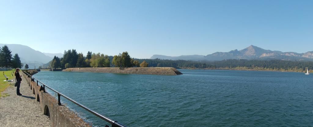
See the bridge? No, not the steel truss cantilever bridge on the left, but the land bridge that extends out to it. According to the latter link, there is considerable disagreement in the radiometric carbon dates obtained for the landslide's age, with the most recent measurements suggesting a date of about 1450, but ranging from 1060 to 1760 AD. My take on these wide ranges is that it's not likely due to inaccuracy of lab measurements, but difficulty ascertaining which wood samples are directly related to the Bonneville Slide.
This photo doesn't illustrate the reason for the locks here well, but I'm not sure others will do a better job. As you can see from the toe of the slide behind the human-constructed bridge on the left, the river was pushed and constricted to the south side of the gorge. Prior to construction of the Bonneville Dam in 1957, this was an area of rapids, which are now submerged in the pool behind the dam. Construction of the locks at this point allowed boat and shipping access to the Columbia Channel upstream from here.
Photo unmodified. October 10, 2012. FlashEarth Location.
Is This Your Hat?
11 years ago


No comments:
Post a Comment