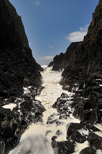
Geology Rocks posted this earlier today, from Seal Rock State Park, between Newport and Waldport. This is likely Columbia River basalt that reached the coast, then re-intruded into unconsolidated sediment. This has been shown to be the case for numerous similar basalt headlands further to the north, but I don't know for sure whether it's been confirmed in this instance. If it is, it's the farthest south occurrence of CRB (exposed, at least) along the coast. It's a gorgeous spot, with a ring dike somewhat sheltering a nice sandy beach. It also happens to be the first Oregon scenery I visited after I arrived in Oregon some 30 years ago. My dorm roomie drove us over to the coast, and we went climbing around on the rocks. This spot is very exciting, and not
too hard to get to, though I doubt I'd try again now.
Followup: Reader/commenter SkinnyDennis left a link to
the location in Google Maps- the photo is looking down that crevice between the two dikes, and if you back out a bit, you can see how the dike arcs out into the surf, then back to shore to the south.


2 comments:
Is this the feature here?
http://tinyurl.com/25aol34
(google maps)
At first look at your photo, I thought that was snow!
That's it! The photo is looking SSW down the crevice between the two dikes.
Post a Comment