Thursday, January 24, 2013

Funny 3-D in 2-D

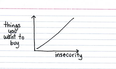
Yesterday, tweeted, "I can't believe I'm not finding any search results for "ternary diagram funny." Can any geologists out there help me out?" I did a search, and found this one, which is fun, but not too pertinent to the Hallowed discipline that is Geology. I also found one from Georneys, which I thought was pretty clever, but which Emily apparently thought was not up-to-par in the humor department. I sent those links along, but followed that tweet with "But you're right... most are seriously intended. This is indeed a void in the geologic literature, crying to be filled."

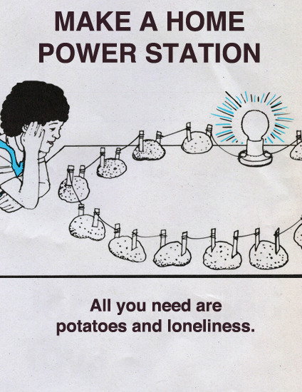
So, in the interest of opening up a new area of investigation in geology, here is my (first) suggestion for a funny ternary diagram:
Okay, it's not going to make anyone die laughing, but it's my first shot...

Here are a couple of blanks if anyone else wants to chime in.
(From Wikipedia) A more formal (and larger) blank ternary diagram:
Anyone else have any ideas? I'm giving this a "Memes" label, not because I expect that it will take off, but because I'd really love for it to do so.

Followup, 12:55 PST: Here's another...

Geo 365: Jan. 24, Day 24: Close Enough

Looking generally southward over the lava flow from Nash Crater, toward McKenzie Highway, Route 126. This was taken a hundred yards or so west of McKenzie Junction on the berm of Route 20. I have mentioned the dual nature of the Cascades before- see paragraphs 2 and 3 here. The McKenzie trough is the clearest expression of the western half of the High Cascades graben. 20 comes down a gentle grade here, out onto the flow, then starts a long, slow climb to Santiam Pass, where it crosses the High Cascade Crest. So this is the spot that I point to when field tripping as the transition from Western Cascades to High Cascades.

It's a bit more complex than that, though. I'm told that tephra from relatively recent eruptions covers the ground pretty deep in the area- so when you reach this spot, you've actually been traveling on recent (High) Cascade material for some miles. You could say, "Oh, but if you dig down a ways, you'd be on Western Cascade bedrock." True, but you could say the same thing out on the flow. The fact is, you could say the same thing all the way across the High Cascades- there's Western Cascade rock underlying the whole pile. I don't know whether any section of the fault (or more likely, fault system) that created this topographic boundary (on the western side)  has ever been actually observed, or just inferred. And that would actually be the best boundary marker.

As an aside, the corresponding eastern half-graben is very clearly expressed at Green Ridge, north of Black Butte. Black Butte is a large cinder cone that probably formed where it did as magma was channeled along the same fault(s) that formed Green Ridge. From an older post:
So getting back to today's photo... does this really represent the Western/High Cascade boundary? I guess my answer would be that, if you can accept the idea that for the western half-graben, the concept of a sharp boundary is at best poorly defined, and, really, kind of nebulous and artificial, I'll just say, "Close enough."

Photo unmodified. October 9, 2012. FlashEarth Location same as yesterday, so today I'll put the cross hairs on the spot where we parked- amusingly, there's another car parked there

Wednesday, January 23, 2013

Geo 365: Jan. 23, Day 23: McKenzie Junction and Three Fingered Jack

"Upstream" from Clear Lake, a series of relatively fresh lava flows dominate the landscape. These flows are broken, jumbled, and highly permeable, so there is no surface flow- all of the precipitation in this area just drains into the ground, moves southward, then issues as springs in and around Clear Lake. There are some seasonal lakes and year-round streams at the margins of the flow- notably Fish Lake and Lava Lake, but those too simply percolate into the rubble to re-emerge at Clear Lake.

The lava flow in this area, which I'll show in more detail tomorrow, erupted from Nash Crater; the flow in the Clear Lake area issued from the Sand Mountain chain of cones. While I've driven through this intersection, called McKenzie Junction, more times than I can count, I'd never stopped here before. The combination of the fiery fall foliage with the crisp greens of the Douglas firs, and the view to Three Fingered Jack was superb.

Photo unmodified. October 9, 2012. FlashEarth Location.

Tuesday, January 22, 2013

Whole Lotta Shaking

I was just checking on the date of the 1700 Cascadia Earthquake; it was, as I thought I remembered, January 26. I'll try to find something appropriate to post for Saturday, but in the meantime, I found the Wikipedia entry informative and interesting.

Also, I checked the "Great Oregon Shakeout" page. I'm pretty sure that used to be on Jan 26, to commemorate that last great quake, but it appears to have been moved to 10:17 AM, October 17. My sense is that this is to better align with other "Shakeout" drills nationally and globally, though off the top of my head, I don't know if this commemorates the anniversary of some other quake. But in the end, it doesn't matter. The best time to be prepared for an earthquake- or any disaster, for that matter- is right now.

The following text was lifted without permission from the shakeout page (PDF Link)- note that it is copyrighted, and if I'm asked to remove it, I most certainly will. But it seems to me that the nature of this information is such that it needs to be shared and read by as many as possible.
Recommended Earthquake Safety Actions

© 9/15/12 Earthquake Country Alliance


Federal, State, and local emergency management experts and other official preparedness organizations all agree that “Drop, Cover, and Hold On” is the appropriate action to reduce injury and death during earthquakes.  Great ShakeOut earthquake drills (www.shakeout.org) are opportunities to practice how to protect ourselves during earthquakes.

You cannot tell from the initial shaking if an earthquake will suddenly become intense…so always Drop, Cover, and Hold On immediately!
•    DROP to the ground (before the earthquake drops you!),
•    Take COVER by getting under a sturdy desk or table, and
•    HOLD ON to your shelter and be prepared to move with it until the shaking stops.

If there is no table or desk near you, drop to the ground and then if possible move to an inside corner of the room. Be in a crawling position to protect your vital organs and be ready to move if necessary, and cover your head and neck with your hands and arms.

Do not move to another location or outside.  Earthquakes occur without any warning and may be so violent that you cannot run or crawl. You are more likely to be injured if you try to move around during strong shaking. Also, you will never know if the initial jolt will turn out to be start of the big one…and that’s why you should always Drop, Cover, and Hold On immediately!

These are guidelines for most situations. Read below to learn how to protect yourself in other situations and locations, or visit www.dropcoverholdon.org.

If you are unable to Drop, Cover, and Hold On: If you have difficulty getting safely to the floor on your own, get as low as possible, protect our head and neck, and move away from windows or other items that can fall on you.

In a wheelchair: Lock your wheels and remain seated until the shaking stops. Always protect your head and neck with your arms, a pillow, a book, or whatever is available.

In bed:  If you are in bed, hold on and stay there, protecting your head with a pillow.  You are less likely to be injured staying where you are.  Broken glass on the floor has caused injury to those who have rolled to the floor or tried to get to doorways.

In a high-rise:  Drop, Cover, and Hold On.  Avoid windows and other hazards.  Do not use elevators.  Do not be surprised if sprinkler systems or fire alarms activate.

In a store: When Shaking starts, Drop Cover and Hold On.  A shopping cart or getting inside clothing racks can provide some protection. If you must move to get away from heavy items on high shelves, drop to the ground first and crawl only the shortest distance necessary. Whenever you enter any retail store, take a moment to look around:  What is above and around you that could move or fall during an earthquake?  Then use your best judgment to stay safe.

Outdoors:  Move to a clear area if you can safely do so; avoid power lines, trees, signs, buildings, vehicles, and other hazards. 

Driving:  Pull over to the side of the road, stop, and set the parking brake.  Avoid overpasses, bridges, power lines, signs and other hazards.  Stay inside the vehicle until the shaking is over.  If a power line falls on the car, stay inside until a trained person removes the wire.

In a stadium or theater:  Stay at your seat or drop to the floor between rows and protect your head and neck with your arms.  Don’t try to leave until the shaking is over.  Then walk out slowly watching for anything that could fall in the aftershocks.

Near the shore:  Drop, Cover, and Hold On until the shaking stops. If severe shaking lasts twenty seconds or more, immediately evacuate to high ground as a Tsunami might have been generated by the earthquake.  Move inland two miles or to land that is at least 100 feet above sea level immediately.  Don’t wait for officials to issue a warning.  Walk quickly, rather than drive, to avoid traffic, debris and other hazards.

Below a dam:  Dams can fail during a major earthquake.  Catastrophic failure is unlikely, but if you live downstream from a dam, you should know flood-zone information and have prepared an evacuation plan.

More information: 
www.shakeout.org/dropcoverholdon      
www.dropcoverholdon.org
www.earthquakecountry.org/dropcoverholdon

Geo 365: Jan. 22, Day 22: Clear Lake Lava

Looking across Clear Lake, to the foot of the lava flow that blocked it. As I mentioned it yesterday, this flow is about 3000 years old, and erupted from the Sand Mountain set of cones.

Photo unmodified. October 9, 2012. FlashEarth Location.

Monday, January 21, 2013

Clear Lake Addendum

These aren't my photos, so they don't count as part of the Geo 365 project- I'll label them that way so this comes up with this morning's post, though.

This is a view in FlashEarth of the area, backed out and moved eastward from this link. See that line of cones? Ed Taylor, from whom I had many great geology classes, often talked about lines of vents in the Central Oregon Cascades, and that there is one of them. It's almost certainly fault-controlled- the fault being a zone of weakness that rising magma can push into and follow more easily. It looks as if the eruption of the flow that created Clear Lake came from about the middle of that line, just based on its shape, but I'd be careful of making that as an actual claim. I haven't checked it on the ground, so I can't claim confidence as to where the actual vent was/is.
And to preempt possible confusion, that line is not the Cascade Crest- that lies a bit farther east- the dotted line on the capture below marks the boundary between Linn and Deschutes Counties, and lies on the topographic (though confusingly, not the hydrological) divide of the Cascade Crest. Because these young flows are so fractured and permeable, groundwater may actually flow freely across what appears as if it *ought* to be the hydrological divide.
Another interesting feature, just west of the divide, and to the east of the northern end of the little line of vents, is Hayrick Butte, a tuya, or sub-glacial volcanic eruption. Taylor did not like this idea one little bit when it was presented at an afternoon seminar in the mid-80's, but it seems to have gained widespread acceptance now. Eric Klemetti has some nice photos and a good discussion here.

Geo 365: Jan. 21, Day 21: Reflections

Concluding the third week of this project, it seems like a good time to toss out some thoughts I've been having. I started this on a kind of spur-of-the-moment impulse, when I saw Ian Stimpson was finishing up his Rock 366 project at Hypocentre. To the extent I thought about it, I guess my main one was doubt: "I doubt I'll be able to stick with it. I'll get bored with the tedium and drop it."

However, I'm not finding that to be the case, at all. I think there are three main reasons for that. First, without really thinking about it at all, I set up the guidelines in such a way that there's zero pressure. All I need to do is find a decent, interesting picture and post it. I suppose I also have to come up with some kind of title, but even that can just be the date and "Day X," if I'm feeling uninspired. So basically I have the freedom to write as little or as much as I'm inclined. Second, the first week, I hopped around a lot, and was getting frustrated at the sheer amount of time I was spending just paging through folders of various photos taken on various trips- mostly with Dana Hunter, but a few others as well. I don't even know how many there are, but it has to be somewhere around three thousand. Then on week 2, again without much consideration, I ended up focusing on aspects of Marys Peak geology I hadn't really addressed before. Suddenly, I only had a hundred or so photos to choose from, and the process was much quicker. I was mentally thinking of it as "Marys Peak Week" by the middle. So this past week, I decided to focus on a pair of outcrops along Highway 97, about an hour north of Klamath Falls, and again, the process went very quickly and smoothly. I expect I'll mostly stick with that: a relatively restricted spot or area each week, simply to narrow the range of choices I have. So far, it's been more or less randomly chosen just from spots I think are particularly pretty and geologically interesting- and lord knows, Oregon has no shortage of those. Finally, the response from the geoblogosphere has been very warm and positive. The Geo 365 series is consistently in 3 or more of the top 5 posts in terms of page views over the previous week.  It's kind of nice seeing Sunday Funnies Editions from 2, 3, or 4 years ago getting kicked down a bit. And it's nice to know that people are enjoying what I'm doing *now,* too.

So when all is said and done, this project is turning out to be easier, more fun and more rewarding than I could have imagined. I'm not in the least bit tired of it. On the other hand, I'm not ignoring the fact that I still have over 94 percent of the year to go yet. :-P

So enough with the introspection. Above is a photo of Clear Lake (Linn County- Wikipedia tells me there are 11 Clear Lakes in Oregon), the source of the McKenzie River. It was formed about 3000 years ago when a lava flow blocked that stream, flooding the valley floor. Trees drowned by that inundation are still standing on the lake's bottom, and due to the incredible clarity of the water, are easily visible from the shore or dock. There's an example of one just below the reflection of the viney maples in the left-middle of the photo.

While this is a spot I've been meaning to visit for years, it kept getting set aside in favor of other destinations. And while I can't say I'm "glad" I put it off so long, I will say visiting for the first time on a gloriously warm, sunny, early October day, when the leaves of the deciduous trees were in full color, wasn't a bad choice at all. Nothing could have prepared me for the beauty of this area.

Photo unmodified. October 9, 2012. FlashEarth Location.

Sunday, January 20, 2013

Sunday Funnies: Sarchasm Edition

Darius Whiteplume's Tumblr
What Would Jack Do?
 "When the cute geology grad. student needs help in the field over the weekend" Geology is Hard
Darius Whiteplume's Tumblr
Blackadder
Tastefully Offensive
Savage Chickens
Bits and Pieces
Bits and Pieces
Amazing Super Powers
Medium Large
Indexed
Senor Gif
Criggo
"When your roommate asks what the sedimentology lab is and why you're always there" Geology is Hard
 "Shoehorn stork:" Senor Gif This is the kind of thing that always makes me stop and think about dinosaurs...
Bits and Pieces
Darius Whiteplume's Tumblr
"When a freshman in GEOL 101 tells me they hate getting dirty and being outside" Geology is Hard
Tastefully Offensive
Bug
The Far Left Side
Cyanide and Happiness
Senor Gif
Tastefully Offensive
Funny to Me
Savage Chickens
Bits and Pieces
Funny to Me
Accidental Remediation found a bunch of examples of a recent Twitter Meme done as captions... I think it works even better this way. Several more at the link.
Tastefully Offensive
"How deep is your mud?" Bits and Pieces
Funny to Me
Are You Talking to Meme?
Sofa Pizza
Fake Science
Non Sequitur
Tastefully Offensive

Geo 365: Jan. 20, Day 20: Normal Faults & Cascades

Same outcrop as the last two entries, showing a couple more normal faults at the downhill end. It just barely shows at this scale, but if you enlarge the photo, you should be able to see what I'm fairly confident is Mount McLoughlin poking up on the left horizon. Below is the view to the south, to help with location-finding. As I've mentioned, the power lines crossing this spot are a useful landmark.

Photo unprocessed. August 18, 2011. FlashEarth location. (Cross-hairs on pull-out.) If you choose to visit this spot, please see Monday's safety comments.