Pilot Butte, from Geo 365. (See the Index for more photos and information)
Newberry... *SO* much to do and see. A large portion of this complex was set aside as Newberry Volcano National Monument in 1990. (See up-to date info on fire closures and other alerts, as well as general and contact information at that link) Here are some highlights:
*Lava River Cave- I haven't been to this feature in years, but it's Oregon's longest known lava tube, at a bit over a mile. There's a per-vehicle fee, but I don't know if that's in addition to the general entry fee for the monument (I kinda doubt it, but I'm not sure). Then there's a rental fee for propane lanterns, but that's like a couple bucks and is trivial compared to the value of exploring the cave. The cave itself is a refreshing brisk walk on a hot summer day- a nice escape from a hot summer afternoon, the average temperature is 42 degrees- you'll want a jacket or something fairly heavy and warm.
*Lava Lands Visitor Center- I don't find the visitor center itself all *that* interesting (others less familiar with the area may disagree) but it's an ideal site to get up close and personal with some typical features of the monument. I'd recommend early in the day for this spot. One can drive to the top of Lava Butte, but parking is limited. The center gives free half-hour passes for parking on a first come-first served basis, but on busy summer days, they can go fast. They open at 9 AM. I'd imagine half an hour is plenty of time to walk the loop trail around the summit crater and take in the views.
Lava Butte summit, looking toward Newberry, from Geo 365. (See the Index for more photos and information)
Also at the visitor center, "The Trail of the Molten Land" may have a corny name, but it does show some very cool features of a "breach flow" (my term, don't know if used generally) from a cinder cone.
Lava Balls on The Trail of the Molten Land, from Geo 365. (See the Index for more photos and information)
*Lava Cast Forest- Again, a spot I haven't visited in 15 or 20 years, and a bit out of the way (which means it's not as busy), on a heavily washboarded road. This is exactly what it sounds like: a forest was inundated by lava, and the trees are "preserved" as casts. In other words, they're not there at all, but the space they occupied is represented as void spaces. It's worth it if you have the time.
*Newberry Caldera- I suppose if I had to pick just one thing to see in the Bend area, this would be it, though McKenzie Pass is a barely marginal second. Paulina Peak must be one of the most sublime but poorly known vistas in Oregon. The road is rough, narrow, and steep but doable in a sedan... not easy, but doable. For the adventuresome, there is a trail from the caldera floor to the top of the peak, but with a 1620 foot elevation gain, I'm no longer that adventuresome.
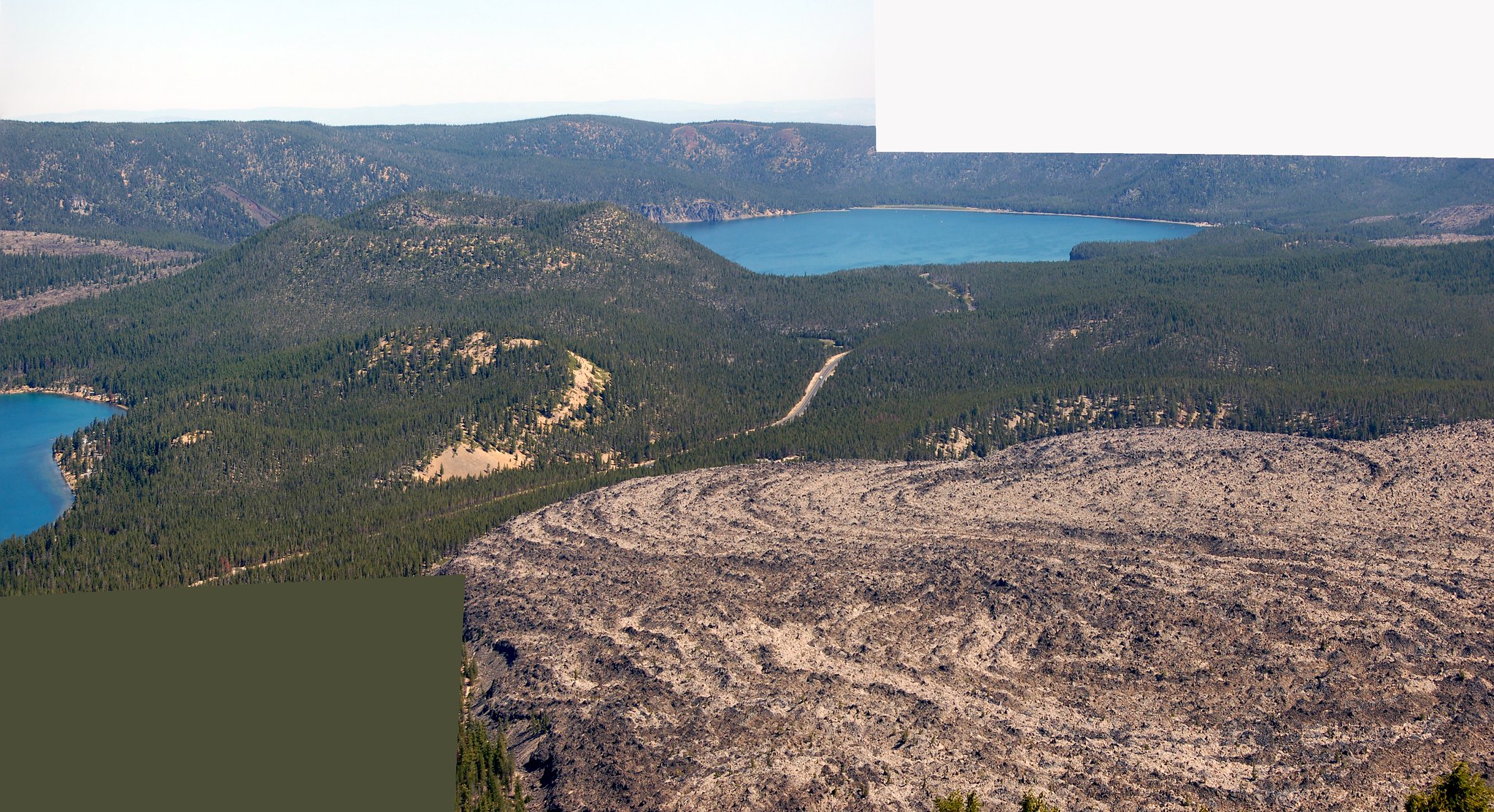
Looking into Newberry Caldera from Paulina Peak. Big Obsidian flow lower right, from Geo 365. (See the Index for more photos and information)
More my speed is the roughly one mile Big Obsidian Flow trail, highlighting the features of a stunningly stark pile of broken glass.
Another spot here, which I haven't visited, but has been recommended to me, is Paulina Creek Falls. I suspect if you choose one of the easier hikes at that link, everything I've listed so far would make a good day (But not if you choose to hike Paulina Peak). However, I've barely scratched the surface in terms of hiking opportunities, focusing more on sights and places I've visited.
Two places I haven't been, but do want to visit sometime, are Cove Palisades State Park, and Smith Rocks State Park. However, the person I know who is actually visiting Bend is planning on some climbing at Smith Rocks, so he probably knows more about that park than I do.
The Headwaters of the Metolius (Wikipedia link, but unfortunately the best link I could find) is a ways west of Sisters, north of Black Butte (The turn-off is just west after you pass the base of this large cinder cone) and it's quite nice, but you're fenced into a relatively small area surrounded by private land, so you can't see much or well. It's frustrating. But this hike looks easy and fun, and a good way to get to know the river better. (I haven't done it, but I should- four miles round trip, fairly flat, I could manage pretty well, I think.)
Finally, as I mentioned earlier, Newberry Caldera just barely squeaks by McKenzie Pass as the number one must-see attraction in the Bend area. Metolius Springs and McKenzie Pass would be an easy, actually, fairly short, day out of Bend, leaving plenty of time for hiking in the Pass area. It looks like Yapoah Crater is a reasonable day hike, if you go after the snow melts back. And I've heard good things about Obsidian Falls. However, I haven't hiked much off-road in this area, so you'll want to track down more information. I found the relatively short (maybe a mile) interpretive trail just to the east of the observatory to be well done and informative.
"Geobloggers in their natural habitat:" Yours Truly, Anne Jefferson, Chris Rowan and Dana Hunter at Dee Wright Volcano Observatory, McKenzie Pass. (See the Index for more photos and information, and this week in particular has some nice panoramas from the same location. Just ignore July 11 and 13.)


No comments:
Post a Comment