Showing posts with label OSU. Show all posts

Thursday, September 15, 2016

Geo 891: Lost Lake Basin and Hogg Rock

The basin the the foreground fills with water during late winter into spring, then slowly drains into the ground over the summer- there is no surface outlet. I've thought for years that Hogg Rock, in the back, looked like a tuya- a subglacial volcanic landform- in terms of its shape, and a couple months ago, I was informed by Adam Kent, a volcanologist at Oregon State, that it is.

Over the past year, there have been a number of stories in Oregon news sources about Lost Lake's "drain hole," starting with one in the Bend Bulletin. Even though I had never stopped here before, I was able to get a general sense of its location from the shape of the landscape in photos accompanying the articles. However Hollie and Gary had visited the site previously, so we didn't have to search it out. Nevertheless, my "general sense" turned out to be quite accurate. We're looking pretty much right at it, but from this angle, it's hidden in the grass and willows.

The countless dead trees on and around Hogg Rock were killed in a nasty fire a few years ago.

Photo unmodified. September 7, 2016. ZoomEarth location.

Friday, November 21, 2014

Geo 730: November 19, Day 688: The Other Bridge of the Gods

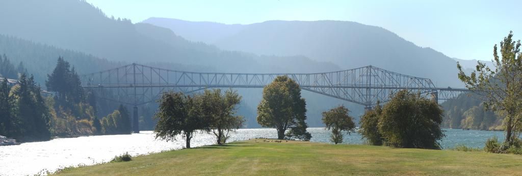
There was a bit of confusion at this stop. Dana didn't realize that "Bridge of the Gods" referred to both the landslide-created "bridge" AND to the engineered steel truss bridge. Nor did she realize "Cascade Locks" referred to both the town and the now-disused shipping locks. I think we got that all straightened out, though. This bridge is the one I've crossed the Columbia on most often, probably more than all the others put together. The reason is that I was a student worker in Forest Soils during much of my undergrad time at OSU, and especially early on, one of our field sites was at Wind River Experimental Forest, which is upstream from here a bit, then north from Carson, Wa.

And in the center mid-ground, more of our friends the geese.

Photo unmodified. October 10, 2012. FlashEarth Location.

Tuesday, November 11, 2014

Geo 730: November 10, Day 679: Red Wood

No, not a redwood, but there's a fair chance this was a dawn redwood, or Metasequoia. Peavy Hall, the Forestry building at Oregon State, has a living dawn redwood near the north entrance, and two petrified logs of it, one near the east entry, and another in the atrium. Both were from the Eagle Creek Formation, as I suspect the above is. Not a terribly informative photo, but I love the color, and the contrast with the fern below.

Photo unmodified. October 10, 2012. FlashEarth Location.

Saturday, August 2, 2014

Geo 730: July 30, Day 576: Student for Scale

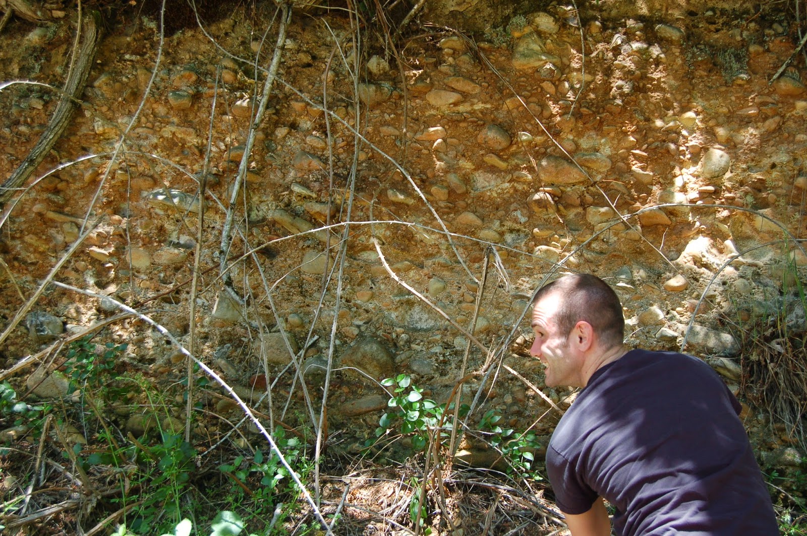
Another shot of the imbrication near the beginning of Quartzville Road, with Bobby for scale. I didn't feel nimble enough to climb up through the briars to put my hammer on the outcrop, so he volunteered. Once he got up there, we realized we didn't really need to worry about the hammer. Bobby has been getting his intro to geology courses at a community college, and is transferring to OSU this fall. He doesn't blog (Yet. I'll work on that.), but I think his intelligence and enthusiasm will carry him through his geo major well. It'll be interesting for me to see how the structure of the major has changed over the last 30 years.

Photo unmodified. June 19, 2012. FlashEarth location.

Friday, February 7, 2014

Geo 730: Feb. 7, Day 403: Meteorminerology and Geology

 Technically, snow is simply a pile of mineral grains. A mineral is "a naturally occurring, inorganic, crystalline solid with a fixed composition, or a composition that varies within a fixed range." Snow (and ice of any kind) meets each criterion of that definition; it is a mineral. And man, oh man, have we a pile of mineral grains in Corvallis right now. I'm guessing about 15-16 inches, rivalling the deepest snow I've ever seen here. As sort of a meta-treat, we're looking at the back side of Wilkinson Hall, the Geosciences building on the Oregon State University Campus. Beyond that is Burt Hall, the Oceanography and Atmospheric Sciences Building. Together, the two house much of CEOAS, OSU's College of Earth, Oceanographic, and Atmospheric Sciences.  (I'll head back to SE Oregon in a day or few, but this snow is pretty amazing, and I can't pass it up.)

Photo unmodified. February 7, 2014. FlashEarth Location.

Monday, January 21, 2013

Clear Lake Addendum

These aren't my photos, so they don't count as part of the Geo 365 project- I'll label them that way so this comes up with this morning's post, though.

This is a view in FlashEarth of the area, backed out and moved eastward from this link. See that line of cones? Ed Taylor, from whom I had many great geology classes, often talked about lines of vents in the Central Oregon Cascades, and that there is one of them. It's almost certainly fault-controlled- the fault being a zone of weakness that rising magma can push into and follow more easily. It looks as if the eruption of the flow that created Clear Lake came from about the middle of that line, just based on its shape, but I'd be careful of making that as an actual claim. I haven't checked it on the ground, so I can't claim confidence as to where the actual vent was/is.
And to preempt possible confusion, that line is not the Cascade Crest- that lies a bit farther east- the dotted line on the capture below marks the boundary between Linn and Deschutes Counties, and lies on the topographic (though confusingly, not the hydrological) divide of the Cascade Crest. Because these young flows are so fractured and permeable, groundwater may actually flow freely across what appears as if it *ought* to be the hydrological divide.
Another interesting feature, just west of the divide, and to the east of the northern end of the little line of vents, is Hayrick Butte, a tuya, or sub-glacial volcanic eruption. Taylor did not like this idea one little bit when it was presented at an afternoon seminar in the mid-80's, but it seems to have gained widespread acceptance now. Eric Klemetti has some nice photos and a good discussion here.

Saturday, December 29, 2012

Census Dot Map

I found a fun website earlier, a map that plots every resident -not residence- as a dot. There is no other information. It becomes sort of a fascinating and disorienting problem to zoom into your neighborhood with no information other than where everybody else lives. Now there is a "cheat mode" in that you can switch over to a Google map and zoom in with geographic features identified. But the first time I found Corvallis, it was purely from the Census information.

Two caveats- in my experience, the point data is very slow to load, so you'll need patience. I just switched over to other tabs and reading, then come back a few minutes after each zoom step. The other weakness of the site, in my opinion, is that I wish you could zoom in another step or two. There is a major transition in street orientation a block west of me, and at the maximum zoom possible, it can't quite be resolved.

Following are a screen capture for my little burg at maximum zoom (scaled to fit; click for full-size), and an annotated version of a few nearby, recognizable features.
It might be kind of fun to do a similar game to "Where on Google Earth:" "Where in the US Census?" But I think if the slow updating is an overall issue, it might get awfully frustrating.

Followup, 6:13 PM PST: I just went back and played with it a bit more. It's loading much more quickly than earlier. I'm begining to wonder if some of my confusion was in not recognizing when some data tiles were missing. Can you figure out where the following is from (City, State)? It's at highest zoom.

Monday, October 15, 2012

Geology At Oregon State University

Update, October 16, 2012: I'm going to move stop 14 to between 4 and (currently) 5, and add Kelly Hall as stop 15, as suggested by Cassady in the comments. I walked up and took a look around this afternoon, and it's definitely worth a stop!

Update, October 21, 2012: Dana has posted the first in a series of photo supplements to this tour/post at her blog, En Tequila Es Verdad.

It's Earth Science Week, from yesterday through Saturday. Yesterday I posted Geogalavanting Around Oregon with Dana, Part II, and it occurred to me a moment ago that I should try to do a geology post a day to commemorate the occasion- lord knows I have enough material. My only concern is that I get obsessive about my reading of science, news, politics and funnies, so we'll see if I can really pull that off...

I decided for today's post, I'd post locations and descriptions of the tour of (mostly) architectural geology that I've been doing since I was an undergrad, and slowly augmented over the years. I have only a few photos at hand right now, so I'm going to skimp on those- only a few- for the time being. Hopefully I can be precise and clear enough verbally, and with FlashEarth, that you can use this guide to find all the good stuff if you're a student or work at OSU, or live close enough to visit... or if you drop by Corvallis sometime, for whatever reason. There's a map you can use for reference here. The crosshairs at the FE links are either on the objects of interest, or near the entrance to the building where they reside.

(Dana's photo supplement for stops 1-6)
1) It's probably no surprise that I generally start and end this tour at Interzone. Take a moment to look at the sidewalk (This location in the photo used in that post is near the diagonal bend in the fence on the southwest corner of the building.) Corvallis was originally laid out parallel and perpendicular to the river front, but "snaps" to the compass-oriented directions at Kings, the next street west. OSU is completely smoke-free as of September 1st of this year- I'm dubious about the effectiveness and sense of that decision, but have no interest in incurring the wrath of the tobacco police. So smoke 'em if you got 'em, before you cross the street. Head east on Monroe to 15th, cross to OSU.
2) Kearny Hall (previously Apperson Hall)- Diabase at base, sandstone in the first and second floors of the building's exterior. I don't know if the sandstone is fairly local, but it looks like it might be (in particular, the mica is very much like the Coast Range turbidites of the Tyee Formation). I suspect the diabase is local; there are numerous occurrences and  a number of quarries in the Coast Range foothills of this area. The name of this building was changed when it was seismically retrofitted a few years ago. From what I could see, and what I've been told subsequently, the building was completely gutted, leaving only the shell of the historic walls, then a steel I-beam frame installed inside that shell, and the walls anchored to that. The interior and roof were then rebuilt relying on the steel frame for structural support, rather than the exterior walls, as they had previously. This had to be an expensive project, but for a few of the older buildings on campus, I gather it's considered worthwhile to preserve a bit of history, and I'm good with that. OSU has a *long* way to go, though, in terms of seismic preparation, and I don't imagine this is feasible for many of the buildings on campus. Walk over to the grassy area in front of Benton Hall.
3) Benton Hall (Music Building), Education Hall, and upper/mid-level terrace boundary. Benton Hall is the oldest building still standing at OSU, and Education Hall is up there, too, though I'm not sure if it's the 2nd oldest. Ed has been retrofitted as Kearny was, but I've not been into it since the remodeling. Of particular interest to me, though, is this slope, which I describe as an old bank of the Willamette River. Most of campus sits on a flat, higher elevation terrace, well above any risk from flooding. Most of Corvallis sits on a lower mid-level terrace, while the other side of the river is a low terrace. Only during the most extreme flood events (like the event of February 1996) will the water encroach into downtown Corvallis.
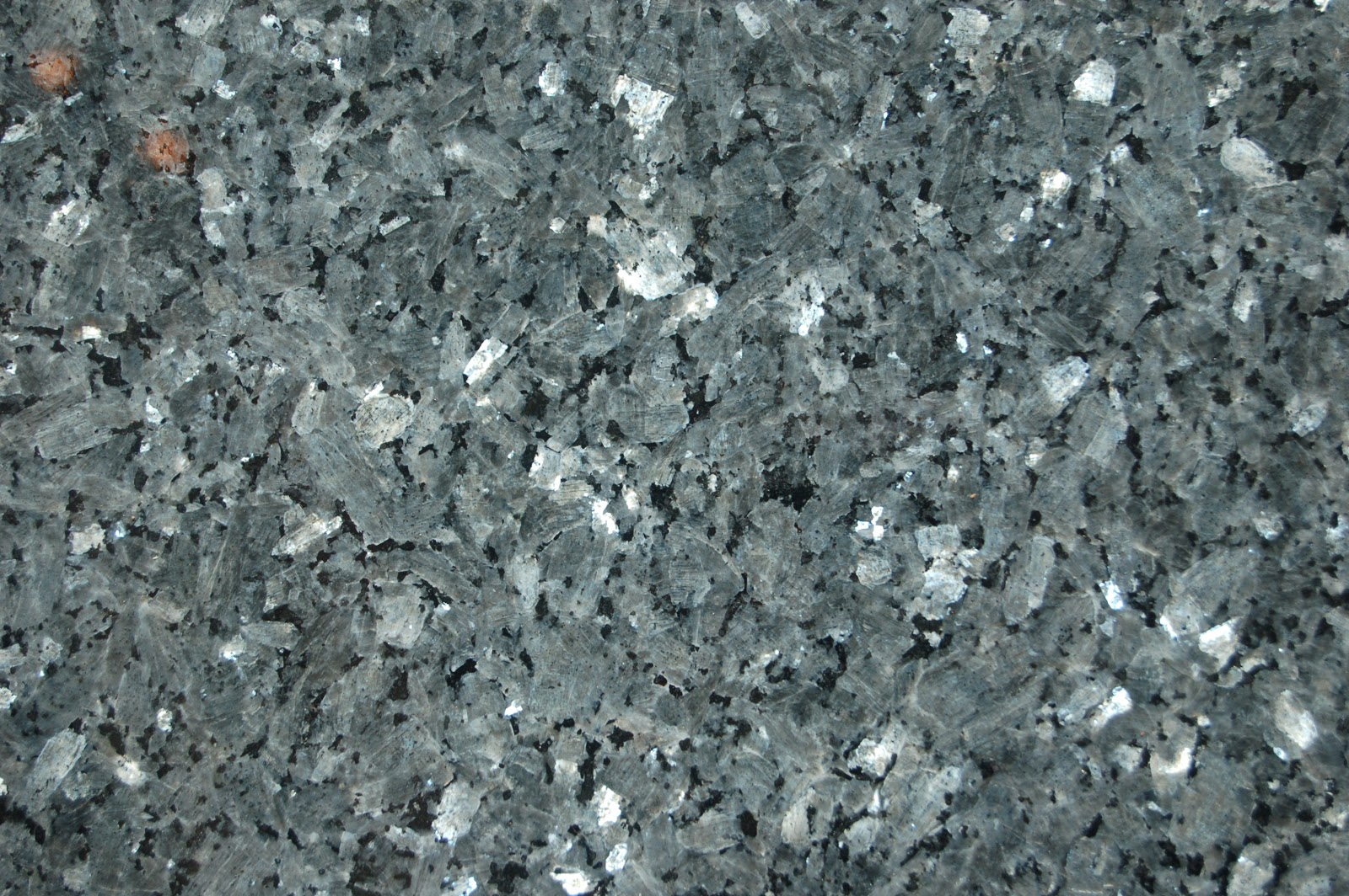
4) Walk back across toward Kearny Hall, then west on Campus Way to Owen Hall, and into the foyer of that building. Oregon requires that 1% of the cost of building or remodeling state buildings is set aside for acquisition of art, and that often ends up being stone sculpture, such as the gorgeous serpentinite sphere above (note paving bricks for scale). There are quite a number of rock types in the sculptures here, which are symbols used in electrical engineering- the disciplinary focus of the building. Rock types include granitoids, gabbro, and either a labradorite anorthosite or larvikite- I think more likely the latter, but I'm not confident enough to make the call without hesitation. Below is a close up the larvikite(?) "H," showing the gorgeous silvery-blue schiller. Walk back out to Campus Way, turn right/west, walk past the end of Merryfield Hall, then turn right/north down the pedestrian wallkway.
5) The building on your left/west is Covell Hall. Enter the east side entrance and climb up to the first floor. The women's room is to the right on the west side of the hall (i.e. turn right as you come into the hall out of the entry stairwell, go down it a little way, then turn left) The men's room is in the exact same location on the second floor. For whatever odd reason, there seems to be a period in time where stylolitic limestone was the must-have stone for bathrooms, especially in public buildings. This creates something of a problem for an older, reserved, but intrepid field trip leader like me, who, one, doesn't want to embarrass anybody, and two, doesn't feel terribly comfortable exploring the ladies rooms on  his own. So I'd known the men's room here had some decent examples (though as I recall, not quite as nice as in the men's room near the northeast end of the concourse on the main floor of the MU- but the women's room there, I'm told, does NOT have this rock type.) However, after seeing the examples on the second floor so she knew what she was looking for, Dana says the examples in the handicapped stall of the women's room are very nice, and her photos confirm: even nicer than one floor up.When you've done the stylolites at Covell Hall, head back out the way you came in, turn back north, then walk west through the parking lot, up the steps, and through the arch between Dearborn and Rogers Hall. As you come out of the arch, stop 6 will be just ahead on your left.

6) A sweet little courtyard surrounded by Shepherd, Dearborn, Rogers, and Gilbert Addition Halls. Another of the 1% for public art bits, this is a nice piece of diabase showing both polished and (fairly, at this point- this was installed after Gilbert Addition was finished in 1981) freshly broken surfaces. As a geology person, I find this both esthetically and intellectually pleasing. It has a wondrously sensuous form, but at the same time, it's interesting to see the differences in the details you can see- or not- in the two different surfaces.

(Dana's photo supplement for stops 7 and 8)
7) Walk under the arch of Gilbert Addition to the north side of Gleeson Hall, the chemical engineering building. The rock used in the railing in the porch to that building is calcareous travertine, or tufa. If you run your hand over the top surface of the railing, you can feel how rough it has become from chemical weathering as it's been exposed to the rain for decades. Compare that texture to that of the same rock type used to line the doorway into the building, where it's much more protected, and still has the original glass-smooth texture. We tend to think of geology as intensely visual, but the fact is- often without conscious awareness of it- we use all of our senses to distinguish one rock type from another. In this case, the textural difference convinces me I'm not looking at a silicious rock, even though they're very similar looking, without a destructive method like acid or scratching.
8) Walk to the west side of the building, and around to the front on the south side of Gleeson. More travertine/tufa, but additionally, a gorgeous pink porphyritic granite, with phenocrysts of orthoclase/perthite up to an inch and a half or two in largest dimensions. Directly above the quarter in the photo is a crystal type I enjoy, which I've gotten into the habit of describing as a "butterfly twin," though that's not the correct term for it (which I've forgotten). There's another, even larger and nicer, up a bit more and to the left. We found several of these on Dana's recent visit.

(Dana's photo supplement for stops 9 and 10)
9) Cross Campus Way, and head back east to Milne Hall, the math building. Walk into the north entrance. There are at least two different kinds of marble in the foyer. Walk south through the main hall to the south entrance, and there is an extremely squarshed, folded marble- the darker greenish layers help highlight what I assume is original bedding, but these folds are tight and isoclinal following extreme pressure and mashing. Walk out the south door, then turn right/west on the sidewalk, and cross SW Waldo Place.

10) The columns surrounding the doors of Strand Agricultural Hall are made of a nice cross-bedded sandstone, and the blocks are turned in various orientations. This is an excellent spot for beginners to use cross-cutting relationships and superposition to work out "which way is up," or original orientations of the blocks. It also offers a fairly rare opportunity to see a fairly large volume of rock in all 3 dimensions, cut in regular shapes (some square cross sections, some round), and thus allowing for some good inferences into interior geometries. Walk west to the sidewalk running south, then walk south to...

(Dana's photo supplement for stop 11)
11) ...the east end of the Memorial Union. I describe this limestone as a "fossil hash," a fairly fine-grained but highly biogenic rock. Looking carefully, even without a handlens, you can recognize bryzoans, mollusk shell fragments (some recognizable as brachiopods, gastropods and pelecypods), crinoid segments and abundant fusilinids. Trace fossils, mainly burrows or perhaps feeding structures are also common. I've been told this is Salem limestone, from the Bloomington, Indiana area, but I'm not familiar enough with that rock unit to be certain. However, another geoeducator, friend, and colleague of mine grew up there, so he's probably right. Also, this is the site of my favorite gag of the walk, but I'll let Dana share that. Her reaction was a sharp guffaw, then, "That is SO stupid, but SO funny."

(Dana's photo supplement for stops 12 and 13 is here)
12) Walk along the north side of the MU to the main entrance. This rock is heavily stained with things like food and gum, and needs a good steam cleaning, but this is a granite-like rock with fairly common more mafic xenoliths in it. You need to be careful though... the stains are deceptive. As I recall, the granite in the steps of the Women's Building, the next stop, is the same, and less stained. Step through the doors into the north entryway, and take a look at the steps up to the main level. They're made of travertine/tufa, which is NOT a good choice for a pavement rock with heavy foot traffic. This building was remodeled maybe 10 or 15 years ago, and by that point, the steps were getting so dished that they were becoming a safety hazard. They were ground flat, and though I haven't seen this confirmed, I have the sense they were treated or infused with some kind of plastic or epoxy to make them more durable in an environment to which they are naturally poorly suited.

13) Continue along the exterior sidewalk west on the north side of the MU, cross 26th Street, then turn north to the Women's Building (or BVILDING, as it actually says over the entrance). Near the base of the steps on the north side is a brilliant red small monument, standing maybe chest-tall. Quartz is clearly recognizable, and the red looks to me to be alkali feldspar of some type, but the brilliance of the red is beyond any other granite-like rock I've ever seen, so I personally don't feel comfortable making this call beyond saying, "well, I think it's granite, but I'd sure like someone who knows better to speak up, 'cause that color just ain't right." The real treasure is inside the foyer, Rosso Ammonitico. (Hopefully, that link will take you to the Italian Wikipedia page translated into English.) The standard warning I give people is that the light is dim and bad at best, but give yourself a few minutes to get your "eye." Anyone who's done geology for a while knows that when you first get to a mineral or fossil collecting location, you don't see it, and you don't see it, then you find one example, then another and another and another, until finally you're wondering how you missed them at first. Same thing here. The micrite/marl has been lightly recrystallized, so boundaries are not sharp. Look for spiral shapes, and once you've spotted a couple, you'll be finding really nice examples all over the place. Also, take moment to quit looking for ammonites and notice that the floor is tiled with a really nice checkerboard black and white marbles. When you're through gawking at cephalopods, head back out to the sidewalk and turn north.

(Dana's photo supplement for Wilkinson Hall is here)
14) Wilkinson Hall/Geosciences. Near the northeast corner of the building on the outside are a few petrified logs, whose provenance is unknown to me. There is also a fairly large block of blueschist, which as I've written before, I suspect is from Bandon, Oregon. Walk into the foyer at the main (south) entrance, and on the north wall at the west end is a large relief map of Oregon. This was a fairly traditional spot to start field trips when I was in school here, as a leader could easily point out travel paths, morphological features, and destinations. Turn left/west, and walk around the the west side hallway, where a small portion of the departments mineral collection is on display in a large window. (A gallery of photos of the collection can be viewed here.) This display gets at least partially turned over on an irregular basis, so even if you've seen it before, it's worth stopping in; they may have new stuff up. Also enjoy the various cartoons, posters and cetera with which people have decorated their office doors and walls. Continue around the building clockwise, and across from the department office (south end of east hallway)  is a nice display cabinet of fossils. Exit through the main entrance where you came in.

15) Walk east across 26th St., parking lot, SW Park Terrace Pl, and more parking, then south a bit to OSU's new Engineering Center, Kelly Hall. Most of the rocks in the floor of the atrium that is the main space of this hall, and at the base and foot of the stairs, look very similar to the Indiana limestone on the east end of the MU, but with a larger component of sparry calcite (clear bits). There is also some brownish, darker limestone, which looks similar other than color. It seems to me the fossils are a bit larger and clearer- less fragmented- than those at the MU, but I think we're still looking at a fairly high-energy, wave-dominated, environment. There are some zig-zaggy looking features near the stairs that look like stylolites, too. And finally, there are lines of what I described in comments as "porphyroblastic amphibolite," and despite only glancing at them five or six years ago, that's still what they appear to be on a more careful look today.

That constitutes the core of what I generally try to hit up when I tour the OSU Campus. There are some additional spots that I may double check to make sure they're still there, such as the Dawn Redwood (Metasequioa) fossils near a living specimen at Peavy Hall (forestry), and a topographic quad mosaic at 1:62500 of most of western Oregon on the second floor of Gilkey Hall- I really should have checked to see if that's still there when I did the walk with Dana a week ago. And others. But the above 15 sites are a good core. If you spend time on or around the OSU Campus, and you think I've missed something nice, or you have questions about some stone there, please drop a comment!

Saturday, October 13, 2012

Geogalavanting Around Oregon with Dana

Dana came into town on Monday, so I got little reading done on the 8th, 9th and 10th. Then Thursday, Interzone WiFi was down, and OSU visitor was exceptionally weak and difficult to access... I was awfully frustrated. So yesterday morning, I was effectively four days behind in my reading. With this rebuilt machine, though, skimming, skipping and reading is much quicker. I also decided to simply delete all news items older than two days, which means maybe 1500 items skipped- I'm sure I missed some MSM science news I'd like to have read, and I've been pleased at how often (and generally, well) OregonLive covers geology-related news in Oregon and the PNW broadly, so I probably missed 2 or 3 of those as well. Well worth it though, to save myself six or seven hours of browsing time. So I spent eleven hours yesterday, and better than four today, plowing my way back to the beginning of the week. And now I'm caught up. Whew!

In other news, I can say with some degree of excitement and pleasure that our rain has returned with a vengeance. The prediction yesterday was for about 0.1 to 0.25 inches; we got 0.37, and it looks like some serious accumulation tomorrow night through Tuesday morning. Various sites are predicting 2-4 inches in this area. To which I say "Bring it on, baby!" A report that I read this morning, from Cliff Mass Weather Blog, commented, "In the Olympics, north Cascades, and southwest BC terrain (particularly Vancouver Is) amounts reach 5-10 inches, with a few higher values on the windward slopes. Wow." So 2-4 inches sounds about right to me.

On with the show. My goal today is to summarize the geotripping Dana and I did on Monday, Tuesday and Wednesday, along with a few photos. Our original intent was to either hit NW California and the Josephine Ophiolite along route 199, or central/eastern Oregon doing day trips out of Bend- in particular, Dana wants to hit up John Day National Monument, and I've never been to the Painted Hills unit near Mitchel, so I'd like to do that. For various reasons, though, we decided to simply do day trips out of Corvallis. Due to a number of other factors, we did an awful lot of last-minute plan changes, too. But it all worked out well- I don't think there's anything we missed on this trip due to time shortages. Dana and I are both getting better at budgeting our time. And on the plus side, there were a number of things neither of us had anticipated seeing, but did. So overall: good trip!

Monday, we decided to just hang out around town, take in some local parks, and do the architectural walk around the OSU campus that I've done with Ryan and Emily. First stop, Chip Ross Park, north of town. The geology is kind of subtle here, but the views are good, and the interesting component is broadly interpreting the geomorphology visible from the park.
 I love the oaks that line the hill crest, so I took way too many pictures of them...
Old Man's Beard (an epiphytic lichen) and fall foliage on Oregon white oak.
Looking ~west at Marys Peak... didn't think to get photo for annotation [followup, turns out I do have a couple good ones], but Corvallis fault runs just off the left edge of the photo, and has raised basaltic Siletz River Volcanics roughly 2000 feet (guesstimate, based on Marys Peak exposures) against younger, more easily eroded later Neogene turbidites, creating a very visible fault-line scarp.
Looking south, down into my little burg. Growing up in SE Ohio, this quantity of haze should seem trivial, but after 32 years in Oregon, it's painful for me to see the air this awful. Witham Hill in mid-distance along right side, Country Club Hill farther back and out a bit farther from the edge. Both of those hills are composed of Spencer Formation, which is shallow marine sediment (lots of fossils) on top of older Tyee turbidites, and Witham has an Oligocene mafic dike. Avery Park, our next stop, is along the Marys River near its confluence with the Willamette, just to the east (left) of Country Club Hill.
Saprolite (which I learned as 'saprolith,' but I gather is the preferred English geo-usage now) at the base of the hill, as we headed back to the car. The word comes from roots meaning dead or rotten rock.
Gorgeous fall foliage at Avery Park. I was thinking maybe a box elder, but followup says not. So no real clue what kind of tree this is- it has compound leaves that remind me of walnut or pecan, but not quite right for those.
While barely visible at the scale above, the picnic table in the above photo is nearly 86 feet long and cut from a single slab of wood (the benches are not, which make getting sat down less problematic).
Displayed in the Rose Garden, this is one of the first millstones in Oregon... from the plaque on the other side, "This was originally quarried in France, and shipped around the horn from New York in 1850 by sailing vessel." The rock was too stained, warn, and coated with gunk for me to be confident, but I think it might be quartzite. Do you need for me to go off on the importance of geology in day-to-day life again? Okay, I'll wait.

We also did my tour of the OSU campus with a focus on the rocks used in construction, but I took no photos, and ones I've taken previously are not on this computer right now, so I'll just leave that dangle. To make up for it, I'll just let you know that between the two of us, we found complimentary men's and women's rooms that have good examples of fossiliferous stylolitic limestone. The one I've stopped at before is in the Memorial Union, and only the men's room has that rock. It's okay during the summer, when there's no one around, but not good during the regular school year. We also ran into Peter Clarke, Aaron's advisor. I introduced myself to him with, "Hi! My name's Lockwood DeWitt, and there's no reason on earth you should remember me."

Day 2: Up to McKenzie Junction, down the Upper McKenzie River, with stops at Clear Lake, Sahalie Falls, and Koosah Falls, then up over McKenzie Pass to Sisters, dinner, then back to Corvallis, with just enough light to get twilight silhouette of Mt. Washington.
Only a small trickle of water on the Middle Santiam River at Cascadia State Park. Hydrology/hydrogeology emerged as the unexpected theme of this trip- that is, I was certainly aware water would be an aspect of what we would see, but I wasn't expecting the way it came to dominate my attention and thinking. Not in a bad way, of course, but in an interesting way.
A very interesting and puzzling cut-and-fill structure up near Tombstone Pass, which I had never stopped at before. Turns out, there's a spacious pullout area that was much appreciated. (Pretty sure this is the location, in FlashEarth) I'd always assumed the underlying material, with the sort of badlands topography, was an ash tuff. It's not. It shows only modest (if any) rounding, but it's more coarsely lithic and mixed in terms of fragment types than you can see in a drive by. I'm thinking maybe explosive debris, but I'll need to flesh out my reasoning another time.
Three-Fingered Jack looming over McKenzie Juction, fall foliage, a fairly fresh lava flow, and Dana's car. This was beautiful spot to stop, as the viney maple was fiery red, and symbolically very pleasing on flows that cooled quite recently.
A tree trunk, submerged and drowned when Clear Lake was created by a blocking lava flow 3000 years ago. I was terribly shaken by this lake; my balance is weak at best, and I need visual cues to stay upright. The clarity of the lake, combined with weird perspectives and shadows, had vertigo playing havoc with my sense of stability. But it was surreally gorgeous in terms of color. And you think it's wild to see these logs from the dock? You can see them from orbit! This shows a down log underwater, extending under the "Clear Lake" label.
Sahalie Falls. Compare the flow rate here to that of the Santiam at Cascadia: much, much greater. Turns out, there's a very interesting set of reasons for that, which I'll get back to someday.
And finally, for Day 2, a view to the south toward North and Middle Sisters. This is at a viewpoint a few miles west of the Dee Wright Observatory and the interpretive walk, which are right at the pass.

It's getting late, so I'll cover day 3 tomorrow, after I get the Funnies up. Stay tuned... there's more awesome yet to come!

Followup: forgot to drop this in... I was just a little bit into this when Dana posted her summary of her vacation, of which this was about half. And Part 2 of my summary is here.

Sunday, September 23, 2012

Willamette Valley Geology Online Resources

Last Saturday I presented for a workshop on Willamette Valley Geology for the Oregon Master Naturalist Program (henceforth OMN), an outreach program by Oregon State University. I'm now switched over to my new (to me) rebuilt computer, and while I'm not very accustomed to it yet, browsing and reading is definitely going faster than on my old machine, and it looks like I'll have more time to blog.

One of the components I was requested to submit was a list of online resources, and there's no doubt in my mind that first among those are posts by our wealth of PNW geobloggers, so that makes up the bulk of this list. Note this is not organized by topic, but primarily by blog and the order in which I found them.

In other notes, I'm initiating a label for OMN, to indicate topics that may be of interest to that group- I'll be primarily focused on earth sciences, but will likely include broader science topics dealing with Oregon's fabulous natural history.

Uncovered Earth (Michael Klaas, Portland, Oregon) http://uncoveredearth.com/

En Tquila Es Verdad (Dana Hunter, Seattle area) http://freethoughtblogs.com/entequilaesverdad/

Got The Time (Aaron Barth, recently moved to Eugene, Oregon, just moved from VA) http://iapetancaptain.wordpress.com/

Outside The Inerzone (Lockwood DeWitt, Corvallis, Oregon) http://outsidetheinterzone.blogspot.com/

Fluvial (stream) Geomorphology (landforms)

New things- posted or found since the above were submitted in August:

Monday, August 29, 2011

Volcanic Ramblings Part 2: A Dedication

I'd like to start off the more methodical portion of this "Volcanic Ramblings" series with a heart-felt dedication to Harold "Sharkey" Enlows, who first showed me many of the stops we made on this trip on the 1984 Petrology series spring excursion. Enlows could be curt and abrasive, but in his way, he was a very caring Teacher. He wasn't affectionate, but he simply wouldn't accept less than what he believed a student was capable of. His nickname arose not from fear, but from the respect and fondness his students felt toward him.

One example: I was not the most responsible student in the history of studenting (I've always said, "I'm an excellent learner, but I'm a terrible student."), and frequently missed early morning classes. The petrology/petrography series lectures fell into that category. So when the test for metapet rolled around, and I was confronted, on the first page, with the question, "Describe the mono-mineralogical problem with respect to metamorphic rocks," I mentally shrugged and skipped it. Sharkey typically sat in his office and did other paperwork while classes took tests, and when we finished, we took our tests to him and dropped them off. He glanced up when I dropped mine off. I turned to go, but he brought me to a sharp stop with "Hold it, DeWitt!" I knew that tone. I turned, and he had his finger on the hole where an answer should have been. I muttered, "I think I must have missed that day," to which he responded, "You did. But you can figure this out. Take this (he shoved the paper back at me) and go sit down until you do."

I had it sussed even before I got back to my seat. If you have only one mineral phase in a nice clean metamorphic rock- like a quartzite or marble- it's nearly impossible to say anything quantitative about the T & P history it's been through. Metapet depends on finding how differing elemental components have been partitioned into differing mineral phases; only one phase, no partitioning. So within a couple minutes I was back in his office, waiting, embarrassed, while he made a great show of reading my answer, then flipping through the rest of the pages to make sure there were no other blanks. He rolled his eyes at me and said, "Good. You're sharp. Don't let lazy get in the way."

Word.

When I graduated, some years later, I made a point to visit most of my profs to explicitly thank them for the effort they'd put into my education. I do believe most of them were close to teary-eyed (I know I was); too few students make that small effort of their own. But I didn't make that happy trip to Sharkey's office. Why? Because unbeknownst to us undergrads, he had been diagnosed with and in treatment for cancer for the entire year we'd had him as a teacher. In summer of 1984, just a month or so after we finished his class, and less than two after he took us on what remains to this day one of the best field trips of my life, the disease took him. One of my biggest regrets is that I never had a chance to express my respect, thanks, and admiration to his face. He wasn't my "favorite" prof, but he's the one who made me work the hardest, and from whom I learned the most.

And that's no small compliment.

So for each of the stops we made on our Volcanic Ramblings that I saw first under Sharkey's tutelage, I'll just skip over the long-winded intro, but preface the post with a dignified "In Memoriam: Harold "Sharkey" Enlows." It feels like the least I owe him.

I was going to write up our first official stop, Salt Creek Falls, but it occurs to me I've forgotten to eat today, and I need to blow my nose and dry my eyes. Dana will have Salt Creek Falls covered for you in the near future. Here's a spur-of-the-moment photo I took when we stopped for gas out near I-5, on our way out of town, looking back over Corvallis to the iconic profile of Marys Peak.
Marys Peak, Oregon: a fore-arc uplift of seafloor basalt overprinted with oceanic plateau basalt, topped with a frosting of deep-water turbidites, then intruded and capped with a gabbroic sill.

Wednesday, May 18, 2011

31 Years Later

Last year, for the 30th anniversary of the Mount St Helens eruption(s), I posted a series on the events of spring 1980. Partly reminiscence, partly drawn from accounts at the time, and largely based in the narrative line of "what was happening 30 years ago today," it was fun to compile.

I had moved from the Cleveland area (Mentor, to be specific; I'll have to show you the "house" I lived in sometime.) to Corvallis to start spring term at OSU, and the first rumblings came the first week I was here. It did sometimes feel as if the mountain was putting on the show to welcome me to the PNW.

For this year's anniversary, I don't have much new to add, so I've decided to simply index my posts from last year. Note that from mid-April to May 17, I emphasize that not much was happening- and that is exactly the point. The public, the media, and from what I've read, even most volcanologists were uncertain what, if anything, the mountain would do next. Was the show over? No one knew.
If I had to pick the two that do the most to explain the situation, I would recommend May 18, part III, and May 19. May 19 was, of course, when most of the print news became available, and the confusion surrounding St. Helens is a core memory for me. No one knew until months, even years, later, what exactly had happened. It's easy to look back now with hindsight and feel as if this was all understood. Let me be blunt: it was not.

Wednesday, January 26, 2011

I Slept Through the Big One

311 years ago today, a so-called "great earthquake" struck the coastal region of the United States Pacific Northwest. Here's my post from last year explaining some of the details of why we think we know this; I'm not going to rewrite it here. However, this year's anniversary is somewhat special for another reason: Oregon conducted its first "shakeout" to encourage preparedness for the inevitable next great quake at 10:15 this morning.

I slept through it.

Unfortunately, metaphorically speaking, so did public awareness. @GlacialTill pointed out earlier that many members of his geology department weren't even aware of it. I was aware of it, and its coincidence with the anniversary, but it was sort of a peripheral awareness, something to which I wasn't paying attention. As I mentioned to him, this is our first such event, so expectations shouldn't be too high. On the other hand, I see my own complacent attitude toward the exercise as cautionary and a little shaming: if a person who is pretty well informed and concerned about this issue is essentially ignoring the shakeout, how can he expect that the general public will catch on? As it turns out, slightly more than 1% of Oregonians are reporting their participation.

So in the spirit of trying to do better next time, here are some links, resources and commentary. The official homepage is here, and the graphic at the bottom claims "Over 37,000 participants." Of particular interest to me are the instructions for how to react at the onset and for the duration of a quake (and the page upon which these instructions are apparently based, with more detail and explanation).

Unfortunately, I think the biggest failure during this first attempt was the lack of media coverage. As I commented to GlacialTill, I remember quite a few cursory articles last fall when the drill was announced. I thought about writing up a post then, but decided to wait until it was closer with the assumption I would be reminded by news releases. I know I've seen at least one article on the event during the last week, but I can't find it now. An article from KVAL (which I do skim over) shows up in Google- though not my RSS- but the link goes to a generic search page with no results. There have been a few articles and press releases, but not in places where I might have seen them without an intentional search. For example, despite my general contempt for press releases, this one at Newswire is very well done, in my opinion. (Oregon State University source is apparently here, with some links I haven't followed yet.) This one, from Portland's Fox affiliate, is shallow and cursory, but at least it's something. A brief at Medford's News Tribune notes the event... in this morning's edition. This seems like a day late to me, at least, but again, it's something.

I don't want to point fingers here- I think it would be wrong-headed and counterproductive. Further, as I implied above, I do not hold myself unaccountable. Between one route and another, I estimate I get somewhat fewer than a thousand readers a day. This is certainly a situation where a trivial amount of effort on my own part could have- likely would have- made a significant and substantive difference. The Medford article claims that 24,000 participants were anticpated, so the actual number tallied thus far- which may increase- is better than 50% higher than expected.

Still.

I don't think Oregonians, Washingtonians and British Columbians have fully grasped the disruption we're talking about here. Roads, water, power, airports, hospitals, food distribution and all sorts of other physical and social infrastructure that we take for granted are likely to be knocked out for weeks, or, at the very best, functioning at very low levels of efficiency. Are you ready for that? Have you really thought about what that means?

It could strike in the next few minutes. It might not strike within the lifetimes of children born today. We don't know. To say it becomes more likely as time goes on, I think, would be misleading: seismologists and structural geologists are constantly reassessing their understandings of how stress and strain are relieved and distributed at any given moment and through time. For example, the recently discovered "slow quakes" of the PNW (that article is also a pretty good back-grounder) are still mostly mysterious. Do they concentrate strain and make a great quake more likely, or relieve strain and make one less likely? We don't know.

Given the unknowns, the potential consequences, and relatively low hassle and cost of being prepared, it seems obvious to me that being prepared is clearly preferable. As I said in last year's post, there is some good news here. I don't feel bleak about the situation. But I do feel we could be doing better.

As I looked back over the above to proofread for obvious errors, one sentence jumped out at me: "This is certainly a situation where a trivial amount of effort on my own part could have- likely would have- made a significant and substantive difference." I earnestly hope and pray you don't recall that sentence as you huddle in the rubble with your family, wondering when help will arrive.

Followup: Glacial Till, a geology student in Portland, and About.com Geology (Andrew Alden) have posted on The Shakeout as well. Both mention, as I forgot to, that British Columbia also conducted a shakeout. Glacial Till notes that the reported participation in BC is 460,000. Wikipedia says the population of that province is about 4.5 million, so that's a 10% participation rate, even though this is their first such event as well. C'mon, Oregon. We can do better. And Washington? You might want to come along next year.

Followup 2: I was half expecting this would get some after-the-fact coverage, despite there being effectively no coverage ahead of time. The Portland Tribune chimes in with the first such article I've seen, and I'll post any similar reports here as I come across them.

Wednesday, December 8, 2010

Finals Week

So we reach the end of yet another term here at Oregon State. For those of you students who are stressing over finals, two notes: first if you keep up through the term, finals just aren't that big of a deal. Believe me, I know how tempting it is to procrastinate to the end, but the price you pay is serious stress now. Second, this is by far and away the worst week for instructors and profs as well. I have spent my fair share of time both taking finals and doing projects, and grading them. I would much rather have to take a test or do a project than grade dozens of them. Just sayin'.

As I'm out of academia now, neither concern is one that troubles me much anymore. Many, if not most, of the students have finished their terms, and the streets are noticeably quieter than they were yesterday. By Friday afternoon and the weekend, Corvallis will be dead quiet. I have a love-hate relationship with the university and with breaks: I miss my friends when they're not here, but I enjoy the peace when OSU is out of session. By the end of a term- or the end of a break- I'm ready for change. I grew up in a university community, Ohio University in Athens, and have spent most of my life living with the rhythm and seasons of academia. I can't imagine living without that pulse now.

Wishing you and yours the happiest of Holidays, Peace and Re-Creation as needed, and luck with end of term duties, whatever they may be.

Saturday, December 4, 2010

woot

So the big "Civil War Game" between OSU and U of O kicks off at noon. Woo-hoo. I wish I could express how passionately I don't give a shit. On the other hand, it's the last home game of the season, and that, my friends, is definitely an event I can get behind.

Friday, October 8, 2010

Deadline For Oregon Voting Registration Approaches

If you're an Oregon resident, and you've moved since the last time you voted (or have never voted before), the deadline for registration is Tuesday.  I saw an article at The Barometer (OSU's student newspaper) a couple of days ago discussing an ASOSU task force trying to get as many students- many of whom have moved over the past year or two- as possible registered over the next few days.  There have been a couple of people with the appropriate forms hanging out at 16th and Monroe today, answering questions and trying to get bypassers registered, and I'm sure there are more teams scattered around other near-campus locations as well.

One of the things I was told by the worker is that you can vote a "fail-safe" ballot as well (assuming you are properly registered).  This is like a back-up ballot; if you haven't received your ballot in the mail when you expect (for example, it's mis-delivered), you can fill this out, and the voting office will hold that form.  If your original ballot isn't returned, or has been improperly completed, the fail-safe ballot gets counted in its stead.

If you prefer, you can register on-line here.  This is going to sound strange at first, but this deadline is, in many ways, both easier to ignore or forget, and more important, than election day itself, at least for Oregon residents.  It's easier to miss because it doesn't get the attention and press that election day does, and I say more important since without getting yourself registered, everything else is irrelevant.

Oregon's vote-by-mail system means that once you're registered, the ballot is mailed to you.  As I remember, it goes out about two weeks before election day.  Once you receive it, you can return it any time before the close of election day (I'm thinking 8:00 PM, but I'll follow up when the day approaches).  You can either mail it back (postage required), or put it in an official drop box- the two I use most often are in OSU's Valley Library and Corvallis Public Library.  In other words, the system is wonderfully flexible in letting you think and vote at a time that is convenient for you.  Other than familiarizing yourself with the issues and candidates, registration is arguably the most important and demanding part of the process- and it's pretty easy.

So whatever your political views, take the time to get yourself registered before the close of day next Tuesday.  The rest of the process pretty much takes care of itself.

Sunday, October 3, 2010

OSU Flash Mob Goes All Bollywood

This is cute, from the front of the MU last Friday, via KGW News.
In all, more than 70 Oregon State University students and staff -- co-conspirators in the surprise event, which had been months in the making -- shed jackets and sweatshirts to reveal bright orange T-shirts and join in the synchronized dance moves.

Since I can't not talk about rocks, there are some nice mafic xenoliths in the granite making up those steps and the piers on either side of them.  There are actually quite a number of cool rocks in and around the MU.

Saturday, October 2, 2010

Sometimes, One NEEDS To Be A Grammar Nazi

A certain female Facebook friend was rooting for OSU's unfortunately named team.

Tuesday, September 28, 2010

I Love Deadlines

"I like the whooshing sound they make as they fly by." It's especially gratifying when it's a deadline I set myself... in this case, the deadline for submissions for AW 27, important geological experiences. Like some other editions of the Wedge, I expected the difficult part would be to pick just one experience- after all, no single experience is enough: there's so much to know and do that "years" is a narrow timeline for feeling anything like competent with respect to geology.  "Decades" is a better approximation, and even then, there are important aspects of the science with which each of us will never feel all that comfortable. How to choose one experience out of the hundreds of hours of class and lab time? Thousands of hours reading? Months of accumulated time pondering over (and silently cussing at) outcrops?

So it was with a feeling of surprise that I knew almost immediately which particular day was the one that stood out in my memory.  A bit of background is in order: I referred to myself as the eternal undergraduate. I started at OSU in spring of 1980, and graduated in June of 1988.  There were simply no classes left in geology that I was allowed to take, and I had sat in on a number of graduate classes.  There were plenty of classes in other departments and disciplines that I'd like to have taken, but it was time to move on.  The main thing that enabled this, though, was that 20-30 years ago, it was possible to work one's way through school, pay as you went, and come out debt free.  That is not the case any more.

I worked in Clinical Pathology in Veterinary Medicine from the beginning of 1981 until summer of 1983, then I landed a job as a lab and field worker with a forest soils research project, where I ended up working until late 1990- even after I graduated, they found ways to keep me on for a while. One of the projects we worked on for years involved looking at the soils and soil water chemistry at Cascade Head. Below is a map of the area, though it doesn't show old 101, which lies a bit east of the new highway. (Screen capture from page 5 of Research Publications of the Cascade Head Experimental Forest and Scenic Area, 1.4 Mb PDF)
(As an aside, if you're ever going through- or even near- Otis, The Otis Cafe is secretly famous for the quality, quantity and price of its food... it's one of those "Don't tell anyone, but you should know..." sorts of places.) Cascade Head is an Eocene volcanic center, and the basalt- partially submarine, partially subaerial- is interfingered with nearshore marine sediment.  And everything is weathered. With the exception of the shore itself, it is no exaggeration to say that the soil and saprolith are 10-15 meters thick.

Except.  Except...

In our soil pits, from which we collected samples and water that had leached through the top meter of the soil, we kept finding these clusters of basalt cobbles, about fist-sized. They too were deeply weathered, but under a centimeter or two of clay, quite fresh.  Judging by the weathered surface, they were pretty angular; if they had been transported, it wasn't far.  Without thinking much about it, I simply assumed they had moved in by soil creep. It turned out later that creep wasn't a tenable mechanism, because there wasn't enough uphill uphill from our site, and no basalt outcrop either.

However, the primary investigator had his own thoughts... he was first and foremost a soil chemist, and these cobble clusters were affecting ground water flow in ways he didn't understand.  They also made getting the lysimeters (the devices that captured soil water) into place a real pain, and they were also very sporadic- some pits had none, others had to be abandoned.  In short, they were throwing an extra variable into some research that was already more complex than anyone liked, and apparently, he really didn't appreciate this.

So it was with a mixture of excitement and trepidation that I greeted PI's announcement that we were going to figure out once and for all what was going on with the cobble clusters.  I didn't have my degree yet, but there was certainly no one else who knew any geology, and I knew immediately that this was show time.  It wasn't a situation where my job was on the line- I was a good worker both in the field and lab, and I knew they knew it.  But my geologic credibility was on the line, and that was very scary to me.

I had read a master's thesis by Melanie Barnes, (M.S. 1981 The geology of Cascade Head, an Eocene volcanic center in the central Oregon coast range), but I went back through it paying special attention to discussion of the sedimentary facies, which didn't help much. So when the big day came, I still had no real idea what might be going on- though I had dropped the idea of creep. Not only was that physically unlikely for the reasons mentioned earlier, but it didn't sit well with the fact the cobbles came in discrete clusters, not randomly scattered.

So basically, we spent the late morning and much of the afternoon simply driving around, looking for outcrops. Since the bedrock is so deeply weathered, that was more difficult than might be imagined.  As Dana learned last week, in the western part of the Pacific Northwest, often the best geology clues and cues can come from subtle color changes in soils and rock weathered in place... but those colors can also be very confusing and misleading.  In effect, we spent most of the day carefully examining silty mud.  I was at wit's end.

Finally, we came around a corner and there it was:
And even though this is terribly simplified and schematic, and the color differences much more stark than the actual outcrop (also, much less obscured by botany), it really was that clear to me: we were seeing lag cobbles in cut-and-fill structures. In the cartoon above, the dark circles represent the basalt cobbles. Smaller clasts, pebbles, had simply gone completely to clay, and were only noticeable as different colored spots- in others words, not really noticeable at all in the context of our soil pits. In the Eocene estuaries, tidal flats and near shore, drainages from the land, particularly during times of high flow, would incise channels and move the cobbles along as part of their bed load. Later those channels would be filled in as flow decreased or as meandering cut off one location after another.  And the clusters of cobbles would be left to confound future scientists.

I've looked around a bit and haven't found any really great photos of cut-and-fill structures, though this one at Andrew Alden's gallery is good, and you can see how the coarser clasts get concentrated at the bottom.  Then earlier today, as luck would have it, Suvrat posted a couple of really nice photos- see pictures 3 and 4.

Now why was this so important to me?  It required me to figure out something on my own when it counted- this wasn't a class exercise with a right answer, and someone who knew it to check my work afterward.  It wasn't just me on my lonesome pondering imponderables. It was work for some people who knew no geology at all, who had no clue what was going on, and to whom the answer really mattered.  And I was able to come through and provide an answer, an explanation, that worked with what we knew, and helped explain some of the things we'd seen.  Sometimes the cobble clusters seemed to channel groundwater flow.  Sometimes they seemed to go back in the soil profile, sometimes they seemed to go across, from the perspective of working in the pits.  They seemed to start or end very rapidly on their edges, but at the same time, they had a vaguely linear presentation.  The cut and fill model worked with what we knew about the area, and what I knew about geology; it fit, and it explained.  It was immensely satisfying.

And though I'll never live to know enough geology to satisfy me, it was the first time that I really understood I knew enough to solve at least some problems that needed solving.

Monday, September 27, 2010

Falling Into Line

FUNNY GRAPHS - Every Man For Himself!
See more Funny Graphs. In terms of my perceptions, fall starts when OSU goes back into session: it's not a matter of weather (which is expected to be sunny and warm this week), or day length, but the daily rhythm of students trudging to and from campus. Classes start today, but the students have been gearing up since a week ago Saturday.  They came in for the game, and just never went back to where they came from.  Much as I love bitching about their noise though, I love their presence more.  Some are indifferent to their studies, but most, in my experience, are fascinated and excited by their classes and their major.

Anyway, they'll quiet down in two or three weeks when they start attending their classes.