Showing posts with label Science across disciplines. Show all posts

Friday, October 19, 2018

Upper McKenzie River/McKenzie Pass Guide

I promised a friend I would write up a self-guided tour of the area described in the title before this weekend, and if I'm going to get it done, it needs to be now. I don't have mileages, but I can post links that have lat/lon details embedded, and satellite imagery. Oh, and photos, of course. Oh, and links to old posts (maybe).

Before starting: Advice
  • Gas up before you leave Sweet Home (probably cheapest here or out at I-5). There's no gas for most of the trip until near the end.
  • Take food. There's a mom and pop burger joint at Clear Lake Resort, but it may be seasonal; I'm not certain it's open at this point.
  • Take layers and a windbreaker. It'll be a lot chillier at Pass levels, and it's often quite windy, so even if you don't need it, be ready to warm up.
  • I just checked: McKenzie Pass appears to still be open, which I expected, but for future reference, it's often closed at this point. It generally doesn't reopen until sometime in July.
Let's start with the Rte 34 crossing over I-5 as a beginning. Continue east through Lebanon, where 34 is rejoined by Rte 20, then on through Sweet Home. Stay on 20 until you come to McKenzie Junction. From I-5, I'm guessing this is a bit more than an hour, maybe 1:15 or thereabout. At the Junction with 126, there's a good pullout just after the turn. (Crosshairs on pullout here.) Walk back up the grade, west, along 20- there's a wide berm, and a great view of Three Fingered Jack.
Also, at this time of year, the vine maples are flaming red. Very evocative on the recent lava flow.
Speaking of lava flows, this is the first of many recent ones you'll see today. On the drive up from Sweet Home, you've been traveling through Western Cascades Volcanic rocks, which range in age from about 35 million to 5 million years old. Coming down this hill, you crossed from Western Cascades to High Cascades volcanics, which started about 5 million years ago, and continue to present. If I recall correctly, this flow is one of several from the Sand Mountain chain of cinder cones, at about 3000 years ago. More info here.

Head south on 126 to the Fish Lake parking area. Most of the year, this location is a meadow, but during late winter and spring melt and runoff, it fills with water and a native trout that resides in the creek most of the time occupies the lake. As it dries during the summer, they return to the creek. An interpretive sign describes their situation: apparently, they're reproductively isolated, and seem to be in the process of speciation- though that's my inference, and not explicitly stated on the sign.
Continue south, watching for signs to the Clear Lake Resort- it's a turn to the left, and always comes sooner than I expect.
A different lava flow than we saw at the junction blocked the McKenzie River about 3000 years ago. Most of the time, except for occasionally during peak melt-off, the lake is entirely spring fed, with no surface streams running into it. Nevertheless, the McKenzie River drains out of it, full-blown. There's a river's worth of springs under this lake! Also, you can see the trunks of trees drowned when they were inundated 3000 years ago!
Also, weird illusions... is this boat *in* the lake, or floating a few feet above it?
There are something like 18 lakes with the same name in Oregon, but to my mind, there's only one "Clear Lake." Note the drive in and out of the resort is south to north, so you passed the exit getting here, and you'll pass the entrance again once you leave. You have my permission to drive back through again. I mean, who could blame you? Continue south, and turn off (right) in a couple miles to Sahalie Falls.
According to the person who did her doctoral dissertation on the hydrology of this area, little or no water is added to the flow between here and Clear Lake, so this is a dramatic demonstration of just how much spring water flows into the lake.

Continue a few miles south to the Koosah Falls turn off, then drive in a ways to park. This is a frustratingly difficult waterfall to get a good view of, but there is a view area along the southern loop of the footpath.
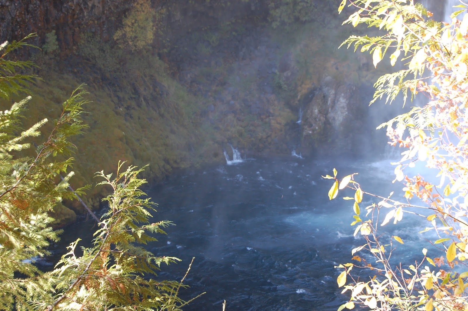
You can also see the brink from a viewpoint there, but you can't really see the falls themselves. The really interesting thing is all the springs coming out of the walls in the lower gorge.
Continue south on 126 to the junction with McKenzie Highway, 242, and turn east (left). This looks like it's about 14 or 15 miles from Koosah Falls. Head east on 242 to Proxy falls, and park in the pullout on the left. There's a nice ~1 mile loop trail to Lower and upper Proxy Falls. The lower falls are quite spectacular.
The upper falls aren't as grand, but they *do* offer a nice analogy for all the weird water goings-on in this area: They originate as springs above the cliff, fall over it, and the plunge pool sinks right back into the ground. I don't think this "stream" even has a name; it's only a few hundred feet long. Incidentally, this lava flow is from Collier Cone, up near the North Sister, and at only 1600 years old, is the youngest lava flow you'll see today.
Continue the loop back to your vehicle, then continue driving east. You're heading up a glacial valley that was incised into the High Cascades during the last ice age, and the road switches back and forth to climb up the headwall of that valley's cirque. It gets... hairy. Take it slow and easy- the road's in good shape, it's just kinda scary. You can see why they don't maintain it for winter travel, though.

When you come out on top of the plateau, the road straightens out, the trees are much more sparse, and the views open up. This is from the edge of the first lava flow you encounter on the roadside after you're up on the plateau.
It may not look like anything special, but this young volcanic landscape is why there are so many springs: hundreds of inches of snow fall up here every winter. When that snow melts, all the water just runs into the ground, then re-emerges as springs along the Upper McKenzie River. The almost entirely spring-fed nature of that section is also why the water quality is so stunningly high. Continue east toward McKenzie Pass. There are several pull-outs on the right, with nice views of the Sisters.

Then comes McKenzie Pass and the Dee Wright Observatory. This spot is an Oregon Gem, but I'm always surprised how few know of it.
The lower story is enclosed, and each of the windows faces toward a particular volcano. The labels under the windows aren't easy to read in some cases. But the upper story is open, and has a compass rose point out many visible peaks. If you have time and interest the trail out onto the flow has quite a few informative signs.

This is more or less the end, but you have a couple of choices here. First, continue east to Sisters, then Head back to Corvallis over 20 and Santiam Pass- more scenic, but longer. Second, you can turn around and head back on 242 to 126, then follow 126 to Eugene/Springfield, then take I-5 back north to 34. Shorter and quicker, but less scenic. Hope this was fun! Below, geologists in their preferred habitat.

Sunday, July 20, 2014

Geo 730: July 20, Day 566: 9 to 5, and Nighttime, Too

Interzone's sundial is marked from nine AM to five PM, and oddly, "Night" is marked, too. How does that work? When the sun goes down, the street light comes on, and casts a shadow along the marked path. We're on a spnning ball of rock, which means the sun appears to move through the sky, but the lamp spins with it, so it appears fixed.

Photo unmodified. July 18, 2014. FlashEarth location.

Saturday, July 19, 2014

Geo 730: July 19, Day 565: Lavender Garnished with River Gravel and a Bonus Butterfly

Prior to chalking in the sundial in yesterday's photo, Tim and his son removed the cheatgrass that normally dominates the base of the pole, brought in some good soil, and planted a number of lavender starts. Then they tiled the bare areas with some river gravel. It's a refreshing change from the nasty invasive. A passing butterfly appears to agree.

While the angle of the shadow with respect to 16th and Monroe is not evident in this photo, I'll first admit, I threw out a bit of a deceptive comment yesterday when I described 16th as running "roughly north-south." The original street grid in Corvallis was laid out parallel to the riverfront, and runs about 20 degrees east of north. At Kings Avenue, a block west of my current location, the street grid snaps to N/S-E/W, or truly compass oriented (See the FlashEarth location). Second, due to modern horological conventions, we're currently on daylight savings time, which means the clock gets to noon about an hour earlier than the sun reaches "true noon," at its greatest height in the sky and directly to the south. Put those two factors together, and you can see why the two o'clock mark is the one that's almost parallel to 16th street, not the 12 o'clock mark.

Understanding these sorts of seemingly unrelated tidbits to make sense of the world around us is all part and parcel of "thinking like a geologist." I commented, "we're looking at an intersection of geology, geography, horology, and human history." When solving geological puzzles, one needs to be able to draw from a great many disciplines, even if the puzzle is as trivial as, "Why isn't the shadow falling where we'd expect it to?"

Photo unmodified. July 18, 2014. FlashEarth location.

Friday, July 18, 2014

Geo 730: July 18, Day 564: High Noon at Interzone

I'll be taking a few days' break from Quartzville to enjoy a spontaneous bit of art that happened at Interzone starting on Tuesday. Every hour, on the hour, IZ denizen Tim snapped a chalk line on the left edge of the shadow cast by the street lamp/telephone/power pole on the northeast corner of 16th and Monroe. Then the lines were bolded and times colored in with sidewalk chalk by Heidi and Erin. Shea drew a silhouette on the two o'clock line, which is the one most parallel to the street. This was shot within a minute of noon; for the time being, it's surprisingly accurate.

Where's the geology in this? If you've followed this blog at all, you know my attitude is that it's all geology, and this is no exception. Under the "12" is asphalt, a mixture of petroleum products, sand and gravel. Under my shadow and in the upper right is concrete, made of lime (CaO) (which in turn is limestone (CaCO3) heated to drive off the CO2) mixed with clay, to which water, sand and gravel are added and allowed to set. The chalk itself is either the same composition as limestone (true chalk) or gypsum (which is softer and easier to work with). These materials are normally powdered, some clay added for a higher degree of consistency and hardness, then pigment and binder added. The result is then molded into the cylindrical form in which we are accustomed to using it.

At a more esoteric level, we're looking at an intersection of geology, geography, horology, and human history. I'll get back to this tomorrow, but I'll leave with a comment and a couple questions: the streets in this area run roughly north-south. Why is the sun at noon casting a shadow so far to the west? Wouldn't you expect the shadow to be falling northwards, roughly parallel to the street, rather than across it?

Photo unmodified. July 18, 2014. FlashEarth location.

Monday, December 23, 2013

Geo 365: Dec. 24, Day 358: Stumps of Mystery

Note: AW #63 has now been accreted.
Accretionary Wedge #63 is unique, as far as I can tell, in that it's a two-in-one pairing of the geobloggers' carnival with the (?) botanobloggers' carnival, Berry-Go-Round. The challenge is to find something in which those two disciplines intersect. Now this really isn't a challenge for me; the fact that geology is related to quite literally everything else is a fundamental belief of mine, and a consistent theme of this blog. So the challenge, for me, has been to find a truly exceptional example- not necessarily the best (What would that even mean?), but an excellent, powerful example. It dawned on me that these stumps at Sunset Bay State Park were an ideal choice.

In the photo above, note the distinct salt water line, about a foot above the beach. The tree in the back center has roots down to, but not much below, that line.
Yet these stumps and their associated roots are well below that line. How is that possible?
And they are not small... these were very large, well established trees, not saplings that managed to grow a bit before an exceptionally high tide and/or storm surge killed them.
And there are a good number of them, probably a couple dozen. This was a decent stand of forest. I'd wager there are even more of them buried in the deeper sand on the other side of the creek (Incidentally, the bridge you can use to cross the creek is back there near the basketball hoop and shelter, and there's a good trail back to the south beach)
We had stopped at Shore Acres a couple miles or so south of here for a while before coming back for low tide, and an interpretive pamphlet Dana picked up informed us these these are spruces, radiocarbon dated to about 1000 years ago. They all died at the same time, as a result of an earthquake and corresponding coastal subsidence. This would not have been the last great Cascadia earthquake, the 314th anniversary of which is coming up in about a month, but the second or third youngest, probably.
The steeply dipping strata on the other side of the bay are a testament to the ongoing collision that ultimately doomed these trees. Both serve as a quiet reminder of the danger all of us here in the PNW face. As I've said before, there's never a convenient time to worry about being prepared for this looming disaster, but NOW is a better time than later. Hey, it's nearly Christmas! How about this year, you give your family to gift of disaster resilience? And the up side? It's good for any crisis, whether it's a quake, flood, storm, or zombie apocalypse!

Top photo unmodified. March 8, 2012. FlashEarth location.

Saturday, November 23, 2013

Geo 365: Nov. 23, Day 327: Windswept II

A close-up of the ridge line on the north side of Humbug Mountain. If you look down under the foliage, you can see the trees grow more or less straight up to that level, then simply torque over about 60 degrees or so. I'm sure if you had a well-insulated concrete bunker, with foot-thick bullet-proof glass, sitting out a storm here would be a wonderful experience. I suspect without those amenities, it would likely be one's final experience.

Photo unmodified. May 7, 2013. FlashEarth location.

Friday, November 22, 2013

Geo 365: Nov. 22, Day 326: Windswept

We're looking southward up Humbug Mountain here, from the bridge that carries Route 101 across Brush Creek. The rock here is Humbug Conglomerate, if I recollect. (Computer and wifi are being fussy right now, and I think the reference I typically fall back on for this area may be temporarily off-line, so I'll double check and correct later, if need be.) But for our first brief stop here, I wanted to show Dana the brute force that the coastal winds exert on the confers growing on the mountainside. Brush Creek has carved a minor canyon north of the mountain, one of the highest (if not the highest) rising directly from the coast in Oregon. This funnels the wind up the canyon, increasing its speed. Those trees show the effect of their frequent torment by coastal gales. Indeed, this section of road around Humbug Mountain takes its toll on travelers as well. Wind-caused accidents are not uncommon here, and during particularly severe storms, it's often simply closed as too dangerous to use.

Photo unmodified. May 7, 2013. FlashEarth location.

Thursday, November 21, 2013

Geo 365: Nov. 21, Day 325: Port Orford's "Port"

The "port" at Port Orford consists of a high dock, with a pair of cranes to physically lift boats out of the water. It appears that there are a pair of boats queued up for their turn, but despite waiting in the chilly wind for some time, we didn't actually get to see the feat accomplished. At a certain point, despite sheltering behind a concrete wall/windbreak, it was just too frigid to wait any longer.

This is certainly an odd situation, and it's related (unsurprisingly, if you know me) to the geological setting of this area. The coast side of the Coast Range and Klamath Mountains get tremendous amounts of rain, so coastal streams and rivers tend to be common and closely spaced, with a significant river every 30 miles or so as one travels north or south. As a result, the drowned estuaries of these drainages make for excellent ports. The typical range for a fishing boat is 30 miles in a day- as much as 15 miles out and 15 miles back to port. But in this area, there isn't a large river and natural port. Bandon to Gold Beach, Oregon, is about 55 miles. This means without an "artificial" port such as this one at Port Orford, a fairly large segment of our rich coastal fishing would be inaccessible. Given that reality, the construction of this dock in a relatively sheltered cove makes good sense.

Photo unmodified. May 7, 2013. FlashEarth location.

Friday, September 6, 2013

Geo 365: Sept. 6, Day 249: Lupines!

Lupines are very common "spring" wild flowers at mid- to higher elevations in the Cascades, especially on recent fragmental volcanic deposits. That was certainly the case here, as we approached the rim of Crater Lake. They are legumes, like peas and beans, and have similar flowers and seed pods. Also, like many (most? all?) members of that group, they're "nitrogen fixers," which is a somewhat inaccurate shorthand of saying they have root structures, or nodules, that host commensal symbiotic bacteria. It's those bacteria that take atmospheric N2, and convert it to biologically useful nitrogen compounds like ammonium and nitrate. This gives lupine a competitive advantage in colonizing nitrogen-poor soils. I vaguely recall that there was one nitrate mineral listed in one of my texts, but for practical purposes, rocks contain no biologically useful nitrogen. Young tephra deposits may have available phosphorus and potassium as they weather, but there will be no available N until something like this lupine puts it there (there is also a small contribution by lightning). So while these pretty little flowers aren't geology directly, they're a huge part of the story of this area's recovery from a catastrophic volcanic eruption.

Photo unmodified. August 18, 2011. FlashEarth location.

Saturday, June 15, 2013

Accretionary Wedge #57: Seeing Geology Everywhere!

Evelyn is hosting AW # 57, Seeing Geology Everywhere.

I see rocks. They're everywhere, in everything. And most of the time, people don't even know they're rocks.

This is a topic I've brought up more times than I can count at this point. (See "Show Me Your Sidewalk," "Geology is All Around Us!" "Geology at Oregon State University," "AW #52: Geology Dream Course," "The Geo Biz," "We Dohn' Need No Steenkin' Rocks," "98 102 97 88" "Cycles Without End (AW #30)," and, in particular, "A Worldview That Resonates With Me," as a few selected examples.) The question I keep getting stuck on is, "What can I say that I haven't said before?"

The only thing I can think of is to phrase it as a challenge: I defy you to find *anything* in your environment that isn't directly or immediately indirectly (by which I mean only one or two steps of remove) dependent upon, or shaped by, geological resources and processes. The thing is, there really isn't anything that doesn't fit that description. The landscape you live in (or vacation in, for that matter), however modified by human engineering, was created in its basic outlines by water, the solid earth, climate and biological interactions. The computer you're reading this on is a creation of a wide variety of minerals and petrochemicals, painstakingly fabricated, doped with extraordinary precision, and despite its incredible complexity, assembled and sold at a price people can readily afford. Almost everything in your home was delivered by (mainly) steel vehicles propelled by hydrocarbon combustion. It's a rare meal indeed, at least in the developed world, that doesn't have a healthy (or unhealthy) dose of table salt, NaCl, or halite. For the sodium sensitive, you can substitute in a certain amount of KCl, or sylvite. If you get heartburn after a hearty meal, you can take an antacid made of fine-grained calcite, CaCO3, or gibbsite, aluminum hydroxide, Al(OH)3, to neutralize the acid. Then you can relax with a glossy magazine or coffee table book. The reason the pages are glossy is that a mixture of clay minerals has been rolled and compressed into the paper; the tiny clay flakes are flattened parallel to each other, giving the paper the appearance of reflectivity. It's the man-made equivalent of phyllite.

Geology's ubiquity and importance in terms of materials and energy make it among the most economically important of the sciences. The fact that so few people seem to get that is frustrating. I am by no means arguing that everyone should be an expert in geology, but I would argue that nearly everyone would benefit by having a good high school-level, year-long, geology course. What rightly or wrongly is perceived as a recent spate of billion-dollar disasters have been in large part geologically mediated. It doesn't require a college degree to be able to pick out settings that are more or less susceptible to flooding, storm surges, wind damage, landslides, slumps, debris flows/lahars, tsunamis, earthquake damage and so on. In many cases, a minimum of education, rather than waiting for the intonations of experts, could help an intelligent consumer make better choices about places that are more or less safe to live.

And I haven't even touched (here) on the awe and amazement I feel when, with the help of both what I know, and research performed by others, I stand on an outcrop, and gaze clearly into the past, through an abyss that might measure billions of years in duration. I have felt nothing, and I mean absolutely nothing, that makes me feel one with creation, in the way that experience does.

So, yes. I see rocks. They're everywhere. Most people don't even know they're rocks. And from my perspective, that's an enormous loss on their part.

Wednesday, February 27, 2013

Accretionary Wedge 55: Avoiding Geo Injuries

Avoiding Geo Injuries: this is not the way to do it.
Maitri is hosting Accretionary Wedge 55 on the topic of geo injuries: injuries acquired while doing geology. Now I had, from the outset, intended to not participate in this one, for two reasons. First, I couldn't recall any significant injuries, and second, as mild as Maitri's injuries have been, just reading that post made me a bit queasy. Yes, I'm extremely squeamish, and averse to blood or any other injuries. When faced with an emergency situation, I respond calmly and appropriately. As soon as my role and responsibility are relieved, though, such as by the arrival of emergency responders, I'm likely to vomit, and even approach going into shock myself. I can't really explain the mindset, though it basically comes down to "If I'm honestly needed, I'm there. Otherwise, HOLY FUCKING SHIT GET ME OUTTA HERE!" Overdeveloped empathy, I guess. I'm very sensitive to pain in others.

A short story: my favorite part of every term was after buying my new texts, taking them home and paging through them. I decided, toward the end of my undergrad years, that if I was going to go into education, I should get a first responder course under my belt. I didn't know if that was the direction I'd go yet, but it was one I was considering, and such a course couldn't hurt, no matter what I decided to do. So I signed up for one, and at the start of the term, took my spiffy new text home, and started paging through it. Bad idea. About half way through, I had been treated to photos of a pencil through the cheek, a horse bite, and a lawn mower injury. Then I got to the section on avulsions, a term which, up to that point, had applied in my mind only to fluvial geomorphology.

I woke up with my forehead planted firmly between two pages. I closed my eyes, raised my head and shut the book before opening them again.

I don't cope well with injuries unless I have to. (I actually coped pretty well with the class, and aced it, but there was plenty of discomfort in the process)

It occurred to me that I *have* been injured in the course of fieldwork. I rather badly cut the back of my left thumb with a machete while surveying in the boundary of a study area for a project called Long Term Ecological Research (LTER) at the HJ Andrews Research Forest, east of Eugene in the Western Cascades. Oddly, my own injuries don't bug me as much as those of others. That particular one was a barrel of laughs (Yes, there were a number of times I actually laughed at the ludicrousness of the situation). We had almost completed the rectangular plot, and had cut over a mile of line at that point. Rather than trudging back up the mountain side, across, then down the mountain side, then across the other direction, then back up the mountain side to the spur where the car was parked, we simply set off through the brush, down the mountain side- the car was only a hundred yards off or so. But we missed the car, and only barely noticed when we crossed the lower traverse. So we hiked back up the cut and surveyed line to where we were parked, then drove over an hour into the closest town, Blue River. In all, it was nearly two hours before we got to the doctor, and the gauze in which the wound was wrapped was a solid mass. I had been holding it tight, keeping pressure on it, so the bleeding had long stopped. And the wound itself didn't really hurt all that much. But getting the gauze off was hellish.

However, it was for ecology and forest soils, so while the skill sets overlap, it really doesn't count for geology.

I had considered yesterday posting on why my safety record, despite spending somewhere around two thousand hours in the field with hundreds of middle school and high school age kids- a demographic not known for their attentiveness to safety or common sense- is so clean. As I commented on Geotripper's post yesterday, "I've been incredibly lucky (and I hope preemptive) in terms of clearly explaining safety issues, and not having to deal with anything requiring more than a squirt of antiseptic and a band-aid." Then, when I saw Callan's submission this morning, I knew I felt like I'd be dodging my responsibilities as an educator, a geologist, and a contrarian, if I didn't.

It's mostly about awareness, alertness and common sense, but here are some guidelines:
  • When visiting a spot for the first time, be especially alert, and actively look for potential hazards. These may include bad footing, danger from falling material, steep or precipitous drops, traffic, rough or cold water, and any of many other potential dangers.
  • If taking someone else to a potentially hazardous spot for the first time, point out hazards you've previously identified.
  • Keep a close eye on, and strong awareness of, your surroundings. This is more difficult than it sounds; we all know how easy it is to get focused on an outcrop, spot a feature of interest, and start toward it without looking at where your feet are going to step. This is a fine way to trip, or step on a snake, or some such disaster. 
  • When taking groups out, especially young people, set a minimum number of of clear, specific, and simple guidelines, so it's easy for them to remember those rules. If possible, do this *before* you go to the field- once you're there, learners are eager to get to the sights, and not really focused on paying attention to you. The Quartzville trip, which I did something like 35 times with middle schoolers, had a pretrip meeting of about 2 hours. It had some teasers, to get excitement up, but the whole point of the meeting was to prep the kids to be comfortable and safe. It included instructions on how to dress, what to bring, how to behave, but most important, the ground rules. These were, 1) No climbing; 2) When you hear a car coming, yell out "Car!" to alert the rest of the group, and get well off the pavement; 3) Be aware of what's over your head, and stay back from cliff faces as much as possible; 4) If you're holding a rock hammer, I expect to see goggles over your eyes. If you have them over your forehead or neck, I will ask you to put on another pair to PROTECT YOUR EYES! 5) When all else fails, pay attention to the leader. (These, by the way are pretty good guidlines overall, but in some cases, I would delete one or two on other trips, and add one or more others as needed.) I would then warn them that we would not leave the motor pool (Where we convened, the day of the trip) until THEY could recite these simple rules back to me. Then at stops that had their own specific problems, I would point those out when we got out of the car. I also built an expectation that at each stop, they would wait for information and instructions before I set them loose on the outcrop. Another tidbit: I know it's not easy with large groups, but try to get every individual's name down: it's much easier to get their attention when you can address them by name. "Hey, Dan!" Get down off there!" is much more effective than "Hey, you!"
  • Be prepared with a first aid kit, and know how to use it. The only thing I ever used it for were a few band aids and antiseptic, but I felt better having it along.
  • Again, for groups, a second responsible adult is pretty much a must, in my mind. First, it makes it much easier to keep an eye on the muchkins. My attention was often diverted by people asking questions; having another adult along meant that between the two of us, we could pretty well keep an eye on the group at all times. Second, what if *I* got injured? Who would drive? Who would fetch help? Likely less of a problem with college-aged students and up, but definitely something that weighed heavily on my mind on occasions when I was alone with a group of kids.
  • Try to make sure someone knows your general itinerary back home. When I did extended camping/natural history tours in central/SE Oregon with high schoolers, I gave parents a list of routes, destinations and where we were expecting to stay each night. We didn't always adhere strictly to the list, but we kept pretty close.
  • Pay attention to weather. This is both a safety and comfort issue. Snow in remote areas is a killer. Heat and dehydration in hot weather are killers. The planet isn't actively trying to kill you, it just doesn't care. Which brings me to...
  • Always carry extra water, food and gear to deal with getting stuck, whether in a ditch, or with vehicle problems.
  • Be aware of the closest location where help is likely to be found. This may be quite some distance if you're in a remote area.
  • Don't over-rely on technology. Many areas in eastern Oregon have no cell phone coverage. You can't just pick up your phone and call 911. More to the point, never, repeat, NEVER rely on GPS routing in remote areas with which you're unfamiliar. Ideally, you should carry decent topo maps of the area you're visiting. I used to have a dog-eared DeLorme atlas/gazetteer of Oregon. Not very expensive, and plenty detailed enough for navigation. And if you don't know how to use and navigate with a topo map, learn to. It's not just a useful skill, but a matter of life and death. We in the geoblogosphere have the phrase "Death by GPS," which refers to tragedies that occur several times a year, when a bot instructs a driver to turn off on some remote road, they get stranded and die. It's sad and preventable. Don't be one of those people, please.
  • As Callan pointed out, try not to spend time geologizing alone. Sometimes it's unavoidable, but no responsible employer should expect solitary fieldwork, in my opinion.
Finally, I'll repeat: "It's mostly about awareness, alertness and common sense." Also, take the time to help companions and students develop those same habits and skills by pointing out known hazards. Anyone who has been following my geoblogging for any period of time knows that I'm compulsive about explicitly noting dangers in specific spots- as recently as yesterday, in fact. It's due to my training as a teacher: keep the kids safe. And it's because I care about the people, even those I don't know, who may follow my directions to some of our wonderful geology without any further advice, and NOT notice hazards. I wouldn't likely know if they were harmed or killed due to following my recommendations, but I kind of feel that heightens my responsibility. I can proactively alert them there are things they should be cautious about.

I think it's an internalization of that set of values, paying attention to everything around me while, at the same time, allowing myself to get lost in the wonderful landscapes and rocks, that has kept me pretty much geo injury free for all these years.

Thursday, February 7, 2013

Geo 365: Feb. 7, Day 38: Darlingtonia

Following yesterday's discussion of how the geological setting affects plant life, I'm compelled to post a photo from Darlingtonia Wayside, a pocket park just north of Florence, Oregon. These odd plants, Darlingtonia californica, are elegantly adapted to capture and digest insects, to supplement the paucity of nutrients available in the water-saturated, nitrogen-poor, soil of this low spot in the dune environment. The geological situation is somewhat different here from yesterday's setting. Obviously, sandy dunes are very water-permeable. Streams coming out of the coast range in this area frequently terminate in lakes on the east side of the dunes, and drain as groundwater to the ocean. In this spot, a low area ended up below that groundwater table, and turned into a peat bog. Because of a lack of aeration in the water, organic material decays very slowly, and the nutrients bound therein are not released. This is exactly the kind of environment in which carnivorous plants compete best.

Photo unmodified. September 21, 2010. FlashEarth Location.

Wednesday, February 6, 2013

Geo 365: Feb. 6, Day 37: Oregon Dunes Viewpoint and Clay

Looking approximately NW from one viewing platform to another viewing platform in the Oregon Dunes. I don't want to try to guesstimate the elevation here, but from the ocean in the distance, you can see we're up at least a few hundred feet. The Wikipedia article says these dunes can get up to 150 meters (~500) feet in height.

What with the heavy coastal rain (The coast gets substantially more than we do here in the valley; we get about 40-45 inches/year, the coast gets 60-80) and temperate climate- rarely below freezing- plants desperately want to colonize these surfaces. However, summers are dry, and there are only a few species that can get roots down deep enough into open sand in a few wet months to tap sufficient moisture during the dry season. A second, more complicated, barrier to colonization is that the sand is dominated by quartz. Typical soils have lots of clay, and clay is the result of weathering of (in particular) feldspar.

Clays are complicated, but very important. In geology, the term has two very distinct meanings: a particle size and a mineral group. In the first sense, it means a particle size of less than 1/256th mm- way tiny. In the mineralogical sense... well, it's complicated. Clays are platy minerals, phyllosilicates, like micas. So they split easily into very thin sheets. Here's the important part with respect to this discussion: first, their inclination to split into sheets means they have stupendous surface area. Second, their composition gives them areas of weak positive and negative ionic charges distributed across those surfaces. This means they bind weakly to all sorts of anions and cations, and can capture them as they're transported by water moving through the soil. That may not seem like a big deal, but here's a partial list of things that clays will glom onto: ammonium, nitrate, potassium, phosphorus salts, and magnesium, among others. That list should ring a bell: it's the major set of soil nutrients needed by plants.

In short, clays allow soils to hold onto nutrients that plants need to grow and thrive, rather than just being carried away by seeping groundwater. Quartz and feldspar don't do that.

Incidentally, the term "clay" is often used loosely, because the things we call by that name tend to be both at the same time: clay minerals are most often clay-sized particles.

Now there is some feldspar in the sand, which is undoubtedly weathering to clays. The problem, in this eolian environment, is that when the wind is strong enough to blow the sand around, it's strong enough to remove clay from the area entirely. While sand bounces and rolls, "saltates," in the jargon, clay just goes airborne, and is probably deposited inland somewhere, or is washed out by rain.

What we're seeing, in the picture above, is an area that has been stabilized long enough that the clays have had a chance to develop without being removed, vegetation of one form and another has grown there long enough that the clays have captured a rich store of plant nutrients. This, in turn, has allowed a mature Douglas fir forest to be established and thrive. If we were to turn and look south from here (see this photo, from this post), we'd be looking over an area of open sand, moving and migrating through the years, and other swaths of forest in the distance.

This patch of forest is almost certainly doomed over a period of decades to centuries, but that's not really a bad or sad thing. Other areas will stabilize, and the process will repeat. While on one hand, geologists cherish life just as much as anyone else, on the other, I think we're more accepting of the idea that, in the long term, we're all dead. Oregon Dunes is simply an environment where "the long term" is shorter than many other places.

And one of the smallest and least obvious components of that environment, clay, is the thing that allows it to happen.

Photo unmodified.  March 8, 2012. FlashEarth Location, cross hairs on the viewing platform on which I was standing when I shot this photo, if you care to zoom in a bit.

Followup- meant to add that clays also cling to water, which means plants that can't colonize open sand, because they desiccate during the dry season, have at least some, if meager, water available year-round.

Monday, January 21, 2013

Clear Lake Addendum

These aren't my photos, so they don't count as part of the Geo 365 project- I'll label them that way so this comes up with this morning's post, though.

This is a view in FlashEarth of the area, backed out and moved eastward from this link. See that line of cones? Ed Taylor, from whom I had many great geology classes, often talked about lines of vents in the Central Oregon Cascades, and that there is one of them. It's almost certainly fault-controlled- the fault being a zone of weakness that rising magma can push into and follow more easily. It looks as if the eruption of the flow that created Clear Lake came from about the middle of that line, just based on its shape, but I'd be careful of making that as an actual claim. I haven't checked it on the ground, so I can't claim confidence as to where the actual vent was/is.
And to preempt possible confusion, that line is not the Cascade Crest- that lies a bit farther east- the dotted line on the capture below marks the boundary between Linn and Deschutes Counties, and lies on the topographic (though confusingly, not the hydrological) divide of the Cascade Crest. Because these young flows are so fractured and permeable, groundwater may actually flow freely across what appears as if it *ought* to be the hydrological divide.
Another interesting feature, just west of the divide, and to the east of the northern end of the little line of vents, is Hayrick Butte, a tuya, or sub-glacial volcanic eruption. Taylor did not like this idea one little bit when it was presented at an afternoon seminar in the mid-80's, but it seems to have gained widespread acceptance now. Eric Klemetti has some nice photos and a good discussion here.

Saturday, January 12, 2013

Teaching Controversial Topics 101

Jessica Ball, AKA Tuff Cookie, AKA the author of Magma Cum Laude, earlier asked a question to which I can relate: namely, how does one approach teaching a (potentially) controversial subject?

First, you want to make sure you know your stuff. Students can smell instructor uncertainty. Definately familiarize yourself as well ahead of time as you can with the textual material your students will be using. I've seen a decent student in science ed get chewed up and spat out because he was really not qualified to TA the subject matter- he didn't have to take that position, he had other options, but thought it would be "fun." I was teaching a different section of the same course, and in some ways was a bit better prepared- though not academically. The difference was I had an interest in the material, I had done plenty of reading about it on my own, and I made sure I understood it better than the students were going to be expected to. I can honestly say the same would be true on the topic of climate change- I've had little formal classwork on the subject, but it's very interesting to me, and I've done a lot of independent reading on it. Below is a list of climate and related blogs/sites I follow in RSS, and a brief sketch of the value I get from each.

Arctic Sea Ice News & Analysis- This may seem like a very esoteric topic, but Arctic sea ice appears to be the most sensitive component of out planet with respect to climate change. It can be viewed as the "canary in the coal mine" or "bellwether" for the rest of the planet. And this is the go-to site for data tracking daily to long term trends in the ice pack up top. Their monthly, seasonal, and annual summaries are don't miss. And their coverage of the approach to least extent in mid-September is stunningly good and gripping.

Arctic Sea Ice Blog- This guy makes no pretense of being an "expert" (do take a moment to read the disclaimer) but he's clearly no slouch, and clearly finds the topic fascinating. He's also very good at finding important statistics and data.

Real Climate- Gotta be honest, this one is generally a bit too wonky for me. I generally skim the posts enough to get the general gist, then skip the gory details. Still, it's a good one for keeping abreast of current news.

Open Mind- One of my favorites of the bunch. There are times when the detailed approach to stats is more than I want to wade through, but generally readable. In particular, Tamino goes out of his way to bluntly take down nonsense from deniers, with Anthony Watts front and center (See "Dishonorable Mention," below).

Jeff Master's Wunderblog- Not a "climate blog" per se, but weather-focused. I think Masters would be among the first to point out meteorology and climate science are different (if related) disciplines. However, news related to climatology pops up there regularly- such as today's post on billion-plus dollar disasters and top ten meteorological events of 2012.

Dishonorable Mention: Watts Up With That? Not recommended as regular reading, but you should know what the deniers are up to... and Anthony Watts is probably the highest-profile denier out there. I often find his posts through links from take-downs, and there is a certain pleasure in reading one and spotting the fallacy (or fallacies) on one's own. The errors take on a few standard forms: misrepresentation or faulty selection of data, misunderstanding or faulty implementation of statistical methods, conflating adjustments to data (which have been debated, discussed, and finally accepted among a large community of qualified scientists as providing better accuracy) as "fudging" or "making up" data and so on. And when all else fails, fall back on ad hominem attack, which in some circles is apparently a valid debating tactic.

Continuing, it also helps to have enough confidence to flatly state "I don't know," when that's accurate. And if the question is important enough to merit it, follow though and find out- then share the answer with the class and/or questioner as seems appropriate. On the other hand, do not promise to follow through on every question. Many are trivial (there's no harm in curiosity, but it can waste a lot of time), and in many, many cases, it's as easy for the student to Google the answer as it is for you. (I love LMGTFY, but it's a bit too snarky to use on any but the most pesky student.)

Don't proselytize. Your job is to inform, not convert. My attitude with respect to evolution was "I don't much care if you 'believe in' evolution or not, but I expect you to understand why most scientists do." For example, I *understand* the tenets of Christianity pretty well- enough to discuss them intelligently- and I think that's important due to the profound cultural impacts of that belief system. That doesn't mean I believe it. Likewise, I understand the ideas, and wonderful twists of logic in "Alice in Wonderland." We each have the freedom to choose what we do and don't believe, but in an academic setting, choosing not to know the consensus in terms of facts has a price- several prices, actually. Grades, advancement, and future performance are all at stake. Letting students know you're looking for understanding, not agreement, can defuse an urge to "push back" against a perceived "agenda." Along similar lines, accept dissent calmly, but ask for reasoned supporting evidence. [Followup: was just outside for a smoke, discussing this with another IZ patron. His comment: "It's like a comparative religion class. The goal is obviously not to convert anyone to any particular religious belief system, but to get everyone to a certain level of understanding."]

I just went back to figure out exactly what the position was; don't be afraid to ask your team-teaching prof- who presumably has much more expertise and experience- for advice, especially when/if sticky situations come up.

Since many topics of this type can be bleak and depressing, find and keep success stories in reserve. How does this relate to controversy? When faced with what seems like inevitable doom, humans are tempted toward two options: fatalistic acceptance, or denial. Both lead to doing nothing. Remind students often that we actually do have quite a number of options for coping with climate change. Some will likely not work out, but some probably will. I personally would like to see more work done with mineralized carbon sequestration- that is, tying up CO2 in carbonates. In the end, if we find effective mitigation techniques, my suspicion is that it will involve a number of measures, not one "magical cure." A favorite example of mine is the ozone scare of the late 80's and early 90's. While ozone depletion is still a bit of a problem, it's getting better. We banned CFC's, and I don't think most people even noticed a blip. There are some problems with some of the replacement chemicals, so the issue is not 100% solved, but for the most part, it's a success story that the vast majority of the public never heard, or have totally forgotten.

Finally, I think the comments by others on that post are thoughtful and helpful. I'd especially like to follow up on Ron's regarding science versus policy: they are two different things. The task of science is to inform and guide policy, not create it. Sentences like "science says the consequence of doing x is y," are useful. Those like "science says we must do x,." are not. Policy has to take into account a bunch of factors like costs, human nature, practicality, benefits, and motivation, that science does not.

Good luck. As I wrote in my quick note, I don't think controversy is something to be "worried" about, but it's not a bad idea at all to be aware it could cause problems, and be thinking proactively about ways to mitigate or avoid it.

Thursday, December 20, 2012

Bring on the Geopocalypse: Accretionary Wedge #53

Bizarro, via Julia Segal's Tumblr

We did get a few intentional submissions, but apparently many were sort of put off by expectation of humor. So I'm going to roll in a bunch of humor from other places, as well as some serious pieces debunking this whole doomsday nonsense- which apparently is de rigueur every few months in our modern society. "Chicken Little" used to be just a silly children's fable- now it appears to be taken seriously by more than a few people. And two or three times a year, my heart breaks, and my credulity strained, as I read about family wealth destroyed, lives ruined- and even ended- because some gullible nitwit believed the wrong hucksters, and paid heed to irresponsible news sources.
Historic LOLs

So let's see. Anne posted a kind of ice-nine scenario of Hell freezing over. "So that got me thinking about what would happen if hell really did freeze over when winter starts. We would be in a winter state all year long because there wouldn't be any ground heat to melt the snow away."

"That is not the action of a fully intact pot"

And Jazinator treats us to a catastrophic tossed salad. "The intense heat from the combination of the impacts and nuclear explosions is expected to cause a fissure along the center of the Earth forcing the Earth to fracture, much like a head of lettuce slammed into a table"
(Image from The Bad Astronomer, Phil Plait)

And mine involves something about broken Higgs Bosons and the earth turning itself inside out. "Now, on the downside, our calculations suggest we will be inundated with something approaching a 340-kilometer deep ocean of molten steel- that's about 210 miles, in English- extinguishing every trace of earth as we know it, not to mention all life on the planet. On the plus side, though, the initial migration of the molten core toward the surface will be even more effective at freeing up 'tight' shale oil and gas than current 'frakking' technology."
 (Image from The Bad Astronomer, Phil Plait)

Finally, and a bit belatedly, Hollis chimes in with a scenario that any card-carrying hippie would find groovy and really far-out, man: "After just a few days, Yellowstone will emit a gargantuan burp of euphoria-inducing gas.  We will all happily swoon and then be peacefully frozen stiff with the onset of a prolonged very cold and very dark volcanic winter.  In other words, I’m an optimistic person."
 (in reference to this)
Now, Phil Plait (linked three times above, to two different posts) and Erik Klemetti, source of the two tweets above, have been doing superb, if exasperated, work in debunking this nonsense. The bits from those two that I would consider their centerpieces are, from Phil, here, and from Eric, here. If you need convincing that this nonsense is, in fact, nonsense, these are very highly recommended.
Narcolepsy Inc.

In a related vein, Dana Hunter has an excellent bit that gets at a central problem in a tangential sort of way, though she starts off pounding the nail squarely on the head:
Please sit down. I have some news to break. It may be very difficult to hear, and it may shake your innocence and trust. But I need you to know the truth.
Are you ready? Have you braced yourself? Okay, let’s have it: sometimes, the media is really terrible at science reporting.
I’m so sorry. But it gets worse: sometimes, they tell you things that really aren’t true at all.
Some people will die because of these rumours, and we are trying our best to stop them.

A particularly depressing- though outstandingly important- site is here. Yes, I rely on humor to combat sadness, and I know for a fact some people think I (at least on occasion) go too far, too soon. I understand, and I'm sympathetic, but believe me when I say you'd like my potential other behaviors less. However, I've spent a lot of time with and around youngsters, and their well-being is always on my mind. I'm much more conservative in language and behavior around them. Scaring a 2nd grader into life-threatening depression is not okay. Got that?
Bits and Pieces

The fact is, there are too many unscrupulous people who wouldn't hesitate to take advantage of fear- however unwarranted- to make an easy buck. And that's especially true in the US, where, apparently, we value money and its acquisition over all else... and I do mean all.
As Callan at Mountain Beltway commented, "Why does our civilization keep believing in these stupid ideas? There are plenty of real things that could disrupt or end a civilization." Well put. There are indeed plenty of things rational minds should fear. Doomsday apocalypse scenarios, whether based on Mayan Calenders, astrology, Biblical "revelations," or any other source, are not among them. On Circulation also recently posted a run-down of potential catastrophes, with a discussion of why none of them constitute the "end of the world."
It's Funny to Me

Which is why articles like this, and the people whose work is to confront such things firmly and decisively, are so important.
La Figa

The fact is, for the foreseeable future, every living entity on earth is going to die eventually. I personally have little fear or problem with accepting that. The fact of my death means there will be resources for someone else, perhaps- I hope- someone better than me. That's why many choose to have children. That's why we struggle to make things better for those around us, despite knowing that, in the end, it's meaningless to us personally. Endings are sad things, yes. But as a wise man once said, "hope springs eternal."

And as moms have said, since, I guess, about forever, "Stop it. You're scaring the children."

Followup

Wednesday, November 28, 2012

AW #52: Geology Dream Course

Note: This wedge has now been accreted at Agile Geoscience.

For Accretionary Wedge number 52, Shawn asks us to expound on a dream course in geology. I'll start by pointing out I've already taken quite a few courses that were ever so much more exciting and engaging than I could have imagined they might be. One that comes to mind is "The Tectonic Evolution of Western North America," by Bob Yeats, which was both far more complex and far more fascinating than I had any inkling it might be. And the Petrography/Petrology Sequence by Harold "Sharkey" Enlows... perhaps the best indicator for that one is that we were expected to spend 6 hours of scheduled lab time per week on that one, and I regularly spent 12 or more hours, just so I could see and learn more. It seems selfish to ask for other courses I might take.

One option offered is to design a course we might like to teach. I'd been contemplating sitting this one out, but a confluence of factors has forced me to choose otherwise. First, most geology people love their subject, and I'm no exception. Second, as I've said before, first and foremost, I consider myself to be a teacher. I can't help it. If geology comes up in conversation, I'm going into teaching mode. Internally, the discussion goes, "What do they know? What do they want to know? How do I get them there? What is the minimum of new information I need to bring up to accomplish that?" Then off I go. Third, another point I've made repeatedly is that I'm often appalled at the lack of regard and respect for the earth sciences, especially given our dependence on both the planet's resources and comparative peacefulness, even as we deplete the first and disturb the second. Finally, and I don't know that I've mentioned this, the main work I've actually done in science education involves curriculum design and evaluation. I don't bring it up much, even in face-to-face conversation, because I find it extremely tedious. It also happens to be in high demand, but people don't want to pay for the background, effort and patience it takes to do it right- much like the rest of education.

So it seems obvious I should come up with a course that helps address my concerns in point three, while enjoying aspects of points one and two, and taking advantage of my skills in point four. What I've come up with is a class with the working title, "Earth Systems and Society." As an overview, it would provide a minimal background with respect to geology and other earth sciences- notably oceanography and meteorology; it's focus, as the title indicates, is really more on the interactions of earth's systems and the human population those systems support.

I've spent enough time on this that, while the outline is more telegraphic than I might like, I think it's fairly clear what I might do with a class like this. This is by no means developed to the degree I would normally expect, but I do think it works as an outline.

Prerequisites: {What I consider to be a basic high school math education:] Algebra I and II, geometry and trigonometry. Basic skills in written English and expository and persuasive communication.

My philosopical positions/assumptions:
  • Western culture generally, and US culture particularly, does not grasp the intimacy and necessity of human interaction with earth systems, let alone the complexity and feedbacks that can make those relationships profoundly difficult to grasp in their entirety.
  • This is particularity true of people in non-science disciplines.
  • Too few people are well-educated in science to substantively shape national and international debates on issues that not only affect all of humanity, but in fact make the medium to long term survival of Homo sapiens a question of real concern.
  • Despite the overall complexity of interactions between Earth systems and society, individual components are intuitive and easily grasped. The difficulty lies in trying to plausibly project the outcome of simple processes and actions interacting with innumerable other processes and actions.
  • Science does not reach social decisions, but informs them. Thus other social skills- including communication, argumentation, processes of political valuation, along with the values of disparate interest groups and individuals- are of great importance in applying and using scientific results
  • To address the problems outlined in the above points, I propose a class focusing on 1) Simple facts regarding earth systems and processes, 2) opportunities to think about and practice projecting how different processes can and do interact to create outcomes that might not necessarily be intuitive, but nevertheless can be foreseen.
To assure the broad goals of this class are addressed and achieved, the following approaches will be important:
  • Start with broad frameworks and the most familiar aspects of earth processes.
  • Move into less familiar processes, but still focus on broad frameworks.
  • Work toward more specificity in various earth system/resource knowledge as term proceeds, while at the same time frequently tying new knowledge back to broad frameworks.
  • Revisit earlier topics frequently and explicitly, to illustrate interactions, reiterations.
  • Expect students to be able to use basic algebraic skills; simple mathematics will play an important role in homework. Students should be able to work with scientific notation.
  • Expect students to show competence with written English.
  • Ramp up critical thinking, evaluation and critical skills expectations as course proceeds, with extensive feedback to written assignments ahead of two major written works, along with at least one required review of each draft of latter, and other reviews as requested by students.
  • Given my background, the solid earth will ground the course [heh], and other component systems will be related to that foundation. However, those based in other science disciplines should have no problem approaching this from another basis, for example bio-science, oceanography or atmospheric science.
  • Above all, keep it exciting. There is much that can be frightening in this topic, but always balance potential scares with potential solutions, alternatives and adaptations.
General Outcomes: Students will be able to
  • Review and analyze environmental risks of a small (>50 km sq, about the area of a medium-sized town) area of their choosing, using historical media reports, skills and knowledge developed in class, along with information from relevant local to national level government agencies. Other source materials should be cleared with instructor. (This will be the final project, and I want to avoid asking S's to go to primary literature.)
  • Recall fundamental terminology and concepts accurately, and use it appropriately in context.
  • Give multiple examples of the concept of opportunity cost, and explain factors that can lead to forgoing more valuable opportunities for less valuable opportunities in terms of earth resources.
  • List ways to increase preparedness, and decrease risks of injury and mortality, with respect to a number of different natural hazards (e.g. floods, earthquakes, tidal surges, tsunamis, lahars, volcanic hazards, etc.)
  • For selected hazards, describe methods of avoidance (e.g. floods, tidal surges, tsunamis, lahars, etc.)
  • Given examples of common household items, describe earth resources used in the production of each.
  • Describe current thought regarding global climate change. This is not intended to be ideological, and I don't care whether you "Believe in it." Even if you don't, you should be able to explain accurately why others do, and in general terms, what their predictions are.
  • Describe feedbacks that could worsen or moderate climate change.
  • List and explain examples of resources whose availability may potentially be affected- for better or worse- by climate change.
  • Keep a log (or blog, preferably) of media stories about earth resources, hazards, processes, and other stories relevant to the content of this class. Include comments, which should note strengths and weaknesses of the story, "flashing lights," that is, evidence that the story should treated with caution or skepticism, and thoughts of how the topic covered in this story relates to other topics relevant to this class.
  • Given hypothetical situations (or generalized portrayals of real situations), create an argument to support one of two or more options. The point here is not to have the "right answer," but to muster pertinent information to argue for one choice from what might be a number of options. As an example, Federal, state and local governments heavily subsidize rebuilding after floods and coastal storms. This encourages people to rebuild/use resources in areas that have in the immediate past been proven vulnerable. Potential options for this problem include 1) The system works as it is, albeit with weaknesses. Don't change anything. 2)a] Require those in vulnerable areas to purchase government-subsidized insurance; 2)b] Require insurance coverage that reflects the best assessment of real risk; 2)c] Require insurance that is overpriced with respect to real risk, thus discouraging development in vulnerable areas. 3)a] Prohibit rebuilding in areas that have been proven by experience to be high risk for calamitous disasters; 3)b] Prohibit rebuilding in areas that have been proven by experience to be high risk for calamitous disasters, with exceptions on a case-by-case basis [e.g, sites of historic importance]. 4) Some combination or variation of the above possibilities, or [an]other[s], suggested by student.
  • An important component of the course will be a summary and conclusions essay. This should be about 3 pages long, and discuss the following: 1) What topics regarding resources, risks, and earth systems should be addressed by your state and/or local government in the near future? 2) In what ways do you think this course may affect your thinking and future decision-making with respect to natural and man-exacerbated risks and hazards, and consumption of resources? 3) What topics in this course did you find of particular relevance or interest? 4) What aspects of this course were less interesting or less relevant? 5) Overall, how would you rate this course? As with the previous point, I'm not looking for any particular answer, but rather your choices regarding the pertinent information you bring to bear and the coherence with which you frame your answer. I'm thick skinned, so don't be afraid to be critical where it's warranted. I suggest you start keeping notes in whatever format is convenient and effective for yourself from early in the term.
[I've spent my career and entire college student-hood in a quarter system- my feeling is that this might be too much for what I think of as a ten-week term, but it might work better in a semester system. Nevertheless as an outline, here's a general overview of what I'd like to tackle. Each bullet represents a lecture & discussion- format class period, with the exception of assignments due at the ends of weeks 8 and 9.]

Week 1
  • Intro, rationale, overview/outline, "deep time" and intro to surface processes
  • Fluvial processes
  • Mass Movement
Week 2
  • Internal processes: plate tectonics and the big picture. Global outline of active areas
  • Seismicity
  • Volcanism. Focus on North American tectonics.
Week 3
  • Integrating surface and internal processes: the consequences of an active planet
  • Exam
  • Geosphere-atmosphere interactions
Week 4
  • Geosphere-hydrosphere interactions
  • Interactions [of previous 3] with the biosphere- elemental cycling
  • The centrality of life in creating earth as we know it today: the importance of microbes and "The age of bacteria."
Week 5
  • Living on a limited planet: risks, hard walls, options, and choices
  • A delicate balance: to use or not to use.
  • It's complicated. Land and resource use versus natural, man-made, and man-exacerbated hazards
Week 6
  • Exam
  • Stuff we take for granted I: energy resources
  • Stuff we take for granted II: metallic resources
Week 7
  • Stuff we take for granted III: industrial and construction resources
  • Stuff we take for granted IV: water and land
  • Stuff we take for granted V: an unchanging planet [climate and other large-scale environmental change]
Week 8
  • Site-specific risks: thinking about risks from floods and mass movement. [do so before land purchases!]
  • Site-specific risks: thinking about risks from seismicity and volcanism. [and special associated mass movement risks]
  • Site-specific risks: atmospheric phenomena and erosion
  • Final project due
Week 9
  • A culture blind to earth systems
  • How to talk to others: dos and don'ts
  • Reasons for optimism: it's too easy to be fatalistic. Life is and has always been a puzzle with lives at risk.
  • Summary and Conclusions essay due
Week 10
  • Study session, Q&A
  • Final Exam
Now, in honesty, I don't have the stamina to teach anymore- I get tired too quickly, and apathy can shut me down without warning. Even if I was offered a generous salary to teach something like this, I would be hesitant to accept it. I'm very reluctant to take a job I'm not certain I can complete. But the fact is, I think this would be a very good experience for non-science folks: enough science to be a valid science "credit," but at the same time, drawing in aspects of life most people wouldn't think of as "hard science." Geo-types get exposed to this kind of uncertainty and ambiguity over and over again throughout their education and career. The thing that I'm curious about is can a similar education be condensed into a one-term class for non-science folks?