Showing posts with label Washington. Show all posts

Friday, November 21, 2014

Geo 730: November 19, Day 688: The Other Bridge of the Gods

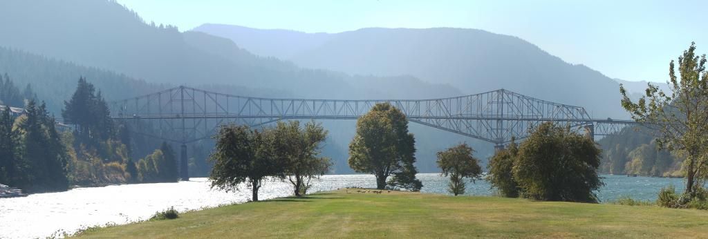
There was a bit of confusion at this stop. Dana didn't realize that "Bridge of the Gods" referred to both the landslide-created "bridge" AND to the engineered steel truss bridge. Nor did she realize "Cascade Locks" referred to both the town and the now-disused shipping locks. I think we got that all straightened out, though. This bridge is the one I've crossed the Columbia on most often, probably more than all the others put together. The reason is that I was a student worker in Forest Soils during much of my undergrad time at OSU, and especially early on, one of our field sites was at Wind River Experimental Forest, which is upstream from here a bit, then north from Carson, Wa.

And in the center mid-ground, more of our friends the geese.

Photo unmodified. October 10, 2012. FlashEarth Location.

Geo 730: November 18, Day 687: Bonneville Slide

Back to the cliffs I've pointed out in earlier posts, this slide was very likely due in part to oversteepening caused by incision during the Missoula Floods. Indeed, the many waterfalls in the gorge, particularly along the north-facing Oregon side, are thought to have their origins in these monstrous floods, which left nearly vertical cliffs in many places. The nice thing about this shot is that you can see both the headwall- the slide's source- and the runout into the river. I don't recall the view from Beacon Rock terribly well, but that's probably the best ground-based view of this feature that one is likely to find. Though come to think of it, the view from either of those peaks might be even better. But there's little doubt in my mind that the clearest views are from above. Here's a crop from a FlashEarth satellite map that shows the overall layout well:
The cliffs in the panorama at top show up as the lighter areas to the left of the word "Headwall," and the "x" in "~Photo location" is approximately where I was standing to shoot the photo.

Photo unmodified. October 10, 2012. FlashEarth Location.
Thursday, November 20, 2014

Geo 730: November 17, Day 686: Bonneville's Toe

This is the view downstream from the footbridge across the former ship channel at Cascade Locks. The "toe" of the Bonneville Landslide, if you want to be picky, is really the outer perimeter of the whole debris lobe. However, I've been tending to think of it as the point where it's closest to the south shore. I'm pretty sure there's no narrower portion of the river downstream from here, and suspect it's quite a ways upstream before you'd find a similar neck, so this is indeed a good spot for a bridge. The well-known Pacific Crest Trail crosses the river at this point.

Photo unmodified. October 10, 2012. FlashEarth Location.
Wednesday, November 19, 2014

Geo 730: November 15, Day 684: Bridge of the Gods

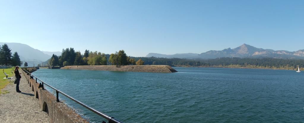
See the bridge? No, not the steel truss cantilever bridge on the left, but the land bridge that extends out to it. According to the latter link, there is considerable disagreement in the radiometric carbon dates obtained for the landslide's age, with the most recent measurements suggesting a date of about 1450, but ranging from 1060 to 1760 AD. My take on these wide ranges is that it's not likely due to inaccuracy of lab measurements, but difficulty ascertaining which wood samples are directly related to the Bonneville Slide.

This photo doesn't illustrate the reason for the locks here well, but I'm not sure others will do a better job. As you can see from the toe of the slide behind the human-constructed bridge on the left, the river was pushed and constricted to the south side of the gorge. Prior to construction of the Bonneville Dam in 1957, this was an area of rapids, which are now submerged in the pool behind the dam. Construction of the locks at this point allowed boat and shipping access to the Columbia Channel upstream from here.

Photo unmodified. October 10, 2012. FlashEarth Location.

Tuesday, November 18, 2014

Geo 730: November 14, Day 683: Source of the Bridge II

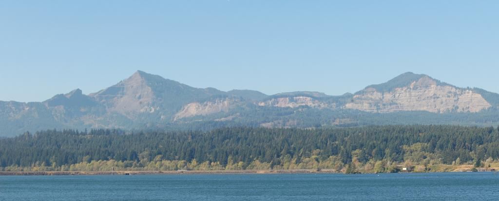
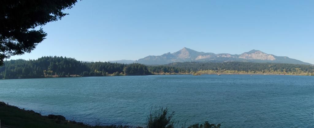
This is more similar to the last post than I'd like, but it's a panorama composed of two more zoomed shots, so looking at the full-size version should allow you to see more easily the rocks composing the two major cliffs here. The amphitheater-like headwall I pointed out in the previous post is the source of a large landslide that occurred maybe one or two centuries before the first European explorers come through this area. Native American legend has it that it blocked the Columbia River at this point (actually, just a bit down stream), allowing easy travel from one side to the other. I can't imagine this being a stable situation for too long- weeks to a month or so at most- before the river overtopped the debris, leading to rapid failure of the "bridge."

Photo unmodified. October 10, 2012. FlashEarth Location.

Geo 730: November 13, Day 682: Source of the Bridge

Looking across the Columbia River at Cascade Locks, the peak on the right, the same as in yesterday's shot, appears to be sedimentary rock. The peak on the left looks like Columbia River Basalt. Given the essentially horizontal bedding in both exposures, it seems pretty certain there's a significant fault between the two, close to the left peak. In closing, note that the pair of cliffs seems to create an amphitheater-like wall, curving around to the south (we're looking close to west, in this view) on the far left.

Photo unmodified. October 10, 2012. FlashEarth Location.
Monday, November 17, 2014

Geo 730: November 12, Day 681: Cascade Cliff

We're standing inside the Cascade Locks visitor center here; you can see the fuzzy reflection of the chandelier in the window in the top center. There's a sight-seeing paddlewheel boat departing in the foreground. I haven't done that excursion, and likely won't, so I have no idea if they discuss the geologic events the led to the creation of this scene. It would be a shame if they didn't; the geology is beautifully laid out. The large cliff to the left of center plays a major role. Given the distance, I can't be certain, but I think most of the cliff is sedimentary rock of some kind, but the high point above its center is a much darker gray, and is probably the base of the Columbia River Basalt flows here. So why a cliff? Stay tuned...

Photo unmodified. October 10, 2012. FlashEarth Location.