Showing posts with label Accretionary Wedge. Show all posts

Monday, December 23, 2013

Geo 365: Dec. 24, Day 358: Stumps of Mystery

Note: AW #63 has now been accreted.
Accretionary Wedge #63 is unique, as far as I can tell, in that it's a two-in-one pairing of the geobloggers' carnival with the (?) botanobloggers' carnival, Berry-Go-Round. The challenge is to find something in which those two disciplines intersect. Now this really isn't a challenge for me; the fact that geology is related to quite literally everything else is a fundamental belief of mine, and a consistent theme of this blog. So the challenge, for me, has been to find a truly exceptional example- not necessarily the best (What would that even mean?), but an excellent, powerful example. It dawned on me that these stumps at Sunset Bay State Park were an ideal choice.

In the photo above, note the distinct salt water line, about a foot above the beach. The tree in the back center has roots down to, but not much below, that line.
Yet these stumps and their associated roots are well below that line. How is that possible?
And they are not small... these were very large, well established trees, not saplings that managed to grow a bit before an exceptionally high tide and/or storm surge killed them.
And there are a good number of them, probably a couple dozen. This was a decent stand of forest. I'd wager there are even more of them buried in the deeper sand on the other side of the creek (Incidentally, the bridge you can use to cross the creek is back there near the basketball hoop and shelter, and there's a good trail back to the south beach)
We had stopped at Shore Acres a couple miles or so south of here for a while before coming back for low tide, and an interpretive pamphlet Dana picked up informed us these these are spruces, radiocarbon dated to about 1000 years ago. They all died at the same time, as a result of an earthquake and corresponding coastal subsidence. This would not have been the last great Cascadia earthquake, the 314th anniversary of which is coming up in about a month, but the second or third youngest, probably.
The steeply dipping strata on the other side of the bay are a testament to the ongoing collision that ultimately doomed these trees. Both serve as a quiet reminder of the danger all of us here in the PNW face. As I've said before, there's never a convenient time to worry about being prepared for this looming disaster, but NOW is a better time than later. Hey, it's nearly Christmas! How about this year, you give your family to gift of disaster resilience? And the up side? It's good for any crisis, whether it's a quake, flood, storm, or zombie apocalypse!

Top photo unmodified. March 8, 2012. FlashEarth location.

Monday, November 11, 2013

Geo 365: Nov. 11, Day 315: Sea Stacks and Whale?

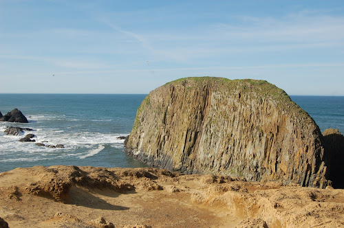
Our time at the coast last May was misty, cloudy, gray, windy and cold. It was gorgeous and fascinating, but unpleasant to be out in it for any length of time, especially if the location offered no shelter from the wind. As a result, many of our stops were quick and cursory. Here we were so exposed that we walked up to the edge, snapped a few photos, then headed quickly back to the car. If you enlarge the photo, you can see the leftmost stack is actually an arch, and even without enlargement, the biggest, near the middle, bears an amusing resemblance to a cartoon drawing of a whale. If it's not called "Whale Rock," it ought to be.

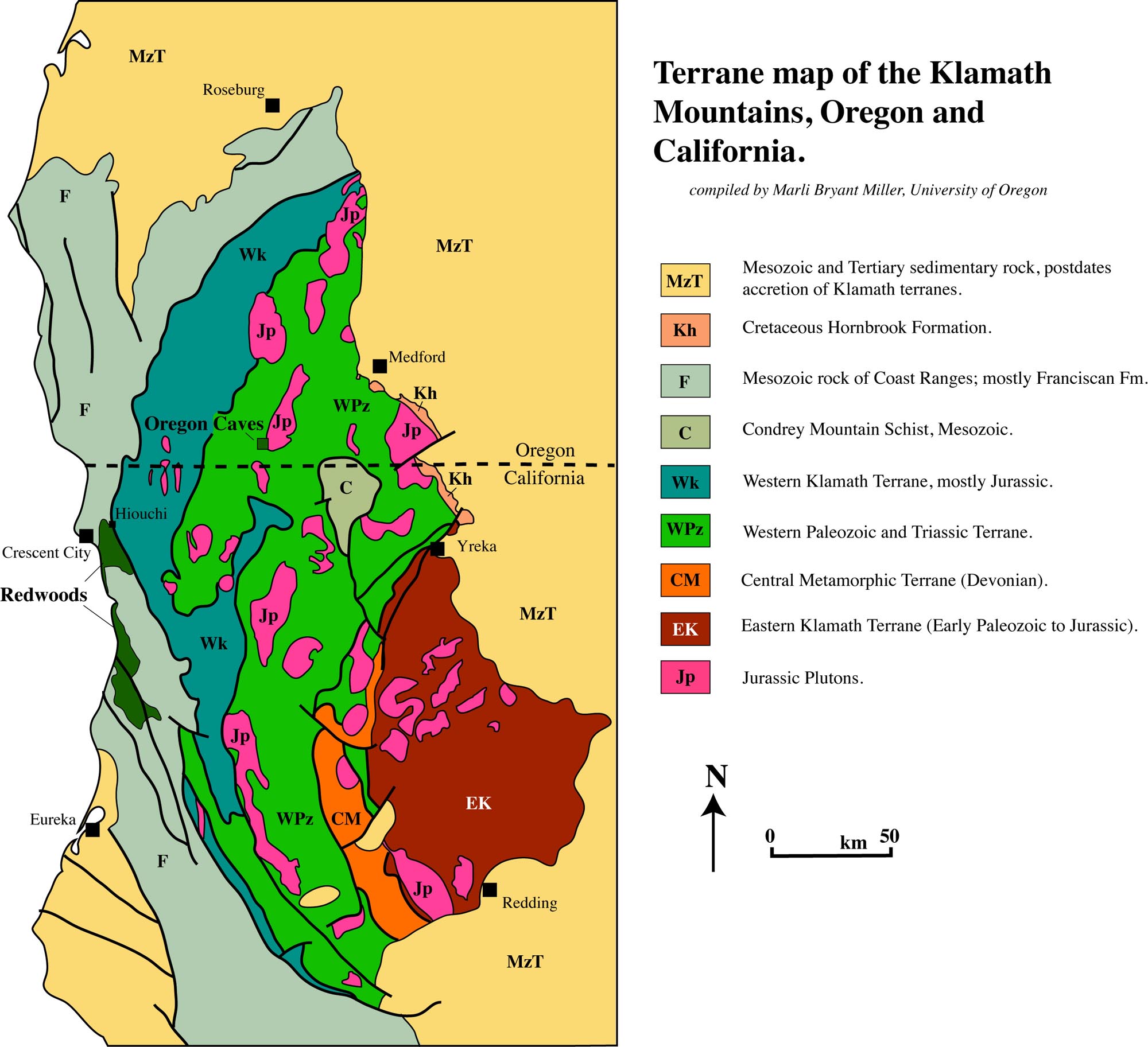
If I had to guess, I'd say the sea stacks in the distance are likely also Otter Point Formation, but lithologies change so fast in the Klamaths- especially east-west- that it would be just a guess, and not a very useful one. The reason I say "especially east-west" is that that's the general strike of the structure. Cross a fault, and you're into rock from an entirely different environment, of an entirely different age, with an entirely different history. And even without crossing a fault, the rocks are severely deformed and folded, again with the axes of the folds striking generally north-south. This means as one travels, the stratigraphic position can change very rapidly, even in the absence of faults. As I just told another Interzone denizen, "Klamath geology makes my brain hurt."
Map image by Marli Bryant Miller. To be clear, this is extremely simplified; each of these terranes have their own subdivisions, and many are themselves composed of two or more subterranes, which accreted before docking with North America.

Photo unmodified. May 7, 2013. FlashEarth location.

Saturday, November 9, 2013

Geo 365: Nov. 9, Day 313: Greywacke

A boulder near the parking area at Cape Blanco. I guess the things that jump out most strongly to me are the veins and patches of secondary calcite, simply because they're so high-contrast in comparison to the rest of the rock
Looking at a crop of the above photo, the nature of the rock itself is more apparent. It is (according to the nomenclature I learned, which may now be dated) a lithic greywacke- poorly sorted and texturally immature: the clasts are mostly angular to poorly rounded. Despite my statement a few days ago that this is Cretaceous in age, it is in fact Jurassic Otter Point Formation, according to this (2 MB) PDF of an Ore Bin issue from 1975 (See near the top of the second page of text). "Melanges" were, I suspect, only beginning to be comprehended at the time of that publication, but by the time I was finishing up my first year of geology in 1981, they were tentatively explained to us younglings as likely representative of old, exhumed, eroded and exposed subduction zones. That idea seems to have been thoroughly accepted. Indeed, if you look at the sorts of lithologies that can be found in the Otter Point Formation, nothing else comes close to making sense. Tagged with "Accretionry Wedge," because it amuses me... this may be the first time I've used the term in its literal sense,as opposed to the Geoblogosphere's carnival.

Photo unmodified. May 7, 2013. FlashEarth location.

Friday, August 30, 2013

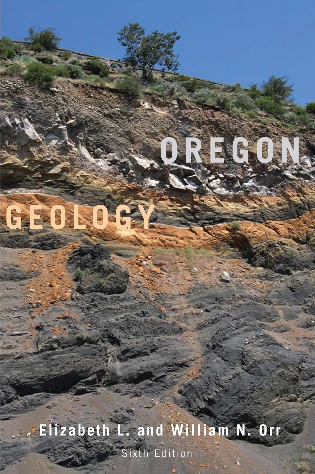
Book Review: Oregon Geology, Sixth Edition

(Image from here) This is an entry for Accretionary Wedge #59, on the topic of geology field guides.

As noted at the bottom of the cover, this is the sixth edition of a book first written in the early 1960's by Ewart Baldwin. I have, at one time or another, owned each of those editions, and as a rule, I find them indispensable. Baldwin was a stratigrapher, and the early editions reflected that- heavy on unit names and discussion of plausible environments. Prior to the acceptance of plate tectonic theory, though, and the concept of terrane accretion in particular, this must have been a terribly frustrating region to try to work out broad geological relationships. It still frequently is, but the concepts developed from 1980 to the end of that decade marked an enormous leap forward.

A great deal of the work in this understanding was done during that decade, and I looked forward eagerly to the arrival of the GSA Bulletin and Geology each month, and regularly stopped by the OSU library to skim through tables of contents looking for pertinent articles. Starting with the fourth edition, in 1992, the Orrs collaborated with Baldwin, and began seriously integrating the plate tectonic revelations of the previous fifteen years. In the fifth edition, 1999, Baldwin was no longer listed as an author, but the Orrs followed the same organizational format, and greatly expanded on the role of plate tectonics in Oregon's geologic evolution.

Since I quit following the professional literature at the time I started my master's work in education in 1991 - lack of time, not lack of interest- I presumed work was continuing, but had no idea what was being accomplished. Very little of that was reflected in the 1999 edition- that is, most of the updates there were already somewhat familiar to me.

With the sixth edition, though, there is a great deal of new material that I've not seen before, and it's exhilarating to go through it. A new feature is some short biographical sketches on geologists whose work has been foundational to our current understandings in each chapter- a nice touch. And it looks as if there are an additional 50 pages or so.

Some caveats: this is not a book I personally would recommend that one should try to sit down with and read. It is an extremely useful reference, but I tend to consume it a few pages at a time to satisfy a particular question. It is fairly dense- it is not "fun" to read. The authors make no pretense they're out to entertain you- though if geology is a passion (raises hand), it is quite engaging. Sadly, I cannot recommend this for raw beginners. On the other hand, if you're not put off by terminology (the book does not have a glossary, so you need to either know the words or use an external reference), have a decent grasp of internal and surface earth processes, and some experience at "thinking like a geologist," whatever that means, this would be an excellent resource for those living in the PNW, or even visitors looking to understand the foundations of this magnificent state. In other words, I would describe this as must-have for anyone with the first year geology sequence, or equivalent, under their belt who expects to spend time in Oregon. While it is not a "field guide" in the sense that it doesn't give you nice mile markers to a series of stops along a route, it is a text I carry with me on trips that get into areas with which I'm not as familiar. It's an incredibly helpful on-the-fly reference.

The organization is quite straight-forward: Oregon is broken into a number of physiographic provinces based on landforms and bedrock geology. The text addresses each of these from oldest to youngest. While there is obviously some overlap in age, each of these provinces has, for the most part, it's own unique geologic history, and the organizational structure works very well.

The book is heavily illustrated with maps, sketches, charts, diagrams, cross-sections, et cetera. Which brings me to a minor quibble, and I think, the reason for the name change from "Geology of Oregon" to "Oregon Geology" The previous editions were published by Kendall-Hunt (incidentally, a publisher by whom I've been almost entirely pleased with respect to their geo publications), and I'd not realized how much their printing quality affected my appreciation for the work. The new edition was published by OSU Printing, and while the image quality isn't bad, neither is it terribly good. Maps seem a little muddy. Identifiers need some squinting to make out. On the other hand, the fifth edition cost in excess of $60; this one is offered at Amazon for roughly a quarter of that, $16.37. So I suppose some loss of image quality is worth the ~$50 savings.(Good Lord! Just checked: Kendal Hunt still offers the 5th edition... at $128! NOPE!) My suspicion is that copyrights held by KH necessitated the name change.

So, to summarize, this is an extremely useful book that will eventually become dog-eared from frequent referencing and harsh treatment in the field. Get a little geology under your belt before trying to use it, but if you spend any time in the state as a geology enthusiast, this book is a necessity.

And to close, I've found many errors in Roadside Geology of Oregon, and have been told of many others. It was not a terribly useful book when it was first published in 1978, and with no new editions since then, it's pathetically out of date. I've been unimpressed with that series generally, but the Oregon edition in particular is just heinous.

Monday, July 15, 2013

Accretionary Wedge #58: Signs of Doherty Grade

Evelyn has turned her geological road signs meme into Accretionary Wedge #58. I don't have a lot of signs photographed, though I am starting to accumulate some of roadside interpretive signs. But the following is my favorite, and a crop is featured as the header on my Twitter profile. Driving east out of Lakeview, Oregon on Route 140, about 45 minutes out, one crosses Guano Valley, just north of the Nevada-Oregon Border. On the first visit, one realizes with stomach-churning uneasiness that the road goes right up to an enormous cliff... then up it.
Taken during 60 mph reconnaissance geology, with Dana Hunter at the helm, you can see the lighter stripe of the road grade climbing the side of the Basin and Range escarpment. The road is actually very well engineered, and there's more berm than you realize, but the sheer drop off and lack of a guard rail can make it feel more like you're driving up a balance beam than a two-lane road. The first trip up Doherty Grade is definitely a memorable experience. Heading into the turn at the base...
...feels a little like reaching the first crest of a big roller coaster. "Dear Lord, what have I got myself into!?" Then just after starting the grade proper, they decided to reassure nervous drivers that, yes, it could be worse. After all, you're driving up a cliff, and rocks do fall off cliffs, right?
It's not terribly obvious at this scale, but just beyond the "Rocks" sign is also what I refer to as the "pointy-headed snakes" warning (winding road).
And yes, there is a pull-out about a mile or so into this climb that I like to stop at. Fortunately, there's not much traffic on this road: it's on the inside of a curve, across oncoming traffic. I've posted a ginormaous panorama of Doherty Rim at Flickr; right-click the image for viewing size options. Guano Valley is notable as the source of the USGS Andesite "AGV-1" geochemistry standard, though I don't think it's available any more, and I've never been able to figure out exactly where it was collected.

Saturday, June 15, 2013

Accretionary Wedge #57: Seeing Geology Everywhere!

Evelyn is hosting AW # 57, Seeing Geology Everywhere.

I see rocks. They're everywhere, in everything. And most of the time, people don't even know they're rocks.

This is a topic I've brought up more times than I can count at this point. (See "Show Me Your Sidewalk," "Geology is All Around Us!" "Geology at Oregon State University," "AW #52: Geology Dream Course," "The Geo Biz," "We Dohn' Need No Steenkin' Rocks," "98 102 97 88" "Cycles Without End (AW #30)," and, in particular, "A Worldview That Resonates With Me," as a few selected examples.) The question I keep getting stuck on is, "What can I say that I haven't said before?"

The only thing I can think of is to phrase it as a challenge: I defy you to find *anything* in your environment that isn't directly or immediately indirectly (by which I mean only one or two steps of remove) dependent upon, or shaped by, geological resources and processes. The thing is, there really isn't anything that doesn't fit that description. The landscape you live in (or vacation in, for that matter), however modified by human engineering, was created in its basic outlines by water, the solid earth, climate and biological interactions. The computer you're reading this on is a creation of a wide variety of minerals and petrochemicals, painstakingly fabricated, doped with extraordinary precision, and despite its incredible complexity, assembled and sold at a price people can readily afford. Almost everything in your home was delivered by (mainly) steel vehicles propelled by hydrocarbon combustion. It's a rare meal indeed, at least in the developed world, that doesn't have a healthy (or unhealthy) dose of table salt, NaCl, or halite. For the sodium sensitive, you can substitute in a certain amount of KCl, or sylvite. If you get heartburn after a hearty meal, you can take an antacid made of fine-grained calcite, CaCO3, or gibbsite, aluminum hydroxide, Al(OH)3, to neutralize the acid. Then you can relax with a glossy magazine or coffee table book. The reason the pages are glossy is that a mixture of clay minerals has been rolled and compressed into the paper; the tiny clay flakes are flattened parallel to each other, giving the paper the appearance of reflectivity. It's the man-made equivalent of phyllite.

Geology's ubiquity and importance in terms of materials and energy make it among the most economically important of the sciences. The fact that so few people seem to get that is frustrating. I am by no means arguing that everyone should be an expert in geology, but I would argue that nearly everyone would benefit by having a good high school-level, year-long, geology course. What rightly or wrongly is perceived as a recent spate of billion-dollar disasters have been in large part geologically mediated. It doesn't require a college degree to be able to pick out settings that are more or less susceptible to flooding, storm surges, wind damage, landslides, slumps, debris flows/lahars, tsunamis, earthquake damage and so on. In many cases, a minimum of education, rather than waiting for the intonations of experts, could help an intelligent consumer make better choices about places that are more or less safe to live.

And I haven't even touched (here) on the awe and amazement I feel when, with the help of both what I know, and research performed by others, I stand on an outcrop, and gaze clearly into the past, through an abyss that might measure billions of years in duration. I have felt nothing, and I mean absolutely nothing, that makes me feel one with creation, in the way that experience does.

So, yes. I see rocks. They're everywhere. Most people don't even know they're rocks. And from my perspective, that's an enormous loss on their part.

Saturday, April 13, 2013

AW #56: Photos From a Geologist's Perspective

This is a tough one, but important.
What makes a landscape beautiful, or a rock beautiful or a fossil beautiful, is more than just its superficial attractiveness. These things also have geological information. In documenting them, the geologist's task is like that of the portrait photographer: to show the beauty in the true.
Why tough? I got my first SLR camera in the early 1980's, after I'd already started on my geology degree. So, basically, I've been taking photos from a geological perspective from the outset of really trying to do serious photography (as opposed to random snapshots of friends). Thus it's difficult to contrast what's different in my perspective; it's the only one I know.

What I can say is this: I definitely think about the esthetic aspect when I'm framing a shot. I'm not really sure exactly what it is I think about, but I often try several different frames and zooms to get a shot that I like. The advent of DSLR's has made that much easier: with film, each shot was a bit less than a dollar taking into account film and developing costs, so a roll of 36 slides was not a cheap proposition. These days, I can fire merrily away, then pick the one or few shots I like. But I definitely want the photos to look appealing.

I tend to focus mostly on outdoor photos, at the scale of a cobble or boulder, to outcrop, to landscape scale. My photos of hand samples tend to be uninteresting, to me, at least.

But it's the comment "These things also have geological information," that resonates with me. There are two broad "topics" that I tend to focus on: things I know and understand, and want to share, and things I don't know or understand, and want to look at more carefully, or perhaps ask others what they think. Time is a huge limit on field trips, but not such a limit in looking carefully at photographs. As an example of the former, here's a recent one from "Islands of Seals:"
Now the fun thing about that one was that it was in that post I came up with a plausible explanation for a photo I'd taken moments earlier of a feature I thought, at the time, I understood, Elephant Rock:
I, like Silver Fox, am definitely thinking about what features are visible in the viewfinder before I press the shutter button. And one nice thing about digital photo technology is that it's easy to mark up and highlight the features I was looking at when I shot the image, as In the Neighborhood of the Splort:
And of course "The Splort" itself is likely my favorite photo I've taken on my new camera. I certainly did not understand WTF I was looking at with this one at the time, mostly because I was focused mainly on what had gone where, rather than looking at and thinking carefully about the faults that accommodated those motions. What I "saw" was a plug intruding down into the surrounding rock, and that just didn't make sense. So, get a picture of it.
A couple of other nice options with digital photography are the options to easily create panoramas, such the not-quite normal normal faults...
(this version has also been annotated) ...and animated gifs: Heeere's Water!
Snow Melt
My feeling about gifs is that they offer an ability to photographically illustrate another dimension beyond the two of traditional photography. Rotating the view can offer a visceral sense of the depth in a view, or as here, the third dimension illustrated is change through time.

So in the end, I think what influences my perspective as a photographer of geology is an imperative to communicate the nature of the planet we live on. The esthetic, emotional aspects are important to me, too, but I guess even if a shot is gorgeous, if it's not telling a story, or part of a story, it's not one I'll be likely to take.

Wednesday, February 27, 2013

Accretionary Wedge 55: Avoiding Geo Injuries

Avoiding Geo Injuries: this is not the way to do it.
Maitri is hosting Accretionary Wedge 55 on the topic of geo injuries: injuries acquired while doing geology. Now I had, from the outset, intended to not participate in this one, for two reasons. First, I couldn't recall any significant injuries, and second, as mild as Maitri's injuries have been, just reading that post made me a bit queasy. Yes, I'm extremely squeamish, and averse to blood or any other injuries. When faced with an emergency situation, I respond calmly and appropriately. As soon as my role and responsibility are relieved, though, such as by the arrival of emergency responders, I'm likely to vomit, and even approach going into shock myself. I can't really explain the mindset, though it basically comes down to "If I'm honestly needed, I'm there. Otherwise, HOLY FUCKING SHIT GET ME OUTTA HERE!" Overdeveloped empathy, I guess. I'm very sensitive to pain in others.

A short story: my favorite part of every term was after buying my new texts, taking them home and paging through them. I decided, toward the end of my undergrad years, that if I was going to go into education, I should get a first responder course under my belt. I didn't know if that was the direction I'd go yet, but it was one I was considering, and such a course couldn't hurt, no matter what I decided to do. So I signed up for one, and at the start of the term, took my spiffy new text home, and started paging through it. Bad idea. About half way through, I had been treated to photos of a pencil through the cheek, a horse bite, and a lawn mower injury. Then I got to the section on avulsions, a term which, up to that point, had applied in my mind only to fluvial geomorphology.

I woke up with my forehead planted firmly between two pages. I closed my eyes, raised my head and shut the book before opening them again.

I don't cope well with injuries unless I have to. (I actually coped pretty well with the class, and aced it, but there was plenty of discomfort in the process)

It occurred to me that I *have* been injured in the course of fieldwork. I rather badly cut the back of my left thumb with a machete while surveying in the boundary of a study area for a project called Long Term Ecological Research (LTER) at the HJ Andrews Research Forest, east of Eugene in the Western Cascades. Oddly, my own injuries don't bug me as much as those of others. That particular one was a barrel of laughs (Yes, there were a number of times I actually laughed at the ludicrousness of the situation). We had almost completed the rectangular plot, and had cut over a mile of line at that point. Rather than trudging back up the mountain side, across, then down the mountain side, then across the other direction, then back up the mountain side to the spur where the car was parked, we simply set off through the brush, down the mountain side- the car was only a hundred yards off or so. But we missed the car, and only barely noticed when we crossed the lower traverse. So we hiked back up the cut and surveyed line to where we were parked, then drove over an hour into the closest town, Blue River. In all, it was nearly two hours before we got to the doctor, and the gauze in which the wound was wrapped was a solid mass. I had been holding it tight, keeping pressure on it, so the bleeding had long stopped. And the wound itself didn't really hurt all that much. But getting the gauze off was hellish.

However, it was for ecology and forest soils, so while the skill sets overlap, it really doesn't count for geology.

I had considered yesterday posting on why my safety record, despite spending somewhere around two thousand hours in the field with hundreds of middle school and high school age kids- a demographic not known for their attentiveness to safety or common sense- is so clean. As I commented on Geotripper's post yesterday, "I've been incredibly lucky (and I hope preemptive) in terms of clearly explaining safety issues, and not having to deal with anything requiring more than a squirt of antiseptic and a band-aid." Then, when I saw Callan's submission this morning, I knew I felt like I'd be dodging my responsibilities as an educator, a geologist, and a contrarian, if I didn't.

It's mostly about awareness, alertness and common sense, but here are some guidelines:
  • When visiting a spot for the first time, be especially alert, and actively look for potential hazards. These may include bad footing, danger from falling material, steep or precipitous drops, traffic, rough or cold water, and any of many other potential dangers.
  • If taking someone else to a potentially hazardous spot for the first time, point out hazards you've previously identified.
  • Keep a close eye on, and strong awareness of, your surroundings. This is more difficult than it sounds; we all know how easy it is to get focused on an outcrop, spot a feature of interest, and start toward it without looking at where your feet are going to step. This is a fine way to trip, or step on a snake, or some such disaster. 
  • When taking groups out, especially young people, set a minimum number of of clear, specific, and simple guidelines, so it's easy for them to remember those rules. If possible, do this *before* you go to the field- once you're there, learners are eager to get to the sights, and not really focused on paying attention to you. The Quartzville trip, which I did something like 35 times with middle schoolers, had a pretrip meeting of about 2 hours. It had some teasers, to get excitement up, but the whole point of the meeting was to prep the kids to be comfortable and safe. It included instructions on how to dress, what to bring, how to behave, but most important, the ground rules. These were, 1) No climbing; 2) When you hear a car coming, yell out "Car!" to alert the rest of the group, and get well off the pavement; 3) Be aware of what's over your head, and stay back from cliff faces as much as possible; 4) If you're holding a rock hammer, I expect to see goggles over your eyes. If you have them over your forehead or neck, I will ask you to put on another pair to PROTECT YOUR EYES! 5) When all else fails, pay attention to the leader. (These, by the way are pretty good guidlines overall, but in some cases, I would delete one or two on other trips, and add one or more others as needed.) I would then warn them that we would not leave the motor pool (Where we convened, the day of the trip) until THEY could recite these simple rules back to me. Then at stops that had their own specific problems, I would point those out when we got out of the car. I also built an expectation that at each stop, they would wait for information and instructions before I set them loose on the outcrop. Another tidbit: I know it's not easy with large groups, but try to get every individual's name down: it's much easier to get their attention when you can address them by name. "Hey, Dan!" Get down off there!" is much more effective than "Hey, you!"
  • Be prepared with a first aid kit, and know how to use it. The only thing I ever used it for were a few band aids and antiseptic, but I felt better having it along.
  • Again, for groups, a second responsible adult is pretty much a must, in my mind. First, it makes it much easier to keep an eye on the muchkins. My attention was often diverted by people asking questions; having another adult along meant that between the two of us, we could pretty well keep an eye on the group at all times. Second, what if *I* got injured? Who would drive? Who would fetch help? Likely less of a problem with college-aged students and up, but definitely something that weighed heavily on my mind on occasions when I was alone with a group of kids.
  • Try to make sure someone knows your general itinerary back home. When I did extended camping/natural history tours in central/SE Oregon with high schoolers, I gave parents a list of routes, destinations and where we were expecting to stay each night. We didn't always adhere strictly to the list, but we kept pretty close.
  • Pay attention to weather. This is both a safety and comfort issue. Snow in remote areas is a killer. Heat and dehydration in hot weather are killers. The planet isn't actively trying to kill you, it just doesn't care. Which brings me to...
  • Always carry extra water, food and gear to deal with getting stuck, whether in a ditch, or with vehicle problems.
  • Be aware of the closest location where help is likely to be found. This may be quite some distance if you're in a remote area.
  • Don't over-rely on technology. Many areas in eastern Oregon have no cell phone coverage. You can't just pick up your phone and call 911. More to the point, never, repeat, NEVER rely on GPS routing in remote areas with which you're unfamiliar. Ideally, you should carry decent topo maps of the area you're visiting. I used to have a dog-eared DeLorme atlas/gazetteer of Oregon. Not very expensive, and plenty detailed enough for navigation. And if you don't know how to use and navigate with a topo map, learn to. It's not just a useful skill, but a matter of life and death. We in the geoblogosphere have the phrase "Death by GPS," which refers to tragedies that occur several times a year, when a bot instructs a driver to turn off on some remote road, they get stranded and die. It's sad and preventable. Don't be one of those people, please.
  • As Callan pointed out, try not to spend time geologizing alone. Sometimes it's unavoidable, but no responsible employer should expect solitary fieldwork, in my opinion.
Finally, I'll repeat: "It's mostly about awareness, alertness and common sense." Also, take the time to help companions and students develop those same habits and skills by pointing out known hazards. Anyone who has been following my geoblogging for any period of time knows that I'm compulsive about explicitly noting dangers in specific spots- as recently as yesterday, in fact. It's due to my training as a teacher: keep the kids safe. And it's because I care about the people, even those I don't know, who may follow my directions to some of our wonderful geology without any further advice, and NOT notice hazards. I wouldn't likely know if they were harmed or killed due to following my recommendations, but I kind of feel that heightens my responsibility. I can proactively alert them there are things they should be cautious about.

I think it's an internalization of that set of values, paying attention to everything around me while, at the same time, allowing myself to get lost in the wonderful landscapes and rocks, that has kept me pretty much geo injury free for all these years.

Friday, December 21, 2012

Followup...

...to yesterday's Notpocalypse post. I've found a few more funnies on the theme for Sunday, but for the most part, th-th-th-that's all, folks. Have a happy just-another-day-that-wasn't-the-end-of-the-world.

Thursday, December 20, 2012

Bring on the Geopocalypse: Accretionary Wedge #53

Bizarro, via Julia Segal's Tumblr

We did get a few intentional submissions, but apparently many were sort of put off by expectation of humor. So I'm going to roll in a bunch of humor from other places, as well as some serious pieces debunking this whole doomsday nonsense- which apparently is de rigueur every few months in our modern society. "Chicken Little" used to be just a silly children's fable- now it appears to be taken seriously by more than a few people. And two or three times a year, my heart breaks, and my credulity strained, as I read about family wealth destroyed, lives ruined- and even ended- because some gullible nitwit believed the wrong hucksters, and paid heed to irresponsible news sources.
Historic LOLs

So let's see. Anne posted a kind of ice-nine scenario of Hell freezing over. "So that got me thinking about what would happen if hell really did freeze over when winter starts. We would be in a winter state all year long because there wouldn't be any ground heat to melt the snow away."

"That is not the action of a fully intact pot"

And Jazinator treats us to a catastrophic tossed salad. "The intense heat from the combination of the impacts and nuclear explosions is expected to cause a fissure along the center of the Earth forcing the Earth to fracture, much like a head of lettuce slammed into a table"
(Image from The Bad Astronomer, Phil Plait)

And mine involves something about broken Higgs Bosons and the earth turning itself inside out. "Now, on the downside, our calculations suggest we will be inundated with something approaching a 340-kilometer deep ocean of molten steel- that's about 210 miles, in English- extinguishing every trace of earth as we know it, not to mention all life on the planet. On the plus side, though, the initial migration of the molten core toward the surface will be even more effective at freeing up 'tight' shale oil and gas than current 'frakking' technology."
 (Image from The Bad Astronomer, Phil Plait)

Finally, and a bit belatedly, Hollis chimes in with a scenario that any card-carrying hippie would find groovy and really far-out, man: "After just a few days, Yellowstone will emit a gargantuan burp of euphoria-inducing gas.  We will all happily swoon and then be peacefully frozen stiff with the onset of a prolonged very cold and very dark volcanic winter.  In other words, I’m an optimistic person."
 (in reference to this)
Now, Phil Plait (linked three times above, to two different posts) and Erik Klemetti, source of the two tweets above, have been doing superb, if exasperated, work in debunking this nonsense. The bits from those two that I would consider their centerpieces are, from Phil, here, and from Eric, here. If you need convincing that this nonsense is, in fact, nonsense, these are very highly recommended.
Narcolepsy Inc.

In a related vein, Dana Hunter has an excellent bit that gets at a central problem in a tangential sort of way, though she starts off pounding the nail squarely on the head:
Please sit down. I have some news to break. It may be very difficult to hear, and it may shake your innocence and trust. But I need you to know the truth.
Are you ready? Have you braced yourself? Okay, let’s have it: sometimes, the media is really terrible at science reporting.
I’m so sorry. But it gets worse: sometimes, they tell you things that really aren’t true at all.
Some people will die because of these rumours, and we are trying our best to stop them.

A particularly depressing- though outstandingly important- site is here. Yes, I rely on humor to combat sadness, and I know for a fact some people think I (at least on occasion) go too far, too soon. I understand, and I'm sympathetic, but believe me when I say you'd like my potential other behaviors less. However, I've spent a lot of time with and around youngsters, and their well-being is always on my mind. I'm much more conservative in language and behavior around them. Scaring a 2nd grader into life-threatening depression is not okay. Got that?
Bits and Pieces

The fact is, there are too many unscrupulous people who wouldn't hesitate to take advantage of fear- however unwarranted- to make an easy buck. And that's especially true in the US, where, apparently, we value money and its acquisition over all else... and I do mean all.
As Callan at Mountain Beltway commented, "Why does our civilization keep believing in these stupid ideas? There are plenty of real things that could disrupt or end a civilization." Well put. There are indeed plenty of things rational minds should fear. Doomsday apocalypse scenarios, whether based on Mayan Calenders, astrology, Biblical "revelations," or any other source, are not among them. On Circulation also recently posted a run-down of potential catastrophes, with a discussion of why none of them constitute the "end of the world."
It's Funny to Me

Which is why articles like this, and the people whose work is to confront such things firmly and decisively, are so important.
La Figa

The fact is, for the foreseeable future, every living entity on earth is going to die eventually. I personally have little fear or problem with accepting that. The fact of my death means there will be resources for someone else, perhaps- I hope- someone better than me. That's why many choose to have children. That's why we struggle to make things better for those around us, despite knowing that, in the end, it's meaningless to us personally. Endings are sad things, yes. But as a wise man once said, "hope springs eternal."

And as moms have said, since, I guess, about forever, "Stop it. You're scaring the children."

Followup

Sunday, December 16, 2012

Hate Being the One to Break This News...

Artist's conception of how our home will look next weekend.. (Also see The Weekend Weather outlook! 3 great options for fun during unseasonably warm weather!)
An international group of expert scientists specializing in science announced in a press conference today that mucking around with the Higgs Boson has broken it, resulting in siderophile elements becoming much less massive, and lithophile elements much more massive. "Our results should be taken as preliminary, at this point, and will need to be refined over the coming months and years. Nevertheless, we feel confident that by the end of the week, the earth's core will erupt onto the surface, and the crust will sink to take its place," said lead scientist, I.M. Moran. "Now, on the downside, our calculations suggest we will be inundated with something approaching a 340-kilometer deep ocean of molten steel- that's about 210 miles, in English- extinguishing every trace of earth as we know it, not to mention all life on the planet."

"On the plus side, though, the initial migration of the molten core toward the surface will be even more effective at freeing up 'tight' shale oil and gas than current 'frakking' technology. That, combined with what is expected to be an unusually low-demand heating season, means that consumers can look forward to steep drops in energy prices. From a scientific perspective, we eagerly anticipate an opportunity to examine the properties of the core directly for the first time. And from an economic perspective, we expect that the abundance of platinum and other precious metals thought to be concentrated in the core may trigger an economic expansion like none since the late forties and fifties."

Asked how people should be prepared, Moran replied, "Well, the usual, you know. Have plenty of extra water, a gallon per person per day, enough for a week or two. Non-perishable food with minimum preparation requirements- peanut butter, for example. Practice and drill escape routes, have a meeting place planned if you get separated somehow. Nothing really out of the ordinary."

When queried regarding other scientists' skepticism about his results, he scoffed "Ivory tower types! What do they know? I have an associates degree in dental assistance, and it was extremely rigorous. They don't even know what I'm talking about."

In related news, US gun sales have surged to new highs. NRA spokesman Charlegun Hasgun says "Our members are fully armed and eager to take on any ocean of molten metal that dares to threaten them, their loved ones, or property."

Dick Cheney, commenting from an undisclosed location, declined to comment.

(This will an entry for AW #53, so be aware THIS IS NOT TRUE!)

Wednesday, November 28, 2012

AW #52: Geology Dream Course

Note: This wedge has now been accreted at Agile Geoscience.

For Accretionary Wedge number 52, Shawn asks us to expound on a dream course in geology. I'll start by pointing out I've already taken quite a few courses that were ever so much more exciting and engaging than I could have imagined they might be. One that comes to mind is "The Tectonic Evolution of Western North America," by Bob Yeats, which was both far more complex and far more fascinating than I had any inkling it might be. And the Petrography/Petrology Sequence by Harold "Sharkey" Enlows... perhaps the best indicator for that one is that we were expected to spend 6 hours of scheduled lab time per week on that one, and I regularly spent 12 or more hours, just so I could see and learn more. It seems selfish to ask for other courses I might take.

One option offered is to design a course we might like to teach. I'd been contemplating sitting this one out, but a confluence of factors has forced me to choose otherwise. First, most geology people love their subject, and I'm no exception. Second, as I've said before, first and foremost, I consider myself to be a teacher. I can't help it. If geology comes up in conversation, I'm going into teaching mode. Internally, the discussion goes, "What do they know? What do they want to know? How do I get them there? What is the minimum of new information I need to bring up to accomplish that?" Then off I go. Third, another point I've made repeatedly is that I'm often appalled at the lack of regard and respect for the earth sciences, especially given our dependence on both the planet's resources and comparative peacefulness, even as we deplete the first and disturb the second. Finally, and I don't know that I've mentioned this, the main work I've actually done in science education involves curriculum design and evaluation. I don't bring it up much, even in face-to-face conversation, because I find it extremely tedious. It also happens to be in high demand, but people don't want to pay for the background, effort and patience it takes to do it right- much like the rest of education.

So it seems obvious I should come up with a course that helps address my concerns in point three, while enjoying aspects of points one and two, and taking advantage of my skills in point four. What I've come up with is a class with the working title, "Earth Systems and Society." As an overview, it would provide a minimal background with respect to geology and other earth sciences- notably oceanography and meteorology; it's focus, as the title indicates, is really more on the interactions of earth's systems and the human population those systems support.

I've spent enough time on this that, while the outline is more telegraphic than I might like, I think it's fairly clear what I might do with a class like this. This is by no means developed to the degree I would normally expect, but I do think it works as an outline.

Prerequisites: {What I consider to be a basic high school math education:] Algebra I and II, geometry and trigonometry. Basic skills in written English and expository and persuasive communication.

My philosopical positions/assumptions:
  • Western culture generally, and US culture particularly, does not grasp the intimacy and necessity of human interaction with earth systems, let alone the complexity and feedbacks that can make those relationships profoundly difficult to grasp in their entirety.
  • This is particularity true of people in non-science disciplines.
  • Too few people are well-educated in science to substantively shape national and international debates on issues that not only affect all of humanity, but in fact make the medium to long term survival of Homo sapiens a question of real concern.
  • Despite the overall complexity of interactions between Earth systems and society, individual components are intuitive and easily grasped. The difficulty lies in trying to plausibly project the outcome of simple processes and actions interacting with innumerable other processes and actions.
  • Science does not reach social decisions, but informs them. Thus other social skills- including communication, argumentation, processes of political valuation, along with the values of disparate interest groups and individuals- are of great importance in applying and using scientific results
  • To address the problems outlined in the above points, I propose a class focusing on 1) Simple facts regarding earth systems and processes, 2) opportunities to think about and practice projecting how different processes can and do interact to create outcomes that might not necessarily be intuitive, but nevertheless can be foreseen.
To assure the broad goals of this class are addressed and achieved, the following approaches will be important:
  • Start with broad frameworks and the most familiar aspects of earth processes.
  • Move into less familiar processes, but still focus on broad frameworks.
  • Work toward more specificity in various earth system/resource knowledge as term proceeds, while at the same time frequently tying new knowledge back to broad frameworks.
  • Revisit earlier topics frequently and explicitly, to illustrate interactions, reiterations.
  • Expect students to be able to use basic algebraic skills; simple mathematics will play an important role in homework. Students should be able to work with scientific notation.
  • Expect students to show competence with written English.
  • Ramp up critical thinking, evaluation and critical skills expectations as course proceeds, with extensive feedback to written assignments ahead of two major written works, along with at least one required review of each draft of latter, and other reviews as requested by students.
  • Given my background, the solid earth will ground the course [heh], and other component systems will be related to that foundation. However, those based in other science disciplines should have no problem approaching this from another basis, for example bio-science, oceanography or atmospheric science.
  • Above all, keep it exciting. There is much that can be frightening in this topic, but always balance potential scares with potential solutions, alternatives and adaptations.
General Outcomes: Students will be able to
  • Review and analyze environmental risks of a small (>50 km sq, about the area of a medium-sized town) area of their choosing, using historical media reports, skills and knowledge developed in class, along with information from relevant local to national level government agencies. Other source materials should be cleared with instructor. (This will be the final project, and I want to avoid asking S's to go to primary literature.)
  • Recall fundamental terminology and concepts accurately, and use it appropriately in context.
  • Give multiple examples of the concept of opportunity cost, and explain factors that can lead to forgoing more valuable opportunities for less valuable opportunities in terms of earth resources.
  • List ways to increase preparedness, and decrease risks of injury and mortality, with respect to a number of different natural hazards (e.g. floods, earthquakes, tidal surges, tsunamis, lahars, volcanic hazards, etc.)
  • For selected hazards, describe methods of avoidance (e.g. floods, tidal surges, tsunamis, lahars, etc.)
  • Given examples of common household items, describe earth resources used in the production of each.
  • Describe current thought regarding global climate change. This is not intended to be ideological, and I don't care whether you "Believe in it." Even if you don't, you should be able to explain accurately why others do, and in general terms, what their predictions are.
  • Describe feedbacks that could worsen or moderate climate change.
  • List and explain examples of resources whose availability may potentially be affected- for better or worse- by climate change.
  • Keep a log (or blog, preferably) of media stories about earth resources, hazards, processes, and other stories relevant to the content of this class. Include comments, which should note strengths and weaknesses of the story, "flashing lights," that is, evidence that the story should treated with caution or skepticism, and thoughts of how the topic covered in this story relates to other topics relevant to this class.
  • Given hypothetical situations (or generalized portrayals of real situations), create an argument to support one of two or more options. The point here is not to have the "right answer," but to muster pertinent information to argue for one choice from what might be a number of options. As an example, Federal, state and local governments heavily subsidize rebuilding after floods and coastal storms. This encourages people to rebuild/use resources in areas that have in the immediate past been proven vulnerable. Potential options for this problem include 1) The system works as it is, albeit with weaknesses. Don't change anything. 2)a] Require those in vulnerable areas to purchase government-subsidized insurance; 2)b] Require insurance coverage that reflects the best assessment of real risk; 2)c] Require insurance that is overpriced with respect to real risk, thus discouraging development in vulnerable areas. 3)a] Prohibit rebuilding in areas that have been proven by experience to be high risk for calamitous disasters; 3)b] Prohibit rebuilding in areas that have been proven by experience to be high risk for calamitous disasters, with exceptions on a case-by-case basis [e.g, sites of historic importance]. 4) Some combination or variation of the above possibilities, or [an]other[s], suggested by student.
  • An important component of the course will be a summary and conclusions essay. This should be about 3 pages long, and discuss the following: 1) What topics regarding resources, risks, and earth systems should be addressed by your state and/or local government in the near future? 2) In what ways do you think this course may affect your thinking and future decision-making with respect to natural and man-exacerbated risks and hazards, and consumption of resources? 3) What topics in this course did you find of particular relevance or interest? 4) What aspects of this course were less interesting or less relevant? 5) Overall, how would you rate this course? As with the previous point, I'm not looking for any particular answer, but rather your choices regarding the pertinent information you bring to bear and the coherence with which you frame your answer. I'm thick skinned, so don't be afraid to be critical where it's warranted. I suggest you start keeping notes in whatever format is convenient and effective for yourself from early in the term.
[I've spent my career and entire college student-hood in a quarter system- my feeling is that this might be too much for what I think of as a ten-week term, but it might work better in a semester system. Nevertheless as an outline, here's a general overview of what I'd like to tackle. Each bullet represents a lecture & discussion- format class period, with the exception of assignments due at the ends of weeks 8 and 9.]

Week 1
  • Intro, rationale, overview/outline, "deep time" and intro to surface processes
  • Fluvial processes
  • Mass Movement
Week 2
  • Internal processes: plate tectonics and the big picture. Global outline of active areas
  • Seismicity
  • Volcanism. Focus on North American tectonics.
Week 3
  • Integrating surface and internal processes: the consequences of an active planet
  • Exam
  • Geosphere-atmosphere interactions
Week 4
  • Geosphere-hydrosphere interactions
  • Interactions [of previous 3] with the biosphere- elemental cycling
  • The centrality of life in creating earth as we know it today: the importance of microbes and "The age of bacteria."
Week 5
  • Living on a limited planet: risks, hard walls, options, and choices
  • A delicate balance: to use or not to use.
  • It's complicated. Land and resource use versus natural, man-made, and man-exacerbated hazards
Week 6
  • Exam
  • Stuff we take for granted I: energy resources
  • Stuff we take for granted II: metallic resources
Week 7
  • Stuff we take for granted III: industrial and construction resources
  • Stuff we take for granted IV: water and land
  • Stuff we take for granted V: an unchanging planet [climate and other large-scale environmental change]
Week 8
  • Site-specific risks: thinking about risks from floods and mass movement. [do so before land purchases!]
  • Site-specific risks: thinking about risks from seismicity and volcanism. [and special associated mass movement risks]
  • Site-specific risks: atmospheric phenomena and erosion
  • Final project due
Week 9
  • A culture blind to earth systems
  • How to talk to others: dos and don'ts
  • Reasons for optimism: it's too easy to be fatalistic. Life is and has always been a puzzle with lives at risk.
  • Summary and Conclusions essay due
Week 10
  • Study session, Q&A
  • Final Exam
Now, in honesty, I don't have the stamina to teach anymore- I get tired too quickly, and apathy can shut me down without warning. Even if I was offered a generous salary to teach something like this, I would be hesitant to accept it. I'm very reluctant to take a job I'm not certain I can complete. But the fact is, I think this would be a very good experience for non-science folks: enough science to be a valid science "credit," but at the same time, drawing in aspects of life most people wouldn't think of as "hard science." Geo-types get exposed to this kind of uncertainty and ambiguity over and over again throughout their education and career. The thing that I'm curious about is can a similar education be condensed into a one-term class for non-science folks?

Saturday, November 17, 2012

AW #53: "It's the End of the World As We (Don't) Know It (And I Feel Fine)"

NOTE: This wedge has been accreted, here.
As you likely know, the world will end on December 21, which happens to be a Friday. So it eerily coincides with the end of the work week. "World?" "Week?" Coincidence? I think not.

So in the spirit of geological celebrations let's have a hilarious final Accretionary Wedge of the entire universe ever, and scoff at the end of the world, the road kill on the margins of the information superhighway who create this dreck and keep it alive, and the so called "respectable" journalists who feel obligated to act as if such idiocy should be covered in anything but a mocking, tongue-in-cheek tone.
``It's Marvin,'' he said. ``Hey, Marvin,'' he said into the phone again, ``we're having a great time. Food, wine, a little personal abuse and the Universe going foom. -Douglas Adams
So I'll suggest several approaches, but feel free to come up with your own. What I'm hoping for primarily is some rollicking laughs, but if you'd like to take some aspect of this stupid meme more seriously- and gawd knows there are grave implications for a society where such nonsense can be treated seriously- feel free to come at it in whatever manner suits you.

The original inkling for this topic came up sometime this past summer, when I suggested that a theme lampooning the over-the-top, sensationalistic, and frankly irresponsible "journalism" often seen with geological topics and disaster warnings generally might make for a good AW. Ron Schott said December was open, and I pounced. "Put up or shut up?" Oh, I am so putting up! You could make up a tale of geologic and sciency absurdity, describing in the most insanely over-the-top manner how the world/universe will end. Contrarywise, you could report on the world's end as it happens, complete with reporters going out to report "LIVE!" from the apocalypse. Personally, I think the world will go out in sectors, like an orange with 24 sections, as they pass through midnight, but I'm not sure whether it'll be at the beginning or end of the 21st.

Or, you might choose to pick a bit of "respectable" journalism, and pick it to pieces in the most acerbic way you can. (Rick Sanchez, "What's that [10 meters] in English," anyone?) Here are a couple examples of me doing that, the first to point out the myriad mindless errors and misjudgements: Science "Journalism" by Press Release. And the second to show the the original press release totally missed the boat on why this news was important and so very interesting: More On the Gigavolcano.
“Don't wake me for the end of the world unless it has very good special effects.”  ― Roger Zelazny
Or, like I said, you might have another idea. But remember, it's supposed to be a party. No downers allowed- though that might be a topic for another Wedge.

I'm going to set the deadline a bit early, let's say, December 17 or 18 (Monday/Tuesday), because I want to get this up by Thursday at the latest, or preferably Wednesday.

Just in case, y'know...
Followup note: To clarify, the idea is to find the humor- in whatever way you choose- in one of three topics: Cultists and conspiracy theorists who force us to reread this stuff, the idea of the world ending in a single, one-day event, or journalism that permits this kind of drivel to reach any level of public consciousness. "Fracking at Newberry will cause PNW Megaquake?" Mwa-ha-ha! That's just the beginning. That'll trigger the San Andreas, in turn triggering peta-eruption at Yellowstone and Long Valley. The combined force of those two eruptions will knock earth out of orbit and into Jupiter," for example.

Wednesday, October 24, 2012

AW #51: Geopoetry

This month's Accretionary Wedge theme is Geopoetry, hosted by Matt Herod at Geosphere. Now I'm generally not much of a poetry person- it's too dense for me, and I prefer the literalism of prose. But I found this one during a search and after reading a few others, and I really, really like it. It captures the feeling of wonder and awe I feel toward geology and the earth. (Also, when I went to leave a comment on the call for posts, I read the poem submitted in the first comment. You should too. It's amazing!)

Oh Lovely Rock
By Robinson Jeffers

We stayed the night in the pathless gorge of Ventana Creek, up the east fork.
The rock walls and the mountain ridges hung forest on forest above our heads, maple and redwood,
Laurel, oak, madrone, up to the high and slender Santa Lucian firs that stare up the cataracts
Of slide-rock to the star-color precipices.

We lay on gravel and kept a little camp-fire for warmth.
Past midnight only two or three coals glowed red in the cooling darkness; I laid a clutch of dead bay-leaves
On the ember ends and felted dry sticks across them and lay down again. The revived flame
Lighted my sleeping son’s face and his companion’s, and the vertical face of the great gorge-wall
Across the stream. Light leaves overhead danced in the fire’s breath, tree-trunks were seen: it was the rock wall
That fascinated my eyes and mind. Nothing strange: light-gray diorite with two or three slanting seams in it,
Smooth-polished by the endless attrition of slides and floods; no fern nor lichen, pure naked rock...as if I were
Seeing rock for the first time. As if I were seeing through the flame-lit surface into the real and bodily
And living rock. Nothing strange...I cannot
Tell you how strange: the silent passion, the deep nobility and childlike loveliness: this fate going on
Outside our fates. It is here in the mountain like a grave smiling child. I shall die, and my boys
Will live and die, our world will go on through its rapid agonies of change and discovery; this age will die,
And wolves have howled in the snow around a new Bethlehem: this rock will be here, grave, earnest, not passive: the energies
That are its atoms will still be bearing the whole mountain above: and I, many packed centuries ago,
Felt its intense reality with love and wonder, this lonely rock.

Friday, October 5, 2012

OMN Willamette Valley Geology Presentation Part Five: Silver Falls

This is the final portion of the spoken presentation that I gave about three weeks ago for the Oregon Master Naturalist Program at Silver Falls State Park, east of Salem, Oregon. There was another planned portion, on non-tectonic geologic hazards- I had intended to focus mainly on mass movement, with some mentions of flooding, though I don't have any good photos or images of the latter. However, due to some issues with logistics, time became an issue, and we dropped that segment. I will cover it in much the same way as with this and the previous four segments. I should also do a quick and dirty summary of Bob Lillie's portion, on plate tectonics and the tectonic setting of the Willamette Valley. In addition, I had about 30 rock samples to illustrate typical kinds of geologic material one might find in and around our area. I don't have photos, yet, but I may get up the gumption to take some shots, and I've kept the sheets I placed the samples upon, with names and notes for each, so it shouldn't be too much trouble to transcribe those.

We had anticipated walking down the path to North Falls, which definitely has the most diverse and interesting geology in the park, but the smallish parking area there was almost completely full. While we had anticipated problems with everyone driving, and had arranged ahead of time for participants to pool into a minimum number of cars, we still had about 7 vehicles, and when we arrived, there was one parking spot available. So we regrouped at a nearby parking area with an overlook, and decided to bag North Falls. Parking at South Falls is much more extensive, so we headed there. We had planned on visiting the CCC building, with its marvelous fossils anyway, and while the geology exposed at South Falls isn't as in-your-face, we figured it would suffice... and it turned out better than we'd planned, for reasons I'll get to presently.

I'm also going to submit this as my entry for this month's Accretionary Wedge, hosted by Evelyn of Georneys, Fun Field Camp/Trip Moments, because this did indeed end up being a lot of fun.
 Bob Lille and his wife, on the scouting trip a couple weeks before our presentation, approaching North Falls. Silver Falls isn't exactly unique, but perhaps a bit unusual, in that there are a number of falls you can see from underneath and behind. The trails "cross' their respective streams not by going over, but under.
One thing I've particularly noticed about these photos is how difficult it is to appreciate the scale here; this alcove is simply huge! In the photo above, note the dark horizontal band of sediment...
...and again here, with some people for scale. The rock layers aren't terribly distinct, but the underlying resistant layer is Columbia River Basalt (CRB) of the Grande Ronde series, as is the upper shelf-forming layer. In between is a layer of stream-carried sediment. I had been under the impression this was marine- from when the Willamette Valley was a shallow embayment- but other sources say this was terrestrial, and that actually fits better with what you can see first hand.
Another shot showing the sheer scale of this overhang.
Light scratches are graffitti, dark lines are cross bedding in the sedimentary layer. The sediment, particularly the upper portions, have been somewhat cooked and hardened by contact metamorphism.
Looking up at the overlying basalt, there are numerous tree casts; we're standing in the root zone, looking up into where a pair of trees were swamped by a flood of basalt. Had this been a marine environment, there wouldn't have been trees growing here.
Looking out toward North Falls and down the gorge.
Almost out on the other side of the alcove.
And looking back at where we've been. The height of this waterfall is 136 feet, 23 times my height of 70 inches.
On our scouting trip, we walked the loop from North Falls, down stream to Winter Falls- so called because it merely drips during dry months- climbed out of the canyon there, then followed the rim trail back to the North Falls parking area.
Durning Dana's visit in March, the North Falls trail was closed due to snow and ice, so we spent more of our time at South Falls. For the OMN workshop, I told the participants that the sediment layer was clear at North Falls, but I hadn't looked carefully enough here to be certain whether there was a similar weak sediment layer responsible for the shelf, or if it was maybe a paleosol instead. Bob suggested that they look carefully to see if they could find evidence for one or the other. Sediment ought to be clearly layered, while a palesol ought to be more massive- perhaps with evidence of preserved roots. But the upshot is that we were quite up front and honest about what we didn't know, and gave the learners a chance to figure it out for themselves.
As you can see from the previous two pictures, much of the exposure is covered with lichen and moss, so finding clues consists in large part of gently pushing aside enough of the botany to see the weathered, crumbly geology underneath. But the students were successful, and we managed to find several spots where the weak horizon showed clear sedimentary layering. So the interflow sedimentation here is not as pronounced as at North Falls, but it clearly is a sedimentary interval, not just a weathering interval.
I also wanted to show the participants some of the other scenes in the park that we wouldn't have time to visit during the workshop, so above is Lower South Falls, a bit more than a mile below Upper South Falls, from the visit with Dana in March. Flow rates were much, much lower in mid-September.
 And this is Upper North Falls, about a half mile upstream from the North Falls parking area.
North Falls from the rim overlook in March. The wind wasn't too stiff, but from the cloud condensation, you should be able to infer it was from the left (west), moving to the right. I'll get back to this in a bit...
I think this may be from the chimney on the backside of the gift shop at South Falls, the other building at Silver Falls that used this fossiliferous siltstone/sandstone from the rock quarried by the CCC (Civilian Conservation Corps) in the 1930s
But the fossils are more abundant and more diverse in the CCC building itself- the above looks like a nice assemblage of filter feeders: clams and razor clams.
A view of the building.
 Fossils with lens cap, 52 mm diameter, for scale.
And another, zoomed in on the same spot. There are four major distinct rock groups in the park; the lowermost is this fossiliferous sediment. Next oldest is CRB flows of the Grande Ronde group, and interbedded with those is the stream sediment so nicely exposed at North Falls, and above that are some tuffs from Cascades volcanism. We found that examples of the three other than the interbedded stream sediment are used either in or very close to the CCC building, making that location a very good spot to summarize the overall geologic history of the area.
 A block of the tuff, used as a landscaping stone, near the South Falls parking area.
I concluded this portion of the workshop by mentioning that even if you know nothing about the rocks, even if you know nothing about what types are around, or what processes formed them and put them where they are, the simple fact of two enormous piles of them in parallel north-south ridges have a profound effect on us here in western Oregon. The town where I live gets about 42 inches of rain on average per year. If I traveled up to the Coast Range Crest, that number can get as high as 160 to 200 inches per year. Maximum annual rainfall in the Cascades doesn't get quite as high, but can still go over 150 inches per year. Those extreme differences are due to rapid elevation changes- that is, rocks. These variations in rainfall create huge differences in vegetation. Even after more than 30 years in this area, I still find myself gasping at our rich, luxurious vegetation, especially at the epiphytes, as shown by the moss growing on the maple above.
And all animal life ultimately depends on the plants they live upon and around, which in turn depend on rocks for nutrients and as a substrate. Geology is a sadly ignored discipline, often treated as a remedial subject for those too "dumb" to "get" "real" science, or, at the other end of the absurd preconceptions spectrum, as hopelessly nitpicky: "Why so many different names and terms? I mean they're just rocks! How much detail can there be?"
But the fact is, if you love forests and plants and wildlife, you can thank the rocks that underpin it all.