Showing posts with label PNW. Show all posts

Saturday, January 5, 2019

What a Trip! 2018 Edition (Part Two)

Our trusty vehicle got a flat, apparently on the rugged and rocky road on the way into the sunstone area (Incidentally, location here), so Gary ended up spending an hour or more getting that monster changed. The sun was already low, and getting ourselves set up was the first order of business. I didn't end up spending much time looking for the namesake mineral in the area, which is a specific type of labradorite feldspar. I did find a few, but the camping area has been improved quite a bit, which means more people near the vault toilet, which in turn means this central area is pretty thoroughly picked over. There are picnic benches with shade shelters. I don't think I've ever been here in real summer weather, but those shelters must be very nice in the heat. Also, there's a nice pad associated with each shelter, for tents.
Looking roughly south, toward the Rabbit Hills, with our table and shelter on the right. Given that we were *not* going to continue the trip without a functional spare, our first order of business on Wednesday was an unplanned detour into Lakeview to get the flat repaired. However, my goal for this trip was to get a nice sample of the basalt that hosts, then ultimately weathers to yield the sunstones- sunstones in situ, if you will. If you head south from the toilet, there's a bit of a dry wash, where mostly fresh basalt can be found easily. Below, looking north, you can see the toilet in the upper right, and some samples (I think I only kept one) on the lower left.
After the quick gallop down the gully, we packed up the last of our things, drove an hour and some to Lakeview and the local Les Schwab. If you buy your tires from that company, they do repairs for free. Then we drove an hour and some *back* to Warner Valley, and up Hart Mountain.

I've stopped at the switchback about 1/3 to 1/2 the way up the mountain a number of times; there's a great view of the shoreline from the pluvial lake that filled Warner Valley during the Pleistocene. (Location here.)
There's a new-to-me interpretive trail, with a nice little parking area at the site. I didn't learn much from it, but I've stopped at this location quite a number times, and pretty well already understood what I was seeing. It's a fairly easy (though rocky) trail, and recommended for folks who are new to the area. Here's Hollie looking out over the pluvial lake remnants, stabilized dunes, and pluvial shorelines on the opposite side of the valley. (The latter shorelines were easily visible to the eye, but the hazy smoke is apparently less penetrable to the camera.)
The water body closest to the viewer here is Upper Campbell Lake. The one farther out is Flagstaff Lake, which, according to National Geographic, is the farthest one can get from Interstate Freeways in the Continental US. It's a *very* remote area.
Another new-to-me feature at Hart Mountain is a spiffy wall around the Hart Mountain Hot Spring. My first assumption was that it's for privacy- whatever the actual rules may be, this is a de facto "clothing optional" spot. However, it may serve primarily as a windbreak. It can get very windy up on the mountain top. (Location)
The spring itself is quite pretty, but not terribly hot, more like a comfortably warm bath. It's also not terribly big; I figure after about 6-8 people, it would start to feel pretty crowded.
Looking roughly southwest from the hot spring, there's an area of patchy sinter, and some "warm puddles," suggesting there's an underlying fault controlling the groundwater flow.
From the spring, we headed back down the mountain, through Plush, then south to Adel, where we turned east on Rte 140. Within 30 minutes or so, we were cruising across Guano Valley, admiring the daunting Doherty Grade, where 140 turns sharply south, and climbs diagonally up the side of a cliff. It's kinda scary the first time, but the road is well-engineered, and wider than it feels. I think it's the lack of guard rails that feels so unsettling. In the following photo, the road is visible as a dim gray line against the dark mafic volcanic rock. (Photo taken August 19, 2011) Approximate location
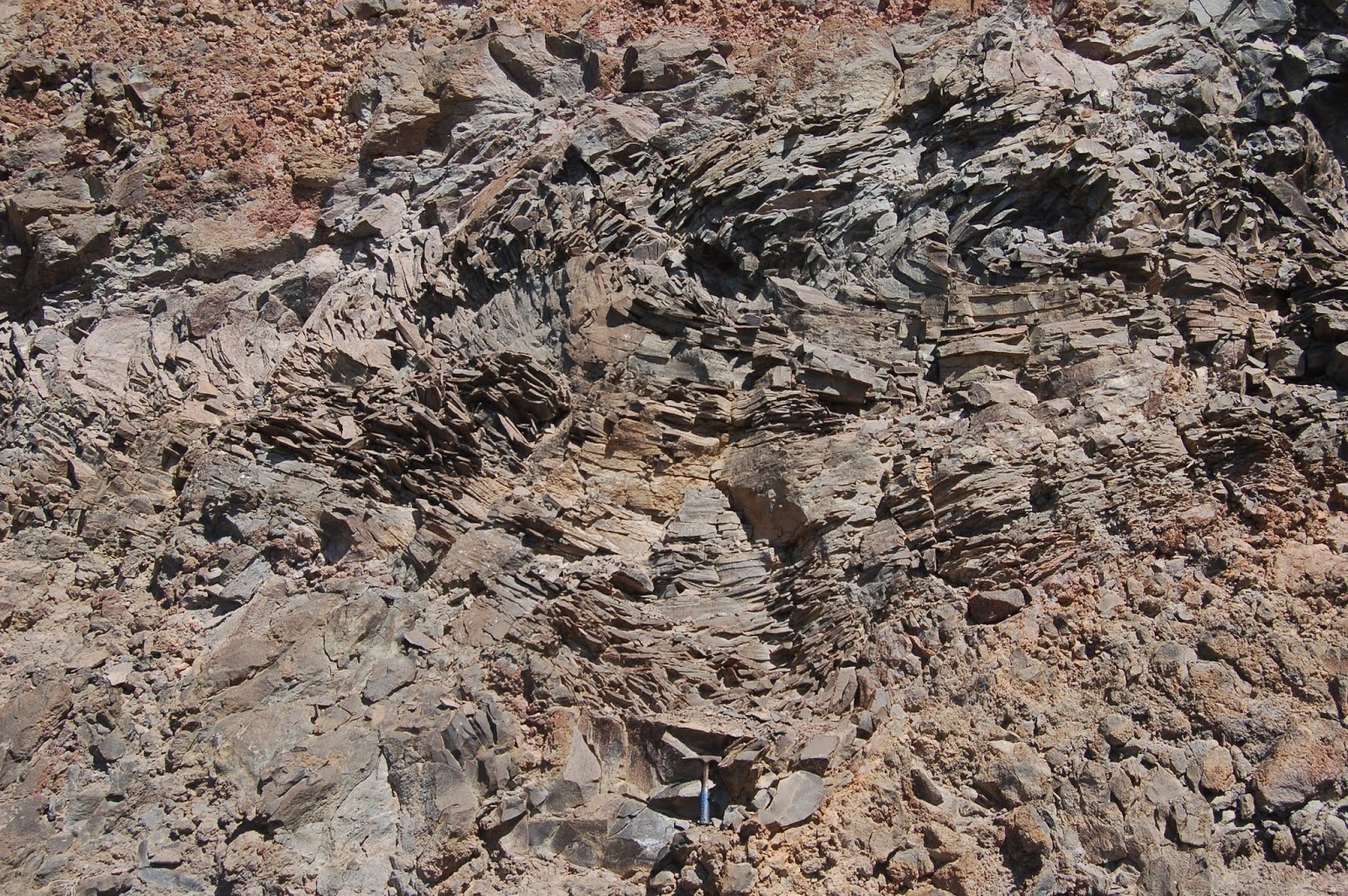
Partway up the grade, there's a good pullout on the left (east, against the cliff face- location). At that spot, there's some terrific platy jointing, with dendrites all over the plates, and vesicular basalt. (There's a hammer for scale at the bottom of the first photo.)
I certainly don't need any more vesicular basalt, but I've never seen platy jointing like this elsewhere, so I added three or four more examples (I have a few from previous trips).

I think I'll wind it up here, for now. As a cliffhanger of sorts, I'll point out that we're only 15 minutes or so from crossing the OR-NV border at this location.

Saturday, December 29, 2018

What a Trip! 2018 Edition (Part One)

I did two geology trips in 2018. The first was with a couple of non-geology friends, in mid-June, up to Quartzville. They had a great time, but I kinda feel as if I've beaten Quartzville to death, and I didn't take any photos (though I did, of course, come home with more rocks), so rather than belaboring it beyond saying we basically followed this guide, that's all I have to say about that.

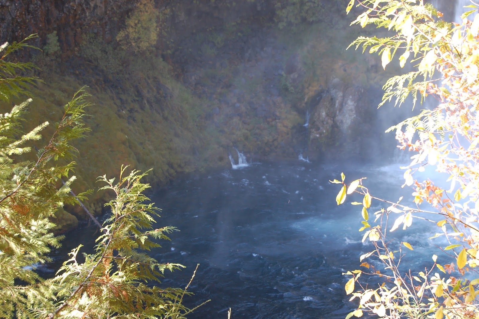
On the second trip, from September 4 through 9, we hightailed across the Cascades at Willamette Pass (Route 58, from roughly Eugene to Crescent), and made a quick stop at Salt Creek Falls. That waterfall is the second tallest in Oregon, after Multnomah Falls.
I also pointed out the glacial striations on the columnar basalt near the top of the falls.
These two photos weren't from this trip, but from August 8, 2011. The memory chip in my camera was nervously close to full, and the card reader in my laptop stopped working, so I had no way to make more space on it (as far as I knew at the time). As a result, I was more miserly about photos than I might normally have been.

Our first real excursion, after coming down the east side, taking the Crescent Cutoff from Rte 58 to Crescent, then north on Rte 97 to La Pine, then southeast on Rte 31 to Fort Rock Road, and east to Christmas Valley, was at Crack in the Ground. Location here, cross hairs over the parking area.
As you can see in this shot, there's a decent path, with a lot of ups and downs over piles of breakdown. Here, I'm at the top of a "hill." looking down into a "valley" with Hollie and Gary. Crack in the Ground is a weird feature, and unique as far as I know. When I was an undergrad, it was thought that asymmetric subsidence associated with the emptying of the magma chamber that fed the Four Cones Volcanic Field had localized flexure at this location, essentially "hinging" along this line, with the east side down, and the west side remaining at its former elevation. Evidence has popped up (I don't have the source available at this moment) that there is a pre-existing fault under the younger lava flows, so that fault may have provided a weak area that helped localize the flexure more narrowly to this location. The total length of the walk, from the car to the crack, through the most popular segment, and back to the car again, is probably about a mile and a half. The crack totals about six miles long, but much of it is prohibitively rugged for me, with enormous piles of large boulders tumbled one atop the other. This segment, though it has a lot of up-and-down clambering, is pretty easy.
The crack has its own microclimate, cooler and moister than the surrounding arid scrub. I was quite started the first time I encountered stinging nettle there (and a little bit itchy and sore), but I've learned to expect and point it out to others. Also, being cooler, and largely shaded, it can hold winter snow quite a way into summer. There are stories of pre-refrigeration locals coming out here to have ice cream parties into July- a month that would make ice cream an especially welcome treat for a sweltering summer.
Looking up to a juniper on the rim.
And back out again! Looking north from the south end of the easy segment of the crack.
We walked back to the car along the west side of the crack. Looking northeast, you can see that this surface is higher than the ground over there. What you *can't* see is that there's a ~60 foot drop just past that line of sage in the foreground.

From Crack in the Ground, we drove back to Christmas Valley, then followed the Christmas Valley Highway east to Rte 395, where we turned south. Just before that road descends toward Abert Rim, there's a well-maintained gravel road, "The Hogback," that trends southeast into the Warner Valley and the foot of Hart Mountain. As we approached the tiny little town of Plush, we turned north to the BLM Sunstone area, where we spent the night, awed by the utterly perfect skies for star watching.

I've just decided to do this as a series. Given the progress today, I'm doubtful I'm going to get the whole trip written up before Interzone closes on New Year's Eve. Better to publish in dribs and drabs than to having almost nothing for 2018. It'll get finished when it gets finished, but having it incomplete will perhaps motivate me to get it done a bit sooner.

Friday, October 19, 2018

Upper McKenzie River/McKenzie Pass Guide

I promised a friend I would write up a self-guided tour of the area described in the title before this weekend, and if I'm going to get it done, it needs to be now. I don't have mileages, but I can post links that have lat/lon details embedded, and satellite imagery. Oh, and photos, of course. Oh, and links to old posts (maybe).

Before starting: Advice
  • Gas up before you leave Sweet Home (probably cheapest here or out at I-5). There's no gas for most of the trip until near the end.
  • Take food. There's a mom and pop burger joint at Clear Lake Resort, but it may be seasonal; I'm not certain it's open at this point.
  • Take layers and a windbreaker. It'll be a lot chillier at Pass levels, and it's often quite windy, so even if you don't need it, be ready to warm up.
  • I just checked: McKenzie Pass appears to still be open, which I expected, but for future reference, it's often closed at this point. It generally doesn't reopen until sometime in July.
Let's start with the Rte 34 crossing over I-5 as a beginning. Continue east through Lebanon, where 34 is rejoined by Rte 20, then on through Sweet Home. Stay on 20 until you come to McKenzie Junction. From I-5, I'm guessing this is a bit more than an hour, maybe 1:15 or thereabout. At the Junction with 126, there's a good pullout just after the turn. (Crosshairs on pullout here.) Walk back up the grade, west, along 20- there's a wide berm, and a great view of Three Fingered Jack.
Also, at this time of year, the vine maples are flaming red. Very evocative on the recent lava flow.
Speaking of lava flows, this is the first of many recent ones you'll see today. On the drive up from Sweet Home, you've been traveling through Western Cascades Volcanic rocks, which range in age from about 35 million to 5 million years old. Coming down this hill, you crossed from Western Cascades to High Cascades volcanics, which started about 5 million years ago, and continue to present. If I recall correctly, this flow is one of several from the Sand Mountain chain of cinder cones, at about 3000 years ago. More info here.

Head south on 126 to the Fish Lake parking area. Most of the year, this location is a meadow, but during late winter and spring melt and runoff, it fills with water and a native trout that resides in the creek most of the time occupies the lake. As it dries during the summer, they return to the creek. An interpretive sign describes their situation: apparently, they're reproductively isolated, and seem to be in the process of speciation- though that's my inference, and not explicitly stated on the sign.
Continue south, watching for signs to the Clear Lake Resort- it's a turn to the left, and always comes sooner than I expect.
A different lava flow than we saw at the junction blocked the McKenzie River about 3000 years ago. Most of the time, except for occasionally during peak melt-off, the lake is entirely spring fed, with no surface streams running into it. Nevertheless, the McKenzie River drains out of it, full-blown. There's a river's worth of springs under this lake! Also, you can see the trunks of trees drowned when they were inundated 3000 years ago!
Also, weird illusions... is this boat *in* the lake, or floating a few feet above it?
There are something like 18 lakes with the same name in Oregon, but to my mind, there's only one "Clear Lake." Note the drive in and out of the resort is south to north, so you passed the exit getting here, and you'll pass the entrance again once you leave. You have my permission to drive back through again. I mean, who could blame you? Continue south, and turn off (right) in a couple miles to Sahalie Falls.
According to the person who did her doctoral dissertation on the hydrology of this area, little or no water is added to the flow between here and Clear Lake, so this is a dramatic demonstration of just how much spring water flows into the lake.

Continue a few miles south to the Koosah Falls turn off, then drive in a ways to park. This is a frustratingly difficult waterfall to get a good view of, but there is a view area along the southern loop of the footpath.
You can also see the brink from a viewpoint there, but you can't really see the falls themselves. The really interesting thing is all the springs coming out of the walls in the lower gorge.
Continue south on 126 to the junction with McKenzie Highway, 242, and turn east (left). This looks like it's about 14 or 15 miles from Koosah Falls. Head east on 242 to Proxy falls, and park in the pullout on the left. There's a nice ~1 mile loop trail to Lower and upper Proxy Falls. The lower falls are quite spectacular.
The upper falls aren't as grand, but they *do* offer a nice analogy for all the weird water goings-on in this area: They originate as springs above the cliff, fall over it, and the plunge pool sinks right back into the ground. I don't think this "stream" even has a name; it's only a few hundred feet long. Incidentally, this lava flow is from Collier Cone, up near the North Sister, and at only 1600 years old, is the youngest lava flow you'll see today.
Continue the loop back to your vehicle, then continue driving east. You're heading up a glacial valley that was incised into the High Cascades during the last ice age, and the road switches back and forth to climb up the headwall of that valley's cirque. It gets... hairy. Take it slow and easy- the road's in good shape, it's just kinda scary. You can see why they don't maintain it for winter travel, though.

When you come out on top of the plateau, the road straightens out, the trees are much more sparse, and the views open up. This is from the edge of the first lava flow you encounter on the roadside after you're up on the plateau.
It may not look like anything special, but this young volcanic landscape is why there are so many springs: hundreds of inches of snow fall up here every winter. When that snow melts, all the water just runs into the ground, then re-emerges as springs along the Upper McKenzie River. The almost entirely spring-fed nature of that section is also why the water quality is so stunningly high. Continue east toward McKenzie Pass. There are several pull-outs on the right, with nice views of the Sisters.

Then comes McKenzie Pass and the Dee Wright Observatory. This spot is an Oregon Gem, but I'm always surprised how few know of it.
The lower story is enclosed, and each of the windows faces toward a particular volcano. The labels under the windows aren't easy to read in some cases. But the upper story is open, and has a compass rose point out many visible peaks. If you have time and interest the trail out onto the flow has quite a few informative signs.

This is more or less the end, but you have a couple of choices here. First, continue east to Sisters, then Head back to Corvallis over 20 and Santiam Pass- more scenic, but longer. Second, you can turn around and head back on 242 to 126, then follow 126 to Eugene/Springfield, then take I-5 back north to 34. Shorter and quicker, but less scenic. Hope this was fun! Below, geologists in their preferred habitat.

Tuesday, September 1, 2015

Well, Hello Again, and Quake Preparedness

I make no apologies. This summer has been brutally hot. I don't cope well with heat, and thinking is one of my most impaired abilities. But we had our first rain in 89 days over the weekend, and it's been somewhat cooler since Saturday. So time to get back on the blog.

One of the big stories over the summer, if you missed it, was from Kathryn Schulz in New Yorker Magazine, on the coming Great Cascadia Quake. One of the political blogs I follow had a post from earlier today, after catching the article a month later. Below is the email I've spent much of the afternoon composing, which I just sent the author.
_________________________________________________________________________________

You're more than a month behind on finding this, but no matter. I'm glad it's catching eyes outside the PNW, where I live, and the geological community, of which I am a part. Most of us felt the article was more or less accurate, but overwrought, sensationalist, and most of all, fatalistic. The fact is, running through some simple calculations, the estimated chance of dying in such an event is about 1 in 1000. The chance of injury is about 3 in 1000. So the vast majority of us will ride it out unscathed- in fact the numbers are dis-proportionally higher for the coast, and lower for those of us in the Willamette Valley, the latter being where most of Oregon's population lives, works, and goes to school.

Given that, I was disappointed, first, by Schultz' lack of discussion of basic preparation measures, most of which are cheap and easy, and could be largely addressed in an afternoon's shopping trip. Namely, water, food that doesn't require preparation other than a can-opener, pet supplies if applicable, radio, flashlight, batteries, first aid kit, and so on. These are non-disaster specific, and can be useful during any sort of disruption, of any duration. The problem here is that our utilities and other infrastructure are likely to be unusable for months after a great quake, with full recovery taking years to a decade or more, so I describe the situation as "being ready for a 2-4 week no-frills camp-out,with no warning." (Following that relatively short period, presuming we don't have another GWB as president, emergency response will take off a lot of the self-reliance pressure) Put like that, it's easy to imaging how to prepare. But seeing it as "Everything west of I-5 will be toast," well, Christ, how do you prepare for that!? As I indicated above, fatalism is perhaps the biggest danger we face in this situation.

Second, there are a few structural measures that most homeowners in the region seem to be largely unaware of. The easiest is to firmly strap down the water heater. Assuming the house survives, this will assure a relatively large reservoir of potable water, one of the most important components of riding this beast out. Another, likely the most expensive, is to bolt wood-framed houses to the foundation, to make sure they don't fall off it. My understanding is that this is the most important measure, but it costs a few thousand dollars. However, given house prices, this is typically around 1 to 1 1/2 percent of their value, and while not a guarantee, most likely assures a house will ride out a quake and remain habitable. Which, not incidentally, would make the "camp-out" a lot easier to endure. I've also seen friends' posts about cross-bracing structural members in the attic and walls, which is supposed to dampen the oscillations. However, I'm a geologist, not a carpenter or engineer, so I don't really know. Securing large objects (e.g. book cases, refrigerators and so on) to walls can prevent injuries inside, as otherwise, they're likely to fall over.

Third, Schultz' portrayal of States' and smaller government agencies' preparation and response plans is terribly lopsided. The magnitude of expenditures needed is certainly in the hundreds of billion dollars range, and may reach trillions. There simply no way to retrofit all the things that need it in less than decades- which we likely have before the next great quake. However, slowly but surely, it is happening. I spend most of my waking life just off the Oregon State University Campus, and at any given time, there are one or two buildings closed for a couple of years for seismic refits. All new construction (and there is a lot of it right now) is required to meet strict seismic codes. K-12 schools across the state are a high priority, but again, costs make that slow. Nevertheless, that too is happening, though you'd never know it from the article. Public facilities such as hospitals, police and fire stations, and government offices, at least here in Benton County, have been retrofitted to be occupiable- that is, usable- following a quake, so they can serve as shelters, organization and command centers, aid stations, and so on. (An easier seismic target is "survivable," which means the building is unlikely to collapse or otherwise kill/injure occupants, but is less likely to be safely used or occupied afterwards. This is often the target for education infrastructure.)

The last parenthetical reminds me of a common joke among geology-types: "Earthquakes don't kill people. Buildings kill people." The upshot is, we can fix the buildings so they don't, or are much less likely to.

So the short version is that Schultz' piece is accurate, except in terms of omission. She left out an awful lot of important information which, instead of panicking PNW residents, could have spurred thoughtful reflection on their part of what they could do now to be better prepared in the aftermath. Initially, I was quite irritated by the article, but over the last month or so, I've seen a ramp-up in awareness and people asking questions, in a way I haven't since the Tohoku quake in March of 2011. In addition, I understand she has written a follow-up article in the same magazine, where she does cover much of the above discussion. I haven't read that one yet, but I'm looking forward to it. I was quite upset by Willamette Valley folks asking about life rafts and jackets to survive the coming tsunami. (Here, we're at about 240 feet elevation. Even in Portland, where there's still tidal influence in the rivers, very little effect is expected from the tsunami. Shaking, is, of course, a very different matter.)

Thanks for slogging through my verbosity, but this is a set of information I've been wildly pushing to get out since the article was published. Please feel free to pass along any portion or all of this letter, as you choose. I didn't see any way to leave a comment, especially one of this length, so chose to e-mail instead.

Best wishes,

Lockwood DeWitt

Friday, January 9, 2015

Geo 1095: January 9, Day 739: North Falls Descent

The trail down to North Falls heads from the parking area a good ways to the west, then switches back to east and under the ledge we see in the photo. Judging from the height above the cove at this vantage point, I'm guessing I took this shot on the westward leg. According to this site, North Falls has a drop of 136 feet, which is not particularly high for a PNW waterfall. However, as that site notes, it's a very dramatic waterfall, and as we'll see soon, there's some very neat geology exposed in the cove.

Photo unmodified. August 30, 2012. FlashEarth Location (approximate).

Sunday, May 11, 2014

Geo 730: May 11, Day 497: Erratic Orientation III

A final "landmark photo" to help find this out-of-the-way and easy to miss wayside. My camera's flash went off, so the sign is much brighter than it would look in natural lighting. It's readily apparent coming from the east (we're looking west here, from the east), but you can see the road takes a turn to the right just beyond the hedge. If you're coming from the west, you've just made that turn, and the sign is easy to miss. I don't get to this spot very often, maybe four or five times in the 34 years I've been in Oregon, and every single time, I've interpreted this dang sign as saying "it's just around the corner here." It isn't. The sign is at the base of the path up to Erratic Rock, and you can see that path just beyond the post. The parking area starts to the left of the power line and pole on the opposite side of the road, and it's pretty long- I'd imagine there's plenty of room for four or five vehicles, at least, to pull off the road. The garage beyond the power pole is also pretty distinctive, and may be a useful landmark to watch for if you're coming from the west. For GPS users, lat = 45.137574, lon = -123.290817.

Photo unmodified. July 10, 2012. FlashEarth location.

Saturday, May 10, 2014

Geo 730: May 10, Day 496: Erratic Orientation II

There's a wide strip on the south side of Oldsville road, where you can get out of the road and park- but it's not very obvious as you sail by at forty miles an hour. The orange sign (which looks brown in this view), at the end of the walkway above, is generally visible as you go by from the east, but it looks as if it's telling you to go around the corner in the road (which is not apparent in this view). It's not: it's pointing up the path. If you're coming from the west, on the other hand, you've just come around that corner, and it's easy to miss the sign. Another landmark to look for is that garage, mostly hidden behind foliage in this view. As I said yesterday, this is an easy spot to miss, so I'm spending a few days showing and describing landmarks to make it easier to find.

Photo unmodified. July 10, 2012. FlashEarth location.

Friday, May 9, 2014

Geo 730: May 9, Day 495: Erratic Orientation I

This may be overkill and belaboring a point, but as I said when I started this series, Erratic Rock Wayside is easy to miss. It's out of the way to begin with, and it's frustrating to realize you've driven by it yet again. So I'm going to spend the next three days pointing out some landmarks that should make it easier to spot visually instead of sailing past it (Though hopefully, with the advent of GPS, it's less of an issue these days). Today, we're pretty high up on the shoulder of the hill, looking roughly south, over Route 18 farther away, and Oldsville Road maybe a hundred yards closer. There is no direct connection from 18 to the wayside; you have to turn off onto Oldsville Road two or three miles to either the east or west, then follow the latter to the parking area at the base of the hill.

Photo unmodified. July 10, 2012. FlashEarth location.

Thursday, May 8, 2014

Geo 730: May 8, Day 494: Christmas Trees and Wine

I think we'd started back down the hill from Erratic Rock at this point, and were looking more or less northeast. The trees just past the fence in the foreground are likely part of a Christmas tree plantation- a very common crop in the Willamette Valley, and a major source of Oregon's export income. The hillside in the middle distance looks likely to be another vineyard. Both of these crops owe some of their productivity to the rich silt deposits of the Missoula floods. Finally, in the right distance, the Western Cascade foothills are barely visible through the haze.

Photo unmodified. July 10, 2012. FlashEarth location.

Wednesday, May 7, 2014

Geo 730: May 7, Day 493: Erratic Rocking Out

A fellow looking for a geocache in the area offered to take a photo of Dana and me standing on the rock. Not only is it nice to have a photo of the two of us, but this is the best of all the pictures I have to give a sense of scale for Erratic Rock.

Photo unmodified. July 10, 2012. FlashEarth location.

Tuesday, May 6, 2014

Geo 730: May 6, Day 492: Not a Stupid Question

I was once asked by a student if there was any danger that the Missoula Floods might occur again... a reasonable question from the standpoint of a student initially trying to grasp the scale and destructive power of these events. From my perspective though, I had not even considered the possibility, because the floods clearly depended on a set of conditions that no longer exist. So it took me a moment to find an answer, and to frame it in such a way as to not sound dismissive. I responded, "None whatsoever. The floods were caused by the breach of a glacial dam, and that glacier and the ones associated with it no longer exist."

Despite the ease of dismissing the potential hazard, it's not the least bit foolish, as one thinks about the potential devastation if there was a recurrence, to be concerned. Had I been standing (or more likely, on a boat) at this same location, looking in the same direction as above, at the time of the flood that deposited these erratics, there would have been no land in the scene before the ridge on the horizon. Everything else we see in this photo would have been submerged in nearly freezing, turbid, and turbulent water. Much better to raise the question of a possible risk, and finding it easily dismissed, than to ignore a potential risk and discovering too late that it's all too real.

Photo unmodified. July 10, 2012. FlashEarth location.

Monday, May 5, 2014

Geo 730: May 5, Day 491: Erratic Vineyard

Actually, there's nothing erratic about this vineyard at all; it has been here for years. Not as long as the erratic rock behind me in this view, but nevertheless...

Photo unmodified. July 10, 2012. FlashEarth location.

Sunday, May 4, 2014

Geo 730: May 4, Day 490: Erratic Erratic

I think at some point, probably late fifties and sixties, this spot was more heavily visited and, if not better known, known with more intense interest. This was likely because the idea of Harlan Bretz, that enormous floods had scoured the Pacific Northwest, had recently been accepted, and seemed so ridiculously outlandish. As such, it seems samples of Erratic Rock were taken as souvenirs. The rock is, frankly, not all that interesting, just a dark, slightly metamorphosed mud/siltstone. Yet the story it tells is gripping. Unfortunately, in taking a souvenir of the story, tourists have diminished the actual storyteller, by roughly 50%, and scattered miscellaneous chunks around the hilltop. Please do not take samples here.

I'm in the midst of a minor crisis- not a big deal, and nothing to worry about  in the grand scheme- and busy dealing with it, so no funnies today.

Photo unmodified. July 10, 2012. FlashEarth location.

Saturday, May 3, 2014

Geo 730: May 3, Day 489: Stranded on the Hilltop

Coming around from the east to north side of Erratic Rock Wayside, we're looking into yesterday's "boat prow." On the rock farther back, the line of sight is  from just above the plane of foliation and cleavage, so we're looking almost parallel to, but a little bit down on, that plane. In the closer block, we're looking down onto that same plane. As pointed out by Callan Bently in a comment on yesterday's post, this is almost certainly Belt Supergroup argillite. Also, as in yesterday's post, wine grapes are visible on the right in the mid-distance.

Photo unmodified. July 10, 2012. FlashEarth location.

Friday, May 2, 2014

Geo 730: May 2, Day 488: Argillite Prow

Resembling the prow of a grounded boat, these blocks of argillite were probably once all one larger boulder. Through processes both natural (weathering and frost wedging, for example) and human, they've been split into a number of smaller slabs. This is somewhat metamorphosed, I think; it's more indurated than shale by a long shot, but the foliation and cleavage is not as well developed as I would expect in slate.

In the mid-distance on the left, you can see the wine grapes foreshadowed in Wednesday's post.

Photo unmodified. July 10, 2012. FlashEarth location.

Thursday, May 1, 2014

Geo 730: May 1, Day 487: The Accidental Tourist

Though this was not a particularly demanding day, slogging a half mile or more through sand to the Tsunami Dock (See March 28 through April 8 of this series) took its toll, and the moderate climb up the hill- maybe 150 feet of elevation gain- seemed interminable. It was nice to come around the corner and finally spot the goal of that effort. The fence post on the far right is about four feet high, and the wooden post in the middle left maybe two feet; this is a big hunk of rock to travel some 500 miles.

Photo unmodified. July 10, 2012. FlashEarth location.

Wednesday, April 30, 2014

Geo 730: April 30, Day 486: Wine Sign

This is actually the text below the map in yesterday's photo, and it's particularly appropriate, given the view from the top of the hill. It's also a little misleading. In addition, wine grapes are grown locally on laterites developed from basalts in the area (which includes Columbia River Basalt, and I think also Siletz River Volcanics, though I'm not positive about the second), and in soils developed from Eocene sandstones and siltstones, equivalent to the Tyee Formation. Farther south, west of Roseburg, there are a growing number of vinyards growing in soils developed from the Lookingglass Formation (pre-Tyee sediments derived from erosion in the Klamath Mountains). So it's not incorrect, but neither does it paint a very complete picture. As I said in Monday's post, take these sorts of signs with a grain of salt.

Photo unmodified. July 10, 2012. FlashEarth location.

Tuesday, April 29, 2014

Geo 730: April 29, Day 485: Sign of a Map

Another one of the interpretive signs at the beginning of the trail up to Erratic Rock, showing the general layout of the great floods that scoured the Pacific Northwest toward the end of the last glacial maximum. Judging from pages 16 and 17 of "Origin, Extent, and Thickness of Quaternary Geologic Units in the Willamette Valley, Oregon" (USGS Professional Paper 1620, PDF), in the Corvallis area the Missoula silts are about 4-5 meters in thickness, but thicken rapidly northward/downstream along the Willamette main stem. This site is well north of my home, but I suspect that up on the hill, where the erratic rests, the thickness is much less than here on the valley floor.

Photo unmodified. July 10, 2012. FlashEarth location.

Friday, April 4, 2014

Geo 730: April 4, Day 459: Attachment Scars I

A variety of organisms colonized the concrete exterior of the dock while it rested in its home harbor in Japan. Many, if not most, of them survived their ride across the Pacific Ocean, a duration of about 15 months. This was unexpected. When the dock grounded at Agate Beach, it was heavily coated with these creatures. They were removed with a combination of scraping and pressurized steam. As I mentioned Sunday, my suspicion is that if they were truly aggressive invasive species, this effort may have been too little, too late. On the other hand, killing and removing them as quickly as possible does decrease the likelihood that a reproducing, expanding population can be established. So I'm not criticizing the effort, just pointing out that it guarantees nothing. Plus, I should state clearly, I'm not really any kind of authority on biology, let alone the niceties of invasive species from Japan that might become established in PNW coastal waters.

The only ones of these scars that I think I recognize with any confidence are the tubeworms. There are several good examples, lower left corner, a bit farther in from the upper left corner, and a third in the upper center.

Photo unmodified. July 10, 2012. FlashEarth location (approximate).

Monday, November 4, 2013

Geo 365: Nov. 4, Day 308: Darlingtonia Twofer

Since I mentioned the Darlingtonia flowers, I felt compelled to show a couple views of them- though I think this is a pair of views of the same one. The above shows the color, and how shy they are about showing themselves.
This one is a view looking directly upward, and I like it not so much for the flower, as for the way it shows the translucent "skylights" in the adjacent insectivorous leaf. Insects are attracted by odor and nectar to the portal on the bottom of the hood. When they go to fly away, they mistake the translucent spots as "sky", and become disoriented and exhausted bouncing off the ceiling. The throat of the column is covered with downward-pointing hairs that ultimately direct the victim into a pool of digestive enzymes and bacteria commensal with the plant, where it is digested.

Frankly, for flower photos, you're better off with Dana's post, and the importance of the geological setting was discussed on February 7th.

Photo unmodified. May 7, 2013. FlashEarth location.