Apologies for the two-week hiatus. If you follow me on Twitter, you know we had about five days over that interval that were hot enough to knock me down and out- hot weather destroys my appetite, so poor nutrition was likely a factor too. I finished the Upper McKenzie stretch of the Geo series, and I just lost motivation- coinciding with the first of the hot days. Then my co-presenter for the Oregon Master Naturalist Willamette Valley Geology workshop had to cancel, so instead of planning half of that day, I'm planning all of it. And I got called for jury duty tomorrow (Update: Yay!). And on and on. I make no promises either way on the continuation of the Geo series, though I have hatched an idea that could allow for a quick catch-up with minimal work. On the "maybe not" side, Dana is also suffering from a series of set-backs (pitch in if you can), I haven't been out in the field since October, and I don't have a whole lot more trips to choose from in terms of photo series.
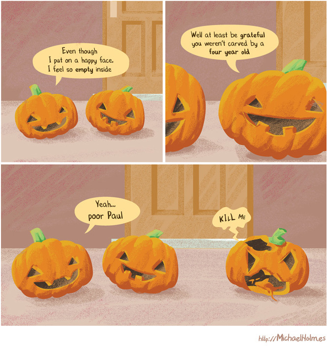
And yes, I am still tagging stuff for Sunday Funnies. Both the last two Sundays have been beastly, and finishing this up today means I won't have time this Sunday either. But never fear, they'll be back. Sigh... okay, here's a good one:
On the flip side, I did do a scouting trip for next Saturday's field trip (too busy taking notes to take photos, though) so here's the result. For those doing this trip on their own, it would likely be easiest to reverse stops 1 and 2, starting in the parking area, then going two to three tenth miles back to the Tyee soil, then subtract 4.9 miles from the mileage at each subsequent stop. (In other words, no need to start at OSU, just start at Chip Ross Park.)
Marys
Peak Field Trip Route and Stops
Players in the
story, oldest to youngest:
·
Siletz
River Volcanics- sea-floor and Hawiian-island type basalt, about 60 to 50
million years old (Ma = "mega-annum," or million years.)
·
Kings
Valley Siltstone- formed from erosion and marine redeposition from one or more
islands of SRV. Toward the end of same span as SRV.
·
Tyee
Formation- Turbidites, vast underwater "sand and dust storms" that
settled out in distinctive sand->mustone couplets, from erosion of granite
to the east, in or near the Idaho Batholith. About 48 to 38 Ma.
·
Corvallis
Fault- A fracture in the earth's crust creating the boundary between the
Willamette Valley floor and Coast Range foothills in the Corvallis area. Probably
active around 35 Ma for a few million years, but does not appear to have been active since the following intrusive activity.
·
Marys
Peak sill (along with numerous similar intrusions of about the same age and
composition in central Coast Range)- Gabbro, similar in composition to basalt,
but slower cooling, so larger mineral grain size. Quite resisitant to
weathering and erosion. 30 Ma.
We will be
walking along the roadside at several stops. Be alert for traffic, and make
safety your first priority.
Mileage
Location/Stop Number/Feature
0.0 Depart
Richardson Hall. Zero odometer as you turn onto 30th Street northward.
-At intersection
with Harrison Blvd., turn right, and jog over a block to 29th.
-At 29th, turn
left and continue north to Walnut Blvd.
-At Walnut, turn
right, and continue east to Highland Dr.
-At Highland,
turn left and wind up the hill to the ridge crest.
-Just before
Highland descends into Crescent Valley, turn left on Lester Avenue. There's a
small brown sign pointing to Chip Ross Park on the right (Correction: left- this is an unusual case where I really did recall right, rather than making a sloppy mistake) berm.
-We didn't get
accurate mileages until noted, so the first two stop mileages are estimates
from Google Maps
4.6 Stop 1
Lester Ave. Roadcut. Soil developed from Tyee Formation- note light yellow
color. The Corvallis Fault cuts across the lower saddle between here and the
Chip Ross parking area. As we move from stop 1 to stop 2, look for nice views
to the southwest of Marys Peak and Alsea Pass, where this same fault cuts
across the Coast Range crest.
4.9 Stop 2
Chip Ross Park Parking lot. Soil developed from Siletz River Volcanics-
Note dark red color. Why are we going up Marys Peak to look at the geology of
the "Willamette Valley?"
-Return to
Highland, and turn right.
-At Walnut, turn
right.
-Follow Walnut
roughly 5.5 miles to Philomath Boulevard. The line of hills to the north and
west of this drive is more resistant Siletz River Volcanics, uplifted by offset
along the Corvallis Fault. The less resistant Tyee (and overlying Spencer)
Formation form, at most, low hills to the south and east.
11.8 -(At this intersection,
we figured out how to get tenth-mile accuracy on our exploratory vehicle.) At
Philomath Boulevard, turn right and procede through Philomath.
15.6 - Route
20/34 split. Turn left, and follow route 34 to Alsea Pass.
24.5- Marys Peak
Road- turn right, and drive to the Marys Peak Summit Parking area.
34.0- Stop 3
Marys Peak Summit Parking area. Lunch. Depending on interest, some of the group
may choose to hike to the summit. (We budgeted about an hour here.) This, to
me, is one of the most profound viewpoints in Oregon. There are quite a number
that are more scenic, but I can think of few that have such a mental wallop.
We're standing on the Coast Range crest, the divide of the Cascadia forearc
ridge. To the east, if we have decent visibility, a few to many of the Cascade
Peaks are visible. Normally, Mount Jefferson and Three Sisters can be seen, and
Mount Hood can be picked out more often than not. On rare days with near
perfect conditions, one can see from Mount Rainier in the north to the vicinity
of Crater Lake to the south. To the west, the Pacific Ocean can be seen, taking
on different appearances as the light changes through the day. With help from
trigonometry, you can calculate that the distance to the horizon is about 75
miles, which is close to where the Juan de Fuca Plate begins its long slide
into the earth's interior. It's that slide that has created the forearc ridge
of the Coast Range, the more-or-less vertically stationary forearc basin of the
Willamette Valley, and water "sweating" off the subduction slab
causes melting in the upper mantle, creating the magma that produces volcanism
in the Cascades. My favorite metaphor to describe what we're seeing is that
here, we have an overview of one piston in the engine that drives earth's plate
tectonic activity!
Before
departing, be sure to make use of the sanitary facilities at the south end of
the parking lot. There will be no further opportunities for actual restrooms
until we return to Richardson Hall.
35.1 Stop 4
(Possible, depending on how time looks) This meadow provides a long parade of
wildflowers from mid-spring into mid-summer, but in terms of rocks, a short
walk up the road to the closest cut will reveal a metamorphic rock called
hornfels, created when heat from the underlying Marys Peak Sill baked the
overlying Tyee formation. This is similar in nature and effect to what happens
when you fire a raw clay pot in a kiln; it becomes harder, stronger, and more
dense.
36.7 Stop 5
Parker Creek Falls. This is the dense, tough, and extremely resistant to
weathering and erosion Mary's Peak Sill, a rock called gabbro, and a good
illustration of how Marys Peak sits about a thousand feet higher than any other
Coast Range mountain. Note that most of the weathered, and lichen/algae coated
cut face looks like basalt. But if you look carefully, a more recently broken
surface will show a typical "salt-and-pepper" appearance. Those light
and dark grains are the minerals making up the rock. Individual mineral grains
are not visible to the naked eye in "typical" basalt. (There are
exceptions beyond the scope of this workshop.)
37.1 Stop 6
We'll pull off a bit up the road from the outcrop, as there isn't safe space at
the spot itself, and walk down the road to a nice outcrop of
horizontally-bedded Tyee Formation. Note the abundant mica flakes and fragments
of plant material- these two features can help distinguish this rock unit from
others. A bit farther on, there is a fairly chaotic outcrop of Kings Valley
Siltstone, which is derived from erosion of Siletz River Volcanics. As we saw
at Chip Ross Park, the color difference between these two units is striking.
Given that the Tyee is horizontal, there must be a fault between these two
exposures, even though we can't see it. Walking across the road to the guard
rail, we see another effect of the hidden fault: a fairly large landslide. The
fault created a zone where the rock was broken up, and water and air had better
access to the rock, speeding weathering and further weakening it.
39.9 Stop 7
Parking lot. Park here and walk back about a quarter mile or so to a quarry
exposing spectacular pillow basalts of the Siletz River Volcanics. Keep in
mind, these were erupted on the ocean floor. Here, they've been uplifted to
thousands of feet above sea level.
40.5 Stop 8
(Possible, depending on how time looks) Columnar basalt is common in Oregon,
which is no surprise, given how much of the state is covered with that rock.
These are the best examples I know of on Marys Peak.
40.7 (In
passing; we'll try to slow down a bit to get a look, but we won't be stopping.)
Slickensides. The vertical scratches, or striations, you see on this wall were
created as a fault ground the two opposing surfaces. The orientation of the
"slicks" gives you two possible directions for fault offset: up or
down, parallel to the scratches. Continue back to Route 34, and turn left
(east) back toward Philomath and Corvallis.
45.1 Stop 9
We will not be crossing the road here. Both we and oncoming traffic have very
poor visibility. Tilted beds of the Tyee Formation. Unlike the flat-lying
beds of Tyee we saw near the top of the peak, these are steeply tilted. Now off
the Siletz River Volcanics, we've crossed the Corvallis Fault again, but it's
very close by, probably crossing through the clear cut up the valley.
Deformation and folding near major faults is common, and explains why these
beds are tipped over to such a degree.
58.3 Return to
Richardson Hall.
Postscript: The sequence
we've seen here, ocean floor volcanics, overlain by marine sediments, and
modified by later events, such as magma intrusions and faulting, varies in
details from place to place in the Willamette Valley and the Coast Range, but
as a general outline, is consistent across the region. In other words, if you
were to drill a hole on the Willamette Valley floor, you would go through a few
to a few hundred feet of Missoula Flood
and Willamette River sediment, then you'd hit marine sedimentary rock of one
formation name or another. (From the Albany-Salem area north to Portland, you'd also encounter Columbia River Basalt interfingered with the uppermost marine sedimentary rock.) Eventually you'd go through the Tyee, which is the
lowermost of those sedimentary units, and pretty much ubiquitous in the region.
Finally, you'd hit basalts of the Siletz River Volcanics. Those basalts are not
continuously exposed on the surface, so they have different names in different
areas (Roseburg Volcanics and Crescent Volcanics, for example), but they were
all formed the same way in a geologically short period of time, and they are
believed to be all the same unit, connected underground where we can't see it.
Climbing nearly four thousand feet off the valley floor has allowed us to see
rocks that lie thousands of feet below it. Furthermore, as we saw at the first
two stops, due the the milder climate of the lower elevations, rock that is
exposed in the valley is often too weathered to get much information from.
























































 Posts
Posts





