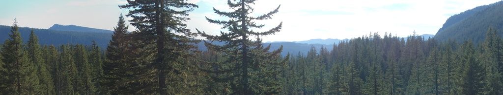
For years, I've wanted to get a shot that captures the glacial nature of the valley leading from the McKenzie River Valley up to McKenzie Pass. It's pretty obvious, as one travels through it, that you're in "U-shaped" valley, but there are so many trees, and the canopy is so dense, that you can't really show it in a single photo. You kind of gather it together from a steep wall here, a cliff there, and a general sense that you're traveling up a broad, flat valley floor. The
above panorama isn't the one I've been trying to get, but it's the closest I have. The situation is much more obvious in the crop of a
topo map (Linton Lake quad) below.
I'm pretty sure we found our pullout in the middle of the middle segment of the tight double switchback in the upper middle of the map, which is the headwall of a cirque at the upper end of this valley. The unusual feature to see in this map is how post-glacial lava flows have modified and hidden the glacial wall south of the road. In coming days, we'll see that there have been recent flows in the immediate area of these switchbacks as well.
Panorama stitched in HugIn. October 9, 2014.
FlashEarth location.


No comments:
Post a Comment