Sunday, March 31, 2013

Geo 365: March 31, Day 90: Lava Butte from Pilot Butte

Looking about south-southwest from Pilot Butte, Lava Butte sits near the middle on the horizon, and on the western flank of the Newberry Volcano shield. Lava Butte is quite similar to Pilot Butte in terms of size and form, but with a distinct summit crater, and definitely younger, based on what I see in weathering and colonization by plants. Also, the Lava Butte eruption ended with a basalt flow that extends 2.5 miles to the Deschutes River. I remarked on Thursday that I would guess Pilot Butte is probably Holocene, but according to the Wikipedia Link, Lava Butte is dated at ~7000 years. Given how fresh it looks, I'll step back from my comment on Pilot Butte's age; it's likely Pleistocene. Also like Pilot Butte, there's a paved road to the summit parking area, though access is limited and first-come, first-served. In the cropped, processed image below, the road to the summit is clearly visible, climbing from the middle of the cone to the upper right.
Main photo unmodified. August 20, 2011. FlashEarth Location. (In the chosen view/zoom, Lava Butte is the little dimple just left of where Route 97 leaves the image at the bottom.)

Saturday, March 30, 2013

Saturd80's: Suburban Lawns Edition

With only one album (and a couple singles), this is an obscure group, but nevertheless, a lot of fun. Flavor Crystals:

"Janitor" was their "big hit," so to speak. I really didn't "get" the chorus at the time, though I liked the verses. It turns out the chorus was a bit of an inside joke: from Wikipedia,
According to Smith, the two were conversing in a loud room when they first met:
She asked me what I did for a living. I said "I'm a janitor," and she thought I said "Oh my genitals." [Richard Whitney] overheard this and wrote the song.

(There's also a very fun live version here (with lyrics overprinted); I finally chose the above because I just love its retro look.)

Finally, this basically ties with Flavor Crystals- I love the lyrics (though repetitive, I find them hilarious)- as my favorite SL song: Mom and Dad and God.

Geo 365: March 30, Day 89: Hazy Horizon

Looking roughly northwest from Pilot Butte, on a hazy late summer day, near sunset. Near the center of the horizon, Mount Jefferson rises to a bit over 10,000 feet. A bit to its left is Black Butte. And barely visible halfway between Mount Jefferson and the right edge of the photo, Mount Hood pokes up (It's the pointy, low one, not the first rise right of Jefferson). I often complain about Oregon's haze in the mid to late summer, but a bit of perspective is in order. First, it's frustrating to me because I've seen the same views on good days: truly breath-taking. I just haven't been able to get back with my current camera. Second, let's look at the actual distances we're peering across: Black Butte is about 30 miles away, Jefferson about 50, and Hood, 93. So whining about "barely" being able to see 93 miles may be a bit of, well, whining. Below is a crop of the relevant section of horizon, run through Paint.net's auto-level routine:
On the other hand, take a look at a panorama from this same location, on a clear day with better light. (Wikipedia link) West toward the Three Sisters during our visit was looking directly into the sun, and futile. The lesson is that this may be a location better visited in the morning, at least for views of the Cascades.

Main photo unmodified. August 20, 2011. FlashEarth Location.

Friday, March 29, 2013

Geo 365: March 29, Day 88: Newberry From Pilot Butte

Looking more or less south from the top of Pilot Butte, the Newberry Volcano shield dominates the horizon. Some of the hundred-plus parasitic cones that cover that edifice can be seen on its flanks, through the foreground foliage.

Photo unmodified. August 20, 2011. FlashEarth Location.

Thursday, March 28, 2013

Geo 365: March 28, Day 87: Pilot Butte

Pilot Butte is a cinder cone smack in the town of Bend. I'm not finding information on its age, but simply judging from the lack of dissection, on one hand, but the moderately well-developed soils and full vegetational colonization on the other, would lead me to guess this is Holocene, but at least several thousand years old. [Note: See second thoughts and semi-correction here] While the photos with which I'll fill out the rest of the week were taken August 20, this was taken the next day on our return from Newberry Volcano National Monument. We're on "new" Route 97, heading north, here. "Old" (or Business) 97 was the route I was accustomed to taking through Bend as an undergrad. The new four-lane expressway was started in the late 80's I think, and completed sometime in the early 90's. There's nothing wrong with Bend, but my destinations are almost always on the other side of it, wherever I am. So it's always felt like an obstacle to get through or around, and I never really learned the layout of the town itself. But as we checked into the Budget Inn, something clicked, and I asked the clerk whether, if we drove up old 97 a ways, we could find Pilot Butte. I was awfully glad I did: it was a very pleasant- and unexpected- end to our day.

Photo unmodified. August 21, 2011. FlashEarth Location.

Wednesday, March 27, 2013

Geo 365: March 27, Day 86: Fire on the Motel

I had been planning on moving on from the obsidian in the motel facade today, but I realized I had a pair of photos from different angles that illustrate the "fire" quite nicely. It's only barely visible at the above scale, but if you click to enlarge, you can see the play of light is visible in the left ellipse, but not in the right. As a viewer moves, or slowly turns a loose cobble in their hands, you can see reddish-orange-gold flickers skimming through the rock's interior. "Fire mahogany," however useless it is as a geologic term- we'd just lump it all as obsidian- is a truly apt name for this rock.

Photo pair cropped and joined, otherwise not processed. August 20, 2011. FlashEarth Location.

Followup: I forgot to mention this when I first wrote it up, but it's important and interesting enough to add it on: Note the conchoidal fracture, originating from the edge on the lower right. That shell-like pattern persists across the whole exposed surface. Looking carefully, you should be able to see little streaks, like meteorites, perpendicular and radial to the conchoidal fracture, and if you look at the full-size version, you can indeed see little white blebs at the head of each, at the end of the streak toward the impact spot at the lower right. Those white blebs are phenocrysts- sanidine would be an educated guess- that disrupted the shock/fracture front as it propagated. So if you look over the entire exposed rock, you can see that the whole surface was created by one impact and one fracture.

Tuesday, March 26, 2013

Geo 365: March 26, Day 85: Obsidian Close-Up

A close up of one of the chunks of obsidian in yesterday's photo, the one near the doorknob on the right. It's not easy to see at this scale, but there's a bit of a glow to the red portion in that lower squiggle. Rock hounds have a slew of names for various colors and textures in what geologists would consider to be a single rock or mineral type. Plain red obsidian is called "mahogany," but examples like this, which preferentially reflect light at certain angles, are called "fire mahogany." Indeed, the dancing play of light can be quite reminiscent of flames in the right samples in the right conditions. It's quite lovely. I suspect the effect is due to an alignment of microscopic crystals- possibly hematite or magnetite- caused during viscous flow. It's fairly common, as I mentioned yesterday, at Glass Butte, about an hour east of Bend.

Photo unmodified. August 20, 2011. FlashEarth Location.

Monday, March 25, 2013

Geo 365: March 25, Day 84: A Pleasant Surprise at a Cheap Motel

Toddling from La Pine to Bend is a gorgeous drive with lots of volcanic features to admire, but the day was getting late, and having been shut out of lodging in La Pine, we wanted to get signed in as quickly as possible before setting out in search of dinner. The Budget Inn in Bend has horrible reviews, though I didn't think it was all *that* bad- lord knows, I've stayed in worse that were more expensive. However, my opinion may have been swayed slightly by the facade- the whole front of the building is studded with beautiful chunks of obsidian. I'm guessing this is likely from Glass Butte, about an hour east of town on Route 20. That dome has a tremendous variety of colors and textures, as seen above. However, short of geochemical testing, there's no real way to be certain.

Photo unmodified. August 20, 2011. FlashEarth Location.

Sunday, March 24, 2013

Sunday Funnies: Snow Day Edition

Were having a nice day here- a thin overcast, but the sun is warm. But from what I'm hearing out of the upper Midwest, people are getting tired of winter. Bits and Pieces
It's official: I got my BS in the Paleozoic. Tastefully Offensive
"When my professor asks if I read her latest publication on Greenschist Facies" Geology is Hard
 Blackadder
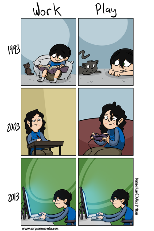
Corpse Run Comics
Sofa Pizza
"White House Petition of the Day" Wil Wheaton's Tumblr
Kicking Cones
Bits and Pieces
"When I do an outreach program all about volcanoes at an elementary school" Geology is Hard
Tree Lobsters
"When a bigwig visits my poster." What Should We Call Grad School
The Things That Were
The print is too fine on this one to post it here, so click over to Tom Tomorrow to see the whole thing- you can click the comic for full size snark.
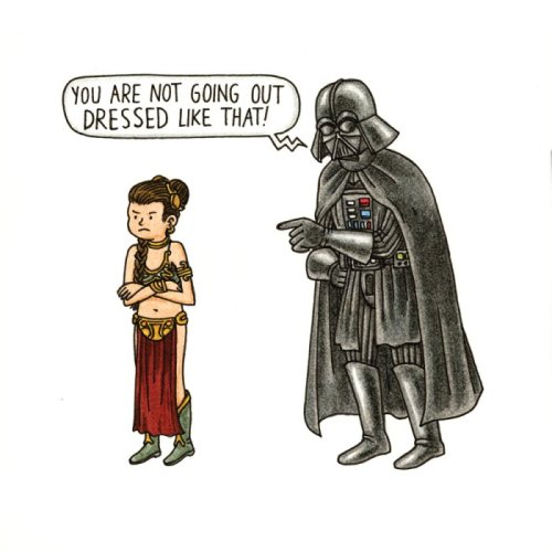
"Vader's Little Princess" Four more at Mezcla Mental, via Blackadder.
Tastefully Offensive
Funny to Me
Pygalgia
Blackadder
Funny to Me "...day ain't over yet."
Pygalgia

Savage Chickens
Sober in a Nightclub
Historic LOLs
Julia Segal
Sober in a Nightclub
Funny to Me
Bits and Pieces
Wil Wheaton's Tumblr
Funny to Me
Blackadder

Geo 365: March 24, Day 83: Deschutes Meander

A meander in the Deschutes River, near "The Big Tree" in La Pine State Park (which I wrote up here). We had been expecting to stay in La Pine, but the lodging options there were more limited than I'd recalled, and a hotel that was reasonably priced didn't have room for us, so we drove up to Bend. This was a very worthwhile stop on the way. While we basically thought the geologizing was over for the day, there were still a couple of surprises in store for us...

Photo unmodified. August 20, 2011. FlashEarth Location.

Saturday, March 23, 2013

Saturd80's: Stan Rogers Edition

A terrific song writer, with a magnificent voice, I don't think I've ever featured Stan Rogers here before. This first one, "Fisherman's Wharf," laments the loss of the traditional fishing life of Canada's Maritime region, and some thirty years later, still gives me goosebumps.
Rodgers died tragically young, at age 33, in a fire on board an airliner, which makes his musical accomplishment all that much more stunning. Despite his relative youth, his knowledge of- and respect for-  Canada's laboring class never ceases to move me. "Rawdon Hills" is his ode to gold mining.

And "The Field Behind the Plow" has given me a whole new perspective on farming... you can hear their struggle to get it all done, in their short 16-hour days.
"Watch the field behind the plow turn to straight, dark rows
Feel the trickle in your clothes, blow the dust cake from your nose
Hear the tractor's steady roar, Oh you can't stop now
There's a quarter section more or less to go "

I think the highest praise I can offer Stan is that I can't think of a single one of his songs that I don't at least like, and the vast majority of them, I feel even more positively about.

"Put another season's promise in the ground." You did, Stan, you did.

Geo 365: March 23, Day 82: Central Oregon Skyline

Coming into La Pine on Route 31, there's a nice long straight stretch with a lovely view of the central Oregon Cascades, over what I refer to as the East Cascade apron (not a formal term). From the left to right in the above photo, South Sister peeks over the shoulder of Mount Bachelor, and either North or Middle Sister sits to its right. (I think North, but I'm not sure.) Finally, off in the trees is Broken Top. Bachelor is significantly closer to the location of this photo, so it appears to be the largest and tallest of these peaks, despite the fact that it's the lowest and smallest. Nevertheless, it's still a significant volcano, at 9068 feet.

Photo run through the Auto Levels processor in Paint.net, to cut through the haze. August 20, 2011. FlashEarth Location (approximate, shot at 60 mph, and backed out enough to see the peaks I mentioned).

Friday, March 22, 2013

Geo 365: March 22, Day 81: Debris Apron and Ponderosas

Turning away from the Hole-in-the Ground crater, and looking off to approximately the northwest, the debris apron from the series of phreatic explosions that created the feature is subtle, perhaps, but still clear to me, at least. I can't really tell if the slope down and away from the crater is as clear as it seems in the photo, or if I'm simply imposing my own memories in interpreting what I'm seeing. What I will say is this: you can definitely tell you're heading uphill as you approach the turn-off and spur up to the rim, and once you turn onto that spur, there's a very distinct, though fairly gentle, grade up to the parking area. The road cutting across the bottom of the photo circles the crater, though I've never got up the courage to see if it's navigable for regular passenger vehicles.

As I alluded yesterday, I do find it a bit puzzling that the ponderosa pines do so well here, but simply can't get established in most of the crater. The only difference I can point to is elevation, but it seems odd that only a few hundred feet can lead to such a stark contrast.

Photo unmodified. August 20, 2011. FlashEarth Location.

Thursday, March 21, 2013

Geo 365: March 21, Day 80: The North Side

Looking to the north side of Hole-in-the-Ground. Comparing this to yesterday's photo, you can see how barren it is with respect to the ponderosa pines. Interestingly, there's enough elevation difference between that bowl and the tableland where I'm standing that there's a quite healthy ponderosa forest behind me  Also, note again the fault on the opposite wall, shown previously on Tuesday.

Photo unmodified. August 20, 2011. FlashEarth Location.

Wednesday, March 20, 2013

In Which Bif Scares the Living Crap Out of Me

Bif greets me at the door every night... and by that I mean every night. He's either at the door when I come in, or bounding at me as fast as his (not so little, any more) kitty paws can carry him. He immediately starts yowling in what I believe is both relief and scolding me for leaving him alone all day. He and I have a call-and-reply relationship: if either of us lets loose with a "Meow!" the other responds in turn.

So last night, I walked in the door and... no Bif. "Meow!?" Nada. "Meow!?" Nothing. Uh-oh. My heart froze. Then I thought I heard a muffled, piteous cry, but I wasn't really sure. "Is he trapped in the sofa?" I wondered. Walked over and gave a tentative call. No response. Lord. He's gone through a screen, and got out, or he's strangled himself. I was convinced I'd lost him.

As a reminder, he's spent a total of ten minutes of his life outdoors and I was keeping a pretty close eye on him, until a jay dive-bombed him, squawking loudly. He dove under a car, and I lost track of him. By the time I thought to look, he'd vanished. When I finally gave up looking, and went back to the apartment to get a book, planning to come back out and read while waiting for him to reappear, he was pawing madly at my door, trying to get back in.

You'd think that experience with the big, scary, outdoors was enough. You'd be wrong. It's still a game every morning to try to dodge through Lockwood's legs without being caught. He's succeeded quite a number of times, but he's almost always distracted by a new scent before he gets more than a few feet from the door. So he gets caught.

So I went out to the parking lot in back, and called. Nothing. Walked around the edges, calling. Nothing. Walked up to the front, steeling myself to walk the curb and finding his mangled body. Nothing. Called... and wait! There's that piteous howl again! Front door, and there he is, cowering on the basement landing (I'm on the midlevel). He shied away as I started down the stairs, but came bounding at me when he saw who it was. He has a habit of hugging when he's been frightened or feeling particularly affectionate, normally one of my arms. He's never wrapped his legs around my neck and hugged like he did last night. Once we got indoors, he didn't seem terribly traumatized, but he sure acted that way until we got him back into familiar territory.

So my guess is that, for the first time, he won his little game yesterday. And he increased the total of his time spent outdoors by a factor of 42, much to my dismay. You'd think that was enough. You'd be wrong. This morning he seemed especially excited to make a run for it.

He got a foot in his face- not kicked, but a very firm stop. Two things: a squirt bottle to keep by the door, and a harness and tether for extensive walks in the rain.

He's an eminently trainable cat, for a cat, and my heart can't take this game any more.

Geo 365: March 20, Day 79: The South Side

Looking south into Hole-in-the-Ground, I have always presumed that the sparse ponderosa pine forest was due to the effects of more shade, thus slower evapo-transpiration, on that north-facing slope. But while writing up Fort Rock a few days ago, I realized that the south-facing amphitheater there indicated prevailing winds from the south. I had known that for decades, but never made the connection to Hole-in-the-Ground. Another contributing factor to the ability of pines to colonize in that area may be that snow drifts deeper there. That is, it may not simply be an area of slower moisture loss, but it could be that it receives more moisture on average than the rest of the crater.

A comment I received yesterday links to an older post, shortly after we returned from this trip, by Cujo 359, AKA Intrepid Companion. I didn't think to get a series of photos suitable for stitching into a panorama, but he got a really nice one, showing the full extent of this feature in one image. In addition, he wrote up a really good compare-and-contrast between the above and Meteor (Barringer) Crater in Arizona. As he points out, the two are of similar size, share a surprisingly similar form, are of similar ages, but have very different origins.

Below is a cross-section of Hole-in-the-Ground, taken from USGS Circular 838, Road Log 6, Mile 25.1.
This is based on two drill holes, indicated on the left interior of the crater by I and II, in addition to a geophysical survey. Here, phreatic explosions blew out pre-existing bedrock, and a portion of the new magma, then the walls slumped in to create the pit. At Meteor Crater, there is no underling magmatic rock, and the layers of country rock blasted out by the impact are folded over- literally upside down- like blankets in a neatly made bed. Another thing I found interesting is that the layer of faulted basalt illustrated yesterday is marked as "Paulina Basalt Flow No. 2," indicating it came from Newberry Volcano, something like 40 miles away. I had no idea flows from there had made it that far in this direction.

Photo unmodified. August 20, 2011. FlashEarth Location.

Tuesday, March 19, 2013

Geo 365: March 19, Day 78: Hole-In-The-Ground

Dana admires Hole-in-the-Ground, a classic maar on the tableland to the west-northwest of Fort Rock. There's a foot path to the bottom from this point- you can see it to Dana's left. However, most geology people probably are aware of the problem of hikes that start downhill: the easy part is when you're fresh, the hard part comes when you're not. So I used to tromp down with kids, but didn't on this trip. (It's a serious slog, coming back up that slope, roughly 400-500 feet  (correction- closer to 200 meters or more, looking more carefully at the guide linked in the next paragraph, so maybe a bit less than) 700 feet vertical, and relentlessly steep.)

The reason I chose this photo as an introduction to Hole-in-the-Ground can be seen above that little tree past and to the left of the central playa, on the opposite wall. The offset in that layer of basalt marks a fault which bisects this crater, and it's thought that this was the weak feature that allowed the basaltic magma to migrate upwards at this spot. More detailed information on HIG can be found in USGS Circular 838, at mile 25.1 in this road log.

In one of those nice little bits of synchronicity, tweeted yesterday, "What is this little perfect round hole in Africa? Likely in Ethiopia near 7.99N, 37.19E. " I replied," Given location- not too far off axis of rift- & water, guessing maar. Funny, just looking at another: " And a few minutes later, I was able to pin it down in FlashEarth: " Yep, definitely looks like a maar- explosive interaction between magma and groundwater, steam blasts hole open." and " location, oriented ~same, scale ~same, as your photo Maar def.: " However, my comments got no reply, so I don't know if he saw them.

Photo unmodified. August 20, 2011. FlashEarth Location. (You can see the fault on the crater wall in that view, almost directly across from the center cross hairs.)

Monday, March 18, 2013

Geo 365: March 18, Day 77: Pluvial Delta?

Toward the west end of the Fort Rock basin, there's this odd, flat-topped, steep-sided, plateau-looking landform. It's a feature I'd been by many times before I even really noticed it, and I recall being a little puzzled when I did. It's off the road far enough that it's not really practical to get closer to look carefully- I don't doubt there's dirt roads that could get one closer, but there's too much else to see in the area to spend the time. But this is getting close to where Fort Rock Road intersects Route 31. Turning north from that intersection, 31 quickly heads up a large gorge. There's little water visible, but it makes sense that, at times, it carries substantial flow. This would have been even more true during the Pleistocene, when the basin we're in for this view was filled with water. The flat top of that feature appears to be roughly congruent with the high water stand in Fort Rock Valley, so my suspicion is that it represents a delta that developed into this pluvial lake during that time. Another possibility is that it's a fault scarp, but doesn't look right to me for that. For one thing, it's not as linear as I would expect; for another, the top surface looks too horizontal.

This is a situation where getting up close and personal would put an end to a lot of questions.

The FlashEarth view (which is approximate- as you can probably tell, this was taken on the fly) I've chosen for this shot is backed out more than normal, so you can see both the feature in question and what clearly is a fault scarp to the south. In addition, Fort Rock is in the upper right middle, and Hole-In-The-Ground, our next destination, is on the top edge to the left. Photo unmodified. August 20, 2011.