Due to logistics and, paraphrasing Robert Frost, a turn not taken, Dana, Intrepid Companion (IC) and I got off to a latish start on Monday and headed up Marys Peak. This wasn't actually our first stop, but it was the lowest stop stratigraphically. The first time I saw this outcrop would have been fall of 1980, and only after many returns did I find the feature here that is now most interesting to me.
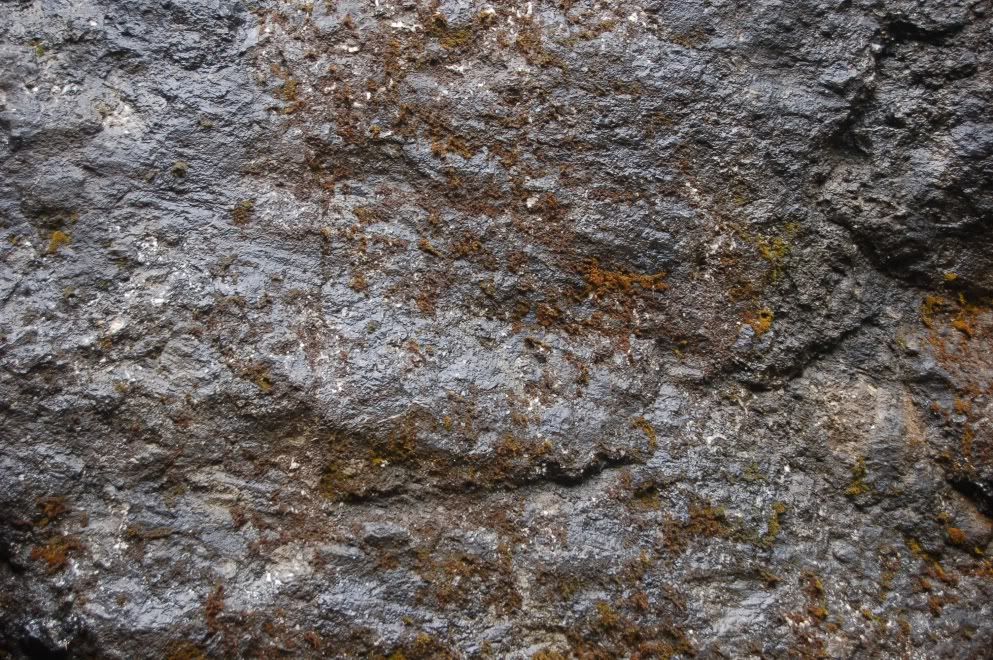
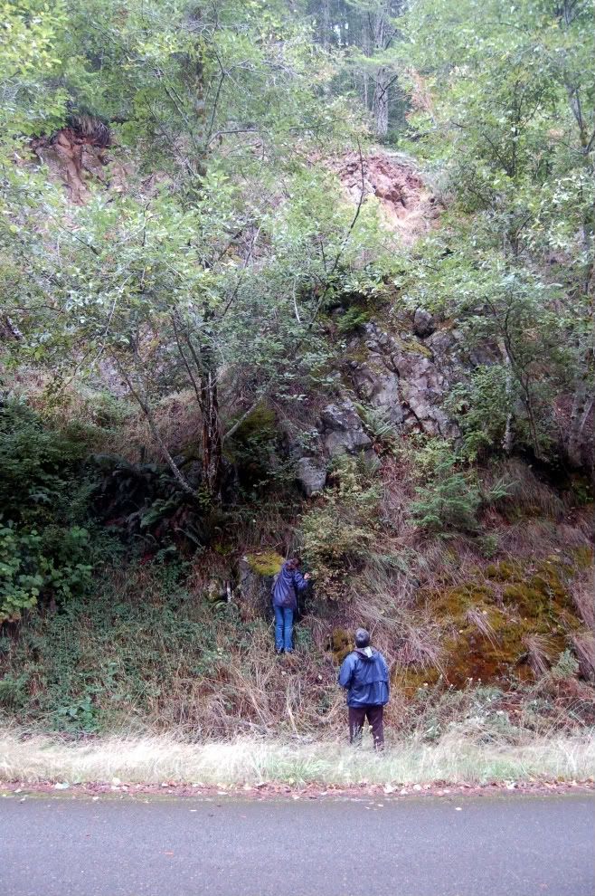
This block is fragmentary, glassy basalt, resulting from a submarine explosive eruption- gentle eruptions (effusive, in geo-speak) would produce pillows, which we'll see at a later stop. This is much more badly weathered than when I first saw it, but even fresh, the glassy basalt fragments, sideromelane, are generally covered in an orange-yellow-brown alteration product called palagonite- formed when the hot material reacts with water to form a mix of clays and oxides. I didn't get a good close-up of this, but I did get a couple of samples, so I'll shoot some pictures later and post them to give you a better sense of the texture. This rock type is called either hyaloclastite, or as I originally learned it, hyaloclastic breccia. Though it might not be immediately apparent from the above photo, both of the large flat surfaces on the exposure are slickensided- the corner where IC is standing is the intersection of two faults.
Here you can see the striations to the left of IC; they appear to be dipping at about 50-55 degrees.
And here, between IC and Dana's location in the first picture is the other slickensided face: you can see the striations are much closer to horizontal.
Though I didn't get any other photos of the overlying mass, you can see above that it has crude columnar joints. Dana is getting a closer look at the location of the next photo. Question: is that a flow or an intrusion? How would you tell?
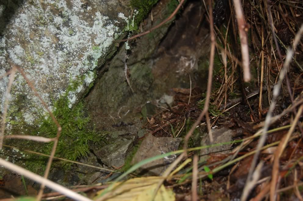
Answer: A flow would very likely have a basal breccia. As the flow advances, the top moves forward, rolls over the toe, and forms the base of the flow. It's exposed to air, cools, and solidifies; as it rolls over the toe and is over-ridden by the advancing flow, it breaks up into a breccia. The basal part of this mass (largely covered in lichen here) is not brecciated, so one can say with some (though not absolute) confidence that this is more likely an intrusion than a flow.
Look carefully at that last picture, at what underlies the base of the sill. That is a 2-3 inch layer of sediment. The sill's base is concordant with that sediment, so it is a sill, not a dike or other kind of intrusion. Though weathered now, the rock is probably best referred to as a hornfels- a non-foliated contact-metamorphosed sediment. The fact that this layer of sediment is tilted up also tells you that the whole outcrop has been folded to a dip of about 35 degrees.
To understand another reason why this little layer of mud is important, some background is needed. The coast range terrane, formally named "Siletzia" after the formation name of this basalt (Siletz River Volcanics), extends from southern Oregon, where the basalt is called the Roseburg Volcanics, up to the Olympic Mountains of NW Washington state, and southern Vancouver Island, where it's called the Crescent Formation. Oddly, it is older at the northern and southern ends, and youngest in the middle. The basement basalt of this block is thought to be the equivalent of a Hawaiian-style hot spot sitting atop an oceanic ridge- much like Iceland is today (though smaller in scale). A unit we visited later is called the Kings Valley Siltstone member of the Siletz River Volcanics- in other words, it's so restricted and so intimately associated with the SRV, that it doesn't merit a formation name of its own. It's considered part of- a "member" of- the SRV. That unit is derived from the erosion of basalt that erupted above the ocean, as part of a Hawaiian Island-like chain. The eroded basalt was then carried to the ocean and deposited as sediment. Later eruptions could dump more basalt on top of the sediment, and often did. In some places the resulting interfingering of basalt and sediment are quite spectacular.
I had probably visited this outcrop a half dozen times before, in trying to find the base of the sill to show someone there was no breccia, I realized this modest little layer of sediment was tucked in there. It's the earliest indicator I know of of the emergence of these now vanished islands from the Pacific Ocean, at some point probably around 55 million years ago. Though it's the least visually impressive, and certainly the hardest to find, part of this exposure, it puts a very tasty decorative frosting on what is already a nice cake of basalt.
Followup, Monday Sept. 27: Dana has posted some very nice photos and descriptions as well... I adore that little "baby pillow."
In the shot from Flash Earth below, I think this stop is close to the cross hairs in the middle of the image. Route 34 can be seen in the lower right (SE) corner, and the outcrop is about 2 miles past the Marys Peak Road turnoff.


I love this dual reporting of one field trip on two blogs.
ReplyDeleteNice post. This makes me love OR geology all the more.
ReplyDelete