For years, I've wanted to get a shot that captures the glacial nature of the valley leading from the McKenzie River Valley up to McKenzie Pass. It's pretty obvious, as one travels through it, that you're in "U-shaped" valley, but there are so many trees, and the canopy is so dense, that you can't really show it in a single photo. You kind of gather it together from a steep wall here, a cliff there, and a general sense that you're traveling up a broad, flat valley floor. The above panorama isn't the one I've been trying to get, but it's the closest I have. The situation is much more obvious in the crop of a topo map (Linton Lake quad) below.
I'm pretty sure we found our pullout in the middle of the middle segment of the tight double switchback in the upper middle of the map, which is the headwall of a cirque at the upper end of this valley. The unusual feature to see in this map is how post-glacial lava flows have modified and hidden the glacial wall south of the road. In coming days, we'll see that there have been recent flows in the immediate area of these switchbacks as well.
Panorama stitched in HugIn. October 9, 2014. FlashEarth location.
Miscellaneous thoughts on politics, people, math, science and other cool (if sometimes frustrating) stuff from somewhere near my favorite coffee shop.
Saturday, May 9, 2015
Geo 1095: May 8, Day 858: McKenzie Summit, Both Sides Now
On the north side of Route 242 (top) we see Dee Wright Observatory. On the south side, the sign marking McKenzie Pass. In both photos, Black Crater provides the backdrop.
Photo unmodified. August 21, 2011. FlashEarth location.
Photo unmodified. August 21, 2011. FlashEarth location.
Thursday, May 7, 2015
Geo 1095: May 7, Day 857: Black Butte and Green Ridge
The flat ridge on the middle to left horizon is Green Ridge, which marks the eastern fault (system?) of the High Cascades Graben. Black Butte, on the right (south) end of Green Ridge, is a large cinder cone which erupted where magma was able to use that fault as an easier conduit to the surface. A bit to the left (north) of Black Butte, and a bit west of Green Ridge, lies the headwaters of the Metolius River, the east side's equivalent of Clear Lake, but without the lake. (The description of the Metolius' water source at the first link is not entirely accurate; it is believed, with good support, that the source includes the landscape up to, and past, the current Cascade Crest.) The Metolius River simply emerges full-blown as a series of springs over a distance of few hundred yard. I've only been there once, and I didn't have a camera at the time, so no photos. But it's a spot I hope to get back to soon.
In the FlashEarth location, I've backed out far enough to see the two features. Black Butte is the cone just north/above the labeled Black Butte Ranch. Green Ridge runs north-south under the label "Camp Sherman."
Photo unmodified. August 21, 2011. FlashEarth location.
In the FlashEarth location, I've backed out far enough to see the two features. Black Butte is the cone just north/above the labeled Black Butte Ranch. Green Ridge runs north-south under the label "Camp Sherman."
Photo unmodified. August 21, 2011. FlashEarth location.
Wednesday, May 6, 2015
Geo 1095: May 6, Day 856: Volcano Observing
While I have four or five of these couplets, I'm just going to share this one, but I'm sure you'll get the idea. The reason the Dee Wright structure is called a "volcano observatory" is not just that there are great views of a large number of volcanoes, nor the compass rose on the top platform, but the first floor has a number of windows, or ports, that frame particular peaks, with their identifications and distances on signs below the ports. They're sized in such a way that if a visitor is standing with their face near the port, the peak just fits that frame. This means that more distant peaks have smaller windows. In the top picture, we see Mount Washington, in the lower one, its name and distance, 5.2 miles.
Photo unmodified. August 21, 2011. FlashEarth location.
Photo unmodified. August 21, 2011. FlashEarth location.
Tuesday, May 5, 2015
Geo 1095: May 5, Day 855: Dee Wright Compass Rose
This is the compass rose on the rooftop observation platform at DWVO... and I really can't think of anything else that needs to be said about it. Have a compass rose at Pilot Butte to make up for the lack of information here.
Photo unmodified. August 21, 2011. FlashEarth location.
Photo unmodified. August 21, 2011. FlashEarth location.
Geo 1095: May 4, Day 854: Dee Wright Volcano Observatory
DWVO has a weird kind of esthetic to me. On one hand, it's ugly as sin, looking like a big pile of poop on a hill. On the other, that's true of the entire landscape surrounding McKenzie Pass, and I find this area, with its blasted, stark beauty, incredibly appealing. I'd imagine, to a new parent, the gruesomeness of afterbirth is invisible in light of the beauty of a new child. This landscape is newborn, and yes, there are some aspects that aren't pretty. Get over it. The beauty and awe of the earth renewing itself are, to me, a near-religious experience.
And when you place DWVO in that context, it blends in perfectly. It's the stocking cap to keep the little kid comfy.
Photo unmodified. July 6, 2013. FlashEarth location.
And when you place DWVO in that context, it blends in perfectly. It's the stocking cap to keep the little kid comfy.
Photo unmodified. July 6, 2013. FlashEarth location.
Monday, May 4, 2015
Geo 1095: May 3, Day 853: Benchmarking With Dana
When I shot with film, each shot ended up costing about a dollar, so each photo was fairly carefully considered as to its value, utility and quality before I snapped the shutter. There are some downsides to digital, but they're all outweighed by the fact that after the initial investment, all the photos are essentially free. So while I took only a couple of film photos of benchmarks, now I'll snap a shot of any that I spot. Here's the McKenzie Pass benchmark, with Dana for scale, and Dee Wright Volcano Observatory in the background. The survey marker is that rusty looking dot near the lower middle, just to the right of Dana's left foot.
Photo unmodified. July 6, 2013. FlashEarth location.
Photo unmodified. July 6, 2013. FlashEarth location.
Sunday, May 3, 2015
Sunday Funnies: Onomatopoeia Edition
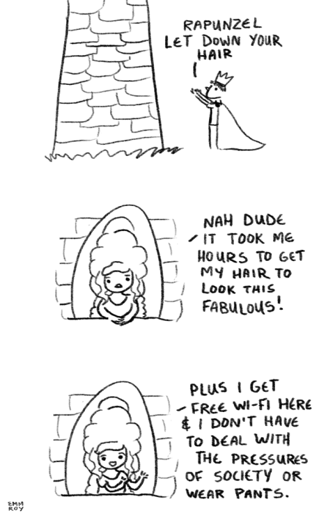
Grammarly
Ken Lacovara (To clarify, Spinosaurus was discovered not too long ago, and an odd gliding or flying bat-like dinosaur was unveiled just a few days ago.)
Ubertool
Merrie Haskell
Sarah Andersen
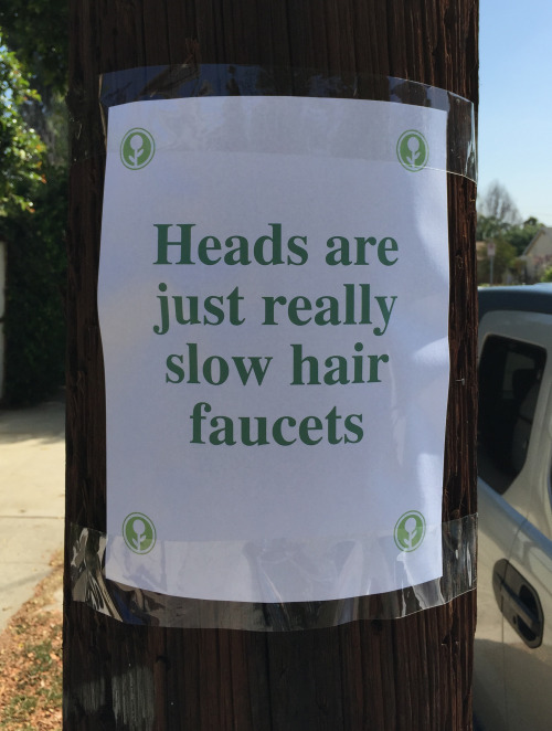
Obvious Plant
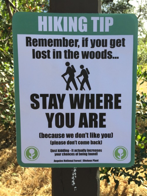
Obvious Plant
ChannelAte
Tastefully Offensive
Berkeley Mews
The Far Left Side
Fake Science
Bizarro
"Cigarette packaging in 15 years." Tastefully Offensive
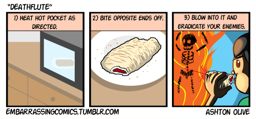
Everything is Embarrassing
Rummy puts Baltimore in perspective. Hullaballoo
Hoomph
Bizarro

Owl Turd Comix
Axby Mag
Tastefully Offensive
Sober in a Nightclub
Sober in a Nightclub
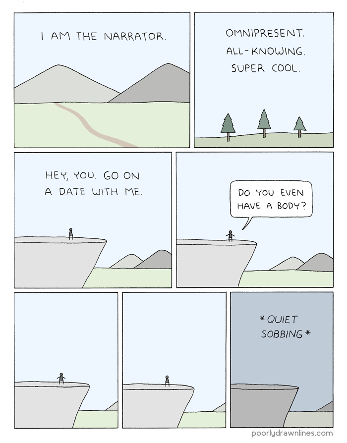
Poorly Drawn Lines
Betty Bowers
Funny to Me
"Nation Offsets Carbon Footprint By Planting Single 300,000-Foot-Tall Tree" The Onion
"When my PI asks if I want to give the group meeting talk" What Should We Call Grad School?
Derpy Cats
Optipess
Tastefully Offensive
Tastefully Offensive
Neurotic Neverland
"Tough Guy" Extra Fabulous Comics
The Gentleman's Armchair
"Remember when Christopher Walken looked like Scarlett Johansson?" Reddit user jrodsprinkles
Mumbletimes
Tastefully Offensive
imgur
Tastefully Offensive
Tastefully Offensive
Funny to Me
Tastefully Offensive
"When I realize I should have studied more for the exam" What Should We Call Grad School?
Ken Lacovara (To clarify, Spinosaurus was discovered not too long ago, and an odd gliding or flying bat-like dinosaur was unveiled just a few days ago.)
Ubertool
Merrie Haskell
Sarah Andersen
Obvious Plant
Obvious Plant
ChannelAte
Tastefully Offensive
Berkeley Mews
The Far Left Side
Fake Science
Bizarro
"Cigarette packaging in 15 years." Tastefully Offensive
Everything is Embarrassing
Rummy puts Baltimore in perspective. Hullaballoo
Hoomph
Bizarro

Axby Mag
Tastefully Offensive
Sober in a Nightclub
Sober in a Nightclub
Poorly Drawn Lines
Betty Bowers
Funny to Me
"Nation Offsets Carbon Footprint By Planting Single 300,000-Foot-Tall Tree" The Onion
"When my PI asks if I want to give the group meeting talk" What Should We Call Grad School?
Derpy Cats
Optipess
Tastefully Offensive
Tastefully Offensive
Neurotic Neverland
"Tough Guy" Extra Fabulous Comics
The Gentleman's Armchair
"Remember when Christopher Walken looked like Scarlett Johansson?" Reddit user jrodsprinkles
Mumbletimes
Tastefully Offensive
imgur
Tastefully Offensive
Tastefully Offensive
Funny to Me
Tastefully Offensive
"When I realize I should have studied more for the exam" What Should We Call Grad School?


