There are a couple of things of note to see at Deer Creek Bridge. The first is not all that obvious unless you know what to look for and where to look for it. We're looking upstream along the McKenzie River here, and the Deer Creek confluence is on the middle left side of the photo. The annotation below should help clarify why that's important.
During winter and spring runoff, Deer Creek makes an important contribution to the river, and Anne says you can often see a muddy plume here from its particulate sediment. At this time of year, it's a minor stream, and its particulate contribution is minor to effectively nil. Anne also pointed out that the Smith River, prior to being dammed (FlashEarth location) and diverted, entered the McKenzie mainstem above this point, but since the reservoir construction, it's not clear to me where the water from that pool re-enters the river.
Photo unmodified. July 7, 2013. FlashEarth Location.
Miscellaneous thoughts on politics, people, math, science and other cool (if sometimes frustrating) stuff from somewhere near my favorite coffee shop.
Saturday, April 25, 2015
Geo 1095: April 24, Day 844: Iconic Oregon
This is the view of Ollalie Creek from the top of its bank, at the edge of the campground. When I moved here 35 years ago, this is, I think, what I imagined the entire state looked like. I imagine this is what others expect it to look like, as well. We have plenty of this kind of landscape, but the Willamette Valley is very different. And better than 2/3 of the state on the other side of the Cascades- not too far from here, in a straight line- is semi-arid grassland and sage scrub. Pretty much the antithesis of this scene.
Photo by Dana Hunter, unmodified. July 7, 2013. FlashEarth Location.
Photo by Dana Hunter, unmodified. July 7, 2013. FlashEarth Location.
Friday, April 24, 2015
Geo 1095: April 23, Day 843: Ollalie Creek
This is an isolated photo in this day's folder, and at first I wasn't certain what it's a photo of. But in terms of sequence, and comparing it to Dana's photos at the same location, it has to be Ollalie Creek. The Ollalie Campground is just off Route 126, where we pulled off to have a look at this entirely spring-sourced tributary to the McKenzie. The thing that threw me off is that I had forgotten what a large and voluminous stream it was. I remembered it looked awfully energetic, and that I wouldn't want to wade it- that it looked as if, without precautions, it could be quite dangerous. And like (nearly) all the other water in this area, it's only a bit above freezing, which makes it even more treacherous. But when I looked at this shot earlier, my first reaction was "Is that just a narrow spot on the McKenzie I've forgotten about?" Nope. It's a tributary stream.
Photo unmodified. July 7, 2013. FlashEarth Location.
Photo unmodified. July 7, 2013. FlashEarth Location.
Wednesday, April 22, 2015
Geo 1095: April 22, Day 842: Full-On Koosah
I think this is the best view I've seen of Koosah Falls. There's a direct trail from the parking area to the eastern lip of the falls, and there's a longer trail that heads downstream a bit before heading back up and rejoining the shorter bit, making a brief loop. I'm pretty sure this spot was just below where the longer trail rejoins the shorter segment. A spur off the longer path provides a more distant, but less obscured, view.
It appears, from this post by Walter Sullivan (If Oregon had a Hiker Laureate, he would be it.), that there is a loop trail between Koosah and Sahalie, with the other portion on the far side of the river. The views would certainly be different, and possibly better, from the other side. However, the hike that I've have gotten myself all hyped-up about, in the course of doing this McKenzie segment, can be seen on the map on page 3 of this PDF: a 7.5 mile downhill hike from Clear Lake to Trail Bridge Reservoir, which would include as a highlight Tamolitch Falls and Blue Pool. From Carmen Reservoir to Tamolitch, the McKenzie goes underground again, to re-emerge full blown at Blue Pool, except during heaviest flow periods. So for several miles below Carmen, the river is present only as a dry bed, and Tamolitch isn't so much a "falls" as a precipice. Logistically, this would require two or more cars, but I've got a lot of Interzone People excited about it, several of whom have vehicles. So I'm just waiting for Dana to start thinking about geogalavanting for the season.
Photo unmodified. July 7, 2013. FlashEarth Location.
Tuesday, April 21, 2015
Geo 1095: April 21, Day 841: Shy Koosah
The forest canopy around Koosah falls is heavy, and there are relatively few spots with a more or less unobstructed view. In fact, there's only one spot I've found where one can see almost the entire cascade without some kind of foliage in the way, and it's well back from the plunge. This is a pretty good shot for this waterfall: you can get a good sense of its form, even with the obscuring conifers. However, I think my best shot is the one I'm planning for tomorrow.
Photo unmodified. July 7, 2013. FlashEarth Location.
Photo unmodified. July 7, 2013. FlashEarth Location.
Monday, April 20, 2015
Geo 1095: April 20, Day 840: More Koosah Springs
In addition to the "parking lot spring" east of the road, there are numerous springs emerging into the gorge below Koosah Falls. As I mentioned way back near the beginning of the Geo series, "I spent more time gazing at these than looking at the falls themselves." We're looking over the eastern lip of the falls here; as you can tell, this isn't the best spot to view the falls themselves. There are a few spots downstream (south) with better views, but the thick forest foliage makes these falls fairly elusive.
Photo unmodified. July 7, 2013. FlashEarth Location.
Photo unmodified. July 7, 2013. FlashEarth Location.
Geo 1095: April 19, Day 839: Koosah Parking Pool
The previous entry in this set was looking more closely at the spring emerging in the bottom middle of this photo. But looking up and generally south, it's a very pretty forest pool. While not exactly hidden, it's not exactly obvious either. It's easy to spot if you look for it, but there is a narrow line of trees and brush between the parking area and the spring. Furthermore, the attraction here is Koosah Falls, which lies in the opposite direction, to the west. So the natural inclination is to get out of your car and walk away from this feature. It's not something I would have known about if Anne hadn't pointed it out, but it's well worth taking a few minutes to enjoy.
Photo unmodified. July 7, 2013. FlashEarth Location.
Photo unmodified. July 7, 2013. FlashEarth Location.
Sunday, April 19, 2015
Sunday Funnies: Computer Mechanic Edition
Wondermark
Cyanide and Happiness
Bizarro
Kartoen
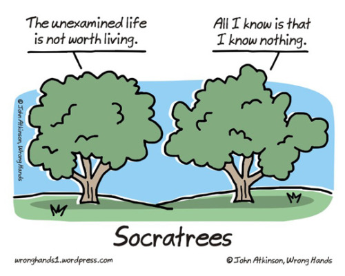
Wrong Hands
Lunar Baboon
Funny to Me
Senor Gif
Cheezburger
Grand Budapest
Percussion Girl
Poorly Drawn Lines
Cyanide and Happiness
What Would Jack Do?
Sober in a Nightclub
Senor Gif
Tastefully Offensive
Darius Whiteplume
What Should We Call Grad School?
General JC Christian
What Would Jack Do?
"Get off mt reef!" Tastefully Offensive
Zero Percent Discount
Savage Chickens
Pygalgia
Tastefully Offensive
Cyanide and Happiness
Bizarro
Kartoen
Wrong Hands
Lunar Baboon
Funny to Me
Senor Gif
Cheezburger
Grand Budapest
Percussion Girl
Poorly Drawn Lines
Cyanide and Happiness
What Would Jack Do?
Sober in a Nightclub
Senor Gif
Tastefully Offensive
Darius Whiteplume
What Should We Call Grad School?
General JC Christian
What Would Jack Do?
"Get off mt reef!" Tastefully Offensive
Zero Percent Discount
Savage Chickens
Pygalgia
Tastefully Offensive


