Here's a panorama of Fish Lake; it'll get much, much larger if you right click and open it in a new tab (Followup- it takes you to the Photobucket page..Hover your cursor over the upper right above the photo and select the "magnify" icon. Then right click, and select "view image." If it's worth the effort to you.) I discussed the geological details of this location in yesterday's post, and the context of lava flows blocking Hackleman Creek should be immediately clear if you look at the FlashEarth location below. The main thing to point out here is the smoke plume from a nearby fire on the left-ish horizon. With our dry summers, and to my impression, increasingly later fall rains, wild fires, viewscapes, and planning for them is something I take into account when deciding where to geologize. They're less predicable than tides, but easy to get details about as one makes plans for the near future. And like tides, if they're not taken into account, they can make a mess of your day.
Photos stitched in HugIn, otherwise unmodified. October 9, 2014. FlashEarth Location.
Miscellaneous thoughts on politics, people, math, science and other cool (if sometimes frustrating) stuff from somewhere near my favorite coffee shop.
Saturday, April 4, 2015
Friday, April 3, 2015
Geo 1095: April 3, Day 823: Fish Lake
This is the site of the seasonal Fish Lake. And no, it doesn't look much like a lake to me, either. But winter and spring runoff from the Western Cascades backs up behind the barrier of the young lava flows shown over the previous days, and creates a temporary standing pool. That water slowly drains into the basalt breccia, and drains the lake by early to mid-summer. Prior to last fall, I had never bothered to stop at what looked to me like a meadow mislabeled as a lake, but prior to Ann Jefferson's visit in 2013, I'd not thought too much about the amazing hydrology of this area.
The peak in the distance is Iron Mountian.
Now, the most interesting information I learned here was contained in a sign, which I stupidly didn't think to photograph. Fortunately, some other, smarter, soul did think to photograph it and post it on the interwebz. The text reads,
Photo unmodified. October 9, 2014. FlashEarth Location.
The peak in the distance is Iron Mountian.
Now, the most interesting information I learned here was contained in a sign, which I stupidly didn't think to photograph. Fortunately, some other, smarter, soul did think to photograph it and post it on the interwebz. The text reads,
You are standing on the shore of a lake that may seem old but in geologic terms was formed yesterday. Fish lake continues to change, seasonally and through the decades
Around three thousand years ago an eruption of Nash Crater formed Fish Lake by damming Hackleman Creek. Seasonal rains and snow overwhelm this little valley’s ability to drain the inflow so that each winter a lake is formed. In the summer, after the last snow melts off the ridges overlooking the valley, the lake quickly disappears and Hackleman Creek vanishes into the lava lakebed.
Grasses that have adapted to the seasonal drying of Fish Lake quickly transform the lake into a lush meadow. The local Hackleman trout [a subspecies of cutthroat trout] population has adapted to this seasonal disappearance of their lake home. When the temperature of the lake starts to rise, the trout head upstream into the creek where they wait for the arrival of winter and the lake’s return.During times of especially heavy runoff, there is an overland channel from this basin to Clear Lake, but for the most part, the trout in this drainage are reproductively isolated from those lower down in Clear Lake and the McKenzie River. The fact that the subspecies has its own name suggests that evolutionary divergence may be occurring, though I don't know enough to make that claim with any confidence.
Photo unmodified. October 9, 2014. FlashEarth Location.
Geo 1095: April 2, Day 822: Western Half-Graben
Part of the point of going back to this location, which I briefly visited during the first year of the series, is to roll in some photos and locations we've visited in the meantime. In this year's posts, starting March 16, and running through March 26, I showed and discussed a couple of outcrops of probable ignimbrites that only recently began to make sense to me. Since then, I've been posting photos from our trip of October 9, 2012, at McKenzie Junction. The photo above is from a trip, amusingly, two years to the day after that, when Dana, B, and I stopped again at that same spot. This shot, though, is probably the best one I have to illustrate the western half-graben of the High Cascades Graben, or more clearly, the western fault system that allowed the subsidence of the modern High Cascades. At least it's the best close-up I have of the structure; my best photo of it was from near the top of Sand Mountain, in 2013. (And for comparison, Green Ridge in this post/photo is the eastern half-graben. Black Butte is a large cinder cone that erupted along that fault.) Here, we're looking pretty much directly south along the fault zone, which is largely hidden under these young lava flows. A short distance down the road, we encountered warning signs regarding a fire burning in the area, and the haze in the trees is apparent.
Photos run through Paint.Net's autolevel routine for contrast and saturation. October 9, 2014. FlashEarth Location.
Photos run through Paint.Net's autolevel routine for contrast and saturation. October 9, 2014. FlashEarth Location.
Geo 1095: April 1, Day 821: Struggling Sentinal
Another near-repeat photo , compare this to one from 2+ years ago. That post explains my understanding of this side of the High Cascades Graben.As I mentioned a few days ago, individual trees out on the fresh lava flow, once they get established, can get quite large. The one closest to the middle here is another example, but it looks as if it's struggling to hold on now.
Farther back in the photo, Route 126 turns south through the lava field. The geologist in me loves this scene, but the simple human in me looks at this rough, rubbley landscape and cringes. I would not want to walk directly across this short distance, and likely couldn't do so without some sort of injury, possibly quite serious. The fact that engineers and equipment can build such a structure as that highway across this landscape is, on hand, inspiring, but on the other, sobering and a little scary. If we can shape this landscape to fit our needs and desires, what lands are safe from our hands? Very few, I'm afraid.
Photos unmodified. October 9, 2012. FlashEarth Location.
Thursday, April 2, 2015
Geo 1095: March 31, Day 820: Three Fingered Jack
I'm not sure what the other large peak in front of and to the left of Three Fingered Jack is (Followup, 4/3: see comment from Ron Schott for its identity and a trail map.), but the latter is the ragged and heavily eroded peak on the horizon. In the context of the Cascade Range, that erosion tells you that TFJ hasn't been active since the ice ages. On the other hand, the closer unnamed peak, with its symmetrical cone, almost certainly attained its current form in the last 10-12 thousand years. I've posted a similar, portrait-framed shot from very close to this same spot, about two years ago, but this one does a better job of showing where the nice, wide pullout is in relation to this junction. This is not by any means a "must-see" stop, but it's pretty, with a safe place to park, and good wide berms make it a sensible place to look around without getting radiator-grilled. In particular (though I'm not sure to what degree I understood this at the time), this is an excellent stop to establish context for the sudden appearance of the McKenzie River at Clear Lake, a few miles south.
Photos unmodified. October 9, 2012. FlashEarth Location.
Photos unmodified. October 9, 2012. FlashEarth Location.
Geo 1095: March 30, Day 819: Coolly Incandescent
This was a crisp, but sunny, fall day, with temperatures in the low sixties, but the vine maples were incandescently glorious. Combined with the sunshine, we didn't feel the least bit chilly. In the upper portion of the photo, just below the rotting logs, you can see some of the fresh (~3 ka) basalt flow. The logs and the flaming foliage about to drop generate various organic acids as they decompose, which contribute to the slow but inexorable chemical weathering of the rock. In addition, the decomposed organic material serves as a source of nutrients and a moisture reservoir that will sustain future generations of plants. At this point, rain and snow melt percolate directly down into the rubble, and flow as ground water to Clear Lake a few miles south of here, where the water emerges as the head of the McKenzie River. Plants, past, present, and future, will eventually block much of the permeability in the ground here, along with the slow accumulation of weathering products from the lava. Barring new flows from close by, in a few hundreds of thousands to maybe a million years, there will likely be a gorgeous babbling stream in this location. However, given the recent history of the area, it's more likely this area will be repaved with new flows, and the process will start all over again.
Photos unmodified. October 9, 2012. FlashEarth Location.
Photos unmodified. October 9, 2012. FlashEarth Location.
Monday, March 30, 2015
Geo 1095: March 29, Day 818: Borderland
Here we see a recent lava flow, about 3000 years old, butting up against the gentle slope of the eastern edge of the Western Cascades. A thick stand of old growth Douglas fir covers that slope. 3000 years is enough time for the same trees to get established, and grow quite large, on the flow, but a seed has to be quite lucky to sprout in a spot that's just right to support it. The tree along the upper right edge is one such example. As a result, the mature trees out on the flow aren't necessarily much smaller than those on the slope, but they're much sparser.
Also, across the middle, we see another flaming swath of vine maples in their fall colors.
Photos unmodified. October 9, 2012. FlashEarth Location.
Also, across the middle, we see another flaming swath of vine maples in their fall colors.
Photos unmodified. October 9, 2012. FlashEarth Location.
Sunday, March 29, 2015
Sunday Funnies: Natural Selection Edition
Pie Comic
Tastefully Offensive
Via Seismogenic Zone
Sober in a Nightclub
Every household needs PetDog (TM)! Senor Gif
Tastefully Offensive
Derpy Cats
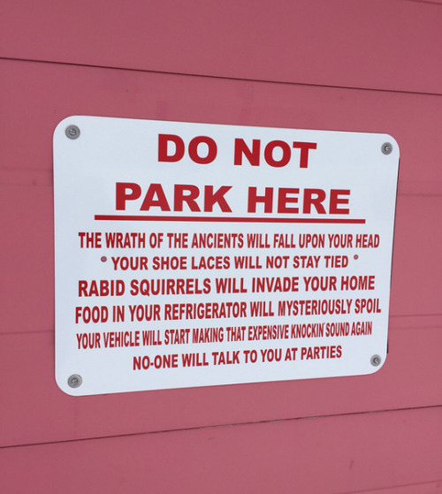
When someone learns I'm a geologist, and tries to tell me about "crystal power." Recaptioned from How a PCV Puts It Gently
Catass
GraphJam
Sober in a Nightclub (Errr... how's he talking?)
Pie Comic
"Crayola update" Ruby etc.
One of the great mysteries of life... Bad Newspaper
Very Demotivational
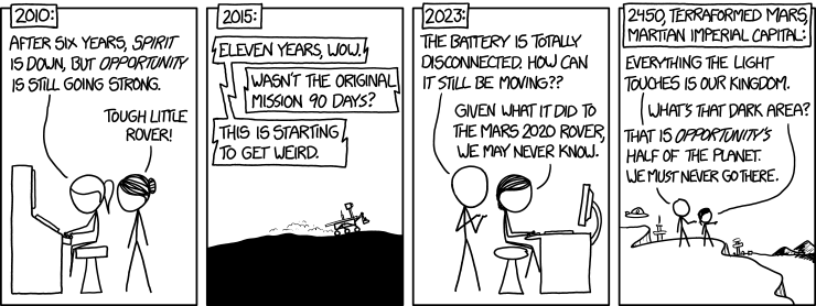
xkcd. A word to the wise... clicking over and reading the hovertext will not be a waste of your time.
Sober in a Nightclub. Frankly, I'm more afraid of being screwed with by TSA, because reasons they won't reveal.
Jim Benton
Fowl Language Comics
Pain Train
Via Tastefully Offensive
Non Seqitur
Savage Chickens
Jim Benton
The Gentleman's Armchair
Jim Benton
Lunar Baboon
Cheezburger
Partially Clips
Jim Benton
The Far Left Side
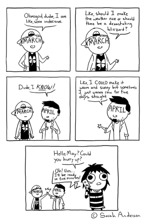
Sarah Andersen
Historic LOLs
Tastefully Offensive
Wondermark
Tastefully Offensive
Raizap
Tastefully Offensive
Modern Darwinian thoughts on the origins of BLTs. Graph Jam
Poorly Drawn Lines
Tastefully Offensive
Via Seismogenic Zone
Sober in a Nightclub
Every household needs PetDog (TM)! Senor Gif
Tastefully Offensive
Derpy Cats
When someone learns I'm a geologist, and tries to tell me about "crystal power." Recaptioned from How a PCV Puts It Gently
Catass
GraphJam
Sober in a Nightclub (Errr... how's he talking?)
Pie Comic
"Crayola update" Ruby etc.
One of the great mysteries of life... Bad Newspaper
Very Demotivational
xkcd. A word to the wise... clicking over and reading the hovertext will not be a waste of your time.
Sober in a Nightclub. Frankly, I'm more afraid of being screwed with by TSA, because reasons they won't reveal.
Jim Benton
Fowl Language Comics
Pain Train
Via Tastefully Offensive
Non Seqitur
Savage Chickens
Jim Benton
The Gentleman's Armchair
Jim Benton
Lunar Baboon
Cheezburger
Partially Clips
Jim Benton
The Far Left Side
Sarah Andersen
Historic LOLs
Tastefully Offensive
Wondermark
Tastefully Offensive
Raizap
Tastefully Offensive
Modern Darwinian thoughts on the origins of BLTs. Graph Jam
Poorly Drawn Lines


