A final shot of the ocean from Boiler Bay State Park, though I have one more shot from the park tomorrow. It looks as if a breccia/conglomerate in the foreground overlies a more uniform sandstone on the shore. To sum up my take on this spot, if I was to plan a trip to look at key geologic sites along the central Oregon Coast, this isn't a spot I would even consider. The geology is quite simple, and not terribly illuminating; it just doesn't tell you very much. And that's before you take into account that (while it's physically possible) you simply can't get a good close-up look at it; all the outcrops are on the other side of the fence. There's ample reasons for keeping people off those areas, at least during foul weather and rough seas, but it's still frustrating for a geology enthusiast.
On the other hand, it's awfully pretty, and there are some nice features that, even though you can't look as closely as you might like, are nevertheless fun to see. If you're on a relaxed sight-seeing trip, and time isn't a major constraint, I'd definitely recommend it as as 20-30 minute amble.
Photo unmodified. July 15, 2014. FlashEarth Location.
Miscellaneous thoughts on politics, people, math, science and other cool (if sometimes frustrating) stuff from somewhere near my favorite coffee shop.
Saturday, October 11, 2014
Friday, October 10, 2014
Geo 730: October 10, Day 648: The Astoria Formation Has Its Faults
Another view, with a different orientation and closer in, of the same faults as in yesterday's photo. There are quite a few apparent offsets, but as I noted at the previous link, some of those may simply be tricks of perspective, as more or less planar bedding forms intersect with a complex three-dimensional surface. However, at least one- in the middle left- shows clear displacement.
Photo unmodified. July 15, 2014. FlashEarth Location.
Photo unmodified. July 15, 2014. FlashEarth Location.
Thursday, October 9, 2014
Geo 730: October 9, Day 647: Another Pit Fault
Looking again at the presumed collapsed ceiling of a sea cave, we can also see some of the overlying sediments, which are broken by several small faults. The least ambiguous of them runs along the right side:
Some smaller, but still clearly evident faults run through the top middle:
While it looks like there are one or two small faults running through the area to the left of the first crop, and below the area of the second, I wouldn't want to make a call with looking more carefully- interactions with the 3-dimensional surface are often misleading. That is, the intersections of planar bedding layers with a non-planar surface can make it look as if there's offset, where there really isn't.
Photo unmodified. July 15, 2014. FlashEarth Location.
Wednesday, October 8, 2014
Geo 730: October 8, Day 646: Pitfalls of Fieldwork
Here's another example of hazards on the other side of the fence. I suspect a sea cave has been eroded along a fault and/or a sedimentary contact into the cliff face, and the ceiling has collapsed, leaving this sinkhole. However, despite the hazards, it was frustrating to see all the interesting rocks just right over there, and not be able to get a closer look. Is that jumbled rock around the pit breccia or re-worked conglomerate? I can't say.
Photo unmodified. July 15, 2014. FlashEarth Location.
Photo unmodified. July 15, 2014. FlashEarth Location.
Tuesday, October 7, 2014
Geo 730: October 7, Day 645: CRB Rears Its Head?
In contrast to much of the sedimentary rock along this portion of the coast, I left Boiler Bay thinking I'd seen no evidence of Miocene Columbia Basalt Flows into the area. But looking at some of these photos, such as the one above, I was probably mistaken. It looks like many of the rocks to the ENE across the bay are black CRB's, not beige Astoria Formation. In fact, looking carefully, I thinking I'm seeing a clastic dike cutting into one of the flows:
I don't know if this area is accessible, and this was on the higher end of the tide, but it might be interesting to try to get at this area.
Photo unmodified. July 15, 2014. FlashEarth Location.
I don't know if this area is accessible, and this was on the higher end of the tide, but it might be interesting to try to get at this area.
Photo unmodified. July 15, 2014. FlashEarth Location.
Monday, October 6, 2014
Geo 730: October 6, Day 644: Astoria Fm Headland
Proceeding farther out onto the headland at Boiler Bay, we found that the entire area is ruggedly fenced. This was somewhat disappointing in that it seriously curtails what one can get up close and hands-on with, but there are some clues as to why it's probably a good idea. First, this was a calm July day. Swells were minimal. But notice how the rock (Miocene Astoria Formation) in the foreground is scoured bare. I imagine during heavy winter seas, this spot is regularly inundated by swash from breaking waves. It would be spectacular, but slippery and disorienting. Being fenced in minimizes the chance of a fatal misstep.
Second, there are a number of abrupt drop-offs, places where fracture-mediated weak zones have led to more rapid erosion of fissures. We see one of those in the lower middle to left side. People's common sense is often not highly developed, and with kids and young adults particularly, it's probably best to at least attempt to put these out of reach. (There were several places where I could have, if I so chose, got under the fence.)
Third.... well, we'll see it in a couple days.
Photo unmodified. July 15, 2014. FlashEarth Location.
Sunday, October 5, 2014
Geo 730: October 5, Day 643: Sea Cave
Zooming in a bit on Friday's photo, we have a somewhat better view of a small sea cave getting started in the gently tilted beds of the Miocene Astoria Formation. Overlying those beds are unconformal, horizontal, terrace deposits.
Photo unmodified. July 15, 2014. FlashEarth Location.
Photo unmodified. July 15, 2014. FlashEarth Location.
Sunday Funnies: "But Why?" Edition
Sober in a Nightclub
Non Sequitur
Senor Gif
Sober in a Nightclub
Sober in a Nightclub
Bad Newspaper
Texts From TNG
Wil Wheaton
Tastefully Offensive
Pictures In Boxes
Campanastan
Lunar Baboon
xkcd
Bug
Tastefully Offensive
Wondermark
Sober in a Nightclub
Sober in a Nightclub
Very Demotivational
Very Demotivational
Texts From TNG
"Kebabmouflage" "Hey, that guy’s a war gyro." Darius Whiteplume
Non Sequitur
This Modern World
Tree Lobsters
Sober in a Nightclub
The Gentleman's Armchair
Tastefully Offensive
"Now that's just cruel." Sober in a Nightclub
Sober in a Nightclub
Invisible Bread
What Would Jack Do?
Cheezburger
@AstroKatie
Tastefully Offensive
Darius Whiteplume
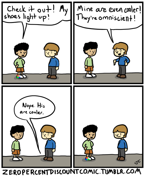
Zero Percent Discount
ButtPoems
Tastefully Offensive
Blackadder
Texts From TNG
Wil Wheaton
Maximumble
Wil Wheaton
Cheezburger
Wil Wheaton
Funny to Me
Funny to Me
Funny to Me
Texts From TNG
"initiating MAXIMUM OVERBIRD" Funny to Me
Blackadder
Funny to Me
Savage Chickens
Amazing Super Powers
Bad Newspaper
Sober in a Nightclub
Non Sequitur
Senor Gif
Sober in a Nightclub
Sober in a Nightclub
Bad Newspaper
Texts From TNG
Wil Wheaton
Tastefully Offensive
Pictures In Boxes
Campanastan
xkcd
Bug
Tastefully Offensive
Wondermark
Sober in a Nightclub
Sober in a Nightclub
Very Demotivational
Very Demotivational
Texts From TNG
"Kebabmouflage" "Hey, that guy’s a war gyro." Darius Whiteplume
Non Sequitur
This Modern World
Tree Lobsters
Sober in a Nightclub
The Gentleman's Armchair
Tastefully Offensive
"Now that's just cruel." Sober in a Nightclub
Sober in a Nightclub
Invisible Bread
What Would Jack Do?
Cheezburger
@AstroKatie
Tastefully Offensive
Darius Whiteplume
Zero Percent Discount
ButtPoems
Tastefully Offensive
Blackadder
Texts From TNG
Wil Wheaton
Maximumble
Wil Wheaton
Cheezburger
Wil Wheaton
Funny to Me
Funny to Me
Funny to Me
Texts From TNG
"initiating MAXIMUM OVERBIRD" Funny to Me
Blackadder
Funny to Me
Savage Chickens
Amazing Super Powers
Bad Newspaper
Sober in a Nightclub


