There are a number of places along this stretch of road, for maybe 5 to 8 miles, where these great banks of clay rise above the road. Other than their bright color, one of the things they have in common is that they're poorly vegetated. My suspicion is that, over the long term, they will probably get recolonized fairly thoroughly. However, being solid clay, they don't have a lot of the nutrients, such as nitrogen, phosphorus, and potassium, that plants need. When the banks were cut, likely during the late 1950's to early 60's, when the Army Corp was constructing the dam, the clay was exposed, leaving no real soil behind. During wet times, surface clay, and any nutrients that may have accumulated, get washed away. This is quite similar to processes that limit plant growth in badlands. So the processes of recolonization, stabilization, and nutrient accumulation have been slow to get traction. Once thorough ground cover has been established, though, I don't know of any reason why soils here shouldn't be just as good as any other. While there is a superficial resemblance to serpentine soil, for example, there aren't any toxins such as copper or nickle here that would hinder plant growth, so far as I'm aware.
Photo unmodified. June 19, 2012. FlashEarth location (uncertain, but looks right, and close).
Miscellaneous thoughts on politics, people, math, science and other cool (if sometimes frustrating) stuff from somewhere near my favorite coffee shop.
Saturday, August 2, 2014
Geo 730: August 1, Day 578: Colorful Closeup
Looking at the area toward the top middle of yesterday's exposure, you can see the widely variable colors of the clay here. A characteristic of hydrothermal alteration is that it is very patchy, as it's dependent on the permeability of its host rock, and on channels such as joints and faults. Near the bottom middle of this photo, you can see some essentially unaltered remnants that look like basalt (behind the scotch broom). This was a feature I would point out on field trips, but again, with middle school students, not one I felt worth the time to actually stop for. But on a trip Hollie did with her college-age students, she found a nice pull-out with a good exposure across the road. So this isn't a stop I'd made before, but it's a quick and easy one, and worth while, IMO.
Photo unmodified. June 19, 2012. FlashEarth location (uncertain, but looks right, and close).
Photo unmodified. June 19, 2012. FlashEarth location (uncertain, but looks right, and close).
Geo 730: July 31, Day 577: Colorful Clays
Very shortly- within a mile or so- after the vesicular/amygdaloidal basalt near Green Peter Dam, one starts to encounter large banks of brilliantly colored clay. These are not "deposits," in the normal sense of the word, but in-place alteration of the bedrock by hot water, or hydrothermal fluids. During the initial stages of hydrothermal alteration- generally, low temperature, low pressure- the effects are similar and comparable to pervasive weathering of the host rock. In particular, feldspars, which comprise 60-70% or more of volcanic rock, change to clays. Mafic minerals such as olivine, pyroxine and amphiboles are much less in volume, but contribute various oxides and hydroxides that pigment the rock. The pigment here is likely mostly iron oxides and hydroxides. Depending on the availability of oxygen, iron pigmentation can range from red, orange, and yellow, to green in reducing environments. So originally, the rock here may have looked very much like what we saw back at Green Peter Dam!
Photo unmodified. June 19, 2012. FlashEarth location (uncertain, but looks right, and close).
Photo unmodified. June 19, 2012. FlashEarth location (uncertain, but looks right, and close).
Geo 730: July 30, Day 576: Student for Scale
Another shot of the imbrication near the beginning of Quartzville Road, with Bobby for scale. I didn't feel nimble enough to climb up through the briars to put my hammer on the outcrop, so he volunteered. Once he got up there, we realized we didn't really need to worry about the hammer. Bobby has been getting his intro to geology courses at a community college, and is transferring to OSU this fall. He doesn't blog (Yet. I'll work on that.), but I think his intelligence and enthusiasm will carry him through his geo major well. It'll be interesting for me to see how the structure of the major has changed over the last 30 years.
Photo unmodified. June 19, 2012. FlashEarth location.
Photo unmodified. June 19, 2012. FlashEarth location.
Friday, August 1, 2014
Geo 730: July 29, Day 575: Imbrication
This photo isn't quite as good an illustration of imbrication as yesterday's, but it's not bad. With the rounder cobbles, you won't see the fabric, but with more tabular (defined in paragraph just above the diagram: large in two dimensions, small in the third) clasts, the upper end will tend to point in the direction the current was moving. Imagine a flat stone coming to rest with its upper end pointing into the current; there's a good chance the current will catch it and flip it over so it points downstream. And in that orientation, the water flow will tend to push it down even more firmly, further stabilizing it. So with imbrication, not every single clast will necessarily point downstream, but there's an easily spotted tendency to do so. A better chance that a randomly chosen cobble will do so, in other words. This shot has more rounded cobbles than yesterday's, and those can't "point" in any direction.
Given that this sediment is Pleistocene in age- quite young and poorly lithified- it's no surprise the flow direction indicated is the same as the modern stream direction. However, this outcrop shows that the imbrication paleocurrent indicator works as advertised, and it can be quite useful in older coarse sediments, where the stream source and destination might not be so obvious or well-known.
Photo unmodified. June 19, 2012. FlashEarth location.
Geo 730: July 28, Day 574: Backing Up
On my last trip up to Quartzville, we stopped at a locale I'd almost forgotten. When I did this trip with middle-school-aged students, first, the safety issue was iffy; there's not a whole lot of berm here. Enough for adults who are accustomed to paying attention, but not really for a dozen or so excited kids. Second, while it's an informative and interesting spot, it's esoteric enough to be not terribly interesting unless you've already got some background. Third, with kids, there's a lot of time wasted getting into and out of vehicles, which means this stop just makes a long day longer. Overall, just not worth it.
However, on the most recent trip, we did stop here. As the post title indicates, it's well before Green Peter Dam and the zeolite/calcite stop. The best landmark is an old schoolhouse which appears to have been recommissioned as a daycare or preschool sort of thing, on the outside of a bend in the road. That school sits on a glacial-era fluvial terrace. Since then, erosion by the Middle Santiam River and roadwork has cut down into the terrace gravels, exposing this excellent example of imbrication. In the roadcut below (NE from) the school, the pattern of gravel deposition indicates right-to-left current direction. Unsurprisingly, that's the same as the modern river flow.
Photo unmodified. June 19, 2012. FlashEarth location.
Thursday, July 31, 2014
Following Up On My Bif Bite
First tweets from the ER. The only downside of an ER visit at Corvallis' hospital, in my experience, (Well, beyond the fact one is often in pain, and the expense.) is the sheer boredom of sitting there with nothing to do. I accept this is necessary time to carry out various tests, develop the best interpretations, and plans for treatment, so I'm not complaining per se, just saying it's extremely boring for a person who likes to keep his mind busy. I can understand they don't want to have reading material (germ transmission between patients). TV might be fine for some, but I find most programming insultingly stupid, and ads worse. It wouldn't help me at all. So I took my computer along this time, hoping they had public wi-fi. They did. So I could get on twitter, catch up on goings-on, and post about my own situation. Including the fact my wrist was swollen to the point that it was in danger of being mistaken for a whale.
(typical Twitter type of mistake: missed the "on" between "etc." and "my hand") So here we are on the 31st. I just had a follow-up appointment this morning, and the Dr. seemed satisfied with my recovery. The swelling is down, but not totally gone, and the redness is apparently gone. (I have a difficult time seeing reds and greens, and never really could see the distinction that was so apparent to others) My hand is still kind of sore, but the dexterity is returning. And the pain in reaction to any sort of heavy task is still pronounced- so, for example, picking up a pint glass of coffee is still not going to happen without assistance from my left hand. However, I can put my wallet back in my right pocket. I'm able to fish that out without too much difficulty.
Most importantly though, I'm getting back up to speed on my ability to use the ol' laptop. Reading, scrolling, and typing are getting much quicker as nimbleness returns to my hand. So hopefully, I can get caught up on the Geo posts over the next two or three days.
Monday, July 28, 2014
Cat Bite Fever: A Tale of a Jealous Bif
I'm not allowed to smoke in my new apartment, so four or five times a night, I trudge down the stairwell and go outdoors. Once the sun gets low, it's often nicer outdoors than in the apartment anyway, so it's turning out to be not as much hassle as I was afraid it might be. And as a bonus, there are a number of friendly cats running around the neighborhood, so I often socialize with them while I'm outside.
Saturday night, I met a new one to me... very affectionate. It (Didn't notice what sex it was.) spent a good five minutes rolling around, rubbing its head, belly, back, and tail against my right hand- I was holding my cigarette in my left hand.
When I went back inside, Bif was fixated on the smell of the new cat. He would not leave my hand alone. I would put him on the floor, and without pause, he was back up on my desk, sniffing at my right hand. Finally, without really looking him, I picked him up to set him down again. And he bit the hell out of my right wrist. I yelled OUCH! which apparently startled Bif out of his hypnosis; he ran off. I washed the wound area with soap and water immediately, then patted it dry until it scabbed over and stopped bleeding. It wasn't that bad Saturday night, but by yesterday, it was pretty clear there was an infection in the area. I decided if it didn't get better by this morning, I'd bum a ride to the ER.
It's worse. It's red, stiff, hot and swollen, and my right hand is next to useless for any task involving more than an ounce or two of exertion. I can type this without too much difficulty, but it's uncomfortable at best, and painful much of the time. So I'll be off to the hospital soon. Expect delays in regular posts.
On the plus side, even though it's painful, I don't think the infection has progressed to the point it'll present any serious difficulties, or risks of secondary problems (e.g. sepsis). But I'll have to have a real doctor make that call. Wish me luck.
Sunday, July 27, 2014
Geo 730: July 27, Day 573: Final Amygdules
A final shot of the calcite amygdules near Green Peter Dam on the Quartzville trip. Both of these have the typical almond-like shape, though there's a bit of moss growing on the blunt end of the left example.
Photo unmodified. June 19, 2012. FlashEarth location.
Photo unmodified. June 19, 2012. FlashEarth location.
Sunday Funnies: Cat Snake Edition
Funny to Me
Cyanide and Happiness
Tastefully Offensive
Blackadder
Tastefully Offensive
Bits and Pieces
Are You Talking to Meme?
Bizarro
Sober In a Nightclub
Sober in a Nightclub
Good Noose
YouTube
Sofa Pizza
Sofa Pizza
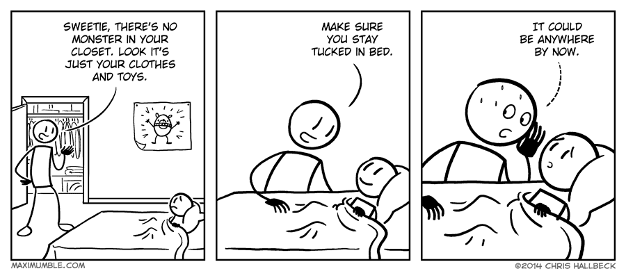
Maximumble
"When I tell freshmen where the bathroom is during fieldwork" Geology is Hard
The Far Left Side
Very Demotivational
"Closet acrobatics" Bits and Pieces
Tastefully Offensive
Bits and Pieces
Dork Tower
Just Stuffs
Twitter: The Comic
Very Demotivational
Bits and Pieces
Funny to Me
"This should be interesting." Bits and Pieces
Cheexburger
Bits and Pieces
Are You Talking to Meme?
Julia Segal
Tastefully Offensive
Matt Bors
"Sounds like the best party ever." Funny to Me
Tastefully Offensive
Bits and Pieces
Left-Handed Toons
Buttersafe
Cyanide and Happiness
Very Demotivational
Liz Climo
Tastefully Offensive
Cyanide and Happiness
Tastefully Offensive
Blackadder
Tastefully Offensive
Bits and Pieces
Bizarro
Sober In a Nightclub
Sober in a Nightclub
Good Noose
Sofa Pizza
Sofa Pizza
Maximumble
"When I tell freshmen where the bathroom is during fieldwork" Geology is Hard
The Far Left Side
Very Demotivational
"Closet acrobatics" Bits and Pieces
Tastefully Offensive
Bits and Pieces
Dork Tower
Just Stuffs
Twitter: The Comic
Very Demotivational
Bits and Pieces
Funny to Me
"This should be interesting." Bits and Pieces
Cheexburger
Bits and Pieces
Are You Talking to Meme?
Julia Segal
Tastefully Offensive
Matt Bors
"Sounds like the best party ever." Funny to Me
Tastefully Offensive
Bits and Pieces
Left-Handed Toons
Buttersafe
Cyanide and Happiness
Very Demotivational
Liz Climo
Tastefully Offensive


