We're looking across the intersection of two roughly planar surfaces in an exposure of Otter Point Formation greywacke, with the Sixes River flood plain/tidal flat in the background. The handle of the hammer is resting on the upper part of the fractured surface we saw yesterday. I'm pretty confident that represents bedding parting. The hammer's head is resting against a fault plane. We'll look at that more carefully tomorrow. There is some secondary calcite near the chisel tip of the hammer, which we'll also look at in more detail in days to come.
Photo unmodified. May 7, 2013. FlashEarth location.
Miscellaneous thoughts on politics, people, math, science and other cool (if sometimes frustrating) stuff from somewhere near my favorite coffee shop.
Saturday, November 16, 2013
Friday, November 15, 2013
Geo 365: Nov. 15, Day 319: Fractured Sandstone
Looking at a tilted slab of the rock at the same stop as yesterday, the pervasive fracturing is clear. This is pretty typical in Klamath exposures- if anything, this rock is unusually fresh and undeformed for this region. This is also a greywacke, I think, though better sorted and finer grained than the boulder we saw out on the cape.
Photo unmodified. May 7, 2013. FlashEarth location.
Photo unmodified. May 7, 2013. FlashEarth location.
Thursday, November 14, 2013
Geo 365: Nov. 14, Day 318: Cape Blanco Highway
(Right-click the image here for size options) We didn't get at any actual bedrock out on the cape proper, but driving back to Route 101, there was a good pull-out with some exposure. There's plenty going on here at a small scale, but not much in the way of larger-scale context. So, for example, we found lots of little faults and deformation (which I'll show in following days), but no significant contacts or obvious large offsets. The Sixes River, to the right of Dana and the prominent block of sandy greywacke, appears to have filled its basin with sediment. At this point, I'd describe it as a tidal flat, but after the post-glacial sea level rise, it was probably more of a bay and estuary.
Photo unmodified. May 7, 2013. FlashEarth location.(Pretty confident I've got the right spot, but not completely certain.)
Photo unmodified. May 7, 2013. FlashEarth location.(Pretty confident I've got the right spot, but not completely certain.)
Wednesday, November 13, 2013
Geo 365: Nov. 13, Day 317: Conjecture and Refutation
Yesterday, I suggested that perhaps a reason for Cape Blanco's prominence out into the ocean was a tough armoring of gravel from a former stream drainage. That may play a minor role, but I doubt it's of any real importance, for three reasons. First, the terrace deposits are only partially consolidated- I wouldn't describe them as "lithified" by any stretch of the imagination. Second, erosion of the terrace surface is inconsequential in terms of the overall erosion and diminishing of Cape Blanco; wave erosion at sea level is pretty obviously the overwhelming agent in that process. Third, that Otter Point greywacke- which is incredibly indurated and tough for a clastic rock (it has been somewhat metamorphosed) is what's actually taking the brunt of the pounding by the surf. As you can see in the photo, the terrace deposits only extend down about a third of the way to the shore. They're consolidated enough to hold a significant slope, but they wouldn't stand up to the surf at all. Despite my off-the-wall conjecture after noticing the imbrication of the gravel in these deposits, I think it's unlikely the resistance to erosion by the coarse material makes much difference to the prominence of Cape Blanco.
Photo unmodified. May 7, 2013. FlashEarth location.
Photo unmodified. May 7, 2013. FlashEarth location.
Tuesday, November 12, 2013
Geo 365: Nov. 12, Day 316: Delta Conjecture
Given my thoughts and comments over the last couple of days, on the nature of the terrace deposits, I decided to back up and show a more detailed shot of the modern Sixes River delta, just north of Cape Blanco. In particular, after recognizing the imbrication in Sunday's post (the latter of the links), I'm wondering if the Cape may be an example of inverted topography- a ridge representing a former channel filled with more erosion- and weathering-resistant materials. I've normally seen inverted topography in the form of mafic lava flows filling a valley. Erosion (in some cases) is then more effective cutting into the previous bedrock to either side of the former drainage, leaving it standing at relatively high relief. In this case, I'm wondering if perhaps the gravel "armor" in a former Sixes River channel has caused the same sort of effect, creating a resistant ridge and promontory headland.
For reasons I'll show and explain tomorrow, I think that's unlikely to be the case, but it's not out of the realm of possibility.
Photo unmodified. May 7, 2013. FlashEarth location.
For reasons I'll show and explain tomorrow, I think that's unlikely to be the case, but it's not out of the realm of possibility.
Photo unmodified. May 7, 2013. FlashEarth location.
Monday, November 11, 2013
Geo 365: Nov. 11, Day 315: Sea Stacks and Whale?
Our time at the coast last May was misty, cloudy, gray, windy and cold. It was gorgeous and fascinating, but unpleasant to be out in it for any length of time, especially if the location offered no shelter from the wind. As a result, many of our stops were quick and cursory. Here we were so exposed that we walked up to the edge, snapped a few photos, then headed quickly back to the car. If you enlarge the photo, you can see the leftmost stack is actually an arch, and even without enlargement, the biggest, near the middle, bears an amusing resemblance to a cartoon drawing of a whale. If it's not called "Whale Rock," it ought to be.
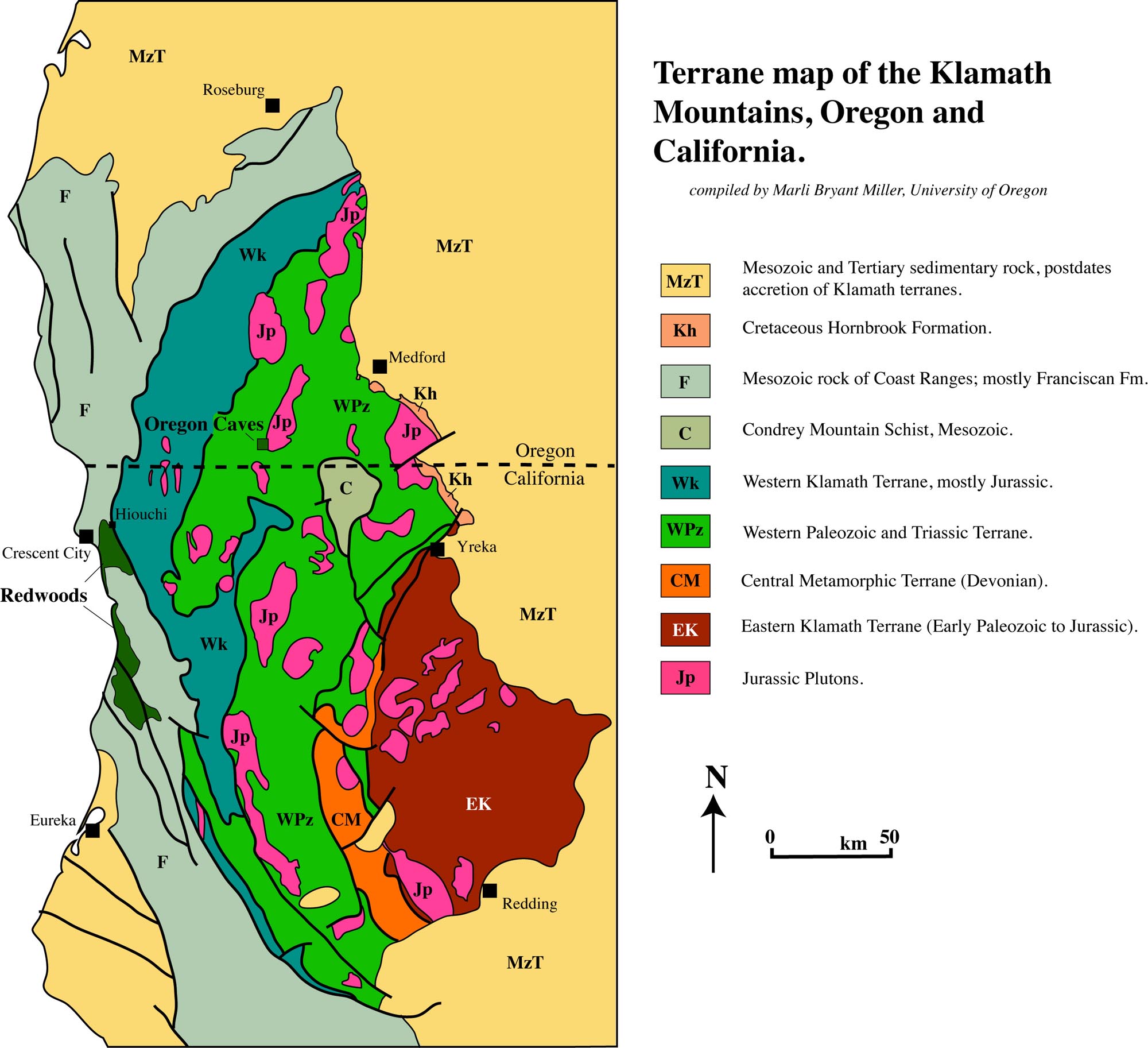
If I had to guess, I'd say the sea stacks in the distance are likely also Otter Point Formation, but lithologies change so fast in the Klamaths- especially east-west- that it would be just a guess, and not a very useful one. The reason I say "especially east-west" is that that's the general strike of the structure. Cross a fault, and you're into rock from an entirely different environment, of an entirely different age, with an entirely different history. And even without crossing a fault, the rocks are severely deformed and folded, again with the axes of the folds striking generally north-south. This means as one travels, the stratigraphic position can change very rapidly, even in the absence of faults. As I just told another Interzone denizen, "Klamath geology makes my brain hurt."
Map image by Marli Bryant Miller. To be clear, this is extremely simplified; each of these terranes have their own subdivisions, and many are themselves composed of two or more subterranes, which accreted before docking with North America.
Photo unmodified. May 7, 2013. FlashEarth location.
Sunday, November 10, 2013
Sunday Funnies: OCD Nightmare Edition
Bob Rutledge
Bits and Pieces
Wil Wheaton
Liz Climo
Berger and Wyse
Funny to Me
Fake Science
Senor Gif
Funny to Me
Bizarro
Are You Talking to Meme?
Bits and Pieces
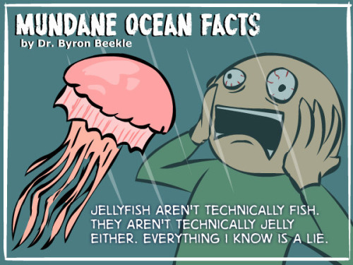
One of seven "Ocean Facts" at Tastefully Offensive.
Wil Wheaton
Sofa Pizza
Tastefully Offensive
imgur
Senor Gif
Cheezburger
Very Demotivational
Ugliest Tattoos
Partially Clips
Funny to Me
Are You Talking to Meme?
Medium Large
Tastefully Offensive
Senor Gif
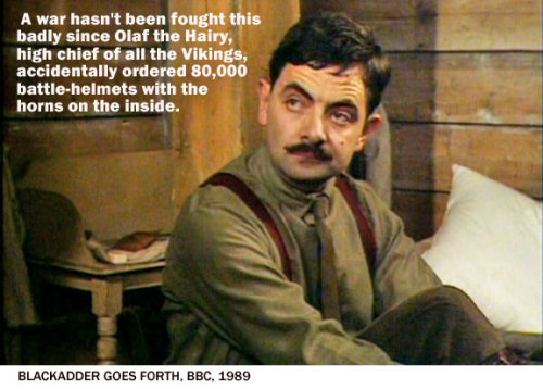
Blackadder
"Morgan Freeman is still doing his own stunts" Senor Gif
Very Demotivational
Funny to Me
Bizarro
Darius Whiteplume
Cyanide and Happiness
Very Demotivational
Cheezburger
Destructive Outlet
Amazing Superpowers
Tastefully Offensive
Funny to Me
Tastefully Offensive
Bits and Pieces
Wil Wheaton
Liz Climo
Berger and Wyse
Funny to Me
Fake Science
Senor Gif
Funny to Me
Bizarro
Are You Talking to Meme?
Bits and Pieces
One of seven "Ocean Facts" at Tastefully Offensive.
Wil Wheaton
Sofa Pizza
Tastefully Offensive
imgur
Senor Gif
Cheezburger
Very Demotivational
Ugliest Tattoos
Partially Clips
Funny to Me
Are You Talking to Meme?
Medium Large
Tastefully Offensive
Senor Gif
Blackadder
"Morgan Freeman is still doing his own stunts" Senor Gif
Very Demotivational
Funny to Me
Bizarro
Darius Whiteplume
Cyanide and Happiness
Very Demotivational
Destructive Outlet
Amazing Superpowers
Tastefully Offensive
Funny to Me
Tastefully Offensive


