A boulder near the parking area at Cape Blanco. I guess the things that jump out most strongly to me are the veins and patches of secondary calcite, simply because they're so high-contrast in comparison to the rest of the rock
Looking at a crop of the above photo, the nature of the rock itself is more apparent. It is (according to the nomenclature I learned, which may now be dated) a lithic greywacke- poorly sorted and texturally immature: the clasts are mostly angular to poorly rounded. Despite my statement a few days ago that this is Cretaceous in age, it is in fact Jurassic Otter Point Formation, according to this (2 MB) PDF of an Ore Bin issue from 1975 (See near the top of the second page of text). "Melanges" were, I suspect, only beginning to be comprehended at the time of that publication, but by the time I was finishing up my first year of geology in 1981, they were tentatively explained to us younglings as likely representative of old, exhumed, eroded and exposed subduction zones. That idea seems to have been thoroughly accepted. Indeed, if you look at the sorts of lithologies that can be found in the Otter Point Formation, nothing else comes close to making sense. Tagged with "Accretionry Wedge," because it amuses me... this may be the first time I've used the term in its literal sense,as opposed to the Geoblogosphere's carnival.
Photo unmodified. May 7, 2013. FlashEarth location.
Miscellaneous thoughts on politics, people, math, science and other cool (if sometimes frustrating) stuff from somewhere near my favorite coffee shop.
Saturday, November 9, 2013
Friday, November 8, 2013
Geo 365: Nov. 8, Day 312: North Cove
Looking down into the north cove at Cape Banco, there's a trail down to the beach. We went down as far as the sign, but didn't feel compelled to go all the way down- we learned our lesson the previous year: multiple walks down to the beach mean multiple climbs back up, so choose wisely. The interpretive sign is a rather generic one I've seen many times, picturing and naming some common tidepool organisms. Looking at the point, there appears to be some bedding striking roughly parallel to the line of sight, and dipping maybe 20 degrees or so to the left. The rock here is poorly sorted, texturally immature sandstone to conglomerate, with a low grade metamorphic overprint. We'll have a closer look at it tomorrow.
Photo unmodified. May 7, 2013. FlashEarth location.
Photo unmodified. May 7, 2013. FlashEarth location.
Thursday, November 7, 2013
Geo 365: Nov. 7, Day 311: Cape Blanco Lighthouse
Looking roughly west from the same spot where yesterday's photo was taken, the elevated terrace of the cape is apparent. I don't quite "get" some people's infatuation with lighthouses; nothing against them, I just don't grasp the intense appeal. I'm guessing the tower farther to the left is some sort of navigation aid, and that the little white box in the left middle is for weather observations. As one might expect on a promontory such as this, some of the most intense winter storm winds on the west coast are measured here, not infrequently gusting over 120 miles per hour. Between the tower and the weather station, semi-consolidated terrace deposits are exposed. Sometime in the next few days, I'll post a shot of how these are used by some of the local biota.
Photo unmodified. May 7, 2013. FlashEarth location.
Photo unmodified. May 7, 2013. FlashEarth location.
Wednesday, November 6, 2013
Geo 365: Nov. 6, Day 310: Cape Blanco
After a good lunch in Bandon, we continued south to Cape Blanco, the western-most point on the Oregon Coast. The rock here is Cretaceous Jurassic (See Geo 365: Nov. 9, Day 313: Greywacke) in age, and appears to be low-grade meta-sediments, with a lot of fracturing and faulting. As such, it's much more resistant to weathering and erosion than the Coast Range sediments farther north. (The boundary between the Coast Range and Klamath-Siskyou rocks is between Coos Bay and Bandon.) As a result, the coast in southeast Oregon is more rugged, with many more sea stacks, than most of the central and northern coast, with the main exceptions being basalt headlands in the Coast Range province. The tectonic disruption also means much greater heterogeneity over short distances, which further enhances the development of sea stacks.
A small delta from the Sixes River can be seen in the right-middle of the panorama. It's not terribly obvious here, but there is a series of quite well developed elevated marine terraces in this region; Cape Blanco State Park includes examples of at least three I can identify. This is also the closest one can get on land to the Juan de Fuca/Cascadia subduction zone; it's only about 35 miles offshore here.
Photo stitched in HugIn, auto-leveled in Paint.Net for improved contrast and color. May 7, 2013. FlashEarth location.
Tuesday, November 5, 2013
Geo 365: Nov. 5, Day 309: Honeyman State Park
A bit south of Florence, a smallish park is easy to overlook: Honeyman. Dana and I did a quick inspection last spring, and the thing that struck me hardest was the invasion of non-native Scotch broom. Apparently, unlike any other woody shrub that I know of, it can colonize bare sand. If this is happening widely, it's a terrible threat to the dunes. Aside from that, Honeyman is a beautiful stop, with a nice mix of woodlands and open sand dunes. However, we were looking for distance that day, and didn't spend much time here. Another point of geologic interest: Cleowox Lake is landlocked; it drains by groundwater directly to the ocean.
Photo unmodified. May 7, 2013. FlashEarth location.
Photo unmodified. May 7, 2013. FlashEarth location.
Monday, November 4, 2013
Geo 365: Nov. 4, Day 308: Darlingtonia Twofer
Since I mentioned the Darlingtonia flowers, I felt compelled to show a couple views of them- though I think this is a pair of views of the same one. The above shows the color, and how shy they are about showing themselves.
This one is a view looking directly upward, and I like it not so much for the flower, as for the way it shows the translucent "skylights" in the adjacent insectivorous leaf. Insects are attracted by odor and nectar to the portal on the bottom of the hood. When they go to fly away, they mistake the translucent spots as "sky", and become disoriented and exhausted bouncing off the ceiling. The throat of the column is covered with downward-pointing hairs that ultimately direct the victim into a pool of digestive enzymes and bacteria commensal with the plant, where it is digested.
Frankly, for flower photos, you're better off with Dana's post, and the importance of the geological setting was discussed on February 7th.
Photo unmodified. May 7, 2013. FlashEarth location.
Sunday, November 3, 2013
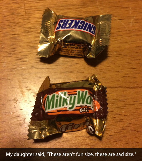
Sunday Funnies: Sad-Sized Edition
This is a shorter than average edition; a lot of the funnies that would have been posted here went to the Halloween post instead. So if you missed it, you might want to check that, too.
Tastefully Offensive- True, dat. I got a couple of these; I can cover them with my thumb.
Bits and Pieces
Are You Talking to Meme?
"After spending tears in grad school" What Should We Call Grad School?
Bits and Pieces
ChannelAte
Are You Talking to Meme?
"Princess Iron Man," from Wil Wheaton. The name for this costume that immediately popped into my head was "Iron Maiden."
Fake Science
Wil Wheaton "Samantha Bee, you beautiful Canadian."
Wil Wheaton
"This is why you don't microwave cellphones." Senor Gif
This is a sort of short edition;
Funny to Me
What Would Jack Do?
Dr. Boli
"This kitten has looked into the abyss." Senor Gif
Bird and Moon
Wondermark
Are You Talking to Meme?
The Far Left Side
"'Titanic' as directed by Michael Bay." Senor Gif
Geo 365: Nov. 3, Day 307: Blooming Darlingtonia
(right-click image here for size options) The day after we visited Newport and Otter Rock, we headed south down the coast, with our ultimate goal being the Josephine Ophiolite in northern California and southern Oregon. Our first stop was at Darlingtonia Wayside SP. Dana wanted to see if her readers could ID the plant by their flowers, which while quite colorful and pretty, are small, hang upside down, and as a result, not terribly easy to get a good look at. Her readers, incidentally, identified it hours before I even got in to Interzone and saw the post. She describes the situation more clearly here, and I wrote about the geological setting in the Geo 365 series earlier this year from a different trip.
Photo unmodified. May 7, 2013. FlashEarth location.
Photo unmodified. May 7, 2013. FlashEarth location.


